Jan 7, 2008, Red Mtn Pt. 5703 ( Salmon La Sac)
1/7/08
WA Snoqualmie Pass
1423
1
After 5 weeks in the snowless and flat mid Atlantic I wanted to test my legs. This Dec. 2006 report with Pico describes the ascent route:
http://www.turns-all-year.com/skiing_snowboarding/trip_reports/index.php?topic=5854.0I
Saw Silas and Co.'s down tracks but couldn't find their skin track. So I broke a new one into the Southernmost basin. Into the basin I veered off the above description. I was hoping to gain the saddle in the back of the valley and ascend to the top of Pt. 5703' from the south. No go, too steep below the saddle so instead an ascent would have to go directly up the big and open south slope. I did not like this, the other route from the east is much safer. But at the last stringer of trees I dug a quick pit on a 30 degree south slope at 5300 ft. Observations:
5" of very light uncohesive snow on top.
8" of denser, settled 4 finger snow below that.
12+ inches of even denser settled snow below that.
The 8" layer slid on the deeper layer after 8 taps at the elbow, Quality 2 or almost 3 shear.
A companion shovel shear, adjacent, took a lot of force to slide on this layer.
I wasn't super comfortable with continuing because the slope above steepened to 35 degrees for 200 ft. before gentling off up to the top. The bit of roll over scared me but I went anyway. Temps stayed well below freezing all day, little direct sun hit the slope, there were no natural slides anywhere to be seen. Pole tests continually showed increasing density snow with inc. depth and an abence of layers or crusts. No shooting cracks or woompfing. Besides, I could see the run of Slias and Co., also 35 degrees max and SE exposure and they wouldn't steer me wrong, right? I know, not good avy. sense.
I think that significant settlement has occured this far east of the crest.
The runs:
So off the top of 5703's south slope to the basin bottom and then a skin up to the north facing slope of Pt. 5085 (USGS) due southeast of Pt. 5703. Both aspects were awesome light snow deeper by a few inches on the north aspect.
Once back into the approach clearcut things changed. What Silas described as heavy powder turned into a 1/2 inch soft breakable crust beneath the four inches of new. I struggle with that when serpentining baby trees. Although, today a taught myself to parallel turn (not pretty, but somewhat effective)!
Interestingly enough, someone followed my uptrack. This person plus dog retraced Pico and my Dec. 2006 ski almost exactly. I wonder if this individual didn't like the last exposed part of my route for hazard. At the car I noticed this someone is a Kittitas Co. resident and I think it may have something to do with the fact that Alpental is closed on Mondays! Come forth???
Pics. to follow!
What a great day, even got a Mozart clarinet quintet on NPR for the ride home. Good to be home in the Cascades!
Here's pics:
1. Self portrait with skin track depth at 5000 feet.
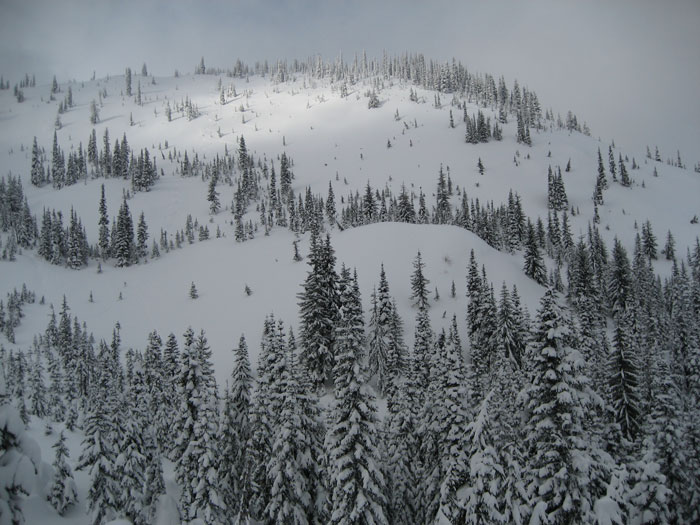
2. South slope of Pt. 5703'.
3. North slope of Pt. 5085'.
1. Self portrait with skin track depth at 5000 feet.
2. South slope of Pt. 5703'.
3. North slope of Pt. 5085'.


Reply to this TR
Please login first: