January 6, 2007, Exit 47 BC (Olallie/Silver Peak)
1/6/07
WA Snoqualmie Pass
2438
4
Left Exit 47 in an attempt to try a route I've traced over the map many times - Nigh straight up out of the Annette Lake TH up the ridge to access the plateau below Olallie Meadows. My intent, for today, was then to carry on to (and up) the W ridge of Catherine.
The execution: As hoped, I was comfortable with the avalanche safety and stability I found in the heavily treed slopes on my way up the ridge. As I neared the top of the ridge, the dense trees became too dense; ~1.5 hours of focused thrashing let me gain less than 400' of elevation. Once above the trees, I laid a circuitous (and occasionally dead-ended) path linking confidence-inspiring isthmuses of safety through open slopes.
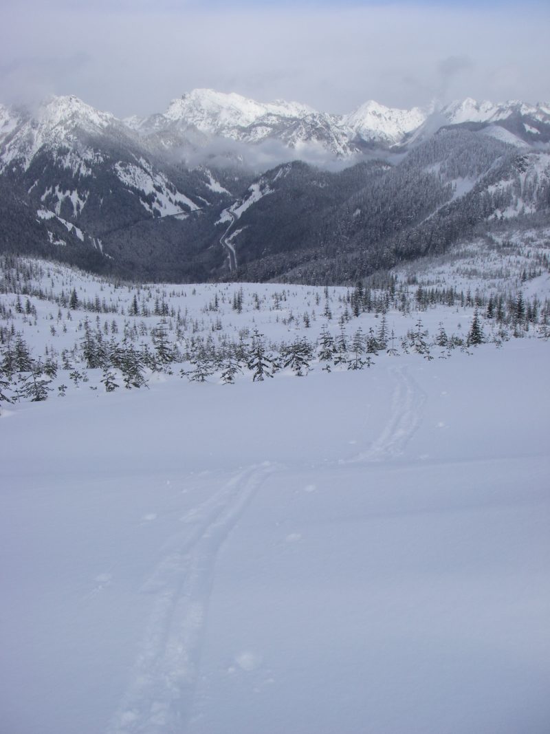
Atop the ridge, I was astounded at how pretty Olallie Meadows are. As I was blissfully unaware of the nordic trail plowed through them (the USGS leaves that out), I reveled in the wide open solitude (then I saw everyone else...). I could see how I'd get to Catherine, but the W ridge just didn't draw me in. The NE environs of Silver Peak, however, did. I toured through low angle glades until I nearly reached the wind-raked ridge.
The upper half of the ski home was good. Above ~4k, there were ~6" of light fresh atop the consolidated base. The lower half of the ski home was extremely unpleasant. In order to avoid the coniferous thicket that I'd thrashed through, I chose what I thought would be a clever and fun line back to the railroad grade. The result was scary. Climb what you ski. Below ~4k, the snow became progressively more wet and manky, with a thin crust, atop soft wet snow, lurking beneath the fresh.
Stability throughout the day seemed decent, but I jumped through a great many hoops (and became gently intimate with a great many trees) to avoid instability. I felt no large scale settlement, only a little dinnerplating between the skis.
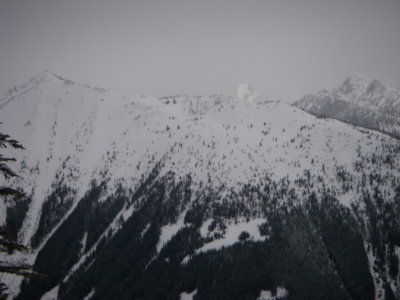
Other things of note: While Granite Mountain was clearly cross loaded from the W, as usual, Olallie Meadows were primarily recently figured by what appeared to have been a pretty stiff wind from the E. Silver Peak held a few laterally small but evil-looking E-facing cornices. Kaleetan's looking fat and in, as is everything else. Pictures will follow sometime.
A lot can happen in a contour interval (especially if a critical feature's missing from the map).
The execution: As hoped, I was comfortable with the avalanche safety and stability I found in the heavily treed slopes on my way up the ridge. As I neared the top of the ridge, the dense trees became too dense; ~1.5 hours of focused thrashing let me gain less than 400' of elevation. Once above the trees, I laid a circuitous (and occasionally dead-ended) path linking confidence-inspiring isthmuses of safety through open slopes.
Atop the ridge, I was astounded at how pretty Olallie Meadows are. As I was blissfully unaware of the nordic trail plowed through them (the USGS leaves that out), I reveled in the wide open solitude (then I saw everyone else...). I could see how I'd get to Catherine, but the W ridge just didn't draw me in. The NE environs of Silver Peak, however, did. I toured through low angle glades until I nearly reached the wind-raked ridge.
The upper half of the ski home was good. Above ~4k, there were ~6" of light fresh atop the consolidated base. The lower half of the ski home was extremely unpleasant. In order to avoid the coniferous thicket that I'd thrashed through, I chose what I thought would be a clever and fun line back to the railroad grade. The result was scary. Climb what you ski. Below ~4k, the snow became progressively more wet and manky, with a thin crust, atop soft wet snow, lurking beneath the fresh.
Stability throughout the day seemed decent, but I jumped through a great many hoops (and became gently intimate with a great many trees) to avoid instability. I felt no large scale settlement, only a little dinnerplating between the skis.
Other things of note: While Granite Mountain was clearly cross loaded from the W, as usual, Olallie Meadows were primarily recently figured by what appeared to have been a pretty stiff wind from the E. Silver Peak held a few laterally small but evil-looking E-facing cornices. Kaleetan's looking fat and in, as is everything else. Pictures will follow sometime.
A lot can happen in a contour interval (especially if a critical feature's missing from the map).
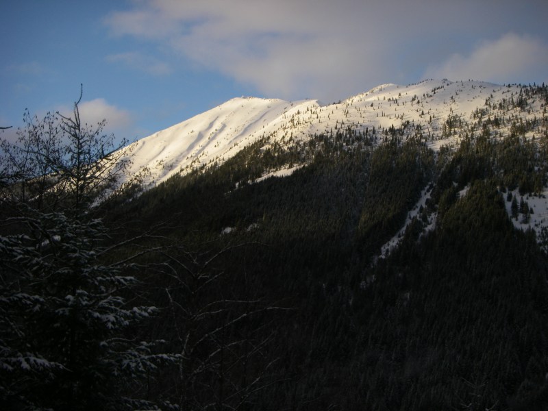
Good "adventure". I was surprised to see Granite bare on the ridge last Friday. Maybe we'll get a clear spell next week and go after it.
Save for the scary bit, with which I'm still coming to terms, it was indeed a good adventure.
Granite's looked beautiful in the sunlight over the past two days. Come in, come in, said the spider to the fly... The benevolent future-gazing NWAC folks seem to have ordered up a whole 'nother batch of winter though - it'll be a while (and worth the wait).
Granite's looked beautiful in the sunlight over the past two days. Come in, come in, said the spider to the fly... The benevolent future-gazing NWAC folks seem to have ordered up a whole 'nother batch of winter though - it'll be a while (and worth the wait).
I was out there as well, and experienced conditions similar to what you did. I got a late start due to home projects and indecision about where to start skiing - Hyak or exit 47. I choose exit 47 after seeing the crowds on the pass and falling for what looked like a more direct route to Silver Peak on the map. As you've noticed, contour lines on maps don't tell the whole story. Who would have known that someone would try to grow a "Christmas tree farm" at the top of the ridge. I was grateful to have a track to follow down, which I’m assuming was probably yours. It didn't matter to me if the track I was following went the best way, it just gave me something to focus on as darkness crept in the woods. It's too bad there's not a good way through the "tree farm" or maybe there is. Maybe there's justification for another exploration of exit 47 sometime soon.
Ah, I'd seen an uptrack on my way out and figured its owner had some sage knowledge of a nifty route upward. I was more than a little concerned that I didn't see a downtrack, as I left the railroad grade not long before dusk.
If your route home following tracks took you through thick trees, along logs, and generally downhill, that was my uptrack. If it took you down steep, but not quite so thick trees, across a sizeable avalanche slope above a munchy looking terrain trap, to a wee road, down steeper trees, into an ancient powerline at eye-level, traversed above even steeper trees, and then followed a few red-taped trees to the railroad grade, that was my way out (with far more sidesteps, kick turns, and sideslips than skiing). Would've been fun in retrospect, save for the scary avy slope.
In safer conditions, I'll wager that you can make it easily off the ridge by skiing the first avalanche gulch that hits the Annette Lake trail above the railroad grade. I've wandered the slopes between the first and second avalanche gulches in the past on snowshoes; it's steeper but far less thick (and probably ends in small open bowls at the top). For more skilled (and perhaps more masochistic) skiers than myself, there might be short steep lines to be had on the NE side of the ridge that extends to 47 from Olallie Meadows, but it'd be worth climbing them from the bottom (and probably more worthwhile to go elsewhere).
Glad you got out safe!
Reply to this TR
Please login first: