June 2, 2007, Tomyhoi Peak
6/2/07
2747
3
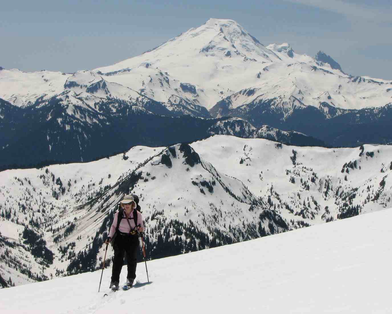
After abandoning our original plan to ski up towards Snowfield Peak and then our backup plan to do Silver Star, my friend Gretchen and I opted to check out terrain that was new for both of us on skis... Tomyhoi Peak. We were treated to great views, almost complete solitude (saw some other new tracks but never saw the skiers responsible for them) but so-so snow on the descent.
You can currently drive up the Twin Lakes Road 3.5 miles from the turn off from 542. All of the blow downs to that point can be passed easily but there is a washout with water running through it at the 3.5 mile mark which does not appear passable at present and leaves you 1 mile shy of the summer trailhead. Rather than following the summer trail, we opted to take the old trail described in Rainer Burgdorfer's book. We started at mile 2.3/3080 feet on the Twin Lakes Road. Despite the fact that the trail is little used, we found it very easy to follow down low. This may change in a few weeks as all the brush starts to grow in but for now it is no problem. We took this to 4000 feet in elevation where we hit the flat area in the forest and quickly lost the trail. We took some bearings but managed to head a bit more westerly than we should have and broke through the trees in the drainage to the west of that which leads up to the Yellow Aster Lakes. This was easily corrected by skiing over a small ridge from where we then accessed the lakes area.
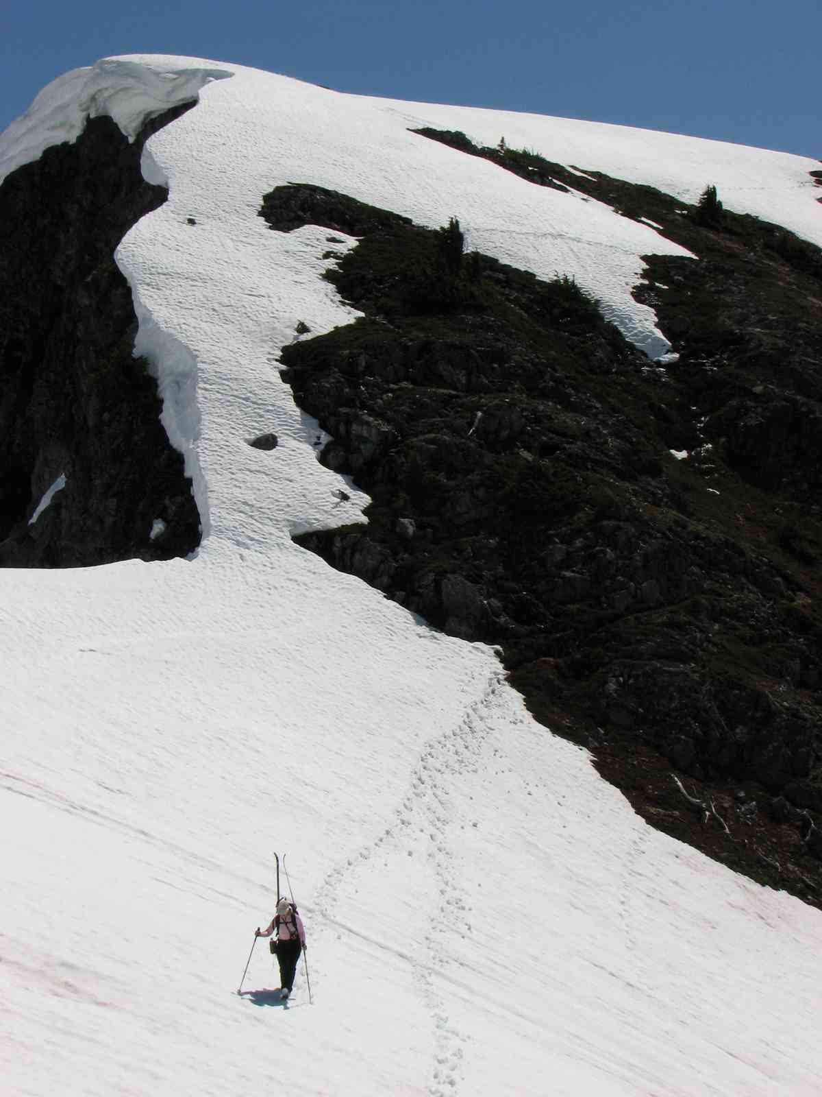
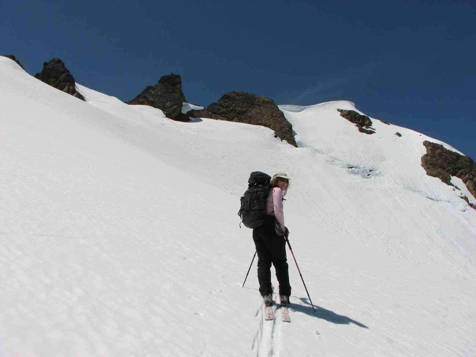
All of the lakes are still frozen and covered in snow. The ascent out of the lakes basin to the broad ridge was completely snow covered and we were able to traverse the entire way up it. The coverage is thin in spots and may melt out within the next week or so. From there, the skinning was quite good up to the 6450 point from where you have to descend 200 feet. This was bare in spots and we had to boot down this section. Be careful not to stray too far to the edge as there are some big cornices hanging over the rock face (see the photo). We then booted up the opposite side of this for about 200 feet before putting on skis again. From here to the false summit, we were able to keep our skis on except for a few short sections. Coverage is thin in spots here as well and more will melt out soon. We skinned up to the ridge just shy (west) of the false summit and decided to call it a day there as neither of us were too keen to do the true ummit block (snow free on the ascent route) in our stiff ski boots.
The descent wasn't as great as hoped. Neither of us could remember if we had actually waxed our skis any time recently. The snow was pretty soft and very slow. We also seemed to accumulate this sticky brown grime in our the remaining wax in our bases which seemed to be adding to our slow speeds. Some turns were had but it required fairly steep slopes to get going. We made it back through the lakes area where we had to do a lot of walking and then headed out via the correct drainage. We skied out from the lakes to a flat, treeless area at 4700 feet from where we picked the correct bearing (true north) and headed down to the 4000 foot flat forested area where we managed to find the start of the trail surprisingly easily. Be aware that there is a new creek running down the slope that leads to this flat area which is not marked on the USGS maps (perhaps season or snow-melt related). The trail is west of this creek. From there it was another hour down to the car and off to Glacier for some celebratory grub at Graham's.
Car-to-Car Time: 11 hours with breaks
An ice ax is probably not necessary unless you want to get to the false summit and go for the true summit (some steeper snow in here)
You can currently drive up the Twin Lakes Road 3.5 miles from the turn off from 542. All of the blow downs to that point can be passed easily but there is a washout with water running through it at the 3.5 mile mark which does not appear passable at present and leaves you 1 mile shy of the summer trailhead. Rather than following the summer trail, we opted to take the old trail described in Rainer Burgdorfer's book. We started at mile 2.3/3080 feet on the Twin Lakes Road. Despite the fact that the trail is little used, we found it very easy to follow down low. This may change in a few weeks as all the brush starts to grow in but for now it is no problem. We took this to 4000 feet in elevation where we hit the flat area in the forest and quickly lost the trail. We took some bearings but managed to head a bit more westerly than we should have and broke through the trees in the drainage to the west of that which leads up to the Yellow Aster Lakes. This was easily corrected by skiing over a small ridge from where we then accessed the lakes area.
All of the lakes are still frozen and covered in snow. The ascent out of the lakes basin to the broad ridge was completely snow covered and we were able to traverse the entire way up it. The coverage is thin in spots and may melt out within the next week or so. From there, the skinning was quite good up to the 6450 point from where you have to descend 200 feet. This was bare in spots and we had to boot down this section. Be careful not to stray too far to the edge as there are some big cornices hanging over the rock face (see the photo). We then booted up the opposite side of this for about 200 feet before putting on skis again. From here to the false summit, we were able to keep our skis on except for a few short sections. Coverage is thin in spots here as well and more will melt out soon. We skinned up to the ridge just shy (west) of the false summit and decided to call it a day there as neither of us were too keen to do the true ummit block (snow free on the ascent route) in our stiff ski boots.
The descent wasn't as great as hoped. Neither of us could remember if we had actually waxed our skis any time recently. The snow was pretty soft and very slow. We also seemed to accumulate this sticky brown grime in our the remaining wax in our bases which seemed to be adding to our slow speeds. Some turns were had but it required fairly steep slopes to get going. We made it back through the lakes area where we had to do a lot of walking and then headed out via the correct drainage. We skied out from the lakes to a flat, treeless area at 4700 feet from where we picked the correct bearing (true north) and headed down to the 4000 foot flat forested area where we managed to find the start of the trail surprisingly easily. Be aware that there is a new creek running down the slope that leads to this flat area which is not marked on the USGS maps (perhaps season or snow-melt related). The trail is west of this creek. From there it was another hour down to the car and off to Glacier for some celebratory grub at Graham's.
Car-to-Car Time: 11 hours with breaks
An ice ax is probably not necessary unless you want to get to the false summit and go for the true summit (some steeper snow in here)
The views look sweet.
Sounds like you had some a-pollen conditions. I read a post last night that said to use a scraper regularly, to freshen the wax and prevent getting grabbed at by the vegetable matter.
Sounds like you had some a-pollen conditions. I read a post last night that said to use a scraper regularly, to freshen the wax and prevent getting grabbed at by the vegetable matter.
Thanks for the post. After reading a bunch of other TRs, I began to gather it must have been the pollen. I did scrape off some of the gunk on the bottom of the skis at one point (that QFC card comes in handy sometimes!) and the nice glide lasted only a few minutes at best it seemed.
Friends of mine took the trail that you describe to the Yellow Aster lakes last fall. They seemed to think that other TH near the switchbacks was being eliminated. It is a spectacular place by looking at their photos and yours. The closest that I have been to the area is Gold Run Pass, Winchester and Goat to the NE.
Hopefully our paths will cross again, Andy.
Hopefully our paths will cross again, Andy.
Reply to this TR
Please login first: