May 12, 2007, Diamond Peak, OR
5/12/07
OR elsewhere
5610
10
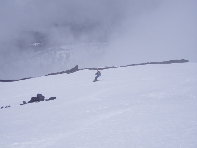
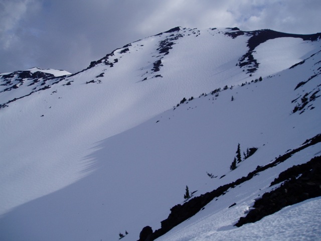
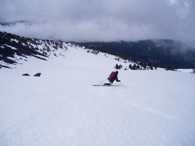
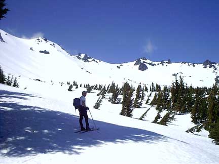
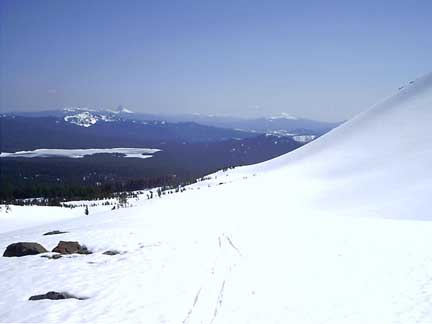
After a peaceful night of camping, Todd and I were on the trail to Diamond Peak around 5:30am. The weather seemed cooperative with starry skies and temps around 40 degrees at 4500 feet. After hiking along the forested trail for about a mile, we found snow and headed towards the southwest ridge. Down lower, there was a large cloud bank that developed and seemed to remain stagnant at about 5000 feet. The climbing was great, and we added crampons at about 7000 feet. We ascended to the southern false summit at about 8400 feet. The great weather from earlier was deteriorating over the morning ascent and large clouds were rolling in and out on the upper mountain. The decision was made to head down instead of traversing the ridge to the main summit at 8700 feet. We got some good shots on the way down, and later the summit was totally engulfed in clouds. The snow had softened just enough to be great corn up high. Down lower there was a little slop. At about 6400 feet, we put the boards back on our backs and booted out to the cars. On the way out, I found an ice axe that I'll give back to the owner if they can identify it to me. The thick fog down low did require the use of a compass to get bearings. The snow in the upper bowls will be good for quite some time to come - I already want to go back :)
Howdy. We met last summer at Snowdome. At any rate, a couple of us were up at Diamond on the 12th. We by no means had an alpine start and were in thick pea soup above treeline. We made it to about 7700, going in via Corrigan. The snow clearly had not frozen the night before, but the slushy turns were still fun. FYI, there is going to be a good crew of folks, mostly pinheads, at Corrigan Lake Memorial Day weekend. Swing by.
I wanna go! It looks awesome. A new place to add to my list. Thanks for the trip report. 8)
Couple of us were up there Sunday, May 13, via Marie Lake on a bluebird day. Lotsa snow at and above the lake, spotty but skiable in the trees below. Fast descent from D. Peak.
Buck - I remember you from Snowdome last summer. I'd love to swing by for Memorial weekend, but I have plans and probably can't break them. However, Todd and I were thinking about doing the South Sister the following weekend. It'd be fun to have some others come along - got any plans?
author=Buck link=topic=7116.msg28456#msg28456 date=1179338260]
FYI, there is going to be a good crew of folks, mostly pinheads, at Corrigan Lake Memorial Day weekend. Swing by.
What days are you going to be there? Like Matt said, we're planning on a trip the following weekend, but I might be able to squeeze in another run at Diamond on Memorial weekend. I'm still a little bent about getting that close to the summit and not tagging it.
There may be some folks up as early as Friday. Myself and the people I'm going with will be there Saturday. I think we are going to do some pre-ski biking on the middle fork trail that day, so we'll be at Corrigan by early evening. I'm planning on skiing Diamond Sunday. I'd not be surprised if there were folks skiing it again Monday, though I'll probably leave Sunday evening. It should be a good time. As to the following weekend, I'll get back to you -- South Sister would be fun.
Directions from Oakridge?
Am I seeing the USFS 21 south many miles past the reservoir to the 2149 at Pioneer Gulch to Scout Creekish????
Any more specifics would be great!
I spoke with Mckenzie at the Willamette Mountain Merc. in Oakridge... A must see Shop!
Pin"
Am I seeing the USFS 21 south many miles past the reservoir to the 2149 at Pioneer Gulch to Scout Creekish????
Any more specifics would be great!
I spoke with Mckenzie at the Willamette Mountain Merc. in Oakridge... A must see Shop!
Pin"
author=pin!head link=topic=7116.msg28568#msg28568 date=1179544551]
Directions from Oakridge?
Am I seeing the USFS 21 south many miles past the reservoir to the 2149 at Pioneer Gulch to Scout Creekish????
Any more specifics would be great!
Yup. That be it. The main road is paved. The turn off the main road is just past Indigo Springs Campground and it is signed (Pioneer Gulch Road). The Corrigan TH is a few miles up the road and is well marked. The parking area sits next to Scout Creek right before the point where it crosses under the road. You can't miss it. Just look for the nice "swimming" hole below the culvert. You gonna be there?
I spoke with Mckenzie at the Willamette Mountain Merc. in Oakridge... A must see Shop!
McKenzie's shop is great. I've only managed to catch him in the store on one occasion, though. That guy spends an insane amount of time on skis.
Hey guys,
How far is it from the car-camping to some of the main features or the closest summit? Are many of the features "generic" or is there better terrain than others there? Is it set up like a crater like cirque with skiing on the inside and outside...or...???
Where are ya'll comming from? Were here in Cornvalli'
Howdy. I emailed you direct, but then just saw this post. I'd recommend camping at Corrigan if you're feeling at all social. Should be a fine assortment of folks, with a number of us arriving Saturday. I prefer to ski the main steep bowl on the northern aspect, though this requires a pretty long traverse back around to Corrigan, or another climb up. There really are no bad aspects on Diamond right now until more melting happens. The scrambles up the ridges, as snow melts, can become pretty hairy with scree. I'm in Corvallis as well so give a call. Do you know Jim S.?
Reply to this TR
Please login first: