May 7- 12, 2006, Mount Whitney Circumnavigation
5/7/06
3187
4
Springtime had finally arrived in the Sierra Nevada so it was time to head south for a bit of backcountry touring through some great terrain in the southern part of the range. Paul and I headed down, meeting up with Mark and Lucy, who live in Berkeley, and hit the road for the long drive out to our intended start point. The initial plan was to travel over 6 days from Whitney Portal to Onion Valley via Russel-Carillon Col, Mt. Barnard, Williamson Bowl, Shepard's Pass, Junction Pass and University Col but for reasons that became apparent as the trip progressed over the first few days, we opted to drop that plan and pursue Plan B... a circumnavigation of Mt. Whitney.
Day 1 was supposed to be an easy day with a short distance and minimal elevation gain to our first nights camp at Lower Boy Scout Lake. We opted to follow the Mountaineers' Route up the North Fork of Lone Pine Creek. Somewhere along the way up, we missed the two turnoffs to the easier alternatives up the drainage and ended up doing several hundred feet of fairly epic bushwacking until we finally crested out on the snow at just below 10,000 feet. It might not have been so bad but with heavy packs and skis sticking up on top, it proved to be quite the chore. Nevertheless, we finally got the skis on and put in a few hundred more feet of climbing before finding a dry camp at around 10,400 feet.
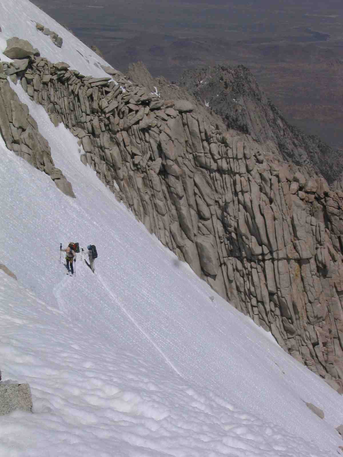
Day 2 was a big day with plans to cross Russell-Carillon Col and head over to Wallace Lake inside the national park boundary. Off at 8:30, we climbed up to Clyde Meadow and took a short break before starting the steep climb up the first part of the col. What didn't look so bad from down in the meadow ended up being a bit below 2000 feet of steep traversing on snow with occasional scrambles on loose scree until reaching a bench at about 12,800 feet. Full packs and the altitude were not helping matters. After a bit of a rest there, we shouldered the packs and climbed the last 400 feet in much more gradual fashion and finally reached the col about 6 hours after beginning our ascent earlier in the day. On the north side of the col, we found some Class 2 scrambling to get down through the steep rock bands at the top of the col before getting onto easier snow that we opted to boot down rather than ski. After a break at the bottom, right next to Tulainyo Lake, one of the highest in the Sierra, we put on the packs again and headed down to Wallace Lake at 11,450 feet where we all finally arrived around 6:30 PM. Upon arriving and making some dinner, we decided to take stock of our trip. The following days would be no easier in terms of the height and difficulty of the passes. Given our slow progress and the fact that one of our group had some pretty good altitude illness going, we opted to change plans. Instead of the planned move over Mt. Barnard the next day, we decided to stay put for a day and let our sick party member recover a bit from his AMS. Rather than heading north after that, we would circumnavigate Whitney, going over Trail Crest and back out through Whitney Portal.
Day 3 dawned with clear skies again and after a somewhat latish start, 3 of us headed out for a day climb of Mt. Barnard, 13,390 feet by the map, 14,010 according to my GPS on the summit. We crossed the southern slopes to gain the SW ridge without much difficulty and followed that up until some large rock bands forced us to traverse across the south facing slopes until we accessed a gully that we could zig zag through on up to the broad summit plateau. From there, it was easy skiing to within the last 50 feet of the summit where we took skis off and did some class 2 scrambling up to the top. Once on top, we realized the wisdom of our decision to alter our trip plans. The east face of Barnard, which we were supposed to have skiied down on our way to Williamson Bowl was completely devoid of snow and would have made for a challenging descent. Plus, with our heavy, full packs, what was already quite a climb as a day ski would have been that much harder, particularly with one person sick from the altitude. So... with that comfort in mind and some good views tucked away, we headed back to camp with great corn and lots of good turns along the way. Only at the very bottom of the peak and in the valley heading back up to Wallace Lake did we find some very very soft snow that easily gave way under the skis.
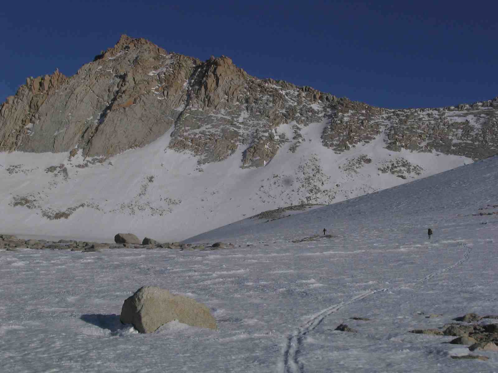
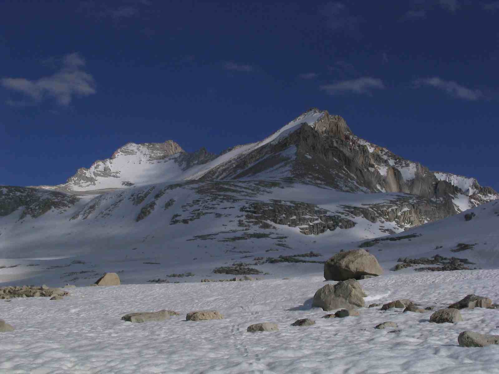
Day 4 came with yet another day of crystal clear skies. With all of our group feeling good at this point, we headed off for a big day touring around to Guitar Lake and the area below and west of Trail Crest. The morning was great as we headed down the valley towards the Muir Trail. The only glitch of the morning was an unfortunate ("dumb" might be the better word) move on my part, crossing a small lake in a not particularly intelligent spot and then having the ice give way just as I was saying to myself... "hmmm... this doesn't feel too stable, I think I should double back." Fortunately, I was standing on the bottom up to my knees after breaking through and was able to get onto the ice again and over to some big rocks to dry out. We waited for about 45 minutes while things dried out a bit and then I donned the moist clothing and we were off again. With the hot temps and sunny skies, I was totally dry within about 3 hours. We climbed up onto the northwest slopes of Mt. Young and traversed around the peak at 11,200 feet, holding elevation the entire time. The western slopes were gorgeous affording clear views of the entire Great Western Divide and the Kaweah Range. After lunch and some turns on the slopes, we continued around the south side of the peak, holding elevation through a pretty forest and then climbing through open terrain to Guitar Lake and eventually to a plateau above the lake (which I chose to ski around this time) at about 11,800 feet with beautiful views of Mt. Hitchcock, Mt. Young and Mt. Hale.
We had another clear, warm night with barely freezing temperatures and were off the next morning by 7AM for a climb up to Trail Crest with plans to go to the Whitney Summit if time permitted. We could see parts of the trail on the west facing slopes heading up to Trail Crest. Low down, the slope was steep and firm so we put on crampons and found great cramponing conditions up the slope towards the ridge. Paul and I made good time going up so we dropped our packs a few hundred feet below trail crest and headed along the summer trail that scoots just below the ridge on the west side over to the summit. Mostly clear of snow, there were several sections in the gullies with firm snow that required crampons on our way out. Otherwise, the travelling was pretty easy, aside from the high altitude. After 1.25 hours along the trail we finally arrived on the summit. It was a bit surreal. This summit is notorious for being loaded with hikers and climbers during the summer and we had it, as well as the entire trail all to ourselves. A much more enjoyable way to experience that peak. After a few short minutes, some photos ands some food, we headed back down to meet up with Mark and Lucy and do the final climbing up to Trail Crest.
Fortunately, what had been a cloudy morning became a sunny afternoon and by the time we arrived at Trail Crest, the slopes had softened up enough to make skiing off the pass possible. Mark went first and we all followed. After some initial traversing down the steep upper portion off the pass , the tele turns broke out on the bottom. Mark led the way from high up and his inspiration got us all making turns lower down on great corn snow. After the initial 700 foot descent, we had yet another 1,500 feet of great corn snow on less steep terrain until we found our last camp around 10,800 feet. Along the way, we stopped at Trail Camp for some much needed rest and time soaking in the sun. Normally an area loaded with tents and people heading up and down to the summit, we had the entire area to ourselves yet again.
Yet one more night camping out on dry ground before we awoke the next morning and headed down to the trail, losing the snow around 9,500 feet and booting the rest of the way down the easy trail back to the parking lot.
Overall, a great trip. Great weather, great snow, great terrain and lots of solitude. It's never a bad thing when the Plan B turns out to be such a great trip!
Day 1 was supposed to be an easy day with a short distance and minimal elevation gain to our first nights camp at Lower Boy Scout Lake. We opted to follow the Mountaineers' Route up the North Fork of Lone Pine Creek. Somewhere along the way up, we missed the two turnoffs to the easier alternatives up the drainage and ended up doing several hundred feet of fairly epic bushwacking until we finally crested out on the snow at just below 10,000 feet. It might not have been so bad but with heavy packs and skis sticking up on top, it proved to be quite the chore. Nevertheless, we finally got the skis on and put in a few hundred more feet of climbing before finding a dry camp at around 10,400 feet.
Day 2 was a big day with plans to cross Russell-Carillon Col and head over to Wallace Lake inside the national park boundary. Off at 8:30, we climbed up to Clyde Meadow and took a short break before starting the steep climb up the first part of the col. What didn't look so bad from down in the meadow ended up being a bit below 2000 feet of steep traversing on snow with occasional scrambles on loose scree until reaching a bench at about 12,800 feet. Full packs and the altitude were not helping matters. After a bit of a rest there, we shouldered the packs and climbed the last 400 feet in much more gradual fashion and finally reached the col about 6 hours after beginning our ascent earlier in the day. On the north side of the col, we found some Class 2 scrambling to get down through the steep rock bands at the top of the col before getting onto easier snow that we opted to boot down rather than ski. After a break at the bottom, right next to Tulainyo Lake, one of the highest in the Sierra, we put on the packs again and headed down to Wallace Lake at 11,450 feet where we all finally arrived around 6:30 PM. Upon arriving and making some dinner, we decided to take stock of our trip. The following days would be no easier in terms of the height and difficulty of the passes. Given our slow progress and the fact that one of our group had some pretty good altitude illness going, we opted to change plans. Instead of the planned move over Mt. Barnard the next day, we decided to stay put for a day and let our sick party member recover a bit from his AMS. Rather than heading north after that, we would circumnavigate Whitney, going over Trail Crest and back out through Whitney Portal.
Day 3 dawned with clear skies again and after a somewhat latish start, 3 of us headed out for a day climb of Mt. Barnard, 13,390 feet by the map, 14,010 according to my GPS on the summit. We crossed the southern slopes to gain the SW ridge without much difficulty and followed that up until some large rock bands forced us to traverse across the south facing slopes until we accessed a gully that we could zig zag through on up to the broad summit plateau. From there, it was easy skiing to within the last 50 feet of the summit where we took skis off and did some class 2 scrambling up to the top. Once on top, we realized the wisdom of our decision to alter our trip plans. The east face of Barnard, which we were supposed to have skiied down on our way to Williamson Bowl was completely devoid of snow and would have made for a challenging descent. Plus, with our heavy, full packs, what was already quite a climb as a day ski would have been that much harder, particularly with one person sick from the altitude. So... with that comfort in mind and some good views tucked away, we headed back to camp with great corn and lots of good turns along the way. Only at the very bottom of the peak and in the valley heading back up to Wallace Lake did we find some very very soft snow that easily gave way under the skis.
Day 4 came with yet another day of crystal clear skies. With all of our group feeling good at this point, we headed off for a big day touring around to Guitar Lake and the area below and west of Trail Crest. The morning was great as we headed down the valley towards the Muir Trail. The only glitch of the morning was an unfortunate ("dumb" might be the better word) move on my part, crossing a small lake in a not particularly intelligent spot and then having the ice give way just as I was saying to myself... "hmmm... this doesn't feel too stable, I think I should double back." Fortunately, I was standing on the bottom up to my knees after breaking through and was able to get onto the ice again and over to some big rocks to dry out. We waited for about 45 minutes while things dried out a bit and then I donned the moist clothing and we were off again. With the hot temps and sunny skies, I was totally dry within about 3 hours. We climbed up onto the northwest slopes of Mt. Young and traversed around the peak at 11,200 feet, holding elevation the entire time. The western slopes were gorgeous affording clear views of the entire Great Western Divide and the Kaweah Range. After lunch and some turns on the slopes, we continued around the south side of the peak, holding elevation through a pretty forest and then climbing through open terrain to Guitar Lake and eventually to a plateau above the lake (which I chose to ski around this time) at about 11,800 feet with beautiful views of Mt. Hitchcock, Mt. Young and Mt. Hale.
We had another clear, warm night with barely freezing temperatures and were off the next morning by 7AM for a climb up to Trail Crest with plans to go to the Whitney Summit if time permitted. We could see parts of the trail on the west facing slopes heading up to Trail Crest. Low down, the slope was steep and firm so we put on crampons and found great cramponing conditions up the slope towards the ridge. Paul and I made good time going up so we dropped our packs a few hundred feet below trail crest and headed along the summer trail that scoots just below the ridge on the west side over to the summit. Mostly clear of snow, there were several sections in the gullies with firm snow that required crampons on our way out. Otherwise, the travelling was pretty easy, aside from the high altitude. After 1.25 hours along the trail we finally arrived on the summit. It was a bit surreal. This summit is notorious for being loaded with hikers and climbers during the summer and we had it, as well as the entire trail all to ourselves. A much more enjoyable way to experience that peak. After a few short minutes, some photos ands some food, we headed back down to meet up with Mark and Lucy and do the final climbing up to Trail Crest.
Fortunately, what had been a cloudy morning became a sunny afternoon and by the time we arrived at Trail Crest, the slopes had softened up enough to make skiing off the pass possible. Mark went first and we all followed. After some initial traversing down the steep upper portion off the pass , the tele turns broke out on the bottom. Mark led the way from high up and his inspiration got us all making turns lower down on great corn snow. After the initial 700 foot descent, we had yet another 1,500 feet of great corn snow on less steep terrain until we found our last camp around 10,800 feet. Along the way, we stopped at Trail Camp for some much needed rest and time soaking in the sun. Normally an area loaded with tents and people heading up and down to the summit, we had the entire area to ourselves yet again.
Yet one more night camping out on dry ground before we awoke the next morning and headed down to the trail, losing the snow around 9,500 feet and booting the rest of the way down the easy trail back to the parking lot.
Overall, a great trip. Great weather, great snow, great terrain and lots of solitude. It's never a bad thing when the Plan B turns out to be such a great trip!
Right on! Sounds like a great adventure. Glad to hear that you had good snow. I was down there a week before you and and things were melting like crazy.
Nice trip. It is amazing how warm it has been in the Sierra and the snow is melting fast below 9500'. We were in Onion Valley over the weekend and things were soft below 12,000. Glad to hear plan B was an enjoyable adventure.
The snow is, in fact, melting fast. On the traverse around Mt. Young, which we did around 11,200 feet the entire way, there was sparse coverage in areas and a lot of spots that looked like they would be melted out in 1-2 weeks. Not sure how much longer this tour will go without lots of taking the skis on and off the pack.
Great TR. It makes me long for climbing trips in the Sierra Nevada. Thanks for the photo's ... I hope to retire in Bishop.
Reply to this TR
Please login first: