April 24, 2006, Jolly Mtn 6442', Cle Elum Valley
4/24/06
WA Cascades East Slopes Central
3226
1
Started very early for this one, I was at Salmon La Sac at 6:45AM. Still can not drive past the Salmon La Sac Guard Station.
On the approach I started up the Jolly road No. 4315 to the first switchback. Here I left the road and hiked the rib, ending at the switchback, along Salmon La Sac Creek. This rib is easy open walking with firm snow patches. This leads one to the bottom of the big clearcut at 3100 feet. From here up it is solid snow. I had it frozen for the entire ascent combining a couple of short spur road sections but generally up the rib line. At the top of the west facing slopes (what Larry R. affectionately calls the "frontside") I turned east on the ridge above the Upper West Fork Teanaway River. Then it was a beautiful subalpine ramble to the summit of Jolly. Somehow I made it by 10:15! I had to kill at least 45 minutes on top to soften the snow and take in the great views.
On the descent I started on the east side of the top for a few turns (sun softened to 1"), then traversed to the north glades (frozen but gentle). Took a side jaunt up Ladybug Peak (Pt. 6080+) to peek down into Jolly Creek (sweet lines here). Then it was a few turns on south slopes (thaw to 2 or 3"), west traverses, more south turns, traverses, etc. to the Frontside. Now noon, the frontside was still frozen! Oh well, I was tentative on icy stuff yesterday so I took the opportunity to practice today. Pretty easy going and began to soften to 1" thaw after the first 800 vertical. Note: the best turns are easy to see along the northwest facing ribline. At 3600 ft I found the short spur road, descended it to 3400 ft and then just descended near the south edge of the cut through dense second growth. A bit lumpy and mushy through there but still 3 to 4 feet deep. Back to the hiking rib at 3100 feet and out. (I actually took the road from here at the 3rd switchback but there were 5 melted out patches so hiking would have been the better option). This should hold in for one more week to maybe two more weeks. Afterward the road should be driveable for a few switchbacks.
Looking at Swooz' Earl Peak report, seems like East Cascades west facing slopes are holding in for most of the day with fine corn to be had! And Jolly will remain an option with the slow to open Spring access.
Some pics:
Pic one is Jolly's summit with my first turns, in center of photo.
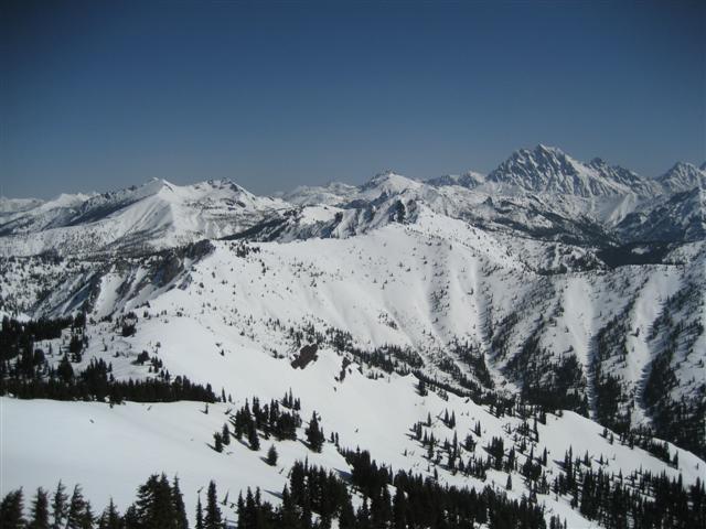
The next is the high Teanaway.
The third is some of my favorite Spring sking terrain to the north with Hawkins, Skookum, Ingalls, and Fortune Mountains.
Pic one is Jolly's summit with my first turns, in center of photo.
The next is the high Teanaway.
The third is some of my favorite Spring sking terrain to the north with Hawkins, Skookum, Ingalls, and Fortune Mountains.


Reply to this TR
Please login first: