Nov 15, 2018, Muir, Solitude and Pseudo-Firnspiegel
November 15, 2018, Mount Rainier, Muir Snowfield, Solitude & Pseudo-Firnspiegel
Firnspiegel (German for "firn mirror") is one of my favorite snow conditions, a very thin glass-like layer of clear ice which occasionally forms atop consolidated corn snow (= firn) during a warm melt-freeze cycle. In the right set of weather and snowpack conditions, the sunlight penetrates the snow surface and just barely melts the rounded grains of corn snow, and the meltwater refreezes into thin layer of ice atop the surface, cooled by the powerful effect of radiational cooling especially overnight. The sunlight can continue to easily penetrate the thin layer of clear ice to repeat the process on subsequent days, building large sheets of thin ice often separated from the snow surface by a substantial gap of several millimeters or more, much greater than the ice thickness.
Firnspiegel looks amazing with the sun glinting off it just like an actual mirror, and skis just as beautifully, shattering off effortlessly under the ski edges as they glide smoothly across the underlying corn surface, while the shattered shards of microscope-slide-thin ice skitter and bounce across the surrounding surface with unusually joyous clinking and tinkling and jingling sound effects. By choosing to ski the majority of my backcountry days at higher elevations on the Cascade volcanoes in spring- or summer-like weather (often even during the seasons of fall and winter like recently), I have the pleasure of seeing and skiing true firnspiegel quite often relative to most skiers, at least several days each year and on perhaps as many as a few dozen days in some years.
But sometimes, quite rarely, a very thin rain crust atop the snow can look and ski almost exactly like real firnspiegel. It really has to be only 1-2 millimeters thick at most, mimicking the thinness of true firnspiegel, and it has to fall atop a smooth firm snow base that mimics well-consolidated corn, not atop powder of any kind. What should we call this very unusual snow condition? It's obviously a rain crust by formation and definition, but it skis beautifully, nothing like the misery of almost any normal rain crust. So I've decided to call it "pseudo-firnspiegel"!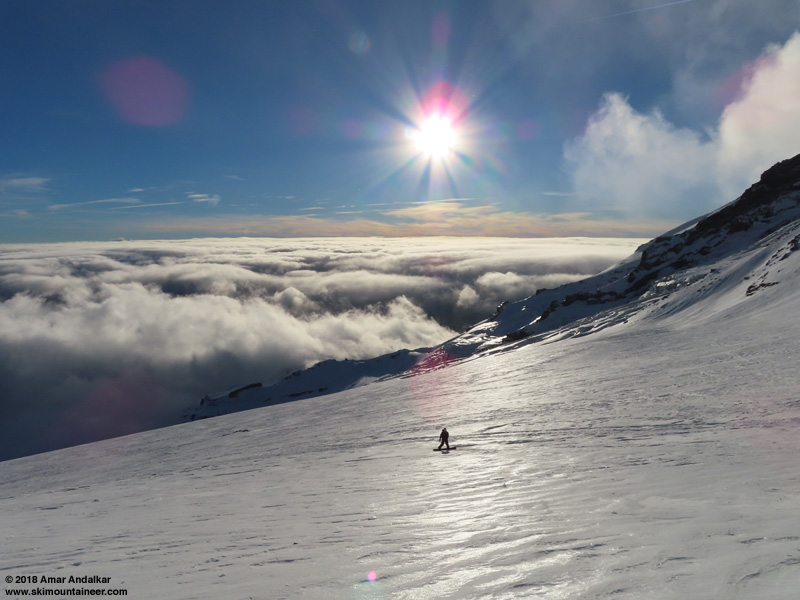
Enjoying a nice run down the pseudo-firnspiegel just below Camp Muir.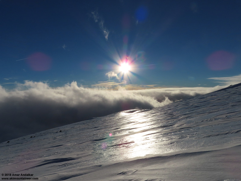
Sunlight reflecting strongly off the pseudo-firnspiegel near 8300 ft on Muir Snowfield.
After lovely sunshine and high pressure in the Washington Cascades from Saturday to Tuesday, November 10-13, a modest storm system came through on Wednesday with over 0.5" of precip at Paradise on Mount Rainier, with temperatures on the NWAC telemetry in the upper 30s °F at 5400 ft and upper 20s °F at 10100 ft Camp Muir. This implied a freezing level of about 8000 ft and a snow level of about 7000 ft (as predicted in the NWS Rainier forecast), so I assumed that there would be about 5-6" of new snow above 8000 ft with a few inches down to 7000 ft. Winds were quite strong during the precip, 30-70 mph at Muir and 20-40 mph at Paradise, so the new snow was likely to be windblown and compacted, not powder at all.
The NWS Rainier forecast for Thursday November 15 looked unpromising all week, mostly cloudy with a chance of showers, and the UW model showed similar conditions. But then on Wednesday afternoon and evening, the forecasts and models changed, showing everything clearing out by Thursday morning for a mostly sunny day, although with moderately high winds at higher elevations and lenticular clouds atop the summit of Rainier (clearly predicted in the 4/3 km cross section #8 in the UW model). It certainly looked like it would be nice enough to be worth heading up to Camp Muir once again, my 5th time in 9 days, and 14th time to Muir since mid-September when new snowfall smoothed out the deep suncups of summer.
The Longmire gate status is in a strange limbo right now, it doesn't actually close most nights despite the park stating that it will close at 5pm and open at 9am. The park's Twitter feed gave no indication that the gate had closed overnight, but I arrived at Longmire just after 9am to find the gate closed with a park ranger SUV parked behind it. Luckily he opened the gate by 9:15am, and all 4 vehicles in line were on their way up to reach Paradise by 9:35am. A few more cars arrived, but overall it was still very empty when I skinned from the lot at 10am, with only 3-4 other parties of skiers. As predicted by the model, lenticular clouds capped the summit, and would continue to do so all day.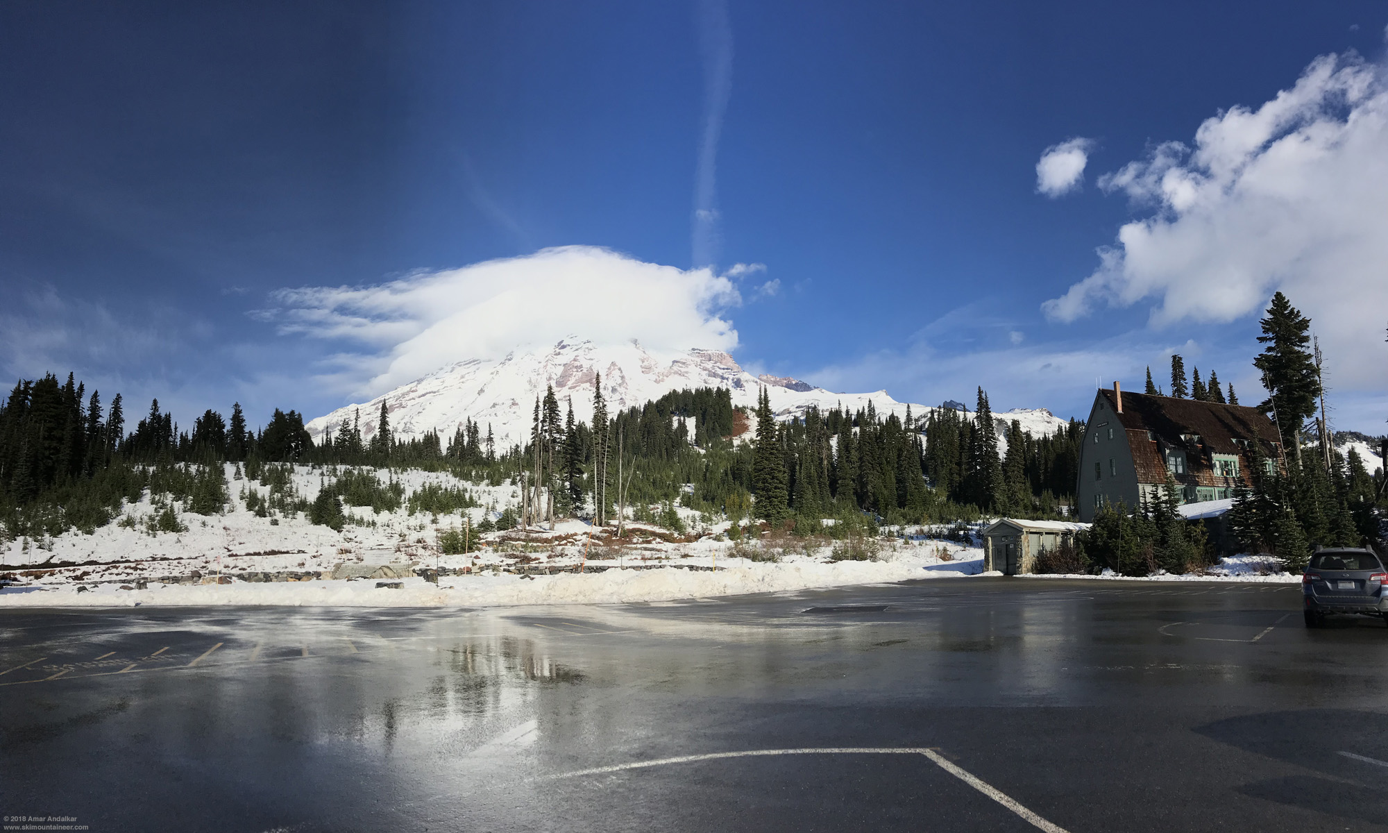
Small panorama of lenticular clouds capped the summit of Rainier, partially reflected in rainwater in the parking lot. (click for double-size version)
There was barely 1 millimeter of new snow atop the old snow surface at Paradise, increasing to maybe a centimeter by 6500 ft. The skin up the summer trail route at Panorama Point was icier and harder than it had been on November 11-12, and ski crampons were very helpful from 6500-7200 ft, but Pan Face looked much worse and was not even worth considering as an ascent option. Looking south, a nicely-formed smooth lenticular capped Mount Adams too.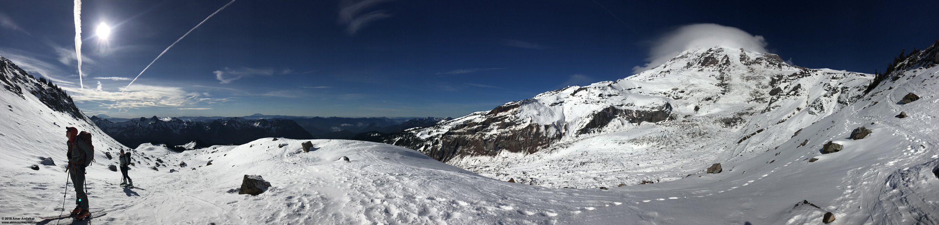
Panorama from the switchback at 6500 ft on the summer trail route, with lenticular clouds atop the summits of Mounts Adams at left and Rainier at right, with the Nisqually Glacier below. (click for triple-size version)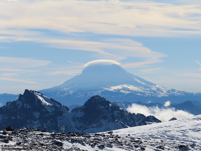
Zoomed view of the lenticular atop the summit of Mount Adams with the nearby Tatoosh Range below.
Above Pebble Creek onto the Muir Snowfield at 7400 ft, the snow surface was mostly 1-2 inches of smooth wind-packed new snow, softening nicely in the warm sunshine and nearly calm winds.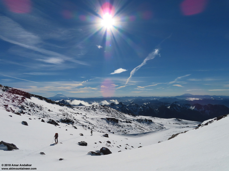
Skinning up past the Pebble Creek rolls near 7400 ft.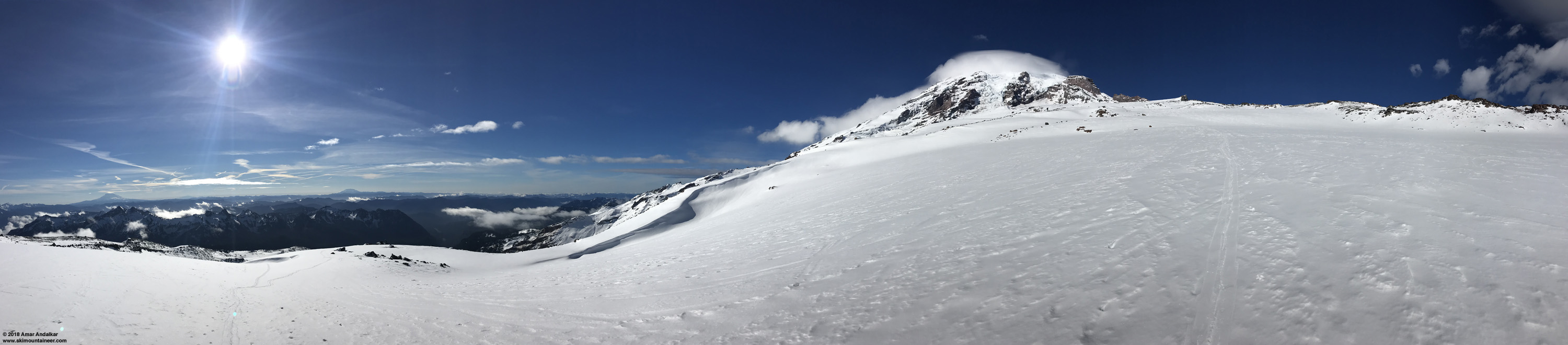
Panorama from about 7500 ft on the lower Muir Snowfield, looking much smoother here than it did a few days earlier. (click for triple-size version)
Things began to unexpectedly change above 8000 ft: a thin shiny layer of water ice, obviously a rain crust from the previous day, covered an increasing fraction of the surface, with decreasing coverage of new snow atop it. This was a big surprise given the telemetry, which indicated that it should have been all snow above 8000 ft with temps below freezing throughout the precip event. By 8300 ft, the ski crampons were back on again, and those without them were struggling mightily and slipping repeatedly. Even with the warm temps well above freezing, the thin ice layer was extremely slippery without ski crampons.
Important Lesson: Always bring ski crampons if you are intending to ski or splitboard near and above treeline, the tiny additional weight has no significance at all, and the potential benefit is huge -- you can't always switch to booting in many cases when you need ski crampons, with this day as a prime example where booting just would not have helped or been faster at all. My own personal rule (and promise to myself) since early 1997, less than a year after I first started backcountry skiing in June 1996:
Ski crampons are not optional, they come along on all trips, with the only exception being deep powder days doing laps entirely below treeline.
This personal rule has saved me from grief many many times, and is a very good rule to adopt for all those who venture up mountains or above treeline on skis or splitboards.
Panorama from about 8300 ft on the Muir Snowfield, with large areas of rain crust topped by broad drifts of windpacked new snow. (click for triple-size version)
Above 8500 ft the surface consisted mostly of the thin water ice layer, topped by broad sinuous ridges of wind-deposited snow, a few inches to maybe 1 ft deep, which covered only about 20-30% of the area. It was best to skin along these areas of windpacked snow as much as possible, then connect across the water ice areas in as short a place as possible.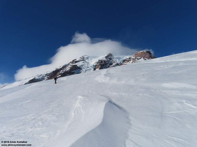
Looking uphill at icy rain crust topped by snowdrifts near 8600 ft.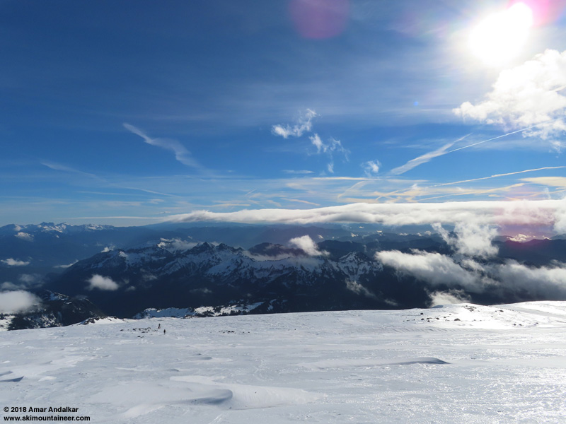
Looking downhill at shiny icy rain crust topped by snowdrifts near 8600 ft.
So how did a layer of water ice get deposited at elevations well above the freezing level? Supercooling! This phenomenon allows water droplets to remain liquid as they are blown upslope by high winds into air temperatures well below freezing, and then when they impact a surface, they freeze suddenly onto it. It's the same process that produces rime, although in that case the droplets are much tinier than rain drops, producing the typically milky-white rime ice instead of clear water ice.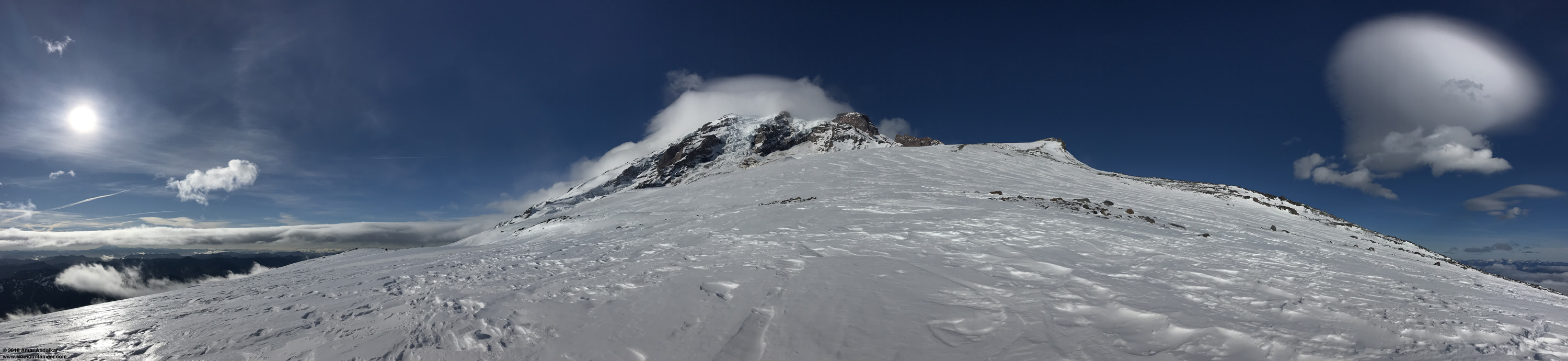
Panorama from about 8500 ft on the Muir Snowfield, with lenticular cloud atop the summit and a series of lee-wave lenticular clouds at far right. (click for triple-size version)
In addition to the lenticulars atop the summit, a series of lee-wave lenticular clouds now extended downwind of Rainier to the east, with 2 or 3 complete waves often visible. Progress had slowed with all the icy sections, and by 2pm we were only at 9200 ft, but at least above this elevation the skinning conditions improved. The coverage of new snow atop the ice layer increased to more like 50-80% of area, which made it much easier to skin mostly on snow instead of ice. The only 2 other skiers who had made it above 8000 ft turned around near 9000 ft, and above that it was only me and a splitboarder from Chicago, who had just moved out to the West Coast and started in the backcountry last year. Overall, the thin ice layer extended all the way up to Camp Muir and perhaps higher, well over 2000 ft above the freezing level.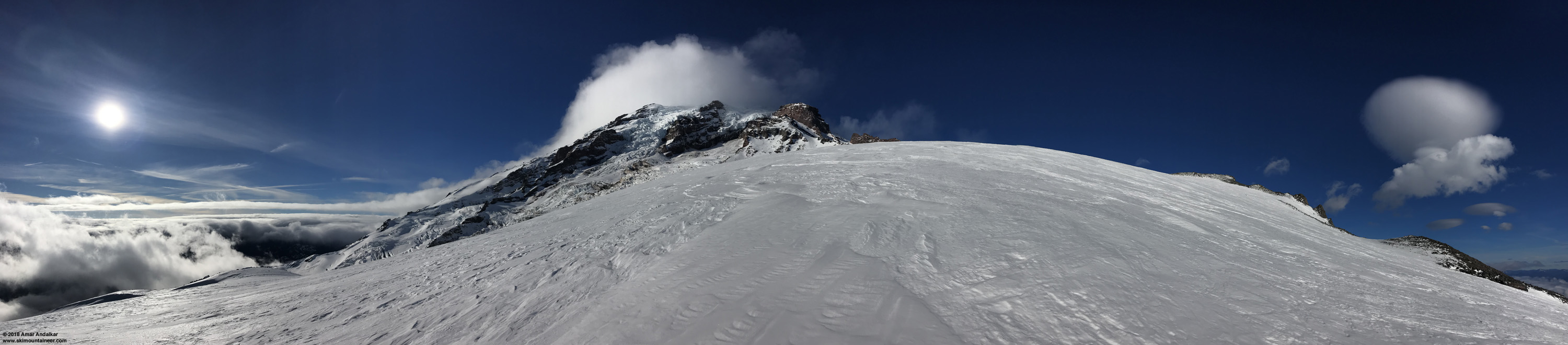
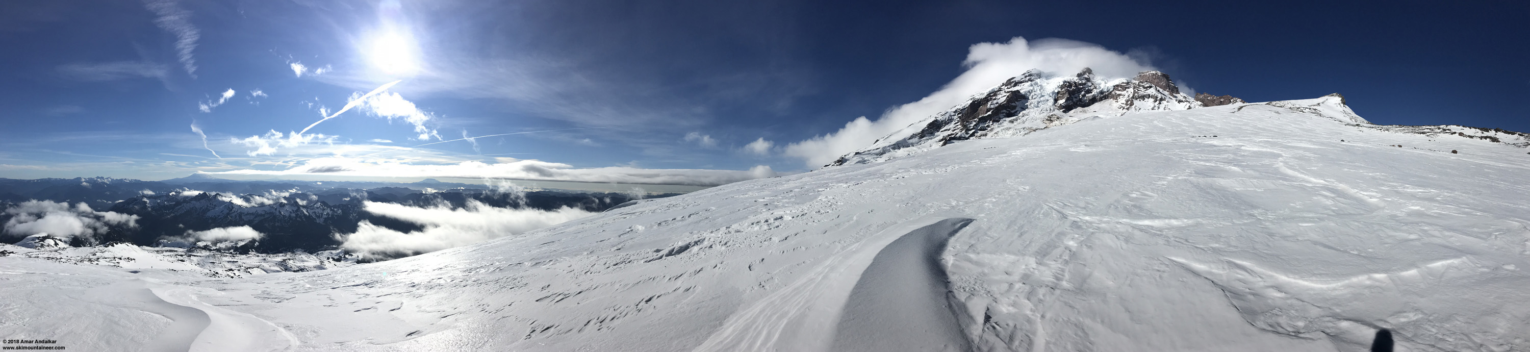
Panorama from about 9200 ft on the Muir Snowfield, with lenticular cloud atop the summit and a series of lee-wave lenticular clouds at far right above Moon Rocks. (click for triple-size version)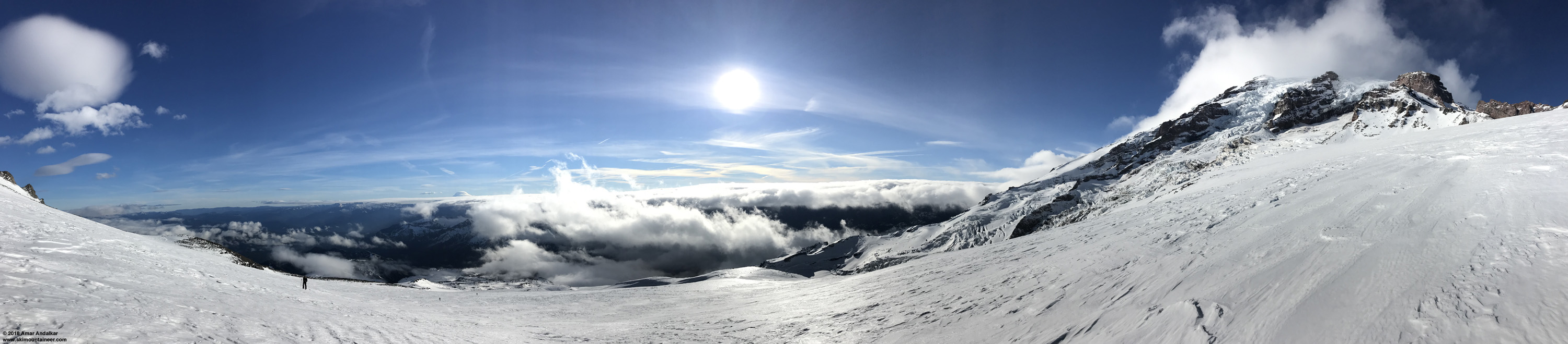
Panorama looking downhill from about 9300 ft, with the lee wave lenticulars at left, Mount Adams with its own lenticular at center, and the splitboarder and 2 skiers skinning up below. (click for triple-size version)
Meanwhile Mount Adams had become an amazing sight off to the south: completely enveloped in a layered lenticular cloud extending far below the summit, with a large stacked lee-wave lenticular just downwind to the east, and a long train of smaller lee waves farther downwind, extending about 8-9 waves in length. Just an outstanding display!
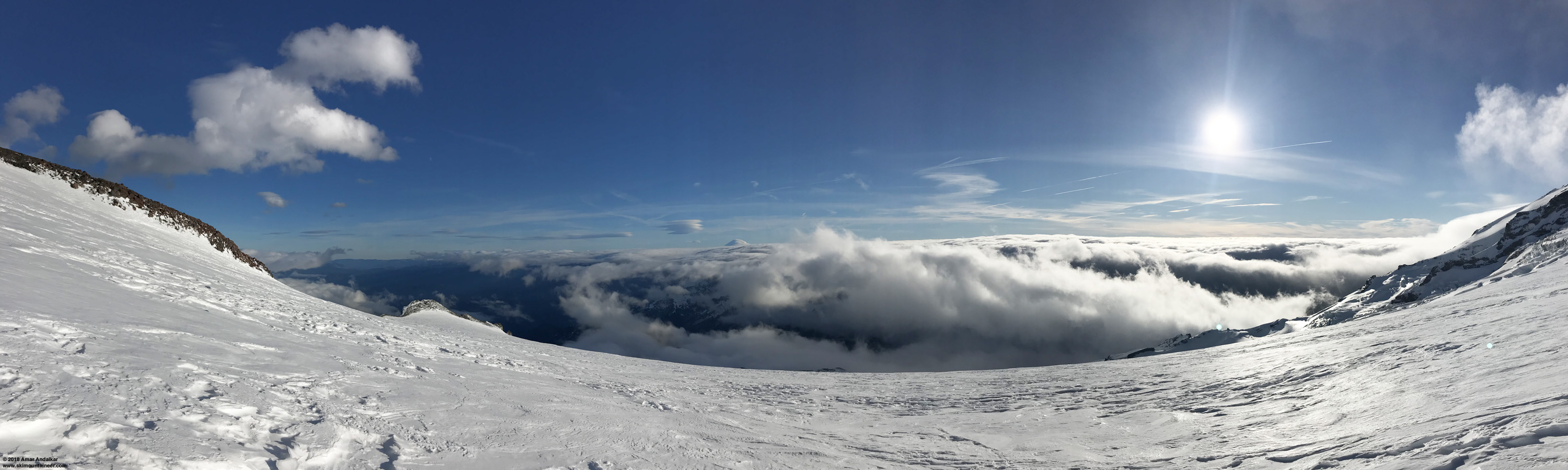
Panorama looking downhill from 9900 ft, with Mount Adams enveloped in a lenticular cloud with a train of lee-wave lenticulars extending left. (click for triple-size version)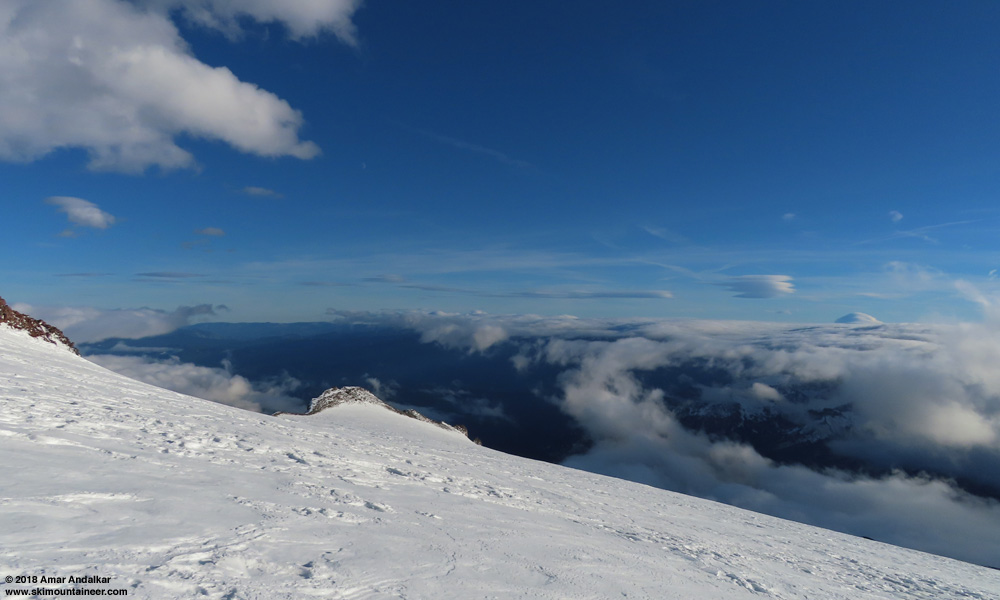
Full 24mm wide-angle view from 9900 ft of Mount Adams enveloped in a lenticular cloud with a train of lee-wave lenticulars extending left, and the quarter-moon also visible above Anvil Rock at left-center.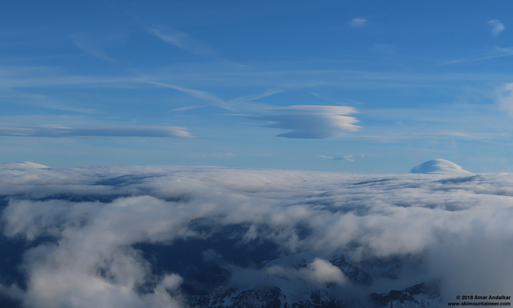
Zoomed view from 9900 ft of Mount Adams enveloped in a lenticular cloud with a train of lee-wave lenticulars extending left.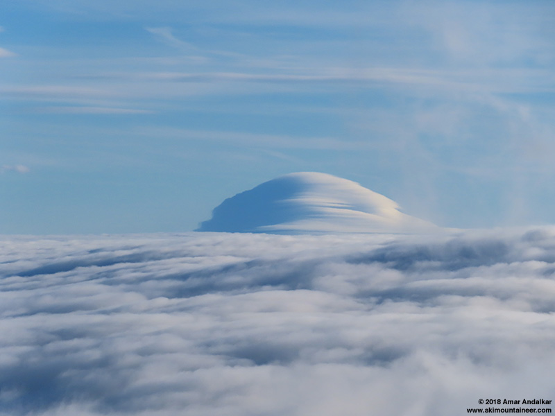
More zoomed view (about 270mm equivalent) from 9900 ft of Mount Adams enveloped in a lenticular cloud.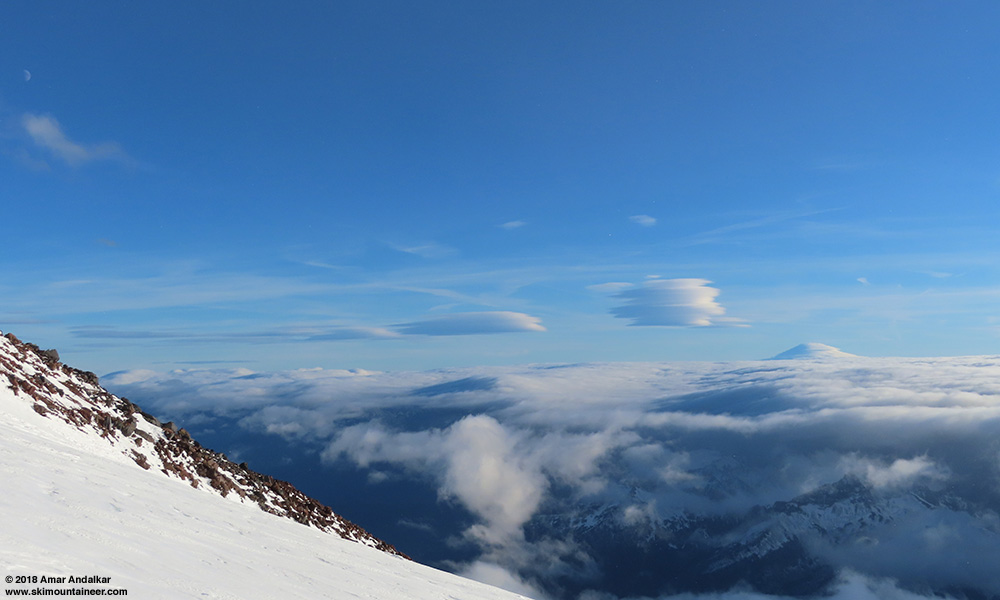
Changing minute by minute, view from 10100 ft as we arrived at Camp Muir.
Note that the avalanche crown at 10300 ft just west of Camp Muir from over a week earlier had still been visible all the way down to the parking lot in the morning (see other TR: Nov 7, 2018, Camp Muir AVALANCHE Red Flags Ignored). The raised ski tracks in AAA Gully had mostly disappeared again under a new deposit of windblown snow, although traces could still be seen from up close.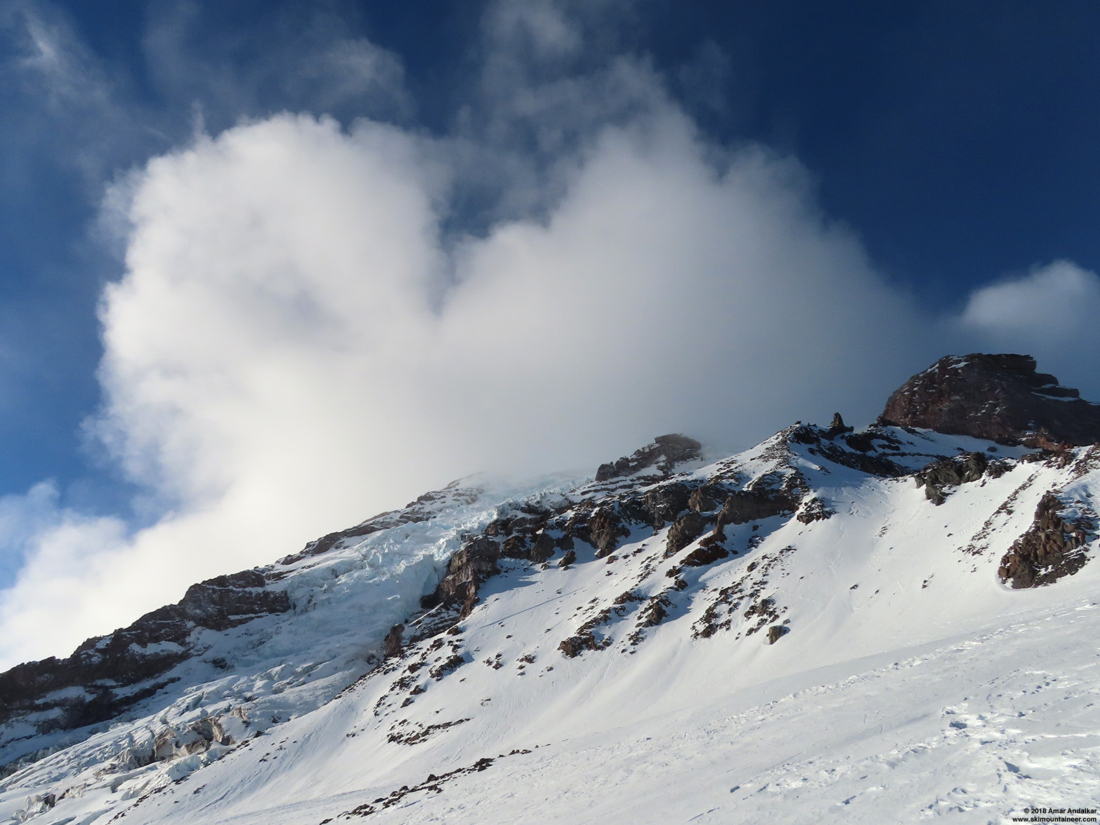
The avalanche crown at 10300 ft and remnants of the ski tracks in AAA Gully from near 9900 ft on Muir Snowfield. (click for double-size version)
We arrived at Camp Muir just after 3pm, and despite the strong winds overhead in the summit lenticular, the wind was only about 10-20 mph at Muir. And thankfully it was possible to find an almost calm, wind-protected spot on the deck of the new stone restroom facility, still under construction after 3 summers of work. It felt kind of surreal to have complete solitude at Camp Muir on a warm sunny day, after the busy party scene of November 11-12 in similar weather. 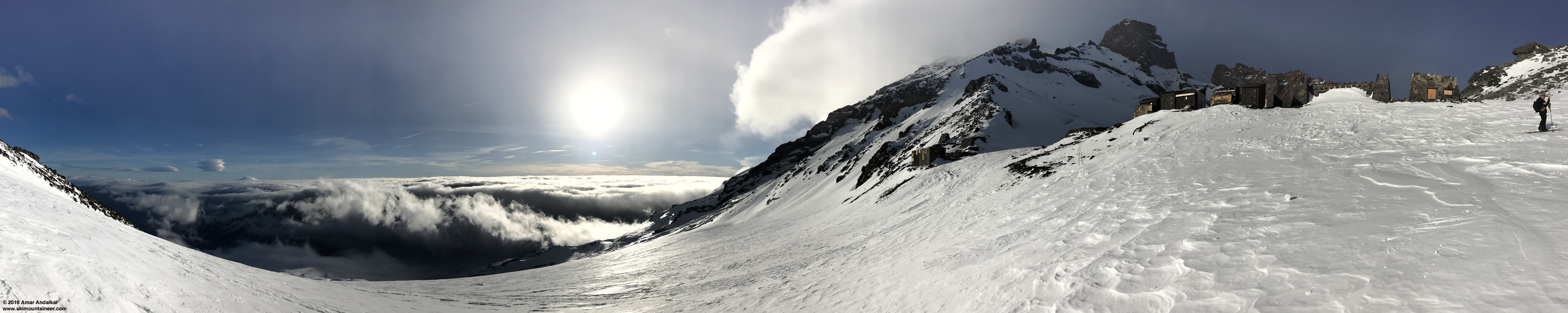
Panorama as we arrived at 10100 ft Camp Muir, with Mount Adams at left enveloped in a lenticular cloud with a train of lee-wave lenticulars. (click for triple-size version)
It was snowing very lightly at Muir, flakes generated in the lenticular above, a strange sight to see given the bright sunshine and temps well above freezing. i tried to capture the flakes on camera, but wasn't really successful at doing so except when a few landed on the lens of the camera.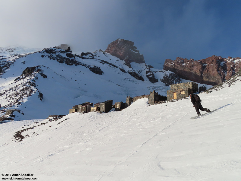
Skied down at 3:25pm, on excellent snow to start on the sun-warmed, slightly SW-facing slope immediately to skier's left of Muir. In general, the pseudo-firnspiegel skied great wherever it was getting enough sun to have softened enough to carve nicely through it like real firnspiegel. It skied more like frozen rain crust on flatter sections and areas getting less direct sunlight where it was staying more firmly frozen.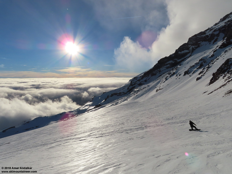
Enjoying a nice run down the pseudo-firnspiegel just below Camp Muir.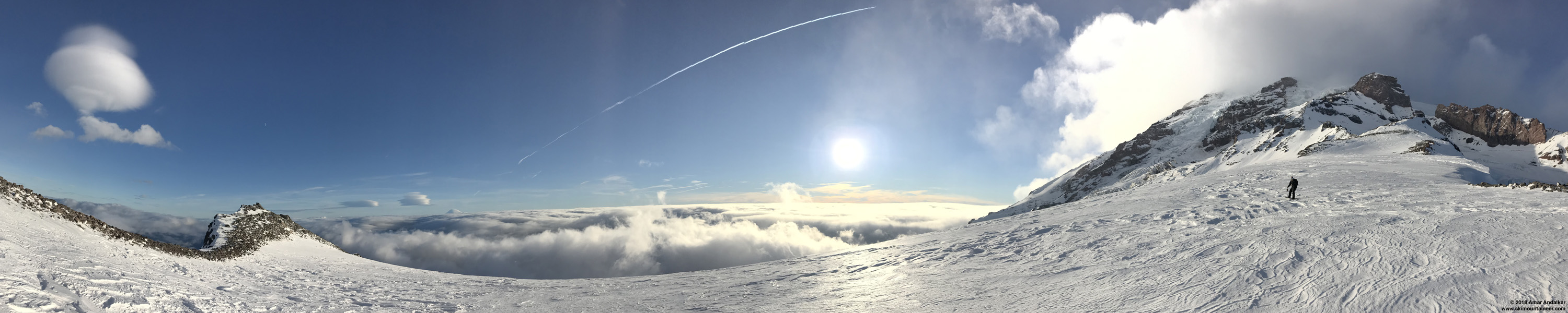
Panorama with Rainier's lee-wave lenticulars at left above 9584 ft Anvil Rock, Mount Adams at left center enveloped in a lenticular cloud with a train of lee-wave lenticulars, sunlight glinting off the pseudo-firnspiegel at center, and the summit of Rainier at right with its own increasingly-ragged lenticular. (click for triple-size version)
The whole key was to carefully pick our descent line to maximize its sun exposure, and then things skied great. Basically anything tilted more towards the setting sun was the place to ski.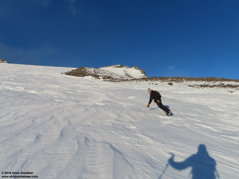
Nice turns on the softened pseudo-firnspiegel near 9000 ft below Moon Rocks.
Sunlight reflecting strongly off the pseudo-firnspiegel near 8300 ft on Muir Snowfield.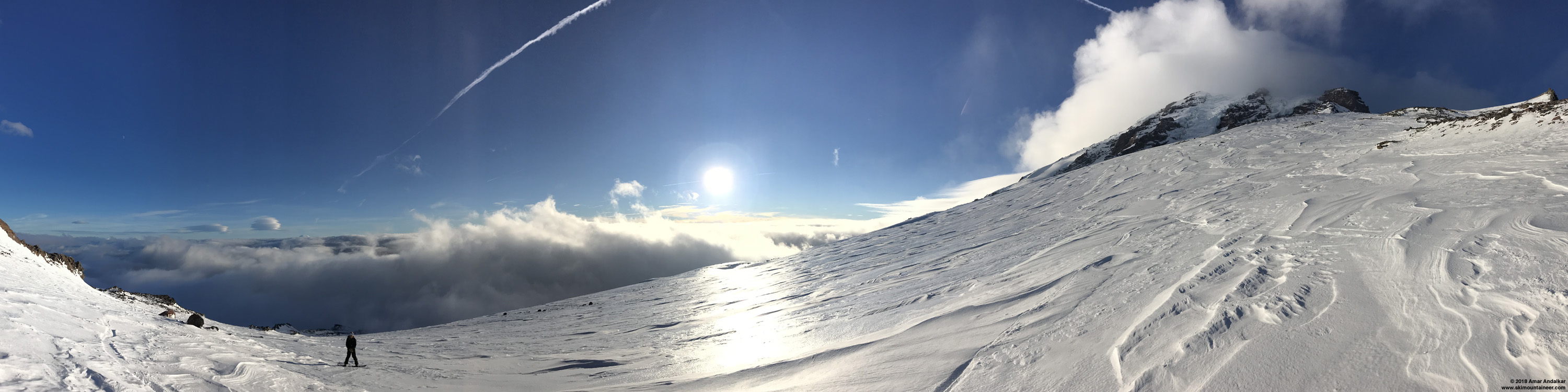
Panorama with sunlight reflecting strongly off the pseudo-firnspiegel near 8300 ft on Muir Snowfield. (click for triple-size version)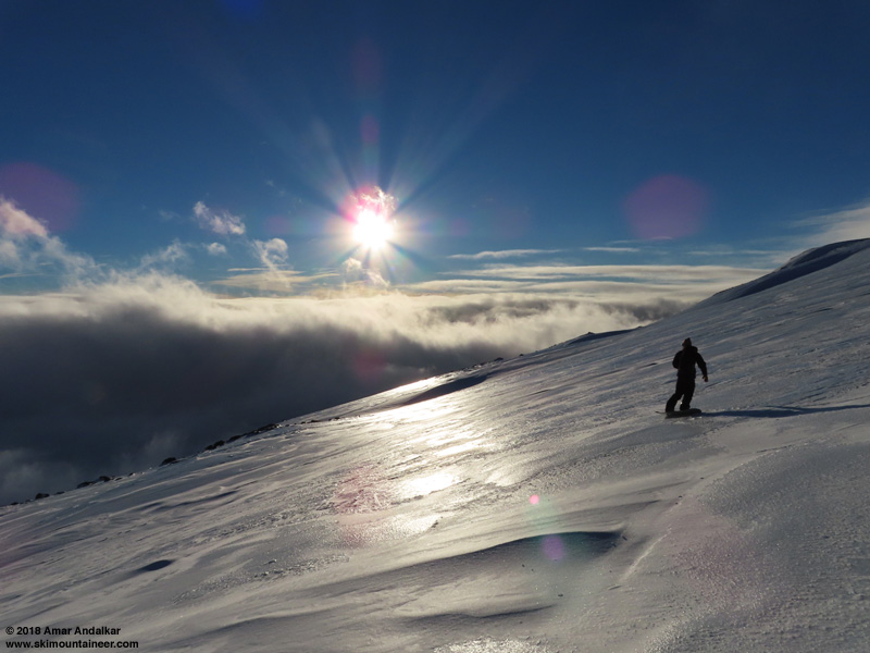
Continued in next post, exceeded 20,000 character limit . . .
Continued from previous post . . .
Eventually below 8000 ft, the pseudo-firnspiegel rain crust vanished and it was just smooth amazing windpacked snow. Excellent fast turns here, definitely the best snow of the day. Pseudo-firnspiegel is nice, but it's still not quite as nice as real firnspiegel.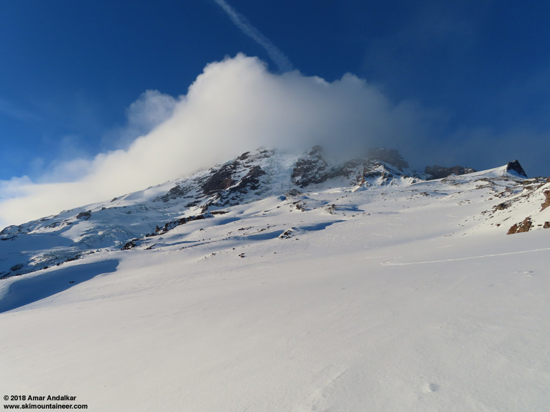
Looking back up at our ski tracks on the smoothest snow from near 7600 ft on Muir Snowfield.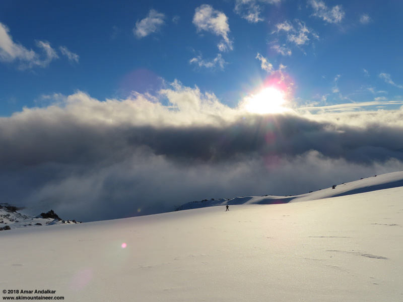
And looking down from the same spot.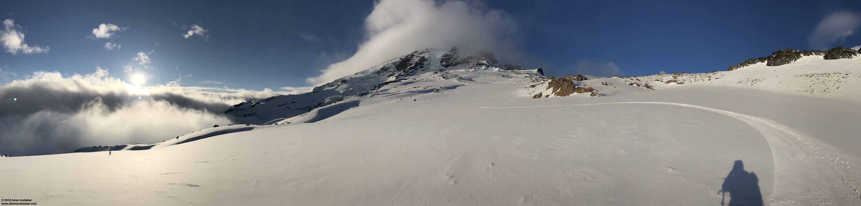
Panorama from near 7600 ft on Muir Snowfield with our ski tracks on the smoothest snow. (click for triple-size version)
And then at Pebble Creek, down into the cloud deck which had been building below for the past few hours.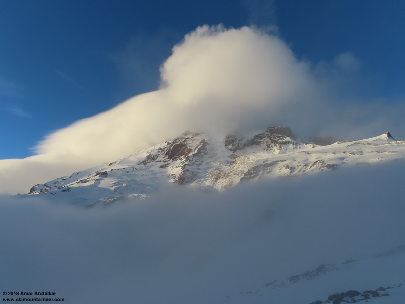
View looking up from 7200 ft, last view of the Mountain for the day.
Careful and slow skiing in clouds and whiteout the rest of the way down to Paradise, but still easy to avoid hitting any rocks on skis via the summer trail route. One spot near 7000 ft was almost fully melted out for about 6-8 ft though, I was able to keep skis on, but most would have removed their skis and it was mandatory on a snowboard. Otherwise, it was still a fairly easy ski all the way back to the parking lot.
Nice to get an unexpectedly outstanding sunny day on the Mountain, and serendipitously ski some pseudo-firnspiegel too!
Weather Forecasts and Data:
Here is the NWS Rainier forecast from Tuesday, which looked very unpromising for Thursday:
Mount Rainier Recreational Forecast
National Weather Service Seattle WA
437 AM PST Tue Nov 13 2018
SYNOPSIS...High pressure aloft will weaken today and shift eastward. A pair of fronts will bring rain at times and windy conditions to the mountain later today through Thursday. Residual showers will end on Friday. Another dry period is expected over the weekend and possibly into Monday. A front may approach the region early next week with a chance of rain .
IMPACTS...Stormy weather by tonight will create difficult backcountry skiing and mountaineering conditions across much of the alpine terrain of Mt. Rainier, including the Muir snowfield. Blizzard- like conditions with strong winds and near zero visibility are likely. A high level of skill and experience in alpine terrain, including use of GPS, is recommended for navigation and camping in these conditions.
TUESDAY...Partly sunny. Freezing level near 10000 feet.
TUESDAY NIGHT...Rain and snow. No snow accumulation near Paradise. Snow level near 8000 feet.
WEDNESDAY...Breezy. Rain and snow. No snow accumulation near Paradise. Snow level near 7000 feet.
WEDNESDAY NIGHT...Windy. Mostly cloudy with a chance of showers. Snow level near 5500 feet.
THURSDAY...Mostly cloudy with a slight chance of showers. Snow level near 5500 feet.
++ Temperatures and wind for the summit and Camp Muir are average
  conditions expected in the free air at those elevations.
++ Temperatures for Paradise and Longmire are the expected highs and
  lows. Wind is the average wind expected during that period.
Extended Forecast...
THURSDAY NIGHT...Mostly cloudy with a chance of showers. Snow level near 7500 feet.
FRIDAY...Partly sunny. A chance of showers, mainly in the morning. Snow level near 6500 feet.
FRIDAY NIGHT...Partly cloudy. Freezing level near 7000 feet.
SATURDAY...Sunny. Freezing level near 7000 feet.
SATURDAY NIGHT...Partly cloudy. Freezing level near 10000 feet.
SUNDAY...Mostly sunny. Freezing level near 10500 feet.
SUNDAY NIGHT...Partly cloudy. Freezing level near 11000 feet.
MONDAY...Mostly sunny. Freezing level near 10500 feet.
But then it all changed to mostly sunny on Thursday:
Mount Rainier Recreational Forecast
National Weather Service Seattle WA
235 AM PST Thu Nov 15 2018
SYNOPSIS...Today will be mostly dry with some sun in Mount Rainier National Park. A weak weather system will affect the park tonight and Friday morning. A sharp upper level ridge will give sunny conditions this weekend. A front may approach the region early next week with a chance of rain and snow.
IMPACTS...Strong winds near the summit Thursday night through Friday night will make it difficult to move safely and could produce local whiteout conditions. A high level of skill and experience in alpine terrain, including use of GPS, is recommended for navigation and camping in these conditions.
THURSDAY...Mostly sunny. Freezing level near 9000 feet.
THURSDAY NIGHT...Partly cloudy with a slight chance of rain and snow in the evening, then rain and snow likely after midnight. Snow level near 6000 feet increasing to 7000 feet after midnight.
FRIDAY...Showers likely in the morning, then mostly cloudy with a chance of showers in the afternoon. No snow accumulation near Paradise. Snow level near 7500 feet.
FRIDAY NIGHT...Mostly cloudy in the evening then becoming partly cloudy. Freezing level near 7000 feet.
SATURDAY...Sunny. Freezing level near 7000 feet.
++ Temperatures and wind for the summit and Camp Muir are average
  conditions expected in the free air at those elevations.
++ Temperatures for Paradise and Longmire are the expected highs and
  lows. Wind is the average wind expected during that period.
Extended Forecast...
SATURDAY NIGHT...Mostly clear. Freezing level near 10000 feet.
SUNDAY...Mostly sunny. Freezing level near 11000 feet.
SUNDAY NIGHT...Partly cloudy. Freezing level near 11000 feet.
MONDAY...Mostly sunny. Freezing level near 10000 feet.
MONDAY NIGHT...Mostly cloudy with a slight chance of showers. Snow level near 5500 feet.
TUESDAY...Partly sunny with a chance of showers. Snow level near 5000 feet.
TUESDAY NIGHT...Mostly cloudy with a chance of showers. Snow level near 5000 feet.
WEDNESDAY...Partly sunny with a chance of showers. Snow level near 4500 feet.
author=Amar Andalkar link=topic=41044.msg162764#msg162764 date=1542412357">...while the shattered shards of microscope-slide-thin ice skitter and bounce across the surrounding surface with unusually joyous clinking and tinkling and jingling sound effects...
I love that! Your description reminds me of a ski weekend at White Pass a few years ago. We called it the "tinkle tour". The sound of the ice skittering down the hill continued after you stopped! It was great. We called it a sun crust, but after reading your firnspiegel description, I think that is what we were skiing. Tinkle Tour Video
I believe you that the pseudo firnspiegel skied well, but the first two pictures make it look like an aweful rain crust!
Reply to this TR
Please login first: