Dec 26, 2017, Tatoosh and Paradise NWAC Site Visit
12/26/17
WA Cascades West Slopes South (Mt Rainier)
2929
7
Tatoosh Freezing-Fog Crust Atop Powder and Paradise NWAC Telemetry Site Visit, 26Dec2017
Well, this post started off as just a reply to this TAY thread (12-21-17 Paradise telemetry) about the sudden 30" drop in snowdepth value at the NWAC telemetry site that day. The next day, NWAC added a note to the Paradise telemetry which stated "Total snowdepth artificially lowered 30 inches 2 pm 12-21", which really made it seem as if NWAC thought that someone had dug away 30" of snow, and then on December 23 NWAC updated the note to read "Total snowdepth out 2 pm Dec 21", while completely blanking the total snowdepth column in the data (see Reply #1 below for the complete set of Paradise telemetry data from December 21-28 showing the ongoing snowdepth anomaly and notes). That other thread explores the possibility that this sudden drop in snowdepth may be part of a deliberate conspiracy by the Park Service and perhaps extending higher up in the government! But as I was about to post my reply there, I realized that it had grown into almost a trip report too, so I decided to add a few nice ski touring photos and post it as a separate TR instead.
![]() http://www.skimountaineer.com/TR/Images2017/RainierNWACSitePano2000-26Dec2017.jpg" />
http://www.skimountaineer.com/TR/Images2017/RainierNWACSitePano2000-26Dec2017.jpg" />
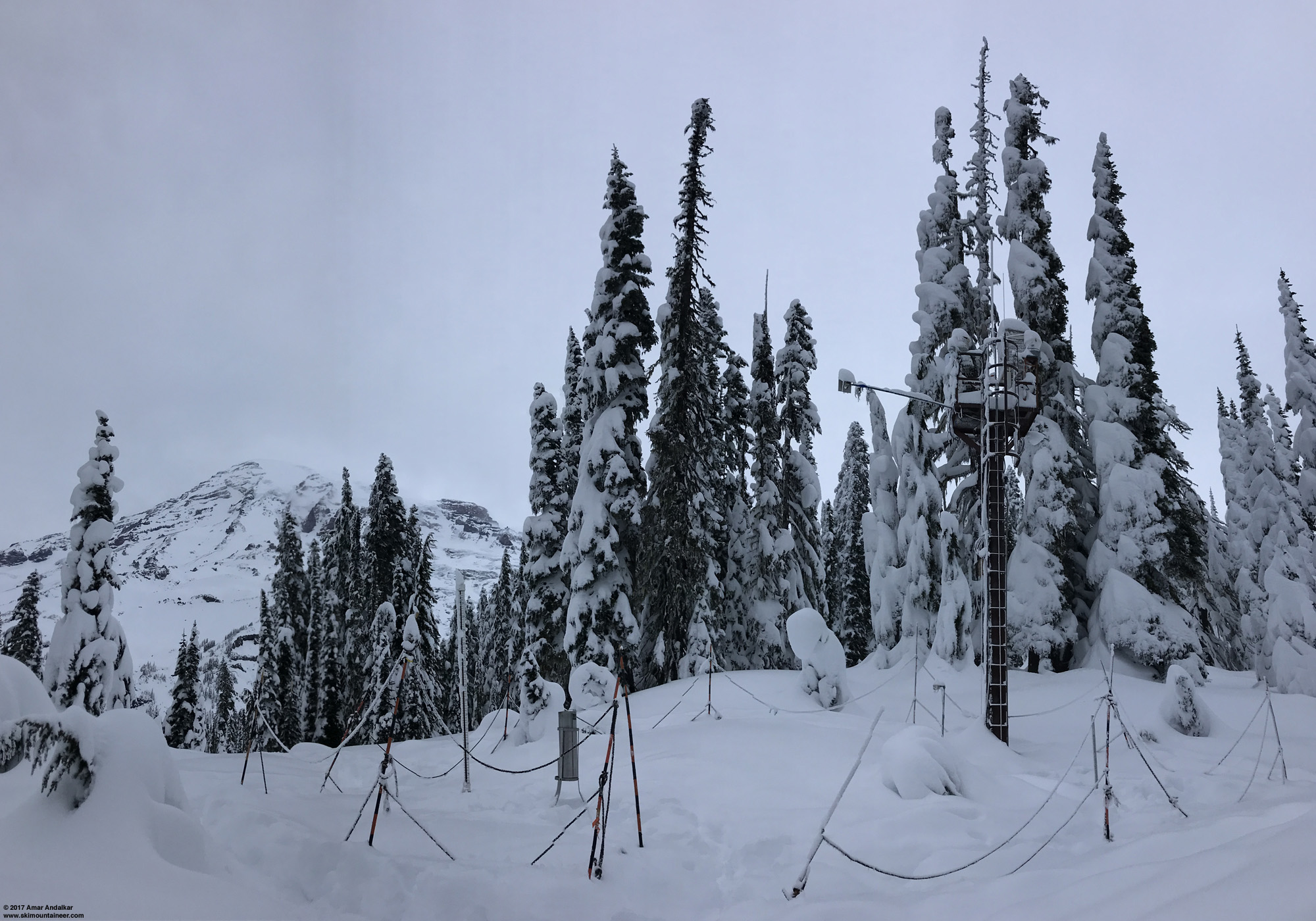
Panorama of the Paradise NWAC telemetry site. (click for double-size version)
I had also noticed this telemetry anomaly shortly after it occurred, and given how often I'm up at Paradise skiing, I figured that I'd be able to take a personal look at the NWAC telemetry site sometime soon to see what might have happened. But the weekend of December 23-24 was spent enjoying nice light foot-deep powder in the Tatoosh Range on both Saturday and Sunday, with great visibility both days too, and so there was no time left to make it up to Paradise from Narada Falls to check the NWAC site before gate closure time.
I headed back to the Tatoosh on Tuesday after Christmas with 4 good friends, hoping to find the same combination of fresh powder and clear skies again. Sadly, although there was 7-8" of new powder as expected from telemetry (and it was still totally untracked with apparently no one heading into the Tatoosh on Christmas day), there was also a thin icy crust atop the light powder! Right from the parking lot and all along the road skin and all the way up the north facing bowls, only a few millimeters thick in most areas, ranging up to several millimeters in the worst spots. It looked and felt like a sun crust, but given the lack of sunlight this time of year reaching anything but steep south faces, that was totally impossible. And given the cold temperatures with snow levels down near sea level throughout the previous 2 days, the only possible culprit to produce such a crust had to have been freezing fog, which consists of supercooled water droplets which remain liquid despite air temperatures below freezing, but freeze instantly on contact with any surface. It's the same process that produces rime.
This very unwelcome Christmas present is apparently widespread now throughout a large length of the Cascades from at least Stevens Pass to south of Mount Rainier. Not at all predicted in any forecasts I had seen, but reports from Crystal, Snoqualmie, and Stevens Pass on Christmas mentioned the freezing fog. And perhaps it should have been evident that something strange had happened given the telemetry data during Christmas day (see Reply #1 below) showing 0.3" of additional precip at Paradise, which produced barely 1" of additional snowfall despite temps in the low-to-mid 20s F.
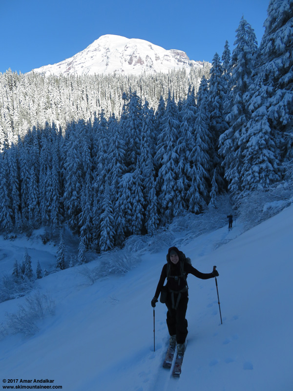
Skinning up the steep slope above the Narada Falls lot, tough going in spots with thin icy crust atop powder snow atop thick old icy crust, with numerous protruding rocks and deep holes too.
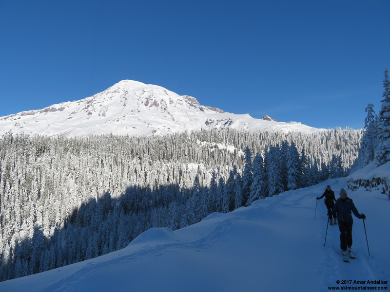
Skinning along the road above the Narada Falls lot, glad to be done with the crux of the day.
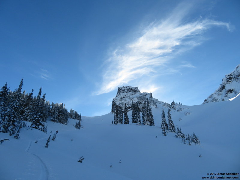
Skinning up past The Castle with cool clouds drifting by.
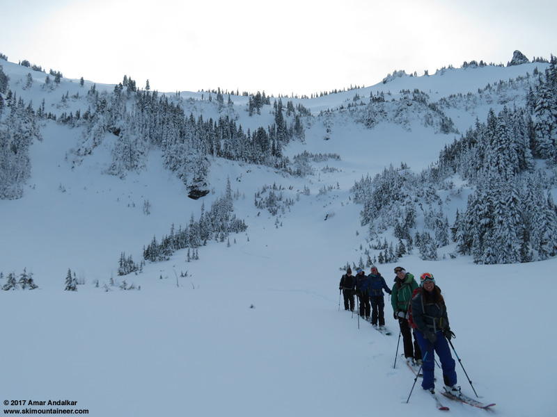
Just as we had arrived at the parking lot, my friend Gordy was heading out, and said he would break trail for us. And he certainly did, re-breaking the entire length of the snow-filled weekend skin track for us, all the way from the parking lot to the Tatoosh ridgeline!
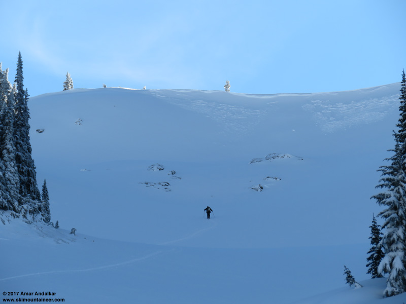
Distant zoomed shot of Gordy breaking trail up the bowl left of The Castle.
Out of the cold north-facing bowls and back into the sunlight for the first time in over an hour.
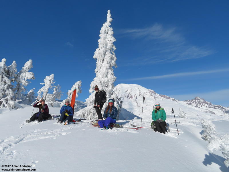
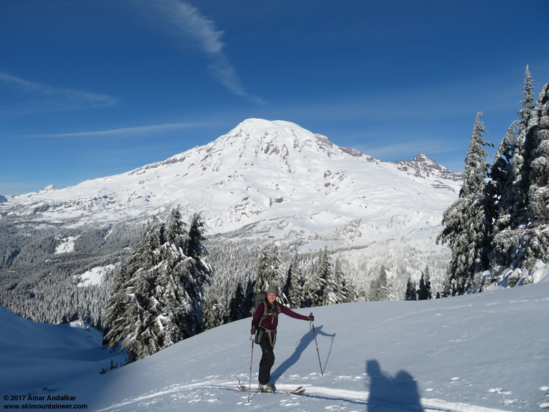
My 4 ski partners (seated) and Gordy, atop the Tatoosh ridgeline at 6250 ft.
Looking south at Mounts Adams, Hood, and Saint Helens on the horizon.
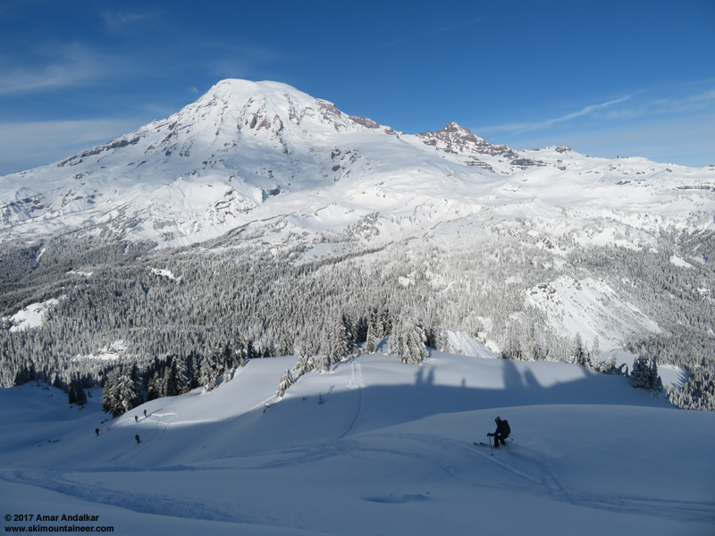
Dropping into the crust-topped powder.
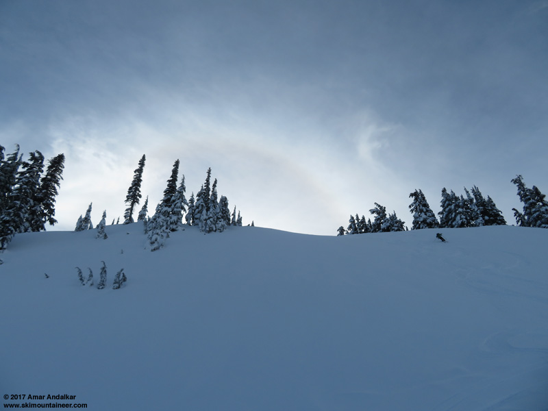
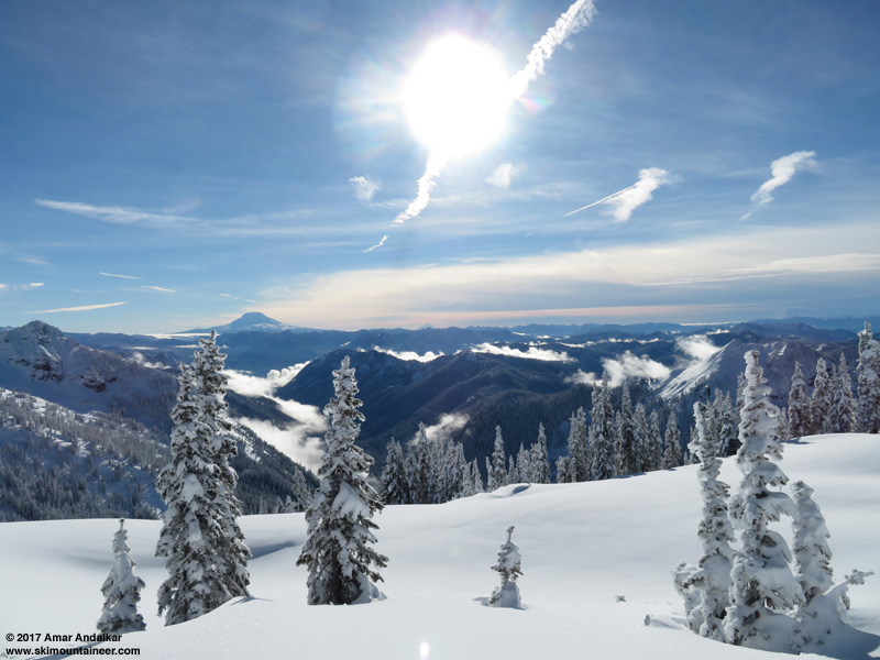
The 22-degree solar halo above some of the best turns of the day.
Anyway, after skinning up to the Tatoosh ridgeline and skiing a long run down to the road, in somewhat mediocre conditions given the thin crust atop medium-density powder, my partners weren't too eager to ski a 2nd lap as we had originally planned. So we decided to bail out and skinned back the 1.7 miles of road from Sunbeam Creek to Narada by 2pm, with plenty of time left in the day for a couple of short hikes in the snow.
All smiles at the end of the run, but all done too!
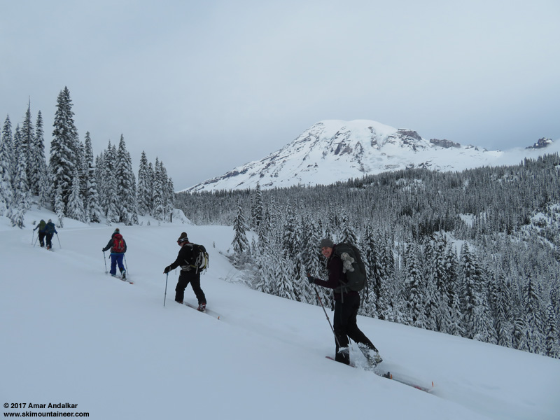
Enjoying the long skin back to Narada.
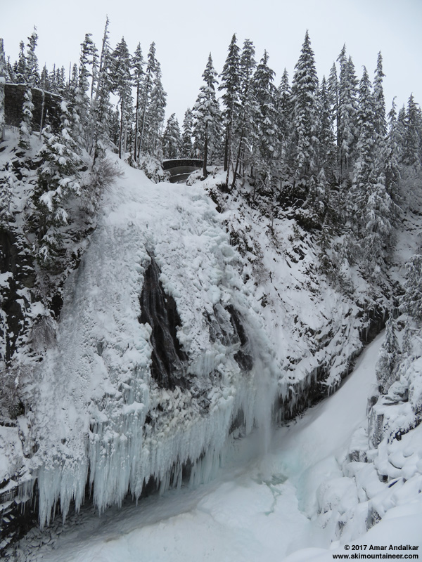
First was a quick jaunt along the summer trail to Narada Falls, still safely doable with snowdepths about 1 ft below the top of the safety railing at the falls viewpoint (this short hike can be lethally dangerous once the snowpack is deep, given the steep slopes atop cliffs atop water). Awesome view of the mostly frozen falls with a curtain of huge icicles extending over the long overhang at the base of the andesite lava flow cliffs:
Next it was time to drive the 3 miles up to Paradise and visit the NWAC site. We parked in the former visitor center lot near the ski dorm and had barely walked to the far end of the lot, when suddenly an LE ranger pulled up in his SUV and started asking out his window what we were doing! (Clearly there is a massive conspiracy to keep people away from seeing the nefarious activities going on at the NWAC site!) I explained to him where we were headed and why (not that I should have even had to!), and asked him if he knew anything about what had happened to the telemetry site. He had no idea, hadn't even heard of the snowdepth anomaly, and had just gotten on duty that day after being off someplace else. Anyway I assured him that I knew what I was doing and that we would cause no harm to the site, and he warned us not to go inside the roped enclosure at the site before driving off. The NWAC site is located within sight of the very busy Nisqually Vista trail, which probably gets hundreds of snowshoers going past it every weekend (although very few skiers ever ski along that trail), so his concerns and warnings would have been better spent directed at the snowshoe tourists than at us.
Here's that overview panorama of the NWAC telemetry site again:
![]() http://www.skimountaineer.com/TR/Images2017/RainierNWACSitePano2000-26Dec2017.jpg" />
http://www.skimountaineer.com/TR/Images2017/RainierNWACSitePano2000-26Dec2017.jpg" />
(click for double-size version)
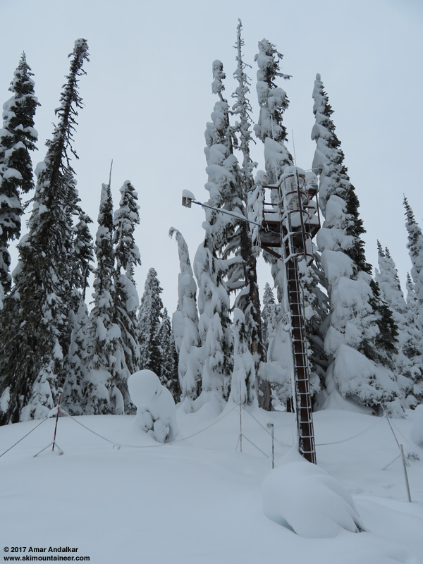
At right is the instrument tower, which extends about 30 ft high above the bare ground. The platform at the top includes the heated tipping-bucket hourly precip gauge and a louvered white box which contains the temperature sensor. The snowdepth sensor is mounted at the end of the long arm extending left from the tower, about 300" above bare ground, and consists of a temperature-corrected ultrasonic sensor which measures the distance to the top of the snowpack. Also at right partially buried by recent snowfall are the two 24-hour snowdepth boards, one with a similar ultrasonic sensor mounted 48" above the board, and a second manual board with a yardstick mounted to it. Sadly, neither board has been cleaned off since December 20th, perhaps there is some staffing issue or other issue responsible for that omission, although daily manual weather data is still being submitted to the National Weather Service. There is also an unknown object near the tower and 24-hour snow boards, which looks like a snow-covered bush, but given the 8 ft snowdepth it must be something else -- no idea what it might be, and I did not want to mess with anything inside the rope line.
At the left side of the roped enclosure are the manual snowdepth stake (which is the official value for Paradise in the daily weather records, not the NWAC telemetry number) and a manual precip bucket. The manual stake consists of multiple segments each roughly 7-8 ft long, which are screwed onto the previous lower segments as the snowdepth increases throughout the winter and spring. Maximum snowdepth ever recorded on the Paradise manual snowstake was 367" on March 10, 1956!! Daily snowfall and snowdepth records at Paradise extend back to 1916, although the measurement location has shifted several times in the past, and there are a substantial number of data gaps over the years, both large and small.
The NWAC telemetry site has been operational since at least 1991, and the maximum snowdepth recorded on the snowdepth sensor (as far as I can determine) appears to have been 283" on March 4, 1999. That record-setting year saw Paradise top 1000" of snowfall for the first time since the 1970s, with 1033" for the 1998-99 snow season (short of its maximum of 1122" in 1971-72), while Mount Baker Ski Area set an all-time world record for measured snowfall in a single season at 1140". Paradise still holds the all-time record for measured snowfall in any one-year period with 1224" (that's 102 ft!) from February 19, 1971, to February 18, 1972, as well as the record for average annual snowfall at any measurement site with an average of about 680". Yes, this is the single snowiest snowfall-measurement site in the entire world!!
And here's a closer look at the snowdepth sensor tower:
The snow surface under the sensor looks smooth, and matches the height and angle of the surrounding snowpack. Even though about 16"+ of new snow has fallen since the snowdepth anomaly on December 21, there is no evidence of any 30" deep hole having been dug beneath the sensor, nor of any artificial lowering of the snowdepth at the entire site.
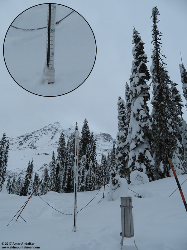
Manual snowdepth stake and manual precip bucket, with zoomed inset showing the 90" depth.
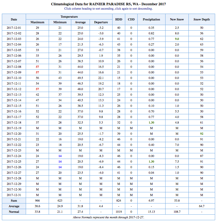
The current snowdepth on the manual snowdepth stake was 90" as of 3pm on December 26, which matches the official value submitted to the National Weather Service that day (to view the daily manual data, go to http://w2.weather.gov/climate/xmacis.php?wfo=sew and pick 1. Rainier Paradise, WA; 2. Daily data for a month; 3. 2017-12; 4. Click Go to view the data). Here is the daily data thus far for December 2017:
So it seems clear that there was no vandalism or tampering with the snowpack beneath the snowdepth sensor. It's probably just a flaky snowdepth sensor which has failed and needs to be replaced, which is quite evident when you look at the telemetry data below for the first 7 days after the initial anomaly at 2pm on December 21. Very incorrect and wildly fluctuating snowdepth values, with a temporary return to (perhaps) near-normal operation for about 30 hours starting late on December 25 before lapsing into wild inaccuracy again on December 27. It's definitely an unusual failure mode for that snowdepth sensor to start showing a new (apparently realistic) value about 30" less than previous, instead of just totally random values or zeros that would have been obviously spurious. Luckily these
Well, this post started off as just a reply to this TAY thread (12-21-17 Paradise telemetry) about the sudden 30" drop in snowdepth value at the NWAC telemetry site that day. The next day, NWAC added a note to the Paradise telemetry which stated "Total snowdepth artificially lowered 30 inches 2 pm 12-21", which really made it seem as if NWAC thought that someone had dug away 30" of snow, and then on December 23 NWAC updated the note to read "Total snowdepth out 2 pm Dec 21", while completely blanking the total snowdepth column in the data (see Reply #1 below for the complete set of Paradise telemetry data from December 21-28 showing the ongoing snowdepth anomaly and notes). That other thread explores the possibility that this sudden drop in snowdepth may be part of a deliberate conspiracy by the Park Service and perhaps extending higher up in the government! But as I was about to post my reply there, I realized that it had grown into almost a trip report too, so I decided to add a few nice ski touring photos and post it as a separate TR instead.
 http://www.skimountaineer.com/TR/Images2017/RainierNWACSitePano2000-26Dec2017.jpg" />
Panorama of the Paradise NWAC telemetry site. (click for double-size version)
I had also noticed this telemetry anomaly shortly after it occurred, and given how often I'm up at Paradise skiing, I figured that I'd be able to take a personal look at the NWAC telemetry site sometime soon to see what might have happened. But the weekend of December 23-24 was spent enjoying nice light foot-deep powder in the Tatoosh Range on both Saturday and Sunday, with great visibility both days too, and so there was no time left to make it up to Paradise from Narada Falls to check the NWAC site before gate closure time.
I headed back to the Tatoosh on Tuesday after Christmas with 4 good friends, hoping to find the same combination of fresh powder and clear skies again. Sadly, although there was 7-8" of new powder as expected from telemetry (and it was still totally untracked with apparently no one heading into the Tatoosh on Christmas day), there was also a thin icy crust atop the light powder! Right from the parking lot and all along the road skin and all the way up the north facing bowls, only a few millimeters thick in most areas, ranging up to several millimeters in the worst spots. It looked and felt like a sun crust, but given the lack of sunlight this time of year reaching anything but steep south faces, that was totally impossible. And given the cold temperatures with snow levels down near sea level throughout the previous 2 days, the only possible culprit to produce such a crust had to have been freezing fog, which consists of supercooled water droplets which remain liquid despite air temperatures below freezing, but freeze instantly on contact with any surface. It's the same process that produces rime.
This very unwelcome Christmas present is apparently widespread now throughout a large length of the Cascades from at least Stevens Pass to south of Mount Rainier. Not at all predicted in any forecasts I had seen, but reports from Crystal, Snoqualmie, and Stevens Pass on Christmas mentioned the freezing fog. And perhaps it should have been evident that something strange had happened given the telemetry data during Christmas day (see Reply #1 below) showing 0.3" of additional precip at Paradise, which produced barely 1" of additional snowfall despite temps in the low-to-mid 20s F.
Skinning up the steep slope above the Narada Falls lot, tough going in spots with thin icy crust atop powder snow atop thick old icy crust, with numerous protruding rocks and deep holes too.
Skinning along the road above the Narada Falls lot, glad to be done with the crux of the day.
Skinning up past The Castle with cool clouds drifting by.
Just as we had arrived at the parking lot, my friend Gordy was heading out, and said he would break trail for us. And he certainly did, re-breaking the entire length of the snow-filled weekend skin track for us, all the way from the parking lot to the Tatoosh ridgeline!
Distant zoomed shot of Gordy breaking trail up the bowl left of The Castle.
Out of the cold north-facing bowls and back into the sunlight for the first time in over an hour.
My 4 ski partners (seated) and Gordy, atop the Tatoosh ridgeline at 6250 ft.
Looking south at Mounts Adams, Hood, and Saint Helens on the horizon.
Dropping into the crust-topped powder.
The 22-degree solar halo above some of the best turns of the day.
Anyway, after skinning up to the Tatoosh ridgeline and skiing a long run down to the road, in somewhat mediocre conditions given the thin crust atop medium-density powder, my partners weren't too eager to ski a 2nd lap as we had originally planned. So we decided to bail out and skinned back the 1.7 miles of road from Sunbeam Creek to Narada by 2pm, with plenty of time left in the day for a couple of short hikes in the snow.
All smiles at the end of the run, but all done too!
Enjoying the long skin back to Narada.
First was a quick jaunt along the summer trail to Narada Falls, still safely doable with snowdepths about 1 ft below the top of the safety railing at the falls viewpoint (this short hike can be lethally dangerous once the snowpack is deep, given the steep slopes atop cliffs atop water). Awesome view of the mostly frozen falls with a curtain of huge icicles extending over the long overhang at the base of the andesite lava flow cliffs:
Next it was time to drive the 3 miles up to Paradise and visit the NWAC site. We parked in the former visitor center lot near the ski dorm and had barely walked to the far end of the lot, when suddenly an LE ranger pulled up in his SUV and started asking out his window what we were doing! (Clearly there is a massive conspiracy to keep people away from seeing the nefarious activities going on at the NWAC site!) I explained to him where we were headed and why (not that I should have even had to!), and asked him if he knew anything about what had happened to the telemetry site. He had no idea, hadn't even heard of the snowdepth anomaly, and had just gotten on duty that day after being off someplace else. Anyway I assured him that I knew what I was doing and that we would cause no harm to the site, and he warned us not to go inside the roped enclosure at the site before driving off. The NWAC site is located within sight of the very busy Nisqually Vista trail, which probably gets hundreds of snowshoers going past it every weekend (although very few skiers ever ski along that trail), so his concerns and warnings would have been better spent directed at the snowshoe tourists than at us.
Here's that overview panorama of the NWAC telemetry site again:
http://www.skimountaineer.com/TR/Images2017/RainierNWACSitePano2000-26Dec2017.jpg" />(click for double-size version)
At right is the instrument tower, which extends about 30 ft high above the bare ground. The platform at the top includes the heated tipping-bucket hourly precip gauge and a louvered white box which contains the temperature sensor. The snowdepth sensor is mounted at the end of the long arm extending left from the tower, about 300" above bare ground, and consists of a temperature-corrected ultrasonic sensor which measures the distance to the top of the snowpack. Also at right partially buried by recent snowfall are the two 24-hour snowdepth boards, one with a similar ultrasonic sensor mounted 48" above the board, and a second manual board with a yardstick mounted to it. Sadly, neither board has been cleaned off since December 20th, perhaps there is some staffing issue or other issue responsible for that omission, although daily manual weather data is still being submitted to the National Weather Service. There is also an unknown object near the tower and 24-hour snow boards, which looks like a snow-covered bush, but given the 8 ft snowdepth it must be something else -- no idea what it might be, and I did not want to mess with anything inside the rope line.
At the left side of the roped enclosure are the manual snowdepth stake (which is the official value for Paradise in the daily weather records, not the NWAC telemetry number) and a manual precip bucket. The manual stake consists of multiple segments each roughly 7-8 ft long, which are screwed onto the previous lower segments as the snowdepth increases throughout the winter and spring. Maximum snowdepth ever recorded on the Paradise manual snowstake was 367" on March 10, 1956!! Daily snowfall and snowdepth records at Paradise extend back to 1916, although the measurement location has shifted several times in the past, and there are a substantial number of data gaps over the years, both large and small.
The NWAC telemetry site has been operational since at least 1991, and the maximum snowdepth recorded on the snowdepth sensor (as far as I can determine) appears to have been 283" on March 4, 1999. That record-setting year saw Paradise top 1000" of snowfall for the first time since the 1970s, with 1033" for the 1998-99 snow season (short of its maximum of 1122" in 1971-72), while Mount Baker Ski Area set an all-time world record for measured snowfall in a single season at 1140". Paradise still holds the all-time record for measured snowfall in any one-year period with 1224" (that's 102 ft!) from February 19, 1971, to February 18, 1972, as well as the record for average annual snowfall at any measurement site with an average of about 680". Yes, this is the single snowiest snowfall-measurement site in the entire world!!
And here's a closer look at the snowdepth sensor tower:
The snow surface under the sensor looks smooth, and matches the height and angle of the surrounding snowpack. Even though about 16"+ of new snow has fallen since the snowdepth anomaly on December 21, there is no evidence of any 30" deep hole having been dug beneath the sensor, nor of any artificial lowering of the snowdepth at the entire site.
Manual snowdepth stake and manual precip bucket, with zoomed inset showing the 90" depth.
The current snowdepth on the manual snowdepth stake was 90" as of 3pm on December 26, which matches the official value submitted to the National Weather Service that day (to view the daily manual data, go to http://w2.weather.gov/climate/xmacis.php?wfo=sew and pick 1. Rainier Paradise, WA; 2. Daily data for a month; 3. 2017-12; 4. Click Go to view the data). Here is the daily data thus far for December 2017:
So it seems clear that there was no vandalism or tampering with the snowpack beneath the snowdepth sensor. It's probably just a flaky snowdepth sensor which has failed and needs to be replaced, which is quite evident when you look at the telemetry data below for the first 7 days after the initial anomaly at 2pm on December 21. Very incorrect and wildly fluctuating snowdepth values, with a temporary return to (perhaps) near-normal operation for about 30 hours starting late on December 25 before lapsing into wild inaccuracy again on December 27. It's definitely an unusual failure mode for that snowdepth sensor to start showing a new (apparently realistic) value about 30" less than previous, instead of just totally random values or zeros that would have been obviously spurious. Luckily these
NWAC telemetry for the period in question, including the relevant header notes about total snowdepth at the times that they were added or updated:
Northwest Avalanche Center
Paradise, Mt Rainier National Park, Washington
MM/DD Hour Temp RH Wind Wind Wind Hour Total 24 Hr Total Solar
PST F % Avg Max Dir Prec. Prec. Snow Snow W/m2
5400' 5400' 5380' 5380' 5380' 5400' 5400' 5400' 5400' 5380'
------------------------------------------------------------------------
12 21 500 17 90 3 6 8 0 0 0 92 0
12 21 600 17 90 3 7 9 0 0 0 91 0
12 21 700 18 90 3 9 1 0 0 0 91 0
12 21 800 18 90 3 6 33 0 0 0 91 2
12 21 900 21 91 3 6 16 0 0 0 91 71
12 21 1000 23 92 3 6 339 0 0 0 91 234
12 21 1100 22 91 6 9 298 0 0 -0 91 260
12 21 1200 22 92 7 12 289 0 0 -0 90 327
12 21 1300 24 91 6 11 284 0 0 -0 90 268
12 21 1400 26 88 8 13 279 .01 .01 -0 88 241
12 21 1500 24 91 8 12 272 0 .01 -0 59 123 >>> Sudden drop in total snowdepth value!?!
12 21 1600 20 94 9 13 277 0 .01 0 61 23
12 21 1700 19 94 9 14 277 0 .01 0 58 1
12 21 1800 19 95 10 17 280 0 .01 -0 60 0
12 21 1900 19 94 5 11 294 0 .01 0 59 0
12 21 2000 19 93 4 11 300 0 .01 0 59 0
12 21 2100 19 94 2 8 84 0 .01 0 60 0
12 21 2200 19 94 2 5 246 0 .01 -0 59 0
12 21 2300 20 94 1 5 265 0 .01 0 59 0
12 22 0 20 94 1 5 38 0 .01 0 58 0
12 22 100 20 95 5 9 285 0 .01 0 59 0
12 22 200 21 95 6 9 276 .01 .02 0 57 0
12 22 300 22 95 6 11 274 .02 .04 0 55 0
12 22 400 22 96 7 16 263 .01 .05 0 54 0
------------------------------------------------------------------------
12 22 500 24 96 14 20 256 .01 .01 0 54 0
12 22 600 24 96 16 22 257 0 .01 0 55 0
12 22 700 24 96 15 21 259 .02 .03 0 53 0
12 22 800 24 96 14 20 260 0 .03 0 53 0
12 22 900 24 96 14 23 258 .02 .05 1 55 16
12 22 1000 25 95 17 30 256 .02 .07 2 53 40
12 22 1100 24 95 18 26 255 .02 .09 2 54 63
12 22 1200 24 96 16 26 252 .03 .12 4 59 66
12 22 1300 25 95 13 18 248 .04 .16 5 58 66 >>> Note added to NWAC telemetry at 1300 Dec22:
12 22 1400 25 95 10 16 252 .04 .2 5 60 60 "Total snowdepth artificially lowered 30 inches 2 pm 12-21"
12 22 1500 25 96 7 13 254 .02 .22 6 54 32
12 22 1600 24 95 4 8 255 .02 .24 6 55 10
12 22 1700 23 95 4 8 265 .04 .28 7 57 0
12 22 1800 22 95 3 7 263 .04 .32 7 56 0
12 22 1900 22 94 0 3 274 .01 .33 7 59 0
12 22 2000 22 94 1 6 79 .02 .35 7 56 0
12 22 2100 22 94 0 6 77 .01 .36 8 63 0
12 22 2200 22 94 0 4 58 .02 .38 8 60 0
12 22 2300 21 94 1 5 83 .01 .39 8 62 0
12 23 0 21 94 0 4 71 0 .39 8 61 0
12 23 100 21 94 0 4 76 .01 .4 7 64 0
12 23 200 20 94 0 5 70 .01 .41 9 57 0
12 23 300 20 93 1 6 68 0 .41 9 58 0
12 23 400 20 93 2 4 72 0 .41 9 56 0
------------------------------------------------------------------------
12 23 500 19 94 2 5 73 0 0 8 60 0
12 23 600 19 93 2 6 78 0 0 8 60 0
12 23 700 17 93 2 5 67 0 0 8 59 0
12 23 800 16 92 2 5 59 0 0 8 55 0
12 23 900 15 92 2 4 42 0 0 8 57 11
12 23 1000 18 89 2 6 63 0 0 8 63 137
12 23 1100 20 90 3 5 71 0 0 7 63 192
12 23 1200 26 93 3 9 81 0 0 6 63 187
12 23 1300 25 90 2 9 67 0 0 8 63 196
12 23 1400 35 88 2 5 53 0 0 8 [i]60[/i] 208 >>> Note updated on NWAC telemetry at 1400 Dec23:
12 23 1500 29 84 3 7 72 0 0 8 [i]60[/i] 200 "Total snowdepth out 2 pm Dec 21"
12 23 1600 21 90 3 6 60 0 0 8 [i]61[/i] 107 and total snowdepth column was blanked out after
12 23 1700 17 89 3 6 64 0 0 8 [i]61[/i] 2 that in the regular NWAC telemetry data display
12 23 1800 15 89 4 6 70 0 0 8 [i]62[/i] 0
12 23 1900 15 89 4 7 67 0 0 8 [i]62[/i] 0 >>> However, the raw Paradise snowdepth data is still
12 23 2000 15 87 4 10 63 0 0 8 [i]62[/i] 0 available in the NWAC data portal! These values
12 23 2100 16 82 4 7 48 0 0 8 [i]64[/i] 0 (after rounding) have been added here in italics
12 23 2200 16 81 4 9 52 0 0 8 [i]63[/i] 0
12 23 2300 16 82 4 9 56 0 0 8 [i]62[/i] 0
12 24 0 17 83 7 13 86 0 0 8 [i]59[/i] 0
12 24 100 16 85 4 9 46 0 0 8 [i]61[/i] 0
12 24 200 16 88 3 6 60 0 0 8 [i]59[/i] 0
12 24 300 18 89 4 8 61 0 0 8 [i]61[/i] 0
12 24 400 17 87 3 5 61 0 0 8 [i]59[/i] 0
------------------------------------------------------------------------
12 24 500 17 87 3 4 70 0 0 8 [i]59[/i] 0
12 24 600 17 87 3 4 59 0 0 8 [i]58[/i] 0
12 24 700 18 87 3 4 65 0 0 8 [i]58[/i] 0
12 24 800 18 85 4 7 64 0 0 8 [i]58[/i] 0
12 24 900 18 89 3 5 63 0 0 7 [i]59[/i] 26
12 24 1000 25 84 2 6 46 0 0 7 [i]57[/i] 85
12 24 1100 27 89 2 4 43 0 0 7 [i]56[/i] 128
12 24 1200 29 81 1 4 53 0 0 7 [i]58[/i] 170
12 24 1300 32 93 0 4 33 0 0 7 [i]58[/i] 140
12 24 1400 30 95 1 4 49 0 0 7 [i]55[/i] 98
12 24 1500 29 95 0 3 24 .01 .01 7 [i]51[/i] 42
12 24 1600 25 96 2 6 287 .04 .05 8 [i]48[/i] 13
12 24 1700 25 96 5 9 269 .05 .1 8 [i]52[/i] 0
12 24 1800 25 96 6 9 262 .05 .15 9 [i]51[/i] 0
12 24 1900 25 97 6 9 263 .04 .19 9 [i]58[/i] 0
12 24 2000 26 96 6 11 265 .03 .22 9 [i]51[/i] 0
12 24 2100 26 97 6 9 271 .03 .25 9 [i]56[/i] 0
12 24 2200 26 97 7 10 269 .02 .27 9 [i]57[/i] 0
12 24 2300 27 97 8 12 261 .05 .32 9 [i]54[/i] 0
12 25 0 28 98 5 11 254 .07 .39 10 [i]53[/i] 0
12 25 100 27 97 7 13 252 .07 .46 11 [i]57[/i] 0
12 25 200 27 97 8 13 260 .07 .53 11 [i]54[/i] 0
12 25 300 27 97 6 12 258 .05 .58 12 [i]56[/i] 0
12 25 400 27 97 4 6 257 .07 .65 12 [i]60[/i] 0
------------------------------------------------------------------------
12 25 500 26 97 3 5 258 .05 .05 13 [i]57[/i] 0 >>> Freezing fog begins sometime after this point,
12 25 600 25 96 3 5 266 .05 .1 13 [i]59[/i] 0 with 0.3" of additional precip producing
12 25 700 25 96 3 4 265 .03 .13 13 [i]62[/i] 0 barely 1" of increase on the 24-hour snow
12 25 800 24 96 3 5 259 .02 .15 13 [i]299[/i] 0 depth (which incidentally had not been cleared
12 25 900 24 96 3 4 260 .01 .16 13 [i]55[/i] 15 off for many days, since December 20) despite
12 25 1000 25 95 3 5 264 .03 .19 13 [i]57[/i] 41 temperatures staying in the low-to-mid 20s
12 25 1100 24 96 5 11 259 .02 .21 13 [i]59[/i] 40
12 25 1200 26 94 6 12 281 .03 .24 13 [i]54[/i] 70
12 25 1300 26 94 5 10 270 .03 .27 13 [i]54[/i] 95
12 25 1400 24 95 6 11 270 .03 .3 14 [i]54[/i] 57
12 25 1500 23 94 6 13 270 .02 .32 14 [i]55[/i] 32
12 25 1600 23 94 4 9 270 .02 .34 14 [i]299[/i] 14 >>> The 299" value is the height of the sensor above
12 25 1700 22 95 3 6 268 .01 .35 14 [i]60[/i] 2 bare ground, so any obstruction of the sensor by
12 25 1800 22 95 1 3 271 0 .35 14 [i]64[/i] 0 snow or rime will often give that value temporarily
12 25 1900 22 95 2 4 262 .01 .36 14 [i]66[/i] 0
12 25 2000 21 94 2 4 75 .01 .37 14 [i]85[/i] 0 >>> Suddenly back to near normal operation, with a
12 25 2100 21 94 0 1 68 0 .37 13 [i]85[/i] 0 reasonable 85" value for snowdepth which is within
12 25 2200 21 94 0 3 26 0 .37 14 [i]85[/i] 0 a few inches of the manual snowstake depth, and
12 25 2300 20 93 0 4 59 0 .37 13 [i]85[/i] 0 decreases slowly but steadily due to settlement
12 26 0 19 93 0 3 45 0 .37 13 [i]85[/i] 0 to 82" over the next 30 hours of dry weather
12 26 100 19 94 0 4 44 0 .37 13 [i]85[/i] 0
12 26 200 19 93 2 7 69 0 .37 13 [i]85[/i] 0
12 26 300 17 93 2 4 50 0 .37 13 [i]85[/i] 0
12 26 400 17 93 1 3 42 0 .37 13 [i]85[/i] 0
------------------------------------------------------------------------
12 26 500 17 92 2 3 48 0 0 13 [i]85[/i] 0
12 26 600 16 92 2 3 52 0 0 13 [i]85[/i] 0
12 26 700 14 91 1 4 52 0 0 13 [i]85[/i] 0
12 26 800 16 91 2 4 44 0 0 13 [i]85[/i] 0
12 26 900 21 99 3 4 5 0 0 13 [i]85[/i] 111
12 26 1000 25 93 1 4 5 0 0 13 [i]84[/i] 234
12 26 1100 25 91 3 8 324 0 0 13 [i]84[/i] 441
12 26 1200 28 91 4 6 267 0 0 13 [i]64[/i] 445
12 26 1300 27 89 4 9 263 0 0 13 [i]83[/i] 337
12 26 1400 24 92 6 9 268 0 0 13 [i]64[/i] 155
12 26 1500 23 92 5 9 278 0 0 13 [i]80[/i] 74
12 26 1600 23 93 4 11 309 0 0 13 [i]83[/i] 19
12 26 1700 22 93 5 10 287 0 0 13 [i]83[/i] 2
12 26 1800 22 91 7 13 289 0 0 13 [i]83[/i] 0
12 26 1900 22 91 5 9 285 0 0 13 [i]83[/i] 0
12 26 2000 22 91 6 11 293 0 0 13 [i]83[/i] 0
12 26 2100 22 92 5 9 274 0 0 13 [i]83[/i] 0
12 26 2200 22 92 7 12 267 0 0 13 [i]83[/i] 0
12 26 2300 22 92 6 13 272 0 0 13 [i]83[/i] 0
12 27 0 22 92 8 13 265 0 0 13 [i]83[/i] 0
12 27 100 22 94 10 15 258 0 0 13 [i]83[/i] 0
12 27 200 23 95 10 16 259 0 0 13 [i]83[/i] 0
12 27 300 23 95 8 11 256 0 0 13 [i]82[/i] 0
12 27 400 24 96 8 13 259 0 0 13 [i]61[/i] 0 >>> Back to being totally flaky with very incorrect
------------------------------------------------------------------------ and wildly fluctuating values
12 27 500 24 96 8 13 256 0 0 12 [i]60[/i] 0
12 27 600 24 96 7 11 255 .01 .01 13 [i]65[/i] 0
12 27 700 24 97 6 10 264 .01 .02 13 [i]65[/i] 0
12 27 800 25 97 9 12 265 0 .02 12 [i]65[/i] 0
12 27 900 26 97 9 13 257 0 .02 12 [i]64[/i] 14
12 27 1000 27 96 10 14 265 0 .02 12 [i]60[/i] 41
12 27 1100 29 96 12 18 261 .01 .03 12 [i]56[/i] 81
12 27 1200 30 97 13 19 262 .01 .04 13 [i]55[/i] 65
12 27 1300 30 98 13 18 263 .03 .07 13 [i]49[/i] 35
12 27 1400 30 97 14 20 264 .06 .13 13 [i]59[/i] 39
12 27 1500 31 99 15 19 268 .02 .15 13 [i]61[/i] 25
12 27 1600 30 98 14 21 264 .02 .17 13 [i]61[/i] 16
12 27 1700 31 98 14 19 262 .02 .19 13 [i]60[/i] 0
12 27 1800 31 99 12 20 263 .01 .2 13 [i]58[/i] 0
12 27 1900 31 99 12 22 261 0 .2 13 56 0 >>> Values back to this point reappeared when the total
12 27 2000 31 99 12 18 265 .01 .21 13 57 0 snowdepth column was un-blanked after 1800 on Dec 28
12 27 2100 31 99 17 25 264 0 .21 13 58 0
12 27 2200 31 99 16 23 266 0 .21 13 58 0
12 27 2300 31 99 15 21 263 .01 .22 13 61 0
12 28 0 31 99 14 24 260 .03 .25 13 58 0
12 28 100 30 98
Amar, you are just a natural born over achiever! Great trip report, quelling any conspiracy theories, on a perfect blue bird day, great pictures too. Thanks
Amar, thank you for the reconnaissance mission photos of the snow depth sensor equipment and the detailed report here.
I'm curious now if NWAC has been alerted to the faulty sensor.
As always your detailed contributions here are extremely appreciated!
I'm curious now if NWAC has been alerted to the faulty sensor.
As always your detailed contributions here are extremely appreciated!
Thanks, Amar :)!
What is this "real news"?! I imagine a similar conspiracy lies behind this;
https://wcc.sc.egov.usda.gov/reportGenerator/view/customSingleStationReport/hourly/679:WA:SNTL%7cid=%22%22%7cname/-167,0/WTEQ::value,SNWD::value,PREC::value,TOBS::value?fitToScreen=false
Careful throwing facts around. You could end up on a rendition flight pulling stuff like this.
https://wcc.sc.egov.usda.gov/reportGenerator/view/customSingleStationReport/hourly/679:WA:SNTL%7cid=%22%22%7cname/-167,0/WTEQ::value,SNWD::value,PREC::value,TOBS::value?fitToScreen=false
Careful throwing facts around. You could end up on a rendition flight pulling stuff like this.
Thanks for the thorough write-up and the education about freezing fog vs freezing rain. The crust was truly a most unwelcome Christmas present.
Well, it's back online: the Paradise total snow column was un-blanked in the NWAC telemetry after 6pm on December 28, with the note updated to read, "Total snow gage repaired 4 pm Dec 28"!
Northwest Avalanche Center
Paradise, Mt Rainier National Park, Washington
Total snow gage repaired 4 pm Dec 28
MM/DD Hour Temp  RH Wind Wind Wind Hour Total 24 Hr Total Solar
     PST   F   %  Avg  Max  Dir Prec. Prec. Snow Snow W/m2
       5400' 5400' 5380' 5380' 5380' 5400' 5400' 5400' 5400' 5380'
------------------------------------------------------------------------
12 27Â 1900Â Â 31Â Â 99Â Â 12Â Â 22Â Â 261Â Â Â 0Â Â Â 0Â Â 13Â Â 56Â Â Â 0
12 27Â 2000Â Â 31Â Â 99Â Â 12Â Â 18Â Â 265Â Â .01Â Â .01Â Â 13Â Â 57Â Â Â 0
12 27Â 2100Â Â 31Â Â 99Â Â 17Â Â 25Â Â 264Â Â Â 0Â Â .01Â Â 13Â Â 58Â Â Â 0
12 27Â 2200Â Â 31Â Â 99Â Â 16Â Â 23Â Â 266Â Â Â 0Â Â .01Â Â 13Â Â 58Â Â Â 0
12 27Â 2300Â Â 31Â Â 99Â Â 15Â Â 21Â Â 263Â Â .01Â Â .02Â Â 13Â Â 61Â Â Â 0
12 28Â Â Â 0Â Â 31Â Â 99Â Â 14Â Â 24Â Â 260Â Â .03Â Â .05Â Â 13Â Â 58Â Â Â 0
12 28Â Â 100Â Â 30Â Â 98Â Â 14Â Â 19Â Â 264Â Â .01Â Â .06Â Â 13Â Â 57Â Â Â 0
12 28Â Â 200Â Â 30Â Â 98Â Â 14Â Â 23Â Â 263Â Â .03Â Â .09Â Â 13Â Â 55Â Â Â 0
12 28Â Â 300Â Â 30Â Â 98Â Â 12Â Â 20Â Â 262Â Â .01Â Â .1Â Â 13Â Â 50Â Â Â 0
12 28Â Â 400Â Â 29Â Â 98Â Â 13Â Â 21Â Â 259Â Â .01Â Â .11Â Â 13Â Â 34Â Â Â 0
12 28Â Â 500Â Â 29Â Â 98Â Â 16Â Â 24Â Â 260Â Â Â 0Â Â .11Â Â 13Â Â 299Â Â Â 0
12 28Â Â 600Â Â 30Â Â 98Â Â 15Â Â 23Â Â 261Â Â Â 0Â Â .11Â Â 13Â Â 58Â Â Â 0
12 28Â Â 700Â Â 30Â Â 98Â Â 14Â Â 20Â Â 260Â Â Â 0Â Â .11Â Â 13Â Â 58Â Â Â 0
12 28Â Â 800Â Â 30Â Â 98Â Â 12Â Â 18Â Â 260Â Â .04Â Â .15Â Â 14Â Â 299Â Â Â 0
12 28Â Â 900Â Â 30Â Â 98Â Â 12Â Â 18Â Â 263Â Â .04Â Â .19Â Â 14Â Â 55Â Â 18
12 28Â 1000Â Â 30Â Â 98Â Â 15Â Â 21Â Â 266Â Â .04Â Â .23Â Â 15Â Â 50Â Â 45
12 28Â 1100Â Â 30Â Â 97Â Â 14Â Â 20Â Â 273Â Â .05Â Â .28Â Â 14Â Â 299Â Â 71
12 28Â 1200Â Â 31Â Â 96Â Â 13Â Â 18Â Â 273Â Â .05Â Â .33Â Â 16Â Â 56Â Â 80
12 28Â 1300Â Â 31Â Â 97Â Â 10Â Â 16Â Â 274Â Â .06Â Â .39Â Â 17Â Â 299Â Â 59
12 28Â 1400Â Â 31Â Â 97Â Â 12Â Â 18Â Â 274Â Â .09Â Â .48Â Â 18Â Â 61Â Â 38
12 28Â 1500Â Â 30Â Â 98Â Â 15Â Â 23Â Â 278Â Â .07Â Â .55Â Â 18Â Â 299Â Â 20
12 28Â 1600Â Â 30Â Â 98Â Â 14Â Â 20Â Â 270Â Â .08Â Â .63Â Â 20Â Â 87Â Â Â 8
12 28Â 1700Â Â 30Â Â 98Â Â 13Â Â 21Â Â 270Â Â .09Â Â .72Â Â 21Â Â 88Â Â Â 0
12 28Â 1800Â Â 31Â Â 99Â Â 11Â Â 18Â Â 265Â Â .09Â Â .81Â Â 21Â Â 89Â Â Â 0
Obviously, the 24-hour snowdepth board still wasn't cleared off when the total snowdepth was fixed, not sure why that wasn't done! Unless it was somehow remotely repaired, and did not require an actual onsite visit. Will have to find out the real story from the NWAC folks sometime.
Reply to this TR
Please login first: