January 29, 2017, Snoqualmie Pass
1/29/17
WA Snoqualmie Pass
2424
1
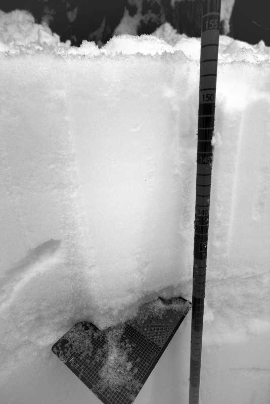
Just a quick snowpack note from right at the pass, at the Washington Alpine Club cabin. While working on snow profiles with Club backcountry-class students, the spherical snow grains pictured below came to light. They're from the center of the January 17 raincrust.
I've not seen such large, spherical, and icy snowpack grains before. I don't believe that they are graupel in the usual sense, as they're solid clear ice. It's tempting to guess that they are flash-frozen raindrops from the profound inversion during that weather event?
A TGR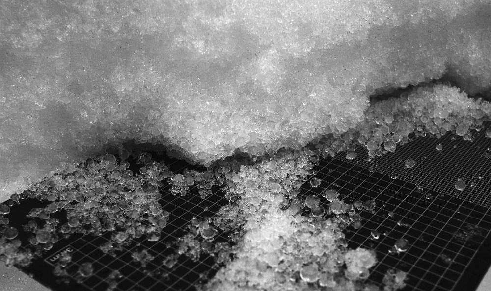
I've not seen such large, spherical, and icy snowpack grains before. I don't believe that they are graupel in the usual sense, as they're solid clear ice. It's tempting to guess that they are flash-frozen raindrops from the profound inversion during that weather event?
A TGR
Yes, I saw this layer earlier during an avy class at the pass. It is definitely not graupel, but is instead sleet (i.e. frozen rain drops). With such a deep inversion layer when the warm front arrived, rain falling through the maximum depth of this layer refroze and resulted in substantial deposits at pass level. At higher elevations, the rain did not have time to freeze before reaching the ground resulting in a thick frozen rain crust.
This seems consistent with reports of challenging skiing at higher elevations on a rain crust of varying thickness and better skiing lower on a deep layer of "graupel" which was actually sleet. (Graupel is formed in different atmospheric conditions.) .....sorry for the long diatribe but I thought it was an interesting weather event as well. .....also, thanks for the photos.
This seems consistent with reports of challenging skiing at higher elevations on a rain crust of varying thickness and better skiing lower on a deep layer of "graupel" which was actually sleet. (Graupel is formed in different atmospheric conditions.) .....sorry for the long diatribe but I thought it was an interesting weather event as well. .....also, thanks for the photos.
Reply to this TR
Please login first: