May 2, 2016, Iron Peak - Teanaway
5/2/16
WA Cascades East Slopes Central
3832
7
Spent a few days out in the Teanaway Skiing and camping. We base camped out of Beverly Camp ground and skied a few different peaks in the area
I haven't seen any report for Iron Peak so I thought I would add one in for interest.
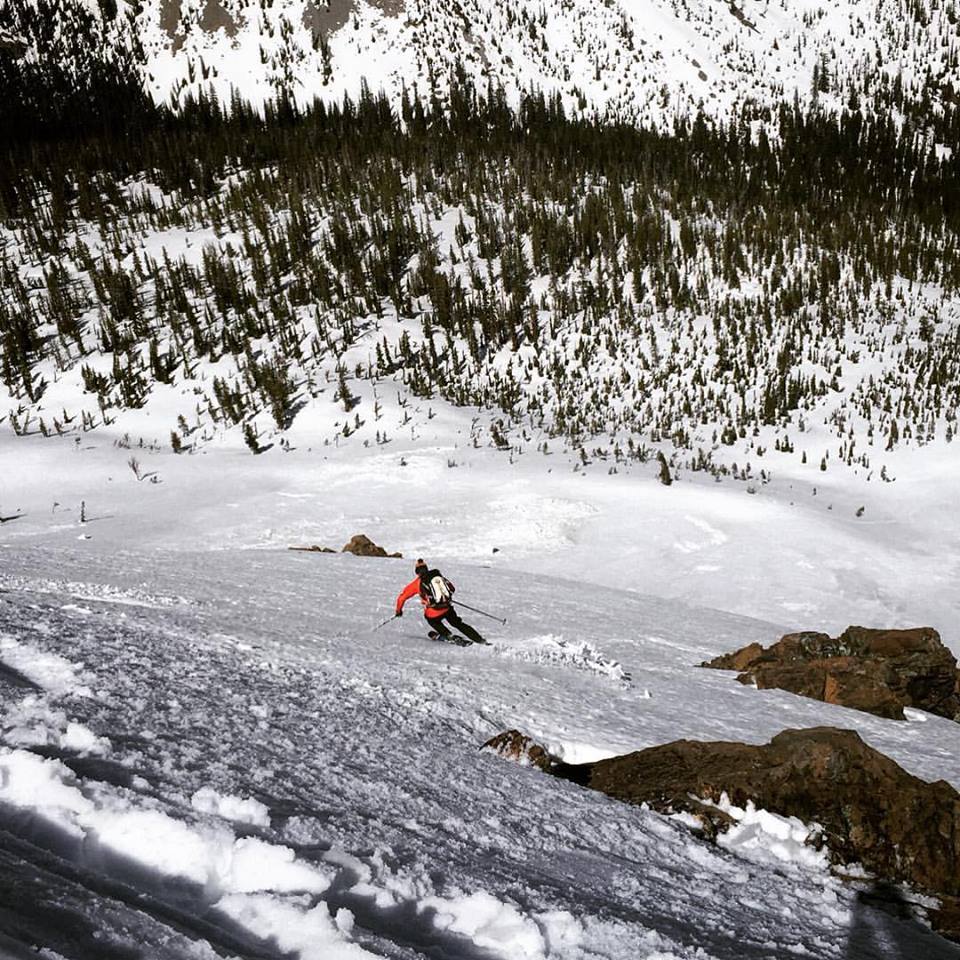
High snow levels on west and South west faces, we opted to approach via Beverly Creek in order to gain the broad north ridge of Iron Peak. The Beverly Creek basin is incredibly scenic. We hiked for 1 or 2 miles from the TH to 4800ft before transitioning to skins on consistent snow. I think the sweet spot for this area was about 2 weeks ago for an optimal skin2ski ratio.
We found tracks of a Bear and her Cub that had been curiously following an old skin track from the previous day. I'd never seen Bear tracks follow a skiers skin track before.
Several large cornices still overshadowing the NE ridge that have not dropped and we gave them a wide birth. We got to the summit around lunch time and enjoyed a few leisurely beers and some food while we waited for the corn to ripen.
great skiing off the summit down the fall line over a steeper convex of the NE face, back down to the Basin. good quality splashy corn snow is a great methadone for powder.
Teanaway Rd 9737 is snow free till approximately after Eldorado Creek. there is a small washout on the road here, but is manageable with a 4x4 with clearance... honestly, I've forded more water in some downtown Seattle downpours.
humbled by the quiet beauty of this remarkable place.
I haven't seen any report for Iron Peak so I thought I would add one in for interest.
High snow levels on west and South west faces, we opted to approach via Beverly Creek in order to gain the broad north ridge of Iron Peak. The Beverly Creek basin is incredibly scenic. We hiked for 1 or 2 miles from the TH to 4800ft before transitioning to skins on consistent snow. I think the sweet spot for this area was about 2 weeks ago for an optimal skin2ski ratio.
We found tracks of a Bear and her Cub that had been curiously following an old skin track from the previous day. I'd never seen Bear tracks follow a skiers skin track before.
Several large cornices still overshadowing the NE ridge that have not dropped and we gave them a wide birth. We got to the summit around lunch time and enjoyed a few leisurely beers and some food while we waited for the corn to ripen.
great skiing off the summit down the fall line over a steeper convex of the NE face, back down to the Basin. good quality splashy corn snow is a great methadone for powder.
Teanaway Rd 9737 is snow free till approximately after Eldorado Creek. there is a small washout on the road here, but is manageable with a 4x4 with clearance... honestly, I've forded more water in some downtown Seattle downpours.
humbled by the quiet beauty of this remarkable place.
How does the SW face of Earl peak look? Does it still have snow?
author=androolus link=topic=36431.msg148481#msg148481 date=1462401891]Skied the NW shoulder Monday before dropping into the basin on continuous if mushy snow(skied off the summit ~4:15). It's going fast. We had to hike more than an hour(Oh, the humanity!) from the trail head before hitting skiable snow where the upper basin opens up.
How does the SW face of Earl peak look? Does it still have snow?
Thanks for the report. I finally have a chance to get out for a few days next week and I was hoping to do some skiing in that area so this is very helpful.
Looks good --thanks
Thanks Glenn...that's what I meant...the nw slope that empties into bean basin. I'm hoping I can still cross the creek there where the upper basin opens up.
I'd never seen Bear tracks follow a skiers skin track before.
Saw a cub two weeks ago SW of Earl. I've seen Cougar tracks in my skin track from the previous day.
Everything like an easy walk - or snack.
Saw a cub two weeks ago SW of Earl. I've seen Cougar tracks in my skin track from the previous day.
Everything like an easy walk - or snack.
I was also in this area on 4-30 and 5-1. What an amazing weather window for spring skiing! I camped at about 6K feet on 4-30, and skied Iron Peak on 5-1. If anyone wants to see photos of the bear cub foot prints in he snow, I can got some good photos of them. You can view them in my photo album below:
https://www.facebook.com/the808/media_set?set=a.10153662835212613.1073741856.502942612&type=3
https://www.facebook.com/the808/media_set?set=a.10153662835212613.1073741856.502942612&type=3
Reply to this TR
Please login first: