April 30-May 1, 2016, Earl Peak and Navaho Peak
4/30/16
WA Cascades East Slopes Central
2663
1
Edit: youtube
David and I headed up Stafford Creek after seeing some encouraging TRs in the more westerly reaches of the Teanaway earlier this month. We may have missed primetime by several weeks but there were still some great turns.
We pulled up to the Stafford TH at around 7:30 AM Saturday and headed uphill with skis on packs. We didn't transition until after making camp after the summer trail crosses Stafford Creek at about the 4800' level.
Earl Peak was on our agenda for day 1. We crossed the western branch of the creek at the Trail 1369 crossing (5000') and skinned along the western bank of the creek in a northerly direction, avoiding the steeper rocky bands on the left before hanging a sharp left into the obvious NNE facing bowl of Earl Peak.
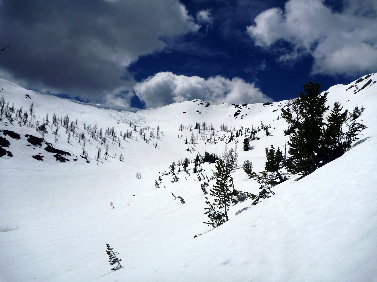
Rather than skinning directly up below the summit, we gained the ridge at the second saddle point on the NE ridge via more moderate slopes then booted/scrambled the ridge to the summit.
The south facing skin up to the ridge was sloppy but the NNE facing slopes immediately below the summit were just slightly overcooked corn, a short but really fun descent.
Some of the failed cornice remnants from the SE ridge were spectacularly large
We met a couple of other parties of skiers, one with a particularly lively dog that chased David on our second lap of the face, then clawed his way all the way back up to the summit in about 90 seconds.
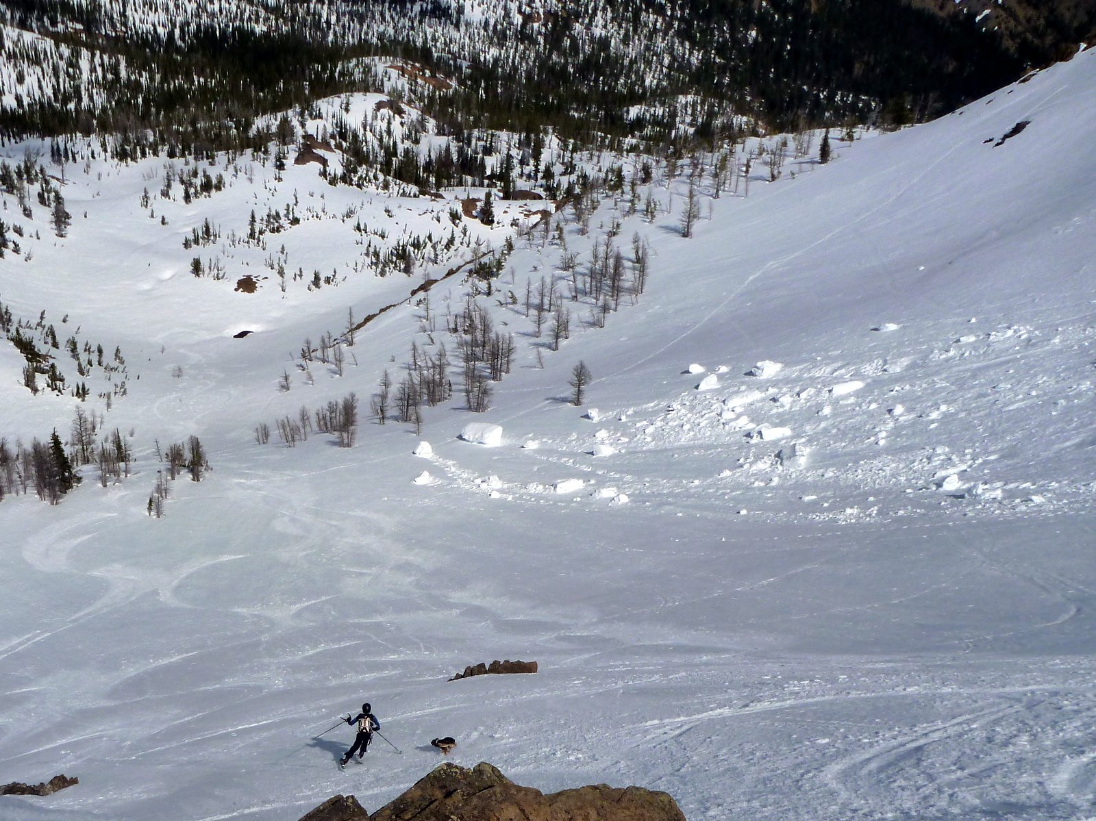
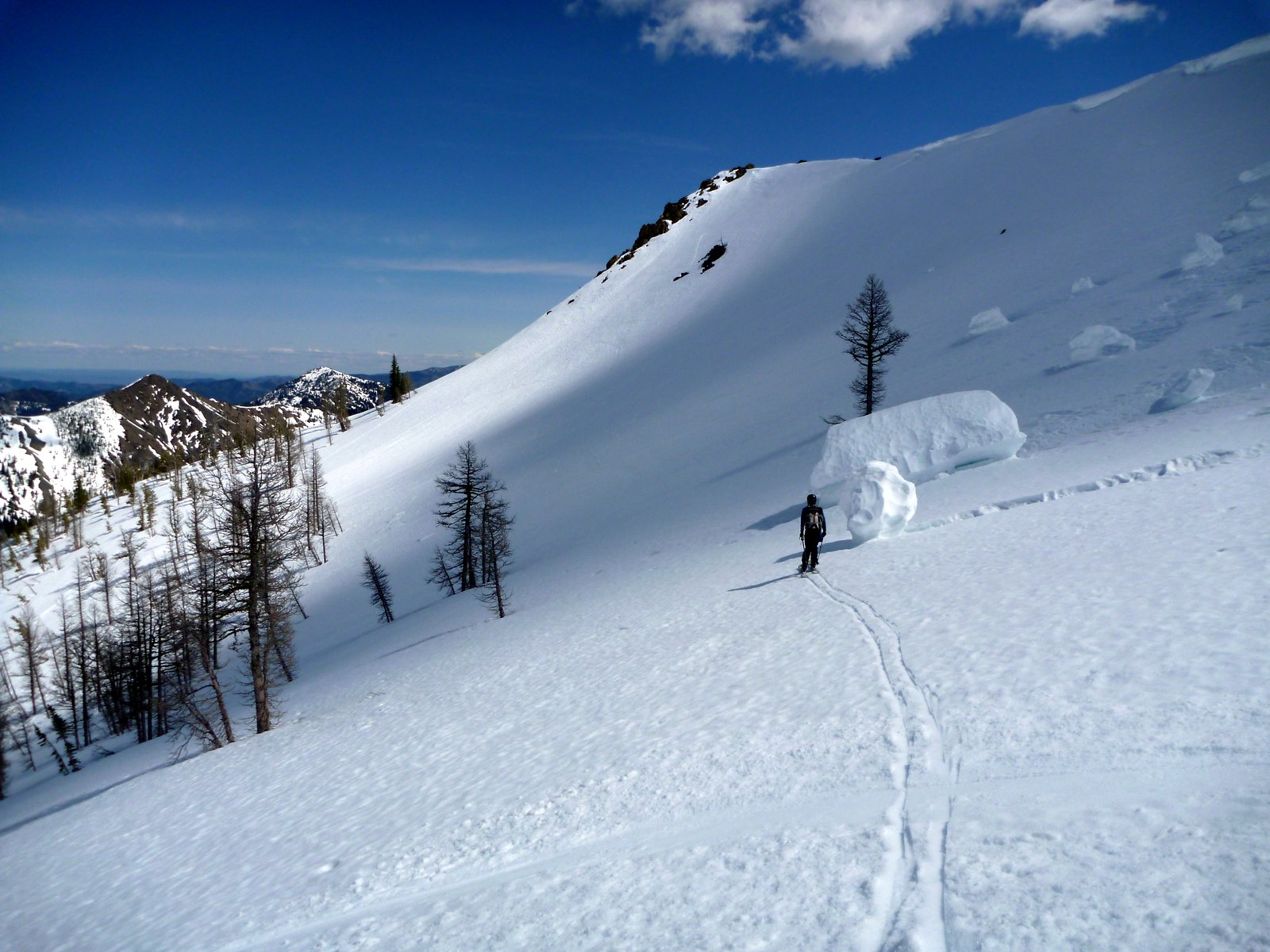
After two laps, we descended to the valley floor and picked up our skin track back to camp. The low elevation snow is going very quickly - I imagine soon that the skin along the creek will turn into a slog in the forest with no designated trail.
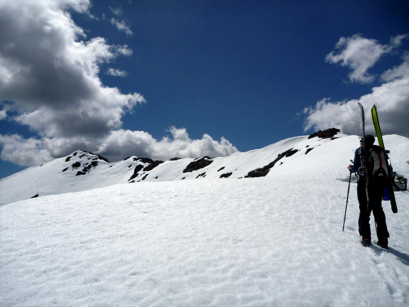
Day 2's objective was Navaho Peak. With greater southern/western exposure, we figured the coverage would be spotty and ended up booting along the summer trail and cross country on dirt until 5600'. With a 8:00 start and a clear night before, we encountered firm conditions on the ascent (hooray ski crampons) which rapidly softened from mid morning. We gained the broad W/SW ridge of Navaho at about the 6300' level and zigzagged our way through the trees, making use of the N and S sides of the ridge and enjoying sporadic views of the Stuart Range.
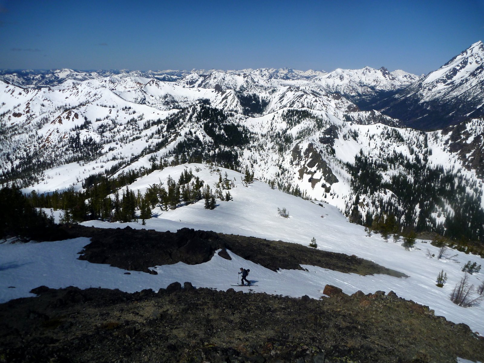
The summit pyramid had pretty amazing views, especially the unobstructed views to the drier lands to the East - an unusual perspective on the Ingalls Creek valley compared to my usual look from Ingalls Pass. The bowl on the north side of Navaho looked like it was in good shape but we didn't check it out ourselves.
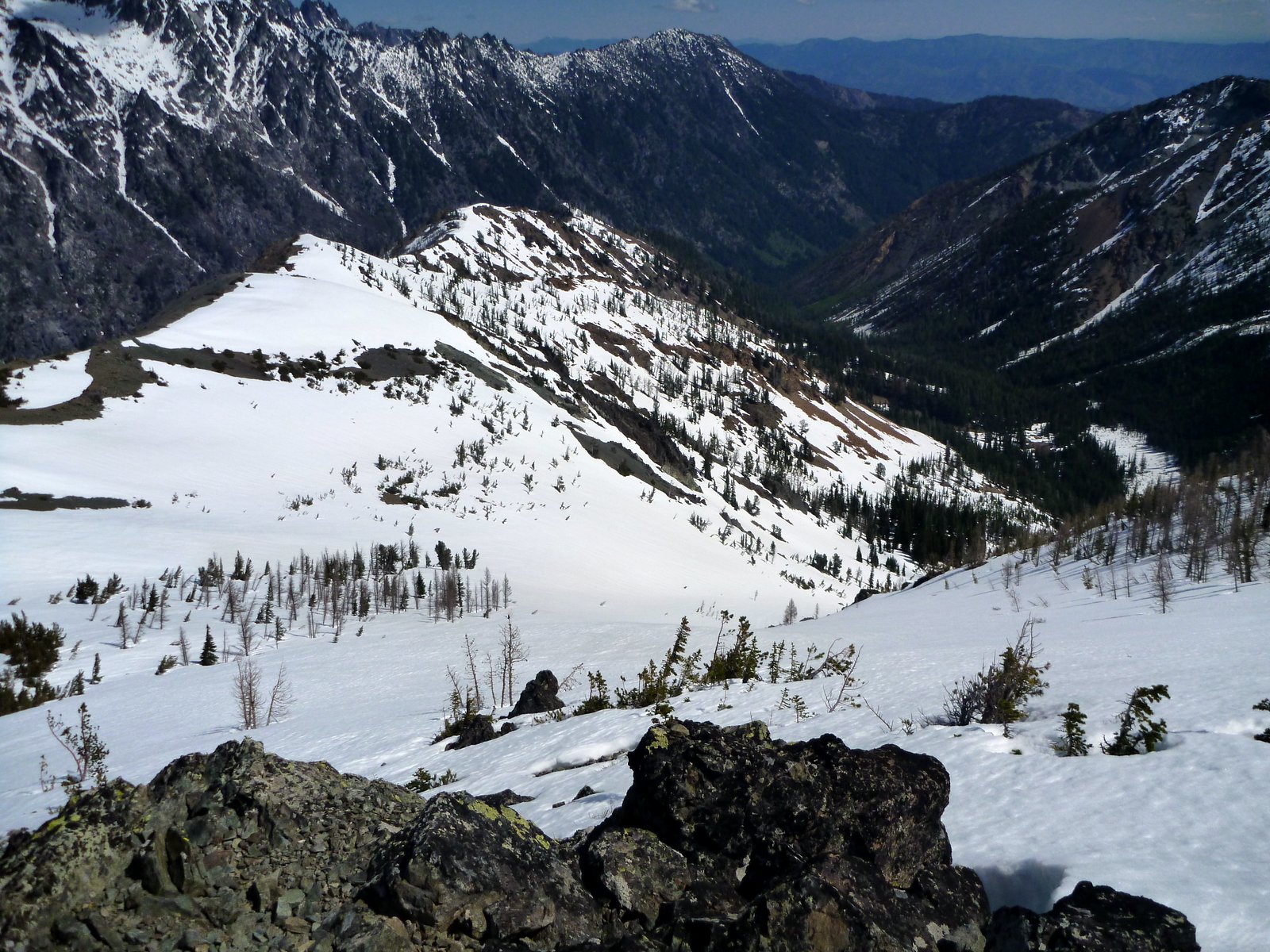
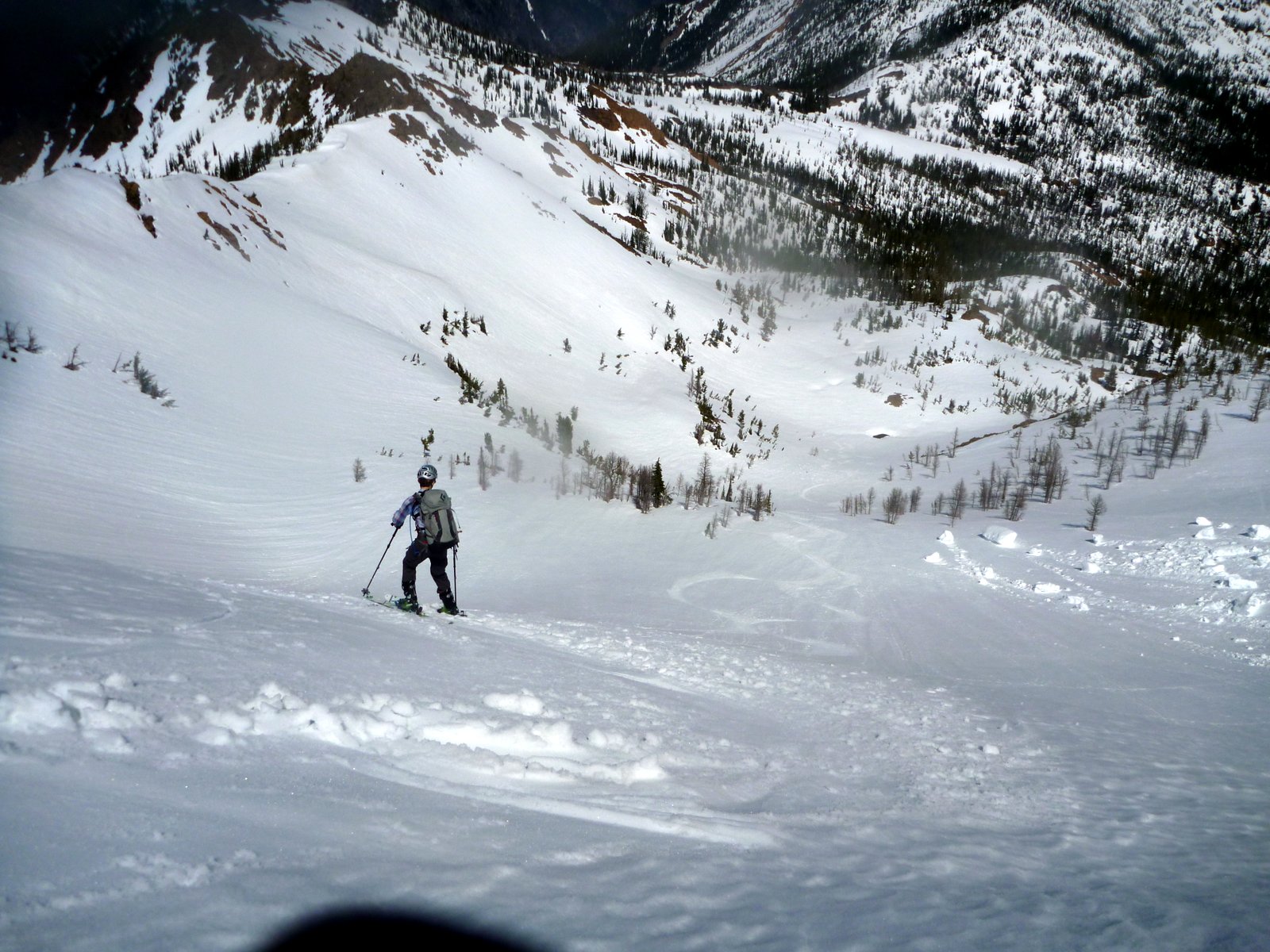
The descent was a treat! We skied the open, gladed SSW face with great corn conditions from the base of the (melted) summit pyramid. There are a number of vertical swaths with few trees that make for great ski lanes if you can find them.
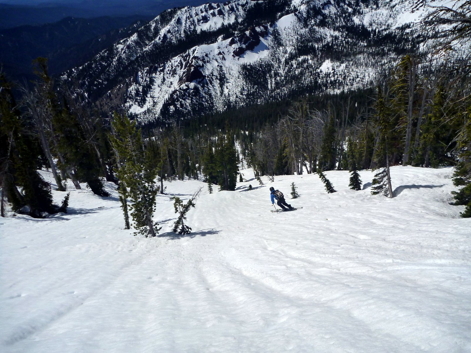
We enjoyed a series of fall-line pitches to 6000' before traversing hard right to avoid a rock band.
We didn't quite make it around the whole band and booted a 30' rock gulley before regaining the summer trail and descending on foot back to camp.
I have lots more pictures of other Teanaway and Stuart Range peaks, let me know if you want beta on a particular location and I can post them.
Map recreated from memory: Hillmap
David and I headed up Stafford Creek after seeing some encouraging TRs in the more westerly reaches of the Teanaway earlier this month. We may have missed primetime by several weeks but there were still some great turns.
We pulled up to the Stafford TH at around 7:30 AM Saturday and headed uphill with skis on packs. We didn't transition until after making camp after the summer trail crosses Stafford Creek at about the 4800' level.
Earl Peak was on our agenda for day 1. We crossed the western branch of the creek at the Trail 1369 crossing (5000') and skinned along the western bank of the creek in a northerly direction, avoiding the steeper rocky bands on the left before hanging a sharp left into the obvious NNE facing bowl of Earl Peak.
Rather than skinning directly up below the summit, we gained the ridge at the second saddle point on the NE ridge via more moderate slopes then booted/scrambled the ridge to the summit.
The south facing skin up to the ridge was sloppy but the NNE facing slopes immediately below the summit were just slightly overcooked corn, a short but really fun descent.
Some of the failed cornice remnants from the SE ridge were spectacularly large
We met a couple of other parties of skiers, one with a particularly lively dog that chased David on our second lap of the face, then clawed his way all the way back up to the summit in about 90 seconds.
After two laps, we descended to the valley floor and picked up our skin track back to camp. The low elevation snow is going very quickly - I imagine soon that the skin along the creek will turn into a slog in the forest with no designated trail.
Day 2's objective was Navaho Peak. With greater southern/western exposure, we figured the coverage would be spotty and ended up booting along the summer trail and cross country on dirt until 5600'. With a 8:00 start and a clear night before, we encountered firm conditions on the ascent (hooray ski crampons) which rapidly softened from mid morning. We gained the broad W/SW ridge of Navaho at about the 6300' level and zigzagged our way through the trees, making use of the N and S sides of the ridge and enjoying sporadic views of the Stuart Range.
The summit pyramid had pretty amazing views, especially the unobstructed views to the drier lands to the East - an unusual perspective on the Ingalls Creek valley compared to my usual look from Ingalls Pass. The bowl on the north side of Navaho looked like it was in good shape but we didn't check it out ourselves.
The descent was a treat! We skied the open, gladed SSW face with great corn conditions from the base of the (melted) summit pyramid. There are a number of vertical swaths with few trees that make for great ski lanes if you can find them.
We enjoyed a series of fall-line pitches to 6000' before traversing hard right to avoid a rock band.
We didn't quite make it around the whole band and booted a 30' rock gulley before regaining the summer trail and descending on foot back to camp.
I have lots more pictures of other Teanaway and Stuart Range peaks, let me know if you want beta on a particular location and I can post them.
Map recreated from memory: Hillmap
I love that area! I went in there a couple years ago. Sounds like conditions are similar to when I went in. I am looking for a destination for the weekend of the 14th and am thinking this might be too cooked out.
My report from 2014 is here: https://langleybackcountry.com/2014/05/18/delayed-gratification/
My report from 2014 is here: https://langleybackcountry.com/2014/05/18/delayed-gratification/
Reply to this TR
Please login first: