August 2, 2015, Mt Baker, Squak Glacier Still Fine
8/2/15
WA Cascades West Slopes North (Mt Baker)
4025
1
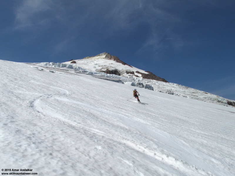
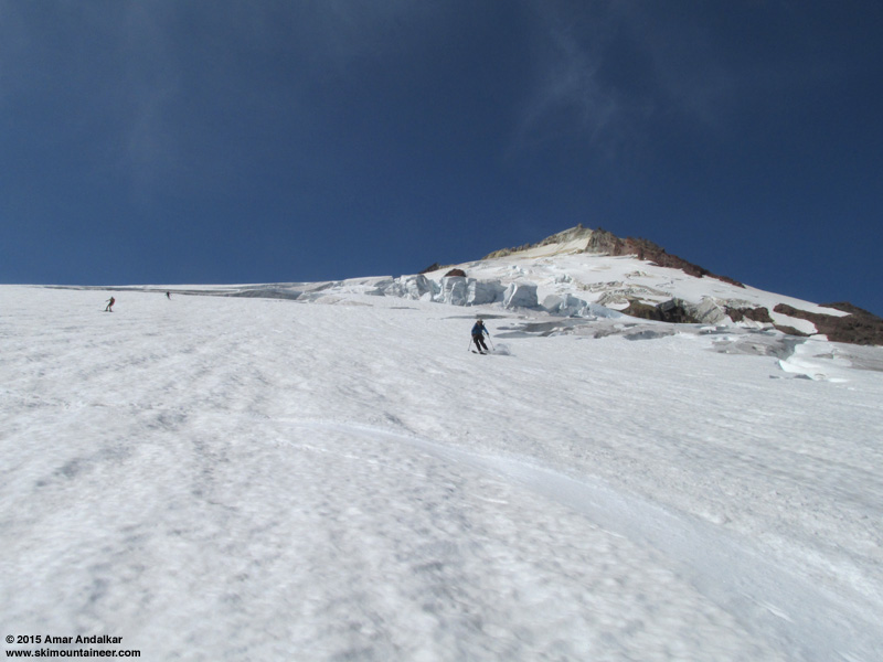
Skiing smooth corn on the Squak Glacier!
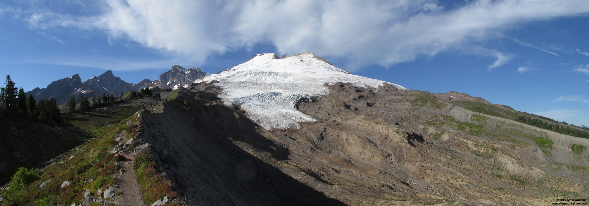
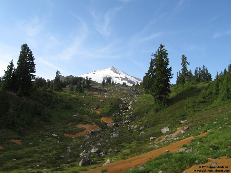
As of August 2, the Squak Glacier route remains in excellent condition, pretty much just as nice as when I skied it on July 20! (See
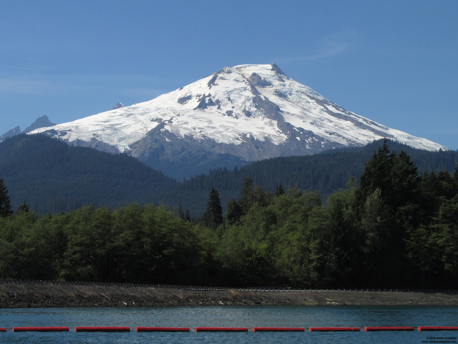
August 1: Mid-afternoon view of Mount Baker rising above 722 ft Baker Lake, with the Squak Glacier at left, Talum Glacier at center below 10160+ ft Sherman Peak, and Boulder Glacier at right below 10781 ft Grant Peak. (click for double-size version)
I spent Saturday afternoon taking some scenic photos from Baker Lake and then hiking up the spectacular Railroad Grade Trail to take a look at the Easton Glacier. Had a nice chat with noted guide Craig Van Hoy who was leading an Alpine Ascents group camped at 5900 ft Sandy Camp. They had summited earlier in the day and had enjoyed quite the crevasse adventure crossing the very broken-up Easton Glacier to get to the Squak route, and then similarly again on the descent getting back to camp via a different variation.
August 1: Three-shot panorama from the Railroad Grade Trail, with the Black Buttes at left, Easton Glacier at center, and Squak Glacier at right below 10160+ ft Sherman Peak. (click for double-size version)
August 1: Enlarged middle section of the previous panorama, with the Deming Glacier below the left skyline, Easton Glacier at center, and Squak Glacier at right. (click for double-size version)
I continued scrambling past the end of the trail up to almost 6100 ft, and walked a bit on the Easton's bare glacial ice just for fun. Then hiked back down and up to 5460 ft Park Butte Lookout to watch the sunset and the near-full moonrise over the Cascades at 9:30pm, before descending back to the trailhead just before 11pm.
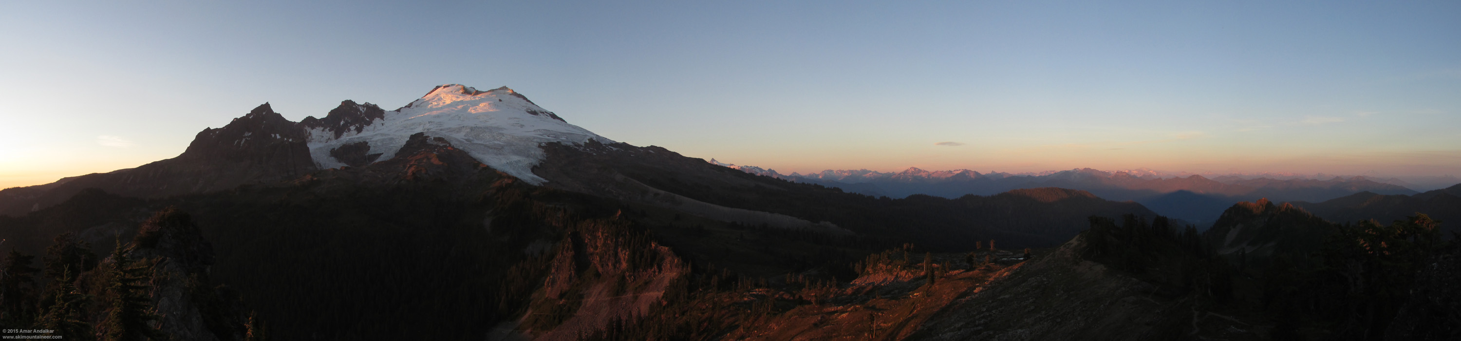
August 1: Six-shot panorama from Park Butte Lookout just before sunset at 8:30pm, with the Black Buttes at left (9080+ ft Lincoln Peak and 9440+ ft Colfax Peak above the lower Deming Glacier), 10781 ft Grant Peak and 10160+ ft Sherman Peak at center above the Easton and Squak Glaciers, 9127 ft Mount Shuksan rising just above Baker's right skyline, and the vast sweep of the North Cascades extending to 10541 ft Glacier Peak at far right almost lost in a haze of wildfire smoke. (click for triple-size version)
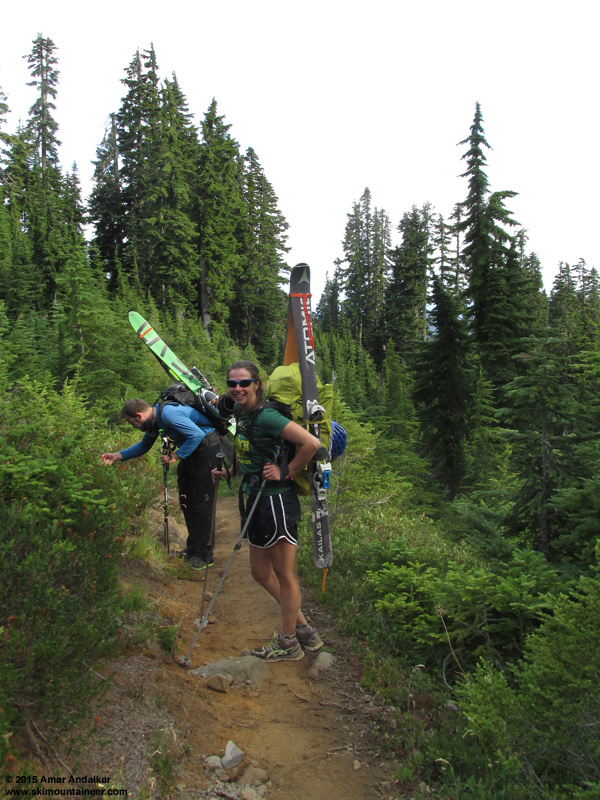
My partners all arrived from separate locations well after dark Saturday evening, and we car-camped at the trailhead. Around midnight, we were surprised to see a pair of skiers returning to the parking lot, and we had a nice chat with them from our sleeping bags. They reported excellent ski conditions, but a very long day as they had departed at 6am and summited after 5pm. It was nice to have confirmation that the Squak route was still in great shape for skiing.
 http://www.skimountaineer.com/TR/Images2015/BakerCragViewSquakGlacierPano2000-02Aug2015.jpg" />
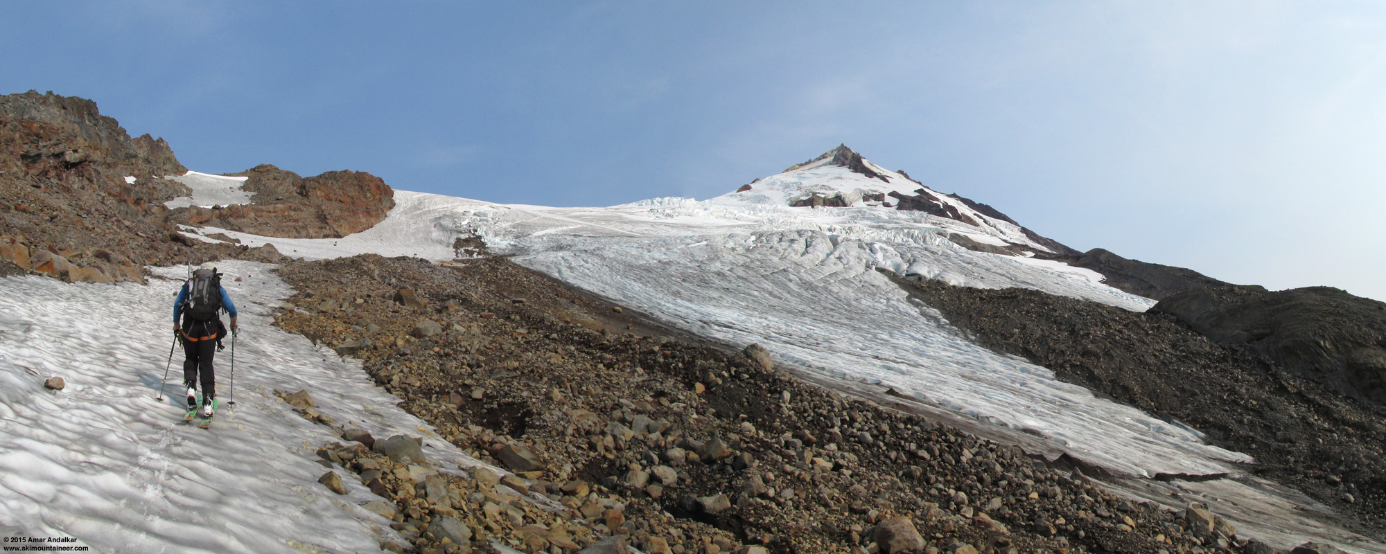
Three-shot panorama from just above 6000 ft after we started skinning, with 6513 ft Crag View on the ridge at left, 10160+ ft Sherman Peak at right center, and one of the several termini of Squak Glacier at lower right. (click for double-size version)
We left the trailhead at 6:30am Sunday, started skinning at 9am, and summited just after 2pm.
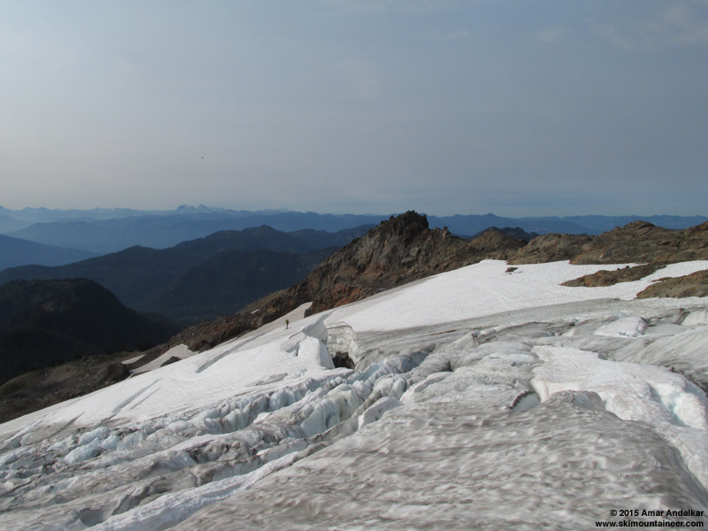
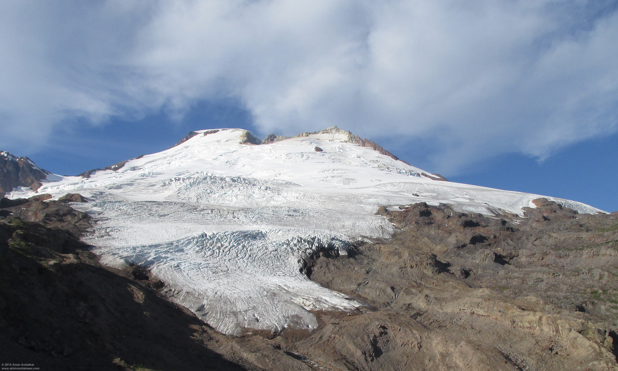
Weaving through crevasses and across blue glacial ice around 6500 ft, with 6513 ft Crag View just beyond the edge of the glacier.
Crevasse bridge near 8700 ft, looking about half as wide as in the
High cirrus clouds briefly produced a nice 22° solar halo.
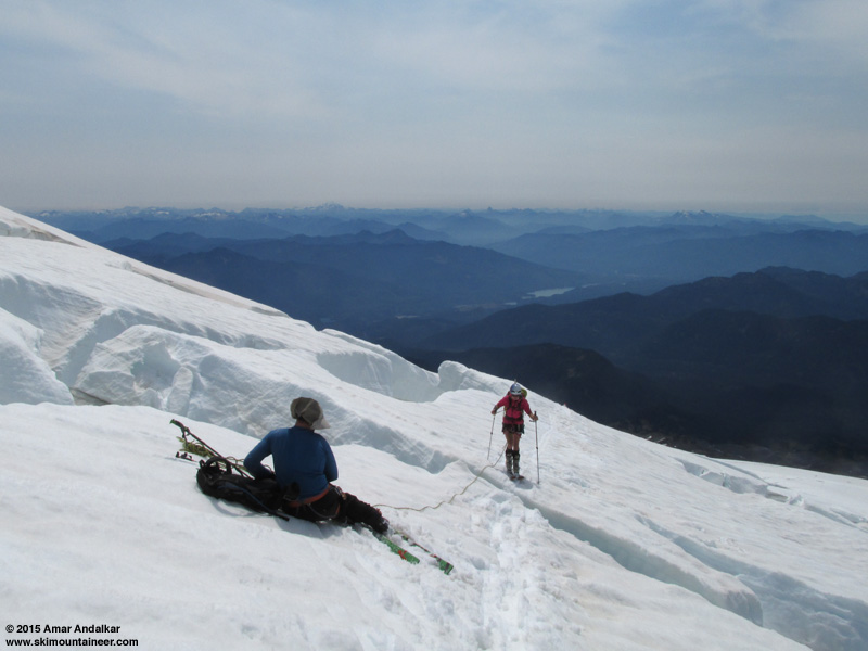
The sketchy undercut crevasse bridge near 9300 ft, now with a small 3" gap between the sides compared with
Crevasse zigzag near 9400 ft, looking a bit narrower than in the
 eventually collapse, and guided groups will have strong incentive to keep some variation of the Squak route viable for the next month or so.<br /><br /><a href=)
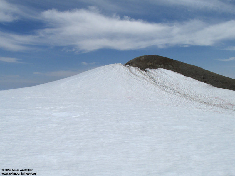
View from near 9400 ft showing the path of the bootpack up the Roman Wall. (click for double-size version)

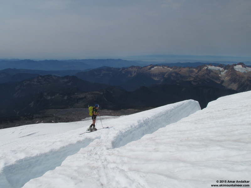
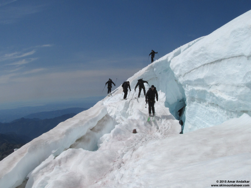
Skinning across a complex crevasse bridge near 10000 ft on the Roman Wall, the crux of the route up the Wall.
 http://www.skimountaineer.com/TR/Images2015/BakerSummitShermanDomePano3000-02Aug2015.jpg" />
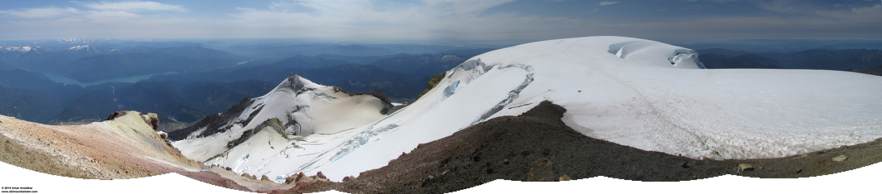
Six-shot panorama from atop 10781 ft Grant Peak, with 722 ft Baker Lake at left far below, 10160+ ft Sherman Peak at center above Sherman Crater and Boulder Glacier, and the 10760+ ft summit dome at right. (click for triple-size version)
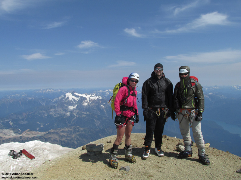
Kristy, Sam, and Zdenek atop 10781 ft Grant Peak, the true summit of Mount Baker, with my skis on the highest skiable snow just below and 9127 ft Mount Shuksan in the background.
It was once again cool and windy at the summit, but winds were a bit lighter this time than on July 20, west 20-30 mph atop Grant Peak. The temperature was much warmer this time at 44 °F, about what would be expected given the 14000 ft freezing level, in sharp contrast to the anomalously cold 33 °F on July 20 despite a freezing level over 13000 ft.
 http://www.skimountaineer.com/TR/Images2015/BakerSummitParkHeadwallPano2000-02Aug2015.jpg" />
Seven-shot vertical panorama looking down the Park Headwall from beside the summit of Grant Peak, with the Mazama Glacier at far left, Sholes Glacier just above that, Rainbow Glacier just to its right, Park Glacier throughout the center, 9127 ft Mount Shuksan at top center, Boulder Glacier at lower right (with a large streak of rockfall debris), and 722 ft Baker Lake at right far below. (click for triple-size version)
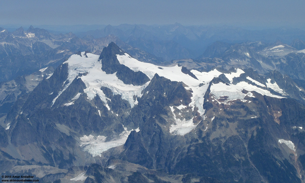
Zoomed view of 9127 ft Mount Shuksan, nice to get a clear view of Shuksan this time since it had been mostly obscured by clouds on July 20.
Skied from the summit at 2:30pm, the uppermost 50 ft on Grant Peak was actually much nicer than on July 20, with new snow covering and smoothing out the rough dirty snow, and nicely corned even on this northwest aspect.
Ski tracks in smooth corn descending from 10781 ft Grant Peak to the summit plateau.
Five-shot multiple exposure of Sam skiing across a complex crevasse bridge near 10000 ft on the Roman Wall, looking a bit narrower than in the
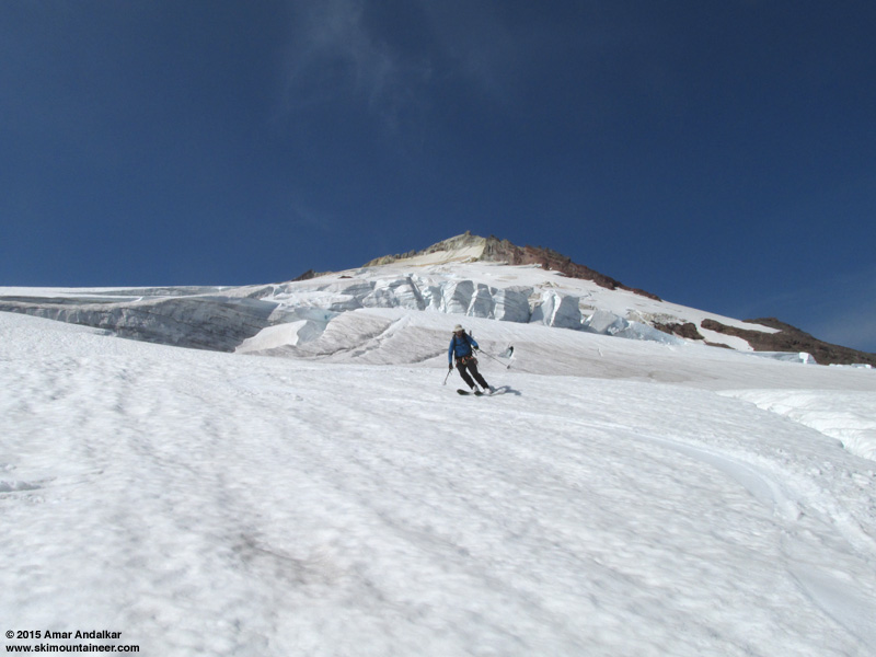
Skiing across the crevasse bridge near 8700 ft.
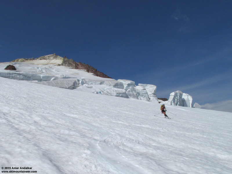
Skiing smooth corn past towering seracs on the Squak Glacier!
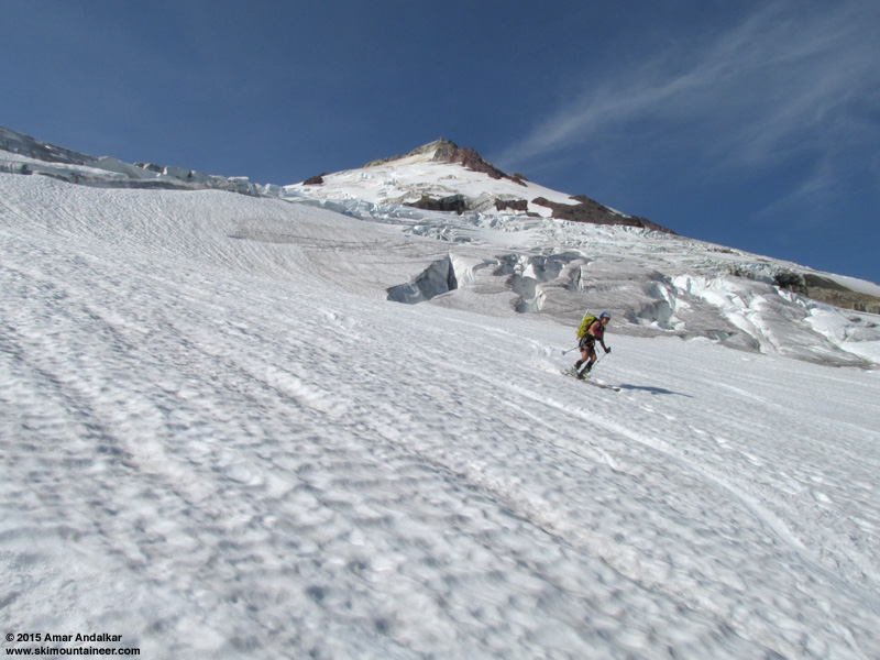
Nice smooth corn extends down to nearly 6500 ft.
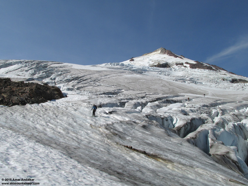
Skiing across blue glacial ice around 6500 ft.
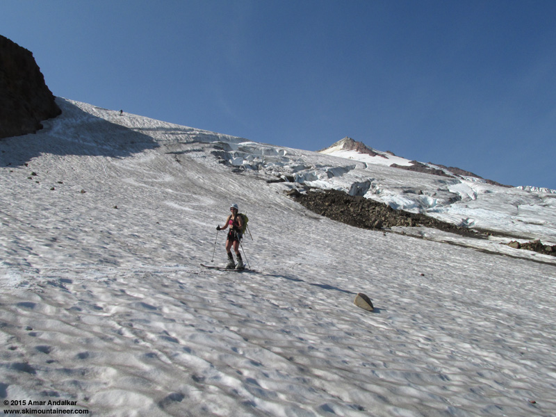
We completely avoided the lower section of blue glacial ice around 6300 ft by skiing a steep pitch around its west side, but the snow was very dirty and hard-frozen, not much better than the much less-steep, sun-softened glacial ice nearby.

On the way back down, we followed the nice portion of the climbers trail (gently contoured in the open subalpine) from 5800 down to about 5200 ft, but then I wanted to avoid the nasty steep parts lower down with trees encroaching in many spots, which were no fun to ascend and even worse to descend, especially with skis on the pack. I remembered that there was a nice open valley just west of the ridge that the climbers trail follows, which would intersect the Scott Paul Trail and completely avoid the nasty parts, having skinned up that valley several times in previous summers with deeper snowpack.
The nice open valley which circumvents the nasty lower portion of the climbers trail.
So we diverged west off the climbers trail into the valley around 5200 ft, and in barely 5 minutes of cross-country walking, intersected the Scott Paul Trail near 5000 ft where it crosses a seasonal stream. Sweet!
Plenty of blueberries to eat along the Scott Paul Trail near 5000 ft.
At a cost of perhaps 1/4 mile extra distance, we had avoided the worst of the climbers trail and traded it for smooth maintained trail instead, with a significant savings of time and toil. This route variation is highly recommended instead of the lower portion of the climbers trail from 4600-5200 ft, and I'll be sure to take it on any future trips here which are snow-free at those elevations. We were back to the cars a bit after 6:30pm, and once again enjoyed a fine dinner at
Photo of my GPS, showing the alternate route connecting the Scott Paul Trail and climbers trail.
Another outstanding day on the Squak Glacier with fine company, gorgeous weather, and great skiing. Over 4800 vert of mostly excellent skiing for about 7600 ft of total gain roundtrip, pretty awesome to still have that in August after one of the worst snowpack years in Northwest history!
[hr]As a general reference for high elevation weather conditions in the Washington Cascades on this weekend and subsequently, here is Saturday morning's NWS Rainier forecast. The forecast freezing level near Mount Baker from the UW weather model was expected to be only about 500 ft lower than at Rainier, but with somewhat stronger winds at 10000 ft closer to 20 mph:
[tt]
MOUNT RAINIER RECREATIONAL FORECAST
NATIONAL WEATHER SERVICE SEATTLE WA
635 AM PDT SAT AUG 1 2015
SYNOPSIS...AN UPPER RIDGE WILL GRADUALLY WEAKEN OVER THE NEXT COUPLE OF DAYS. ONSHORE FLOW WILL RETURN EARLY NEXT WEEK FOR COOLER WEATHER. AN UPPER TROUGH WILL BRING A CHANCE OF SHOWERS LATER IN THE WEEK.
SATURDAY...SUNNY. FREEZING LEVEL NEAR 15000 FEET.
SATURDAY NIGHT...MOSTLY CLEAR. FREEZING LEVEL NEAR 14500 FEET.
SUNDAY...SUNNY. FREEZING LEVEL NEAR 14500 FEET.
SUNDAY NIGHT...PARTLY CLOUDY. FREEZING LEVEL NEAR 14000 FEET.
MONDAY...MOSTLY SUNNY. FREEZING LEVEL NEAR 13500 FEET.
TEMPERATURE AND WIND FORECASTS FOR SELECTED LOCATIONS.
SAT SAT SUN SUN MON
NIGHT NIGHT
SUMMIT (14411 FT) 32 30 30 27 24
W 30 SW 25 SW 25 SW 15 SW 20
CAMP MUIR(10188 FT) 55 54 51 49 46
W 15 W 10 SW 5 W 10 W 15
PARADISE (5420 FT) 82 61 78 57 68
SW 5 NW 5 S 5 W 5 W 10
LONGMIRE (2700 FT) 94 55 87 55 79
CALM CALM CALM CALM CALM
++ TEMPERATURES AND WIND FOR THE SUMMIT AND CAMP MUIR ARE AVERAGE
CONDITIONS EXPECTED IN THE FREE AIR AT THOSE ELEVATIONS.
++ TEMPERATURES FOR PARADISE AND LONGMIRE ARE THE EXPECTED HIGHS AND
LOWS. WIND IS THE AVERAGE WIND EXPECTED DURING THAT PERIOD.
EXTENDED FORECAST...
MONDAY NIGHT...PARTLY CLOUDY. FREEZING LEVEL NEAR 13000 FEET.
TUESDAY...MOSTLY SUNNY. FREEZING LEVEL NEAR 12500 FEET.
TUESDAY NIGHT...PARTLY CLOUDY. FREEZING LEVEL NEAR 12500 FEET.
WEDNESDAY...MOSTLY SUNNY. FREEZING LEVEL NEAR 11500 FEET.
WEDNESDAY NIGHT...PARTLY CLOUDY IN THE EVENING THEN BECOMING MOSTLY CLOUDY. A CHANCE OF RAIN SHOWERS. SNOW LEVEL NEAR 10500 FEET.
THURSDAY THROUGH FRIDAY...MOSTLY CLOUDY WITH A CHANCE OF SHOWERS. SNOW LEVEL NEAR 10500 FEET.
[/tt]
Thanks for the excellent TR. Glad to see there is still good skiing somewhere in the PNW.
Reply to this TR
Please login first: