April 14-20, 2015, Mt Rainier High Orbit Route
4/14/15
WA Cascades West Slopes South (Mt Rainier)
30113
7
Sorry for the delay in getting this posted, but my partner was obliged to do a write-up on the trip for Gear Junkie first. In general the condition of the glaciers was very good, with only a few surprises. The challenge was getting on and off them at times. This is a great trip, and quite an adventure...but committing for sure, especially when the only open access point to the mountain is from Paradise. Here's the link to the trip report, including a few pics:
http://gearjunkie.com/high-orbit-gear-junkie-tackles-rainiers-hidden-route
http://gearjunkie.com/high-orbit-gear-junkie-tackles-rainiers-hidden-route
Fantastic! It brings back great memories. Here is Gary W. and my high orbit trip report from 2008. I was on the inter glacier yesterday looking over St.Elmos pass and recalling our adventure.
http://www.turns-all-year.com/skiing_snowboarding/trip_reports/index.php?topic=10496.0
http://www.turns-all-year.com/skiing_snowboarding/trip_reports/index.php?topic=10496.0
Thanks for the nice write-up and congratulations on a successful trip! Pretty bold for a party of two. And ah yes, the memories...I should get my slides digitized :)
I also packed light for our May trip and nearly froze my butt off. Guide Geo scouted the high variation near St Andrews Rock from our Puyallup Glacier camp and wisely took us across the Tahoma Glacier much lower. Half of our party of six used skinny skis and pin bindings and felt they were the better gear choice since there was so little unroped downhill skiing on this trip.
I also packed light for our May trip and nearly froze my butt off. Guide Geo scouted the high variation near St Andrews Rock from our Puyallup Glacier camp and wisely took us across the Tahoma Glacier much lower. Half of our party of six used skinny skis and pin bindings and felt they were the better gear choice since there was so little unroped downhill skiing on this trip.
Looks like you shared some of our experiences, for sure! You do feel extremely isolated at times, and it has taken me a few weeks before thinking I'd ever do it again! Takes a bit for the sharp edges of the trip to dull a bit, and the beauty and majesty of the trip to take over my memories. I think starting at White River is a great way to do this...wasn't an option for us since we did the trip earlier in the year.
For us, getting onto the N Mowich was a real challenge...in hindsight, going for the high route and not dropping down near Needle Rock might have saved a lot of effort (would not have been on skis for the high route, most likely). The other major challenge we had was getting onto the Tahoma. We had to get to well over 10,000' because of large overhanging wind-blown cornices on the lower gaps. This was pretty sketchy...bulletproof ice on the ski up, then deep, soft avalanche debris above a huge crevasse to get onto the Tahoma. Then lots of route finding along the Tahoma. Lower is better if possible. If I were to do this again, I'd definitely want to have an extra person or two, increasing the margin of safety.
For us, getting onto the N Mowich was a real challenge...in hindsight, going for the high route and not dropping down near Needle Rock might have saved a lot of effort (would not have been on skis for the high route, most likely). The other major challenge we had was getting onto the Tahoma. We had to get to well over 10,000' because of large overhanging wind-blown cornices on the lower gaps. This was pretty sketchy...bulletproof ice on the ski up, then deep, soft avalanche debris above a huge crevasse to get onto the Tahoma. Then lots of route finding along the Tahoma. Lower is better if possible. If I were to do this again, I'd definitely want to have an extra person or two, increasing the margin of safety.
Cool trip and fun write up; thanks for posting!
A friend and I came across your tracks on our way up the Russell the day after you passed by and wondered who it might have been. It was interesting to look down on your route across the Mowich from atop the Russell; awesome zone.
We also used a section of your skin track the following day to gain Observation. So...thanks again!
author=vogtski link=topic=34220.msg141231#msg141231 date=1430831782]
Half of our party of six used skinny skis and pin bindings and felt they were the better gear choice since there was so little unroped downhill skiing on this trip.
Yea...I used my voile vector BC's which were great, but there was very little downhill turns without being roped. Skinny skis do well on the hard ice that we had a lot of as well. As I posted in another response, I agree with trying to hit the Tahoma lower if it works. Really a great trip, and I'm thrilled to know more people have done it...I feel I know Rainier much better than I have from previous climbs up it.
author=Snow Bell link=topic=34220.msg141238#msg141238 date=1430842635]
A friend and I came across your tracks on our way up the Russell the day after you passed by and wondered who it might have been. It was interesting to look down on your route across the Mowich from atop the Russell; awesome zone. We also used a section of your skin track the following day to gain Observation. So...thanks again!
I wish we would have seen you...we were feeling pretty isolated out there! That was a hard night because the weather looked to be changing and we really weren't sure how to get down to the Mowich...which was much bigger, deeper, and impressive than it appeared on the map! Luckily the weather gods were on our side and we had great visibility.
Congrats on a safe and successful trip!
It's fun to follow the links to past reports about the high-level orbit. Definitely a route of character, one that doesn't get done very often.
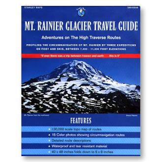
If you don't have it already, you might look for a copy of this map:
It includes details of vogtski's May 1990 trip with RMI and a couple other early trips as well. My brother Carl wrote up our 1996 ski orbit in the November 2002 issue of Backcountry magazine.
Dee Molenaar's Challenge of Rainier is the classic reference for the high-level orbit. See Chapter 19, "Encircling the Mountain." Our 1996 trip followed Molenaar's route, starting at White River and ending at Fryingpan Creek.
It's fun to follow the links to past reports about the high-level orbit. Definitely a route of character, one that doesn't get done very often.
If you don't have it already, you might look for a copy of this map:
It includes details of vogtski's May 1990 trip with RMI and a couple other early trips as well. My brother Carl wrote up our 1996 ski orbit in the November 2002 issue of Backcountry magazine.
Dee Molenaar's Challenge of Rainier is the classic reference for the high-level orbit. See Chapter 19, "Encircling the Mountain." Our 1996 trip followed Molenaar's route, starting at White River and ending at Fryingpan Creek.
Reply to this TR
Please login first: