April 8-9, 2015, Rainier, Muir Paradise POWDER x2!
4/8/15
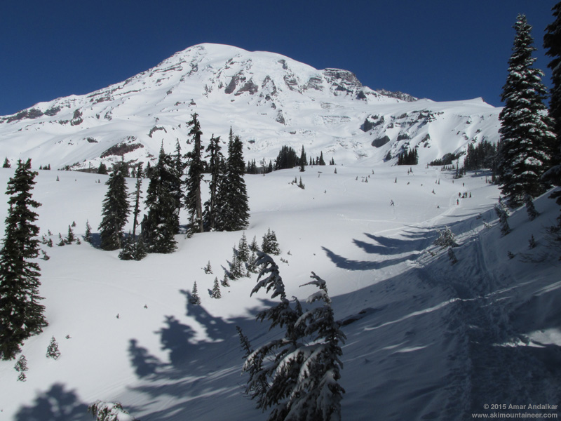
WA Cascades West Slopes South (Mt Rainier)
4756
7
Enjoyed 2 unexpectedly great days of powder skiing on the south side of Mount Rainier, skiing from Camp Muir on Wednesday and then from 10450 ft on Cowlitz Cleaver on Thursday, via the Muir Snowfield and uppermost Paradise Glacier. The high elevation mitigated the effects of solar heating on the snow, and ongoing recent snowfall of 2-3" per day since last weekend, which fell with almost zero wind even at 10000 ft, provided an exceptionally smooth snow surface. About 8-12" of newish lightish powder at Muir, atop a similar amount of older denser recent snow from last week's snowstorm (see 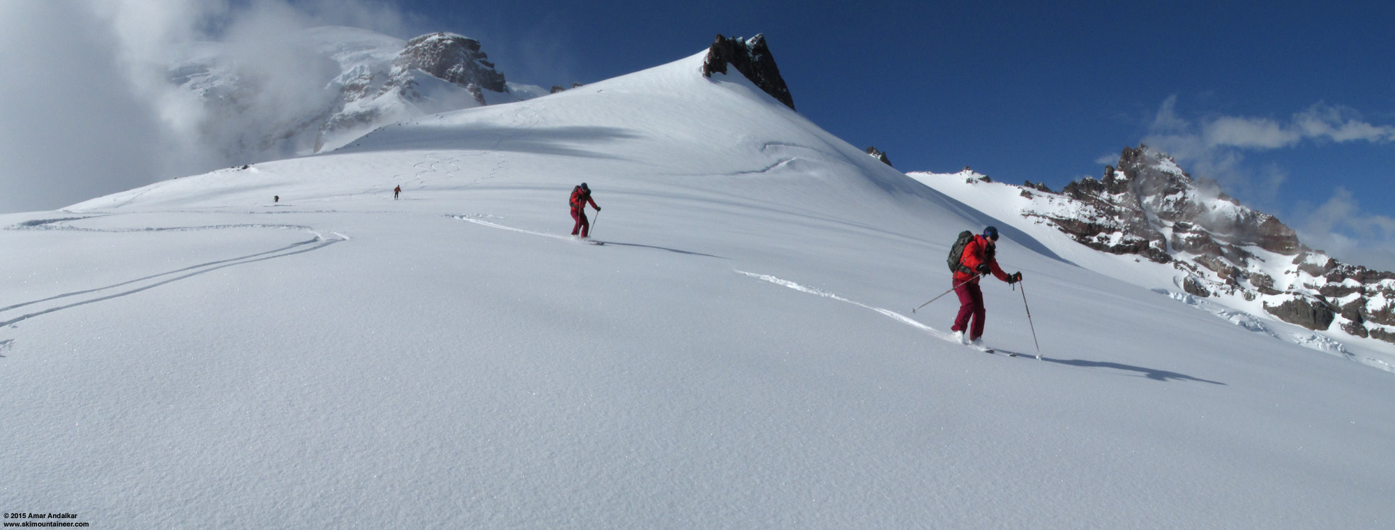
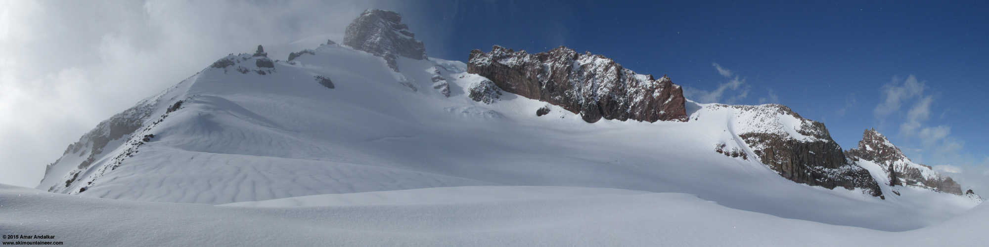
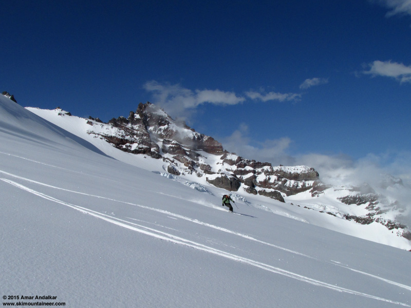
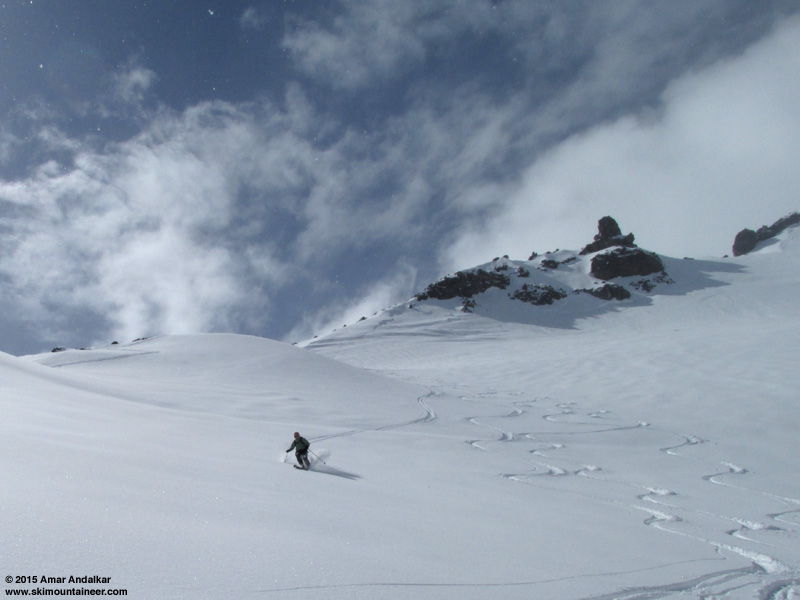
Two-shot panorama / multiple exposure skiing the Paradise Glacier below Anvil Rock, with Little Tahoma at far right above crevasses of the Cowlitz Glacier. (click for double-size version)
Not wanting to make the longer drive to the North Cascades Highway in search of preserved powder from last week's storm, Cori, Jill, DavidS, and I opted for Rainier on Wednesday, intending to head eastward (far eastward) from Paradise in search of northeast-facing, sun-protected powder. A weak ridge of high pressure was forecast for Wednesday-Thursday, but it was very weak, and in fact overall, the upper-level pressure was lower than normal despite it being nominally a high-pressure ridge relative to its surroundings on the weather map. The consequence: forecasts were all over the place for Wednesday, partly sunny to mostly cloudy, but all with a near-certainty of diurnal instability leading to afternoon cloud and snow shower development and maybe even thunderstorms, due to the increased spring solar intensity warming the surface while a pool of much colder air was up above. We hoped that the partly sunny forecasts would prevail.
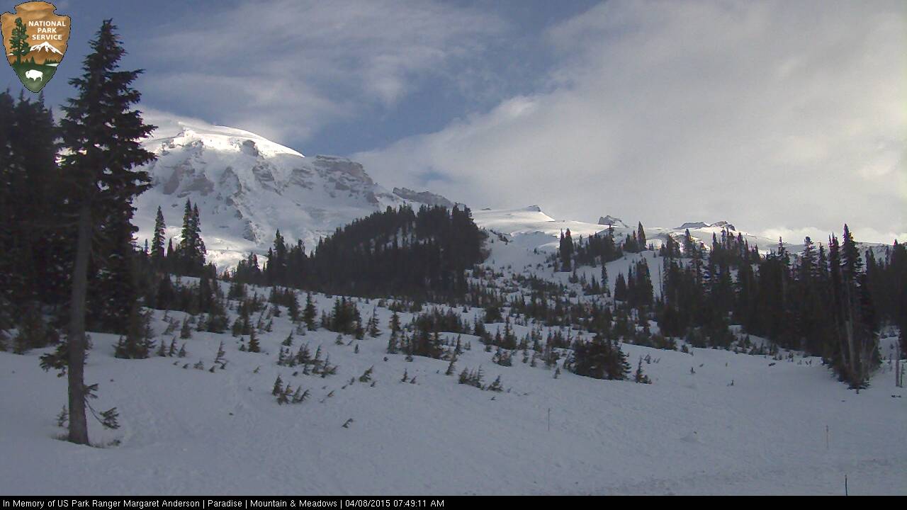
The morning webcam view looked promising as we left Seattle, but as we drove closer the webcam view became fully obscured by clouds, and we arrived to totally socked-in conditions at Paradise, with ongoing light snowfall which was not accumulating on the solar-warmed pavement. Given the likely whiteout conditions, our original plan of traversing far eastward mostly at 6000-7000 ft seemed like no fun, and I was certain that heading upward instead towards Muir would give us the best shot of breaking out of the whiteout and seeing some sun, with hopefully reasonably good snow.
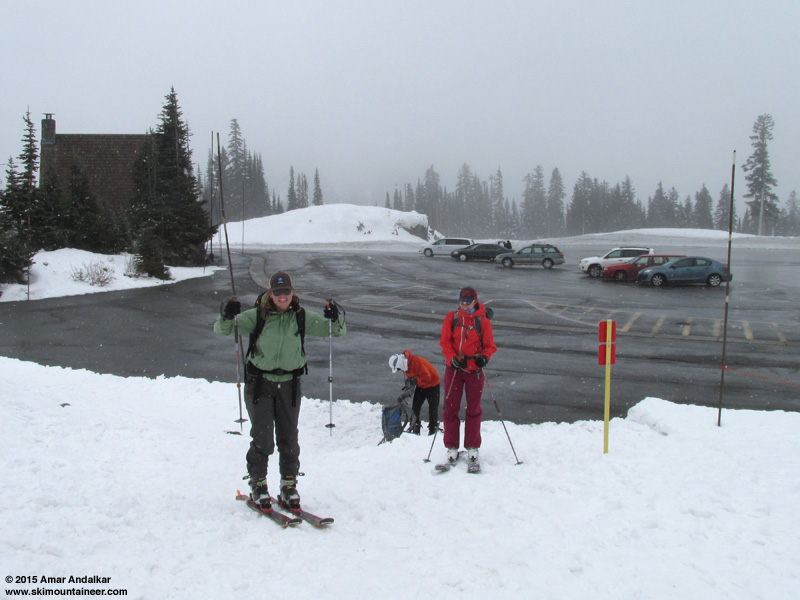
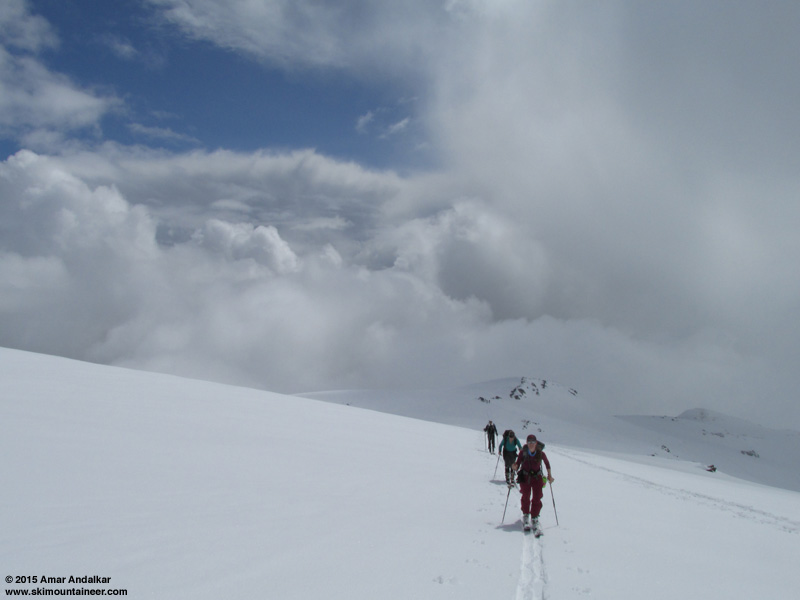
Got a late start at 11am, and skinned up into the clouds, with snow still falling. As hoped, we broke out into partial sunshine near Pan Point, and once again it was nice to meet and skin with my friends Seth & Solveig Waterfall leading an RMI ski seminar just like last week. The RMI group skied down from 7800 ft at Sugarloaf, and from there onward we broke trail the rest of the way to Muir, finding only a few short sections of previous skin track which had not been destroyed by the scourge of boot and snowshoe.
Some people (misguidedly) like to dis the Muir Snowfield as same-old-boring-flat or whatever else they might say, but if you keep your eyes open and looking around, then you can almost always see something new or fascinating up there on almost every trip. Even though this was my 222nd time reaching Camp Muir (218 with skis, including 52 in winter), I was amazed to see something that I don't think I've ever seen there before: almost the entire lower portion of the Snowfield from 7200 ft on up to over 8500 ft was covered in a beautiful layer of surface hoar, about 1-2 cm deep. Clear skies and calm air (along with a moisture source) are essential for surface hoar formation, as even a slight breeze or cloudiness above disrupts the process completely, so it is very rarely found far above-treeline in the Cascades. But this time the winds were exceptionally calm at Camp Muir overnight, less than 6 mph all night and averaging 1 mph over a 15-hour period (!! see telemetry below, the anemometer was not rimed). So this most atypical snow surface could develop nicely.
Surface hoar on the Muir Snowfield.
We enjoyed partly sunny, very warm, oven-effect conditions as we skinned up the Snowfield, but by 9000 ft the clouds above thickened and snow was once again falling. It looked like we would be skiing down in a whiteout for sure.
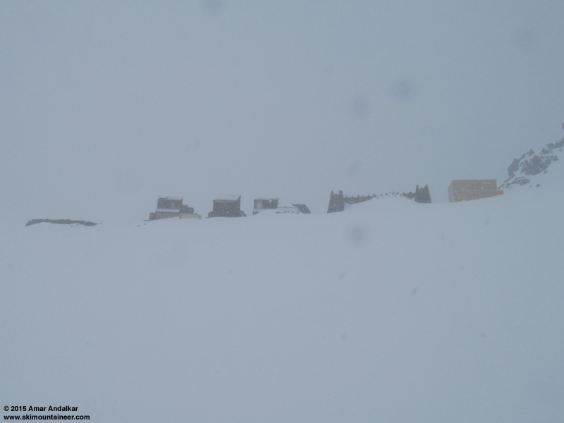
We arrived at Muir at 3:30pm in a snowstorm, but with winds still very light. There was almost a foot of new snow covering the steps at the public shelter's Dutch door, so we cleared those off and then hung out inside for a while, eventually joined by a large IMG Denali prep seminar group on snowshoes which we had passed near 9000 ft.
The winds were calm enough to leave the door open, and then lo and behold, a bit after 4pm there was a sunbreak. And soon more sunbreaks, and shortly afterward it was almost totally sunny outside. Time to ski while we could see!
Four-shot panorama of the powder-draped Cowlitz Glacier from Camp Muir after the sun came out, with Cowlitz Cleaver at left, Gibraltar Rock at top, Cathedral Gap at right center, and Little Tahoma at far right. (click for double-size version)
Skied down at 4:30pm in nearly-full sunshine surrounded by clouds all around, with very nice powder conditions, finding only an occasional inconsistent patch.
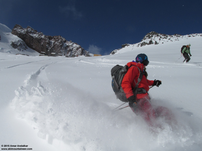
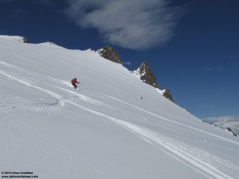
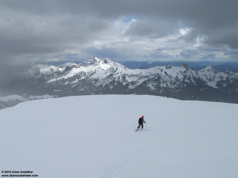
Hoping to find snow which was least affected by the earlier sunshine, we dropped onto the slightly SE-facing uppermost Paradise Glacier at Moon Rocks (9200 ft) and found more beautiful sparkly powder snow. The snow was denser powder here and less deep than higher up, but still skied great since it was so smooth. We continued down the western edge of the Glacier to about 8200 ft (no crevasses visible, except the usual bergschrund at 9000 ft below Anvil Rock).
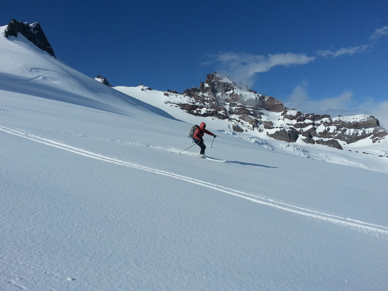
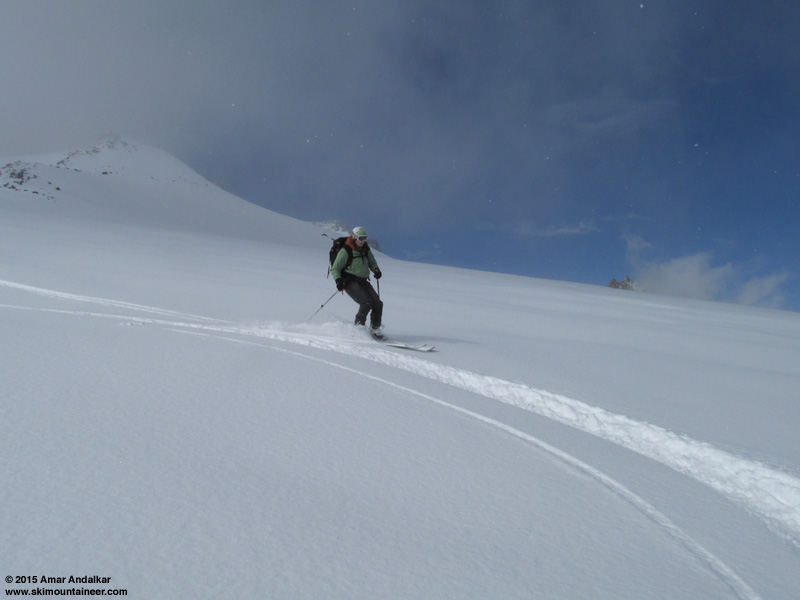
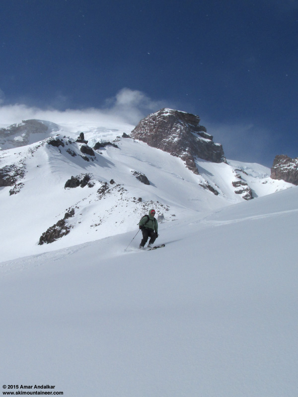
Hey, that's me skiing! (photo by Jill Yotz)
Eventually lower down the snow was sticking doggedly to all of our ski bases as we entered the edge of the clouds near 8200 ft, so we stopped for a lengthy break to scrape them clean (a plastic ski scraper is a godsend in such conditions, and weighs less than an ounce). We angled back onto the Muir Snowfield and dropped back into the whiteout below that, with flat light and poor visibility through the top of Pan Face. Ski conditions remained OK down there and below, definitely sun-affected and dense, but no breakable crust. Eventually it was snowing hard once again, and conditions improved lower down with more new snow falling atop snow which had gotten much less sun.
Got back to the parking lot a bit after 5:30pm, so we weren't going to make it to Longmire by the 6pm gate closure. But a park ranger SUV was still parked there, and when the ranger walked by later as we were polishing off a round of Rainiers, she was super nice and offered to follow us down the road and open the gate if it was locked. No hassle at all.
The drive home featured an awesome rainbow (with a partial double-rainbow and several
Two-shot panorama of the rainbow above Clear Lake north of Eatonville, with several supernumerary bows visible inside the main bow. (click for double-size version)
[hr]The forecast for the next day, April 9, was much better, with mostly sunny conditions, but still a chance of diurnal instability producing afternoon snow showers. I was pretty sure that would happen, and wanted to get an early start leaving Seattle at 6am, which would also minimize the effect of the sun on the snow. But that really wasn't practical given that we got home to Seattle after 9pm the night before and needed some sleep, so the meeting time ended up more like 7:30am. The plan was once again to head for Rainier, this time actually planning to go to Muir and hoping the powder would be preserved, but with only 3 out of the previous day's group of 4 (sadly Jill had to work).
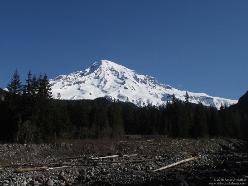
It was a stunningly clear and gorgeous morning as expected, well worth stopping in Longmire and taking in the excellent view of the Mountain from the community center. Skinned up from Paradise at 10:30am on about 1" more new snow which had fallen since we had left the previous evening.
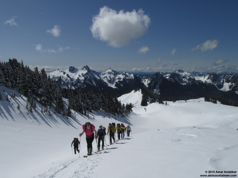
Cori leading a group of climbing rangers up the skin track!
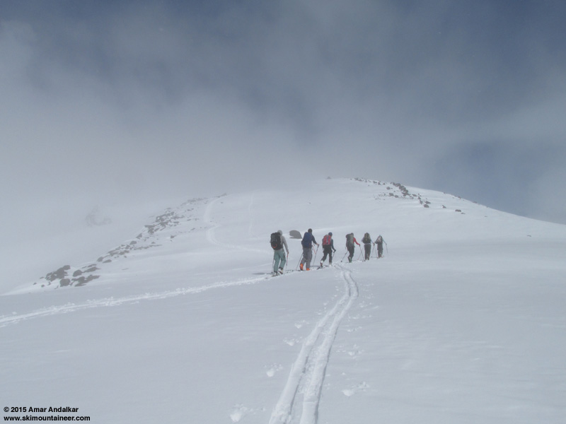
Thankfully yesterday's skintrack that we had put in from 7800 ft up to Muir had survived mostly intact, only because there was a prominent snowshoe/boot track nearby, and we made easier progress up to Muir this day, only re-breaking trail for the small fraction which had been thrashed. As forecast, clouds had been building all morning, and large snow showers could be seen falling from nearby clouds after 1pm. We reached Muir by 2:30pm, with clouds and snowfall moving in fast.
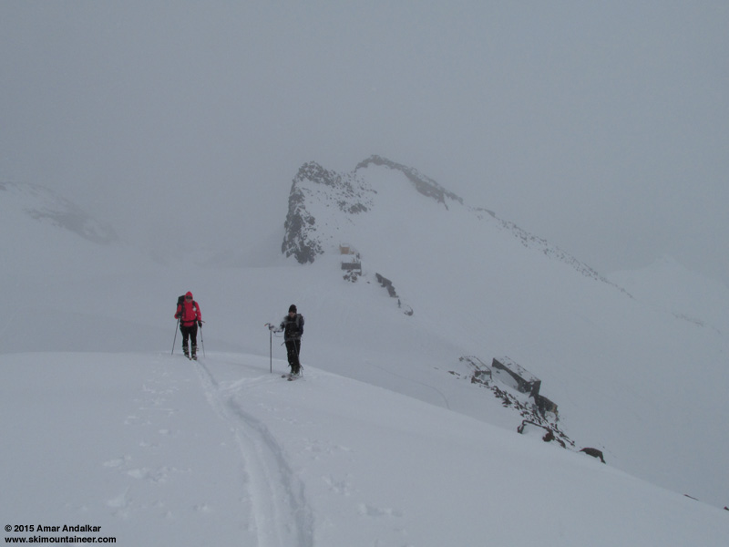
Skinning up Cowlitz Cleaver with Camp Muir below.
But as we arrived we saw a skin track already in place up Cowlitz Cleaver, so we decided to quickly continue up that to the flat spot at 10450 ft. The goal was to ski the nice east-facing powder run along the edge of Cowlitz Glacier, which had only a pair of previous ski tracks.
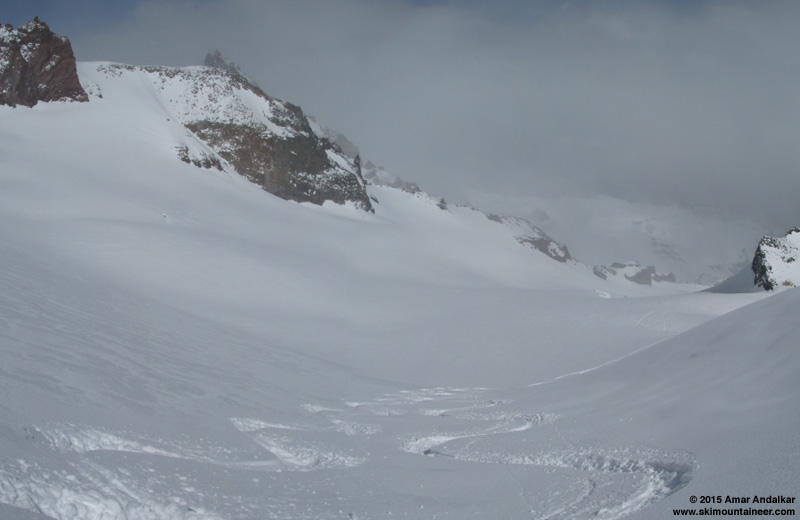
Two-shot vertical panorama looking down at previous tracks in the powder of Cowlitz Glacier, with Camp Muir at far right.
Dropped in just after 3pm for the best snow of the day, 12" deep light powder on that slope, lightest on the most NE-facing edge of the slope.
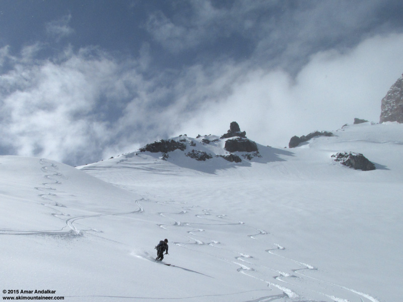
Two-shot panorama of powder tracks on the Cowlitz Glacier from just north of Camp Muir, with Cowlitz Cleaver at left, the Beehive at top center, and Gibraltar Rock at top right. (click for double-size version)
The run down from Muir was still decent snow above 9200 ft, the powder had stayed semi-preserved despite many hours of direct sun.
But as we dropped back into the whiteout and onto the Paradise Glacier near 9200 ft, the snow conditions deteriorated. Nothing too bad, no breakable crust, but just very sun-affected. We cut back to the Muir Snowfield much earlier than the previous day, to find more tracks which would give some definition to the snow in the whiteout. Very flat light down to maybe 7500 ft, then improving visibility and also improving snow. It was snowing quite heavily, and almost all of it was graupel, 1-3 mm chunks, accumulating quickly in a near-continuous layer on the snow surface.
The graupel-enhanced snow surface skied well, and the turns down to Pan Point and all the way back to Paradise were fairly good, maybe better than the previous day.
Another great day of springtime powder and sunshine and snowstorm, about 5100 vertical feet for the day. No rainbows this time on the way home, but still smiles all around. April has been a powder-Paradise so far, and more pow is on the way!
Two-shot panorama / multiple exposure skiing the Paradise Glacier below Anvil Rock, with Little Tahoma at far right above crevasses of the Cowlitz Glacier. (click for double-size version)
Not wanting to make the longer drive to the North Cascades Highway in search of preserved powder from last week's storm, Cori, Jill, DavidS, and I opted for Rainier on Wednesday, intending to head eastward (far eastward) from Paradise in search of northeast-facing, sun-protected powder. A weak ridge of high pressure was forecast for Wednesday-Thursday, but it was very weak, and in fact overall, the upper-level pressure was lower than normal despite it being nominally a high-pressure ridge relative to its surroundings on the weather map. The consequence: forecasts were all over the place for Wednesday, partly sunny to mostly cloudy, but all with a near-certainty of diurnal instability leading to afternoon cloud and snow shower development and maybe even thunderstorms, due to the increased spring solar intensity warming the surface while a pool of much colder air was up above. We hoped that the partly sunny forecasts would prevail.
The morning webcam view looked promising as we left Seattle, but as we drove closer the webcam view became fully obscured by clouds, and we arrived to totally socked-in conditions at Paradise, with ongoing light snowfall which was not accumulating on the solar-warmed pavement. Given the likely whiteout conditions, our original plan of traversing far eastward mostly at 6000-7000 ft seemed like no fun, and I was certain that heading upward instead towards Muir would give us the best shot of breaking out of the whiteout and seeing some sun, with hopefully reasonably good snow.
Got a late start at 11am, and skinned up into the clouds, with snow still falling. As hoped, we broke out into partial sunshine near Pan Point, and once again it was nice to meet and skin with my friends Seth & Solveig Waterfall leading an RMI ski seminar just like last week. The RMI group skied down from 7800 ft at Sugarloaf, and from there onward we broke trail the rest of the way to Muir, finding only a few short sections of previous skin track which had not been destroyed by the scourge of boot and snowshoe.
Some people (misguidedly) like to dis the Muir Snowfield as same-old-boring-flat or whatever else they might say, but if you keep your eyes open and looking around, then you can almost always see something new or fascinating up there on almost every trip. Even though this was my 222nd time reaching Camp Muir (218 with skis, including 52 in winter), I was amazed to see something that I don't think I've ever seen there before: almost the entire lower portion of the Snowfield from 7200 ft on up to over 8500 ft was covered in a beautiful layer of surface hoar, about 1-2 cm deep. Clear skies and calm air (along with a moisture source) are essential for surface hoar formation, as even a slight breeze or cloudiness above disrupts the process completely, so it is very rarely found far above-treeline in the Cascades. But this time the winds were exceptionally calm at Camp Muir overnight, less than 6 mph all night and averaging 1 mph over a 15-hour period (!! see telemetry below, the anemometer was not rimed). So this most atypical snow surface could develop nicely.
Surface hoar on the Muir Snowfield.
We enjoyed partly sunny, very warm, oven-effect conditions as we skinned up the Snowfield, but by 9000 ft the clouds above thickened and snow was once again falling. It looked like we would be skiing down in a whiteout for sure.
We arrived at Muir at 3:30pm in a snowstorm, but with winds still very light. There was almost a foot of new snow covering the steps at the public shelter's Dutch door, so we cleared those off and then hung out inside for a while, eventually joined by a large IMG Denali prep seminar group on snowshoes which we had passed near 9000 ft.
The winds were calm enough to leave the door open, and then lo and behold, a bit after 4pm there was a sunbreak. And soon more sunbreaks, and shortly afterward it was almost totally sunny outside. Time to ski while we could see!
Four-shot panorama of the powder-draped Cowlitz Glacier from Camp Muir after the sun came out, with Cowlitz Cleaver at left, Gibraltar Rock at top, Cathedral Gap at right center, and Little Tahoma at far right. (click for double-size version)
Skied down at 4:30pm in nearly-full sunshine surrounded by clouds all around, with very nice powder conditions, finding only an occasional inconsistent patch.
Hoping to find snow which was least affected by the earlier sunshine, we dropped onto the slightly SE-facing uppermost Paradise Glacier at Moon Rocks (9200 ft) and found more beautiful sparkly powder snow. The snow was denser powder here and less deep than higher up, but still skied great since it was so smooth. We continued down the western edge of the Glacier to about 8200 ft (no crevasses visible, except the usual bergschrund at 9000 ft below Anvil Rock).
Hey, that's me skiing! (photo by Jill Yotz)
Eventually lower down the snow was sticking doggedly to all of our ski bases as we entered the edge of the clouds near 8200 ft, so we stopped for a lengthy break to scrape them clean (a plastic ski scraper is a godsend in such conditions, and weighs less than an ounce). We angled back onto the Muir Snowfield and dropped back into the whiteout below that, with flat light and poor visibility through the top of Pan Face. Ski conditions remained OK down there and below, definitely sun-affected and dense, but no breakable crust. Eventually it was snowing hard once again, and conditions improved lower down with more new snow falling atop snow which had gotten much less sun.
Got back to the parking lot a bit after 5:30pm, so we weren't going to make it to Longmire by the 6pm gate closure. But a park ranger SUV was still parked there, and when the ranger walked by later as we were polishing off a round of Rainiers, she was super nice and offered to follow us down the road and open the gate if it was locked. No hassle at all.
The drive home featured an awesome rainbow (with a partial double-rainbow and several
Two-shot panorama of the rainbow above Clear Lake north of Eatonville, with several supernumerary bows visible inside the main bow. (click for double-size version)
[hr]The forecast for the next day, April 9, was much better, with mostly sunny conditions, but still a chance of diurnal instability producing afternoon snow showers. I was pretty sure that would happen, and wanted to get an early start leaving Seattle at 6am, which would also minimize the effect of the sun on the snow. But that really wasn't practical given that we got home to Seattle after 9pm the night before and needed some sleep, so the meeting time ended up more like 7:30am. The plan was once again to head for Rainier, this time actually planning to go to Muir and hoping the powder would be preserved, but with only 3 out of the previous day's group of 4 (sadly Jill had to work).
It was a stunningly clear and gorgeous morning as expected, well worth stopping in Longmire and taking in the excellent view of the Mountain from the community center. Skinned up from Paradise at 10:30am on about 1" more new snow which had fallen since we had left the previous evening.
Cori leading a group of climbing rangers up the skin track!
Thankfully yesterday's skintrack that we had put in from 7800 ft up to Muir had survived mostly intact, only because there was a prominent snowshoe/boot track nearby, and we made easier progress up to Muir this day, only re-breaking trail for the small fraction which had been thrashed. As forecast, clouds had been building all morning, and large snow showers could be seen falling from nearby clouds after 1pm. We reached Muir by 2:30pm, with clouds and snowfall moving in fast.
Skinning up Cowlitz Cleaver with Camp Muir below.
But as we arrived we saw a skin track already in place up Cowlitz Cleaver, so we decided to quickly continue up that to the flat spot at 10450 ft. The goal was to ski the nice east-facing powder run along the edge of Cowlitz Glacier, which had only a pair of previous ski tracks.
Two-shot vertical panorama looking down at previous tracks in the powder of Cowlitz Glacier, with Camp Muir at far right.
Dropped in just after 3pm for the best snow of the day, 12" deep light powder on that slope, lightest on the most NE-facing edge of the slope.
Two-shot panorama of powder tracks on the Cowlitz Glacier from just north of Camp Muir, with Cowlitz Cleaver at left, the Beehive at top center, and Gibraltar Rock at top right. (click for double-size version)
The run down from Muir was still decent snow above 9200 ft, the powder had stayed semi-preserved despite many hours of direct sun.
But as we dropped back into the whiteout and onto the Paradise Glacier near 9200 ft, the snow conditions deteriorated. Nothing too bad, no breakable crust, but just very sun-affected. We cut back to the Muir Snowfield much earlier than the previous day, to find more tracks which would give some definition to the snow in the whiteout. Very flat light down to maybe 7500 ft, then improving visibility and also improving snow. It was snowing quite heavily, and almost all of it was graupel, 1-3 mm chunks, accumulating quickly in a near-continuous layer on the snow surface.
The graupel-enhanced snow surface skied well, and the turns down to Pan Point and all the way back to Paradise were fairly good, maybe better than the previous day.
Another great day of springtime powder and sunshine and snowstorm, about 5100 vertical feet for the day. No rainbows this time on the way home, but still smiles all around. April has been a powder-Paradise so far, and more pow is on the way!
MOUNT RAINIER RECREATIONAL FORECAST
NATIONAL WEATHER SERVICE SEATTLE WA
400 AM PDT WED APR 8 2015
SYNOPSIS...A WEAK UPPER RIDGE WILL MOVE ACROSS WASHINGTON WEDNESDAY AND THURSDAY...BRINGING A MIX OF SOME SUNSHINE AND LIGHT SPOTTY SHOWERS TO MOUNT RAINIER NATIONAL PARK. A RATHER VIGOROUS FRONTAL SYSTEM WILL BRING PRECIPITATION AND WINDY WEATHER TO THE MOUNTAIN LATE FRIDAY THROUGH THE WEEKEND. ANOTHER SYSTEM COULD BRING MORE RAIN AND SNOW EARLY NEXT WEEK.
WEDNESDAY...PARTLY SUNNY. A CHANCE OF SHOWERS. SNOW LEVEL NEAR 4500 FEET.
WEDNESDAY NIGHT...MOSTLY CLOUDY WITH A CHANCE OF SHOWERS IN THE EVENING...THEN PARTLY CLOUDY AFTER MIDNIGHT. SNOW LEVEL NEAR 5000 FEET.
THURSDAY...MOSTLY SUNNY...BECOMING PARTLY CLOUDY IN THE AFTERNOON WITH A CHANCE OF SHOWERS. SNOW LEVEL NEAR 4500 FEET.
THURSDAY NIGHT...MOSTLY CLOUDY WITH A CHANCE OF SHOWERS IN THE EVENING...THEN PARTLY CLOUDY AFTER MIDNIGHT. SNOW LEVEL NEAR 5500 FEET.
FRIDAY...PARTLY SUNNY IN THE MORNING...THEN CLOUDY WITH A CHANCE OF RAIN AND SNOW IN THE AFTERNOON. SNOW LEVEL NEAR 5000 FEET.
TEMPERATURE AND WIND FORECASTS FOR SELECTED LOCATIONS.
WED WED THU THU FRI
NIGHT NIGHT
SUMMIT (14411 FT) -3 -2 -1 2 4
NW 5 NW 5 S 5 W 25 SW 55
CAMP MUIR(10188 FT) 15 17 18 19 18
NW 10 E 5 S 10 SW 15 SW 30
PARADISE (5420 FT) 39 30 44 31 43
E 5 N 10 SW 5 NW 5 W 10
LONGMIRE (2700 FT) 50 36 57 37 56
W 10 NE 5 NW 5 N 5 NW 5
++ TEMPERATURES AND WIND FOR THE SUMMIT AND CAMP MUIR ARE AVERAGE
CONDITIONS EXPECTED IN THE FREE AIR AT THOSE ELEVATIONS.
++ TEMPERATURES FOR PARADISE AND LONGMIRE ARE THE EXPECTED HIGHS AND
LOWS. WIND IS THE AVERAGE WIND EXPECTED DURING THAT PERIOD.
EXTENDED FORECAST...
FRIDAY NIGHT...BREEZY. RAIN AND SNOW. SNOW LEVEL NEAR 4500 FEET.
SATURDAY...RAIN AND SNOW. SNOW LEVEL NEAR 3000 FEET.
SATURDAY NIGHT...SHOWERS. SNOW LEVEL NEAR 2500 FEET.
SUNDAY...SHOWERS. SNOW LEVEL NEAR 2500 FEET.
SUNDAY NIGHT...SHOWERS LIKELY. SNOW LEVEL NEAR 3000 FEET.
MONDAY...RAIN AND SNOW LIKELY. SNOW LEVEL NEAR 2500 FEET.
MONDAY NIGHT...SHOWERS LIKELY. SNOW LEVEL NEAR 2000 FEET.
TUESDAY...SHOWERS LIKELY. SNOW LEVEL NEAR 2000 FEET.
NWAC telemetry for the days of these trips plus the previous and next days. Note the exceptionally calm winds at Camp Muir overnight from 9pm PDT (2000) April 7 to 11am PDT (1000) April 8, less than 6 mph maximum and averaging 1 mph over that 15-hour period! And also the high winds over 90mph which develop as the next snowstorm begins on the evening of April 10:
Northwest Avalanche Center Northwest Avalanche Center
Paradise, Mt Rainier National Park, Washington Camp Muir, Mt Rainier National Park, Washington
Total snow sensor readings unsteady Wind gages unheated and may rime
MM/DD Hour Temp RH Wind Wind Wind Hour Total 24 Hr Total Solar MM/DD Hour Temp RH Wind Wind Wind Wind Solar
PST F % Avg Max Dir Prec. Prec. Snow Snow W/m2 PST F % Min Avg Max Dir W/m2
5400' 5400' 5380' 5380' 5380' 5400' 5400' 5400' 5400' 5380' 10110' 10110' 10110' 10110' 10110' 10110' 10110'
------------------------------------------------------------------------ ---------------------------------------------------------------
4 7 500 29 91 4 9 71 0 0 0 295 0 4 7 500 13 95 11 14 18 223 0
4 7 600 28 94 4 9 74 0 0 0 70 2 4 7 600 13 95 8 13 19 232 0
4 7 700 29 94 4 11 71 0 0 0 70 29 4 7 700 13 96 10 13 19 251 0
4 7 800 30 94 5 10 74 .01 .01 0 70 72 4 7 800 14 96 7 11 17 225 0
4 7 900 31 90 4 11 67 .01 .02 0 64 144 4 7 900 15 95 0 4 8 218 0
4 7 1000 33 88 4 11 55 .03 .05 0 30 270 4 7 1000 15 95 2 8 19 235 0
4 7 1100 35 82 5 10 67 .07 .12 0 70 532 4 7 1100 17 96 3 9 15 251 0
4 7 1200 36 77 4 9 86 .02 .14 0 27 549 4 7 1200 19 95 1 6 14 232 0
4 7 1300 39 73 6 13 82 .01 .15 0 68 850 4 7 1300 23 95 1 6 11 218 0
4 7 1400 37 77 5 9 87 0 .15 0 69 559 4 7 1400 19 90 2 9 14 249 0
4 7 1500 37 77 5 11 92 0 .15 -0 69 491 4 7 1500 21 89 3 8 13 238 0
4 7 1600 38 76 6 12 94 0 .15 0 68 409 4 7 1600 17 88 2 9 19 256 0
4 7 1700 35 86 6 11 96 0 .15 -0 69 213 4 7 1700 16 89 4 8 13 255 0
4 7 1800 34 83 3 6 88 0 .15 0 64 107 4 7 1800 14 93 5 9 13 290 0
4 7 1900 33 85 2 8 70 0 .15 0 69 13 4 7 1900 14 95 0 3 8 265 0
4 7 2000 33 84 1 4 83 0 .15 0 69 0 4 7 2000 13 92 0 0 2 344 0
4 7 2100 32 82 1 3 77 0 .15 0 71 0 4 7 2100 13 93 0 0 4 341 0
4 7 2200 31 87 1 3 75 0 .15 0 69 0 4 7 2200 12 94 0 0 2 18 0
4 7 2300 31 86 0 3 74 0 .15 0 70 0 4 7 2300 12 95 0 2 4 4 0
4 8 0 30 88 1 3 74 0 .15 0 64 0 4 8 0 12 94 0 2 6 293 0
4 8 100 30 92 0 2 73 0 .15 0 69 0 4 8 100 13 93 0 3 5 279 0
4 8 200 30 98 1 4 71 0 .15 0 69 0 4 8 200 12 94 0 3 6 22 0
4 8 300 31 98 0 3 31 0 .15 0 65 0 4 8 300 12 94 0 1 3 342 0
4 8 400 30 98 0 4 16 0 .15 0 70 0 4 8 400 11 93 0 1 5 5 0
------------------------------------------------------------------------ ---------------------------------------------------------------
4 8 500 30 95 0 3 13 0 0 0 64 0 4 8 500 10 94 0 0 2 44 0
4 8 600 30 98 2 4 12 .01 .01 0 70 2 4 8 600 11 93 0 1 4 34 0
4 8 700 30 95 1 4 349 .01 .02 0 69 40 4 8 700 15 84 0 1 4 332 0
4 8 800 33 93 1 4 301 0 .02 -0 69 128 4 8 800 19 85 0 0 4 269 0
4 8 900 31 98 3 6 292 0 .02 0 64 119 4 8 900 19 85 0 2 5 117 0
4 8 1000 33 95 3 5 259 .01 .03 0 84 277 4 8 1000 22 78 0 3 5 68 0
4 8 1100 33 95 3 9 248 .01 .04 0 70 251 4 8 1100 28 62 0 2 8 252 0
4 8 1200 33 93 3 7 247 .03 .07 0 67 281 4 8 1200 29 69 0 2 6 77 16
4 8 1300 34 94 5 9 265 .06 .13 0 69 296 4 8 1300 23 79 0 2 7 254 64
4 8 1400 34 95 6 10 262 .04 .17 1 190 379 4 8 1400 21 84 0 4 12 231 48
4 8 1500 34 94 5 10 269 .03 .2 0 64 285 4 8 1500 19 87 2 7 14 208 0
4 8 1600 34 95 1 4 253 .02 .22 0 69 239 4 8 1600 20 85 0 1 5 325 0
4 8 1700 33 96 3 6 244 .03 .25 0 68 134 4 8 1700 17 92 0 3 9 301 0
4 8 1800 32 97 2 4 244 0 .25 1 31 18 4 8 1800 15 81 0 4 10 265 0
4 8 1900 31 98 2 6 239 .01 .26 1 62 5 4 8 1900 14 81 0 2 6 307 0
4 8 2000 31 98 0 4 249 .06 .32 1 32 0 4 8 2000 14 95 0 2 5 317 0
4 8 2100 31 98 0 3 249 .04 .36 1 32 0 4 8 2100 14 67 0 2 5 306 0
4 8 2200 29 97 1 2 250 .01 .37 1 300 0 4 8 2200 14 65 0 4 8 348 0
4 8 2300 29 97 1 3 251 .01 .38 1 33 0 4 8 2300 14 74 0 1 6 323 0
4 9 0 29 98 0 2 252 0 .38 1 300 0 4 9 0 14 60 0 2 6 348 0
4 9 100 29 96 0 2 252 0 .38 1 33 0 4 9 100 14 56 0 3 7 356 0
4 9 200 29 97 0 2 252 0 .38 1 300 0 4 9 200 13 55 1 6 10 27 0
4 9 300 29 94 0 3 252 0 .38 2 191 0 4 9 300 13 57 4 6 8 29 0
4 9 400 27 95 1 4 252 .01 .39 2 69 0 4 9 400 13 54 5 6 9 32 0
------------------------------------------------------------------------ ---------------------------------------------------------------
4 9 500 26 96 1 3 252 0 0 2 300 0 4 9 500 14 57 4 7 10 22 0
4 9 600 27 95 1 4 247 0 0 2 300 5 4 9 600 13 64 6 8 9 16 0
4 9 700 29 92 2 4 232 0 0 2 70 79 4 9 700 18 47 2 6 9 30 0
4 9 800 35 84 3 7 173 0 0 1 300 250 4 9 800 17 65 2 4 6 47 0
4 9 900 39 76 7 11 96 0 0 1 68 505 4 9 900 17 71 4 6 11 53 0
4 9 1000 40 72 7 12 96 0 0 1 26 717 4 9 1000 25 43 0 3 7 74 0
4 9 1100 41 66 4 12 83 0 0 1 64 884 4 9 1100 26 47 0 2 7 238 0
4 9 1200 43 60 4 10 32 0 0 1 70 838 4 9 1200 21 65 2 5 9 229 0
4 9 1300 44 52 3 9 230 0 0 1 67 812 4 9 1300 17 60 5 9 13 248 6
4 9 1400 42 67 4 16 53 0 0 1 63 565 4 9 1400 18 84 9 13 18 272 6
4 9 1500 37 78 3 9 29 .01 .01 1 64 165 4 9 1500 17 98 11 15 21 261 0
4 9 1600 39 78 2 5 42 .02 .03 1 69 180 4 9 1600 17 97 8 15 25 261 0
4 9 1700 37 87 2 6 185 .01 .04 1 295 131 4 9 1700 16 97 8 16 25 278 0
4 9 1800 38 75 2 5 232 0 .04 1 69 135 4 9 1800 14 95 15 18 21 286 0
4 9 1900 36 76 1 4 263 0 .04 1 64 25 4 9 1900 15 92 10 17 25 283 0
4 9 2000 35 79 1 4 344 0 .04 1 65 0 4 9 2000 14 97 19 23 26 283 0
4 9 2100 35 79 2 4 2 0 .04 1 69 0 4 9 2100 14 87 13 18 23 285 0
4 9 2200 34 76 2 4 20 0 .04 1 69 0 4 9 2200 14 97 13 20 26 282 0
4 9 2300 35 68 1 4 48 0 .04 1 65 0 4 9 2300 14 96 13 24 37 282 0
4 10 0 35 77 2 6 126 0 .04 1 71 0 4 10 0 17 27 20 32 40 275 0
4 10 100 35 71 2 5 211 0 .04 1 71 0 4 10 100 17 9 15 25 34 281 0
4 10 200 36 71 3 7 247 0 .04 1 70 0 4 10 200 16 23 20 29 42 282 0
4 10 300 36 74 5 12 281 0 .04 1 71 0 4 10 300 17 13 21 35 50 276 0
4 10 400 35 77 6 11 287 0 .04 1 70 0 4 10 400 14 82 29 40 48 268 0
------------------------------------------------------------------------ ---------------------------------------------------------------
4 10 500 36 75 5 12 289 0 0 1 71 0 4 10 500 16 20 39 47 60 272 0
4 10 600 34 80 5 14 261 0 0 1 70 4 4 10 600 17 11 41 49 55 271 0
4 10 700 34 80 4 9 260 0 0 1 69 58 4 10 700 19 9 39 49 57 276 0
4 10 800 37 73 6 11 258 0 0 1 70 290
Great photos Amar!
Nice job......Sunday and Wed next week it will not be just boot top........maybe hat skiing.
Way to get it Amar
Nice going, blower pow, and no wind! A day of skiing on Rainier like this is on my to do list.
author=Amar Andalkar link=topic=34088.msg140690#msg140690 date=1428704297]... finding only a few short sections of previous skin track which had not been destroyed by the scourge of boot and snowshoe.
All of my trail breaking for naught! I've never seen the snowfield like that... absolutely no wind effect (granted I'm 180-190 Muir trips shy of Amar).
Great write-up and photos, Amar! It's been fun getting out with you, although I suppose our 100% success rate at finding powder has to break down at some point. ;)
Reply to this TR
Please login first: