Jan 11, 2015, Squak tour up to 6700'
1/11/15
WA Cascades West Slopes North (Mt Baker)
5251
6
First time up (part of the way) Mt Baker. Seasonal road block on FS Rd 13 at about 2 miles from TH with rapidly melting snow patches before and after roadblock. Road very drivable. Probably about 1 mile of consistent snow before TH on the approach.
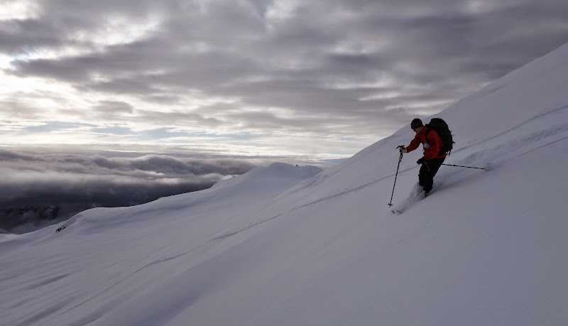
Stuck to the trail for the most part, fortunately. Drizzle to about 4500', then intermittent snow, gradually clearing. Early afternoon there was about 1/2" accumulation where the trail accesses the ridge, increasing to about 2" new at 6700' on the Squak. Good skiing above from 6700' down to maybe 5200' where rain runnels were the main feature. Probably fantastic (relatively speaking) from 6700' up to the summit. Zero wind. The layer below the new snow was supportively firm but not ice.
https://flic.kr/s/aHsk7Bk8hf
Coord's of road closure: 48.69044, -121.76891
2,839' elev.
2,839' elev.
More pics
On a related note, does anyone have a gpx track for a good way to access the Squak? We just followed the Scott Paul Trail, is there a more direct route?
Follow Scott Paul trail until you find enough snow to skin up the mountain, to descend reverse procedure
Is there significant crevasse hazard on this route?
author=richfef link=topic=33388.msg138420#msg138420 date=1421106076]
Is there significant crevasse hazard on this route?
There are large crevasses that start just above Crag View at ~6500 in late summer, and that close in winter. I guess they will be covered by now given the OK snow cover at higher elevations but this winter is just too weird...Squak Gl. route is considered more safe than Easton Gl. route regarding the crevasse hazard.
author=Alex L link=topic=33388.msg138403#msg138403 date=1421046665]
On a related note, does anyone have a gpx track for a good way to access the Squak? We just followed the Scott Paul Trail, is there a more direct route?
There is a Google Earth screenshot of our tracks from June 2013 at the end of this album:
https://www.flickr.com/photos/runningclouds/sets/72157634089255303/
If you want the actual GPS track let me know
Reply to this TR
Please login first: