May 16-17 Teanaway - Navaho
5/16/14
WA Cascades East Slopes Central
5975
1
I delayed a planned trip due to the hideous weather a week ago, so I ended up going solo as my partners couldn't reschedule. I hit the trail a little after 3pm on Fri (16th) and camped near the trail junction at about 5000 ft. I had to carry my skis the whole way (ugh!). I saw at least 3 different butterflies, trillium blooming, and avalanche lillies just starting. The route crosses a couple of very impressive avalanche debris fields on the way!
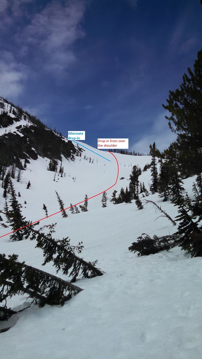
Overnight was clear and cold and I left camp at 6:45 in the morning. Everything was very firm and the skinning was perfect all the way up. I gained the saddle between point 6658 and Navaho. From there I stayed to the NW side of the main ridge since the ridge was nearly completely melted out and found some old snow machine tracks in the small basin there. The summit was completely melted out and I had to ditch the skis about 75' below the true summit and hike up to tag the summit.
Up to this point the weather had been changeable, but mostly cold, overcast, and breezy, so things were still pretty firm at 11am. I decided to wait in the shelter of some rocks where I left my skis, have a snack, and wait for things to soften up a little more to ski down the NE bowl that leads to Falls Creek. You can ski from nearly the summit, but with the steeper pitch, firm show, and the fact I was solo I decided to play it safe and ski down the shoulder to the N then turn about 1000' down the drainage. Possibly the best spring conditions I have skied in years! True hero snow!
I then slogged back up to the 7000' shoulder and retraced my route back to camp. The ski down was still in great shape until about 5600' where things started getting pretty wet and sloppy. I had to take my skis off about 5200' because things were melting out so fast. I packed up camp and headed back to the car, which with the very soft, discontinuous snow to 4000' was kind of a death march.
Here is the route starting from camp and including the decent to the trailhead: http://caltopo.com/map?id=574M
UPDATE: Full story with photos at Langleybackcountry.com http://wp.me/p2ftAE-1T
NOTICE: I neglected to mention that the NE side of Earl and Point 6459 SSE of Earl still have lots of snow. However many of the ridges in that area have large cornices on them, especially the NE ridge of Earl between Earl and Point 6658. Be careful!
If you gotta go on a death march at least you found great snow!
Reply to this TR
Please login first: