November 17, 2013, Heliotrope
11/17/13
WA Cascades West Slopes North (Mt Baker)
3233
6
Susan and I met Kate and Nick in Glacier this morning; they wanted to chance the Glacier Creek road. Sounded good to us!
Parked a couple miles below the trailhead and skinned up. Burlier 4x4s/tires made it much higher. Skinning the trail was fine.
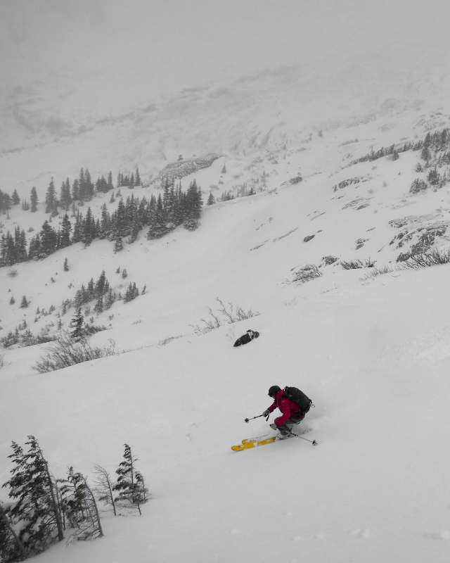
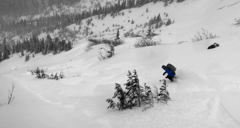
Snow of increasing depth, becoming boot-top+ at and above treeline. Above the highest trees, the wind had been at work. A stout breeze and continued precip (graupel, round icy pellets, assorted other types) had us skinning in goggles and zipped-up shells. Several other parties out, and everyone seemed to know everyone else. We followed today's skintrack up pretty high, until we felt it was too breezy/windpacked to justify further work.
On the down, we found sheltered powder out of the wind, especially at and below treeline. Fun was had by all, so we lapped a couple times.
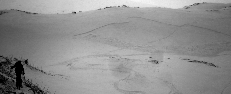
On our last trip up, we observed a slab that had been ski-triggered by another party. Crown was 1'+, tapered at the ends, ~100' wide by ~50' run. Chatting with the party, no-one was caught. Location is here.
The trail-ski out was fun and captivating; only a couple minor dings in the ptex.
Fun day in the snow! Thanks, all! :).
Parked a couple miles below the trailhead and skinned up. Burlier 4x4s/tires made it much higher. Skinning the trail was fine.
Snow of increasing depth, becoming boot-top+ at and above treeline. Above the highest trees, the wind had been at work. A stout breeze and continued precip (graupel, round icy pellets, assorted other types) had us skinning in goggles and zipped-up shells. Several other parties out, and everyone seemed to know everyone else. We followed today's skintrack up pretty high, until we felt it was too breezy/windpacked to justify further work.
On the down, we found sheltered powder out of the wind, especially at and below treeline. Fun was had by all, so we lapped a couple times.
On our last trip up, we observed a slab that had been ski-triggered by another party. Crown was 1'+, tapered at the ends, ~100' wide by ~50' run. Chatting with the party, no-one was caught. Location is here.
The trail-ski out was fun and captivating; only a couple minor dings in the ptex.
Fun day in the snow! Thanks, all! :).
windslab, and good where you were. how steep were those slopes
author=all mtn link=topic=29651.msg124375#msg124375 date=1384747374]windslab, and good where you were. how steep were those slopes
Measuring from photos, much of what we skied today above timberline was in the 20 degree realm (the most-reliable measurement was 22 degrees). The roll that slid is steeper.
author=Charlie Hagedorn link=topic=29651.msg124371#msg124371 date=1384746536]
The trail-ski out was fun and captivating; only a couple minor dings in the ptex.
I'll take a few dings in the p-tex over two miles of down hiking in ski boots (like I did last Saturday on Heliotrope) anytime!
Interesting and thanks for the map; Charlie would you mind telling us qualitatively where that was w/respect to the top hogsback summer tent camp; I can't quite pick it out.
author=David_Britton link=topic=29651.msg124414#msg124414 date=1384798438]Interesting and thanks for the map; Charlie would you mind telling us qualitatively where that was w/respect to the top hogsback summer tent camp; I can't quite pick it out.
I've not been up there in true summer before; the only campsite I've seen in springtime was against some outcroppings overlooking the Thunder Glacier. This was much lower than that.
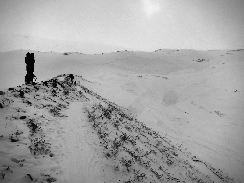
In the photo below, you can see what appeared to be a summer trail, directly on a windswept ridge. Every party we saw heading up from here (including us) made a right turn at the top of the ridgelet (you can see the skintrack traversing the slope right at the bottom of the deposition zone) in order to remain on/access mellow slopes for continued ascent.
Hope that's helpful? Perhaps a picture is worth a thousand words? (Apologies for camera lens dust! Aagh!)
Great photos Charlie!
Excellent day out with a good group of folks!
I'll share some photos very soon.
Excellent day out with a good group of folks!
I'll share some photos very soon.
Reply to this TR
Please login first: