August 23, 2013- another Mt. Daniel Report
8/23/13
WA Cascades West Slopes Central
5228
9
Dear USFS,
In an effort to reduce trail head theft, I understand that you recommend we leave no valuables in the vehicle. Would the filling that rattled out of my mouth on road 4330 count as a valuable?
:)
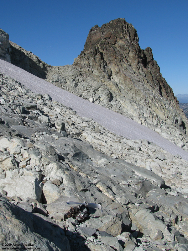
I squeezed in a day trip to Mt. Daniel. Late season, but still fun. Snow is pretty sparse on the easy access side, between Peggy's pond and the East Summit. I like to walk straight up to the middle of the Hyas glacier and then decide based on coverage whether to go left around the cliffband, or right.
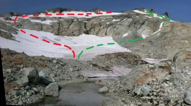
It was a tough decision this trip because neither route had continuous snow. I chose green, even though it was more discontinuous, because I like the steep gully, and because the no-snow area is loose rock, rather than slab.
The snow that is there skis well with very small surface irregularities. It is sparse enough, that I wouldn't recommend the trip right now if all you wanted to do was ski above Peggy's Pond (that is, unless all you wanted to do was ski the low angle Hyas Glacier). However, if you have more time or stamina, and want to ski something on the far side of the East Peak... Here is what is available up there:
Daniel Glacier from the East Peak
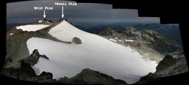
I went over to the Middle Summit and skied a run on the Daniel Glacier all the way to the bottom of the snow, and it was great skiing! On the way up, I had met Kurt from Seattle (BlameTheDog on nwhikers) along with his dog. Kurt went over to the West Summit to touch the top while I was skiing, and timing was good for company back to the East summit and on down from there. He was on foot, but I had no advantage with the skis since I had to take them on and off at the bottom of that gully.
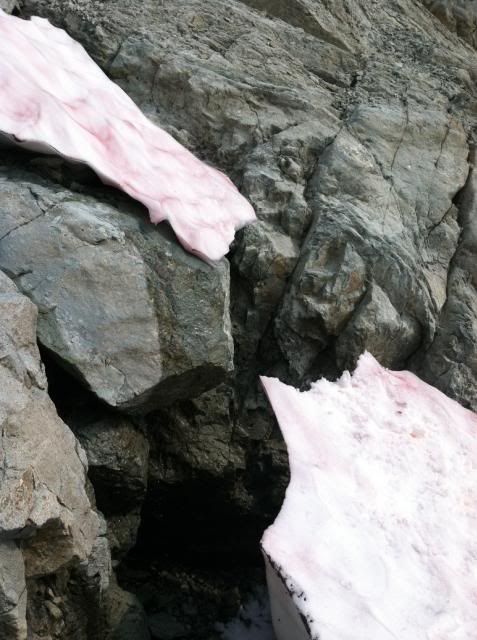
I mentioned that snow is sparse east of the East Peak. Here is just how sparse:
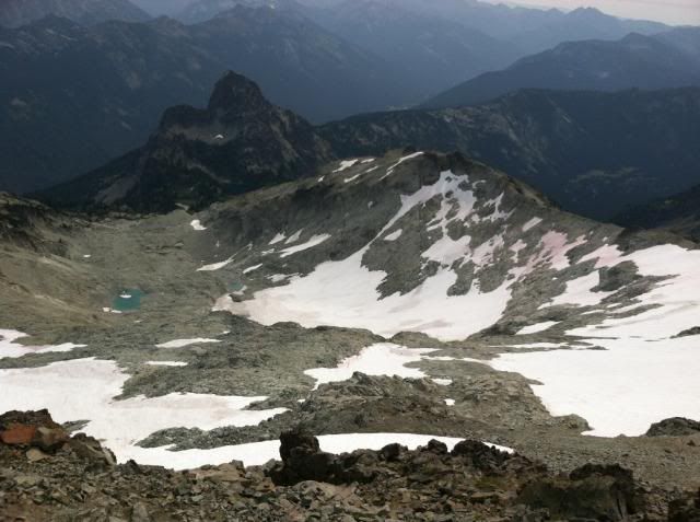
Even so, I patched together a run from the East Peak that got me all the way to the bottom of the Hyas Gl with just two carries. The second carry was the obvious scree I knew about from first viewing. The first carry though was a doosy. On the way up that gully there was one narrow spot that I investigated before crossing:
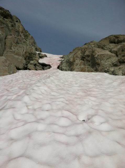
The snow bridge was pretty thin, and I didn't think it was going to work. The snow is steep here, 45degrees-ish. From standing below the bridge on good solid snow, I could reach up with my whippet and grab onto solid snow above the bridge, which I did, and then I whacked the bridge with my arm and it broke like single pane glass. It fell (the snow, not me) maybe ten feet. I admit that I felt my stomach rise and my sphincter tighten. This almost ended the uphill for me, but there happened to be a nice bench on the slab that I was able to use to get around and above the (now) moat. Here's the broken bridge from the adjacent slab.
So anyway, the first carry on the way down was to retrace that ledge system, which I found to be easier going up than down.
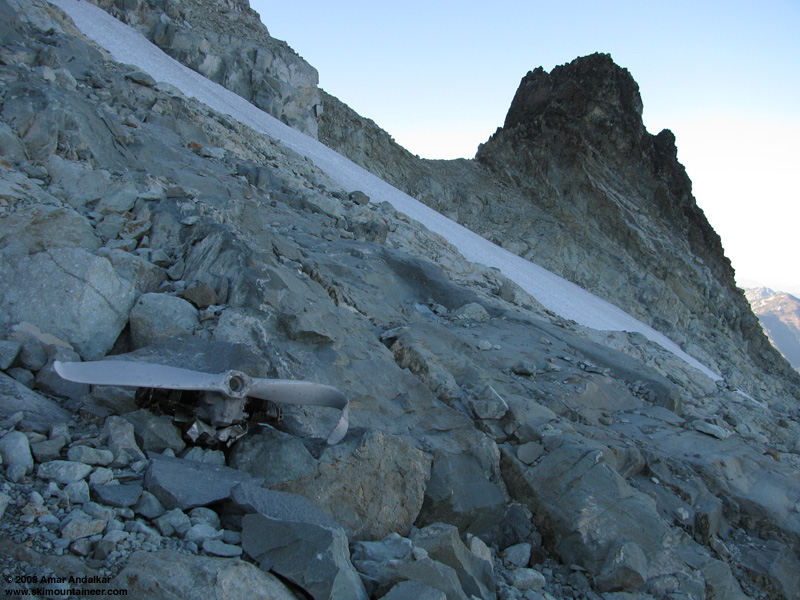
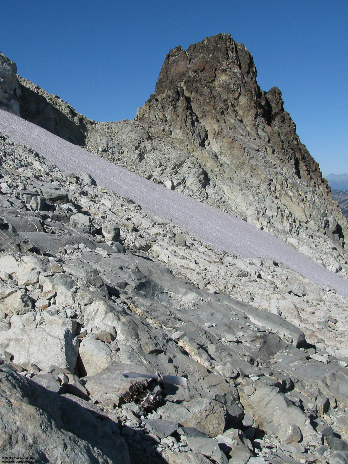
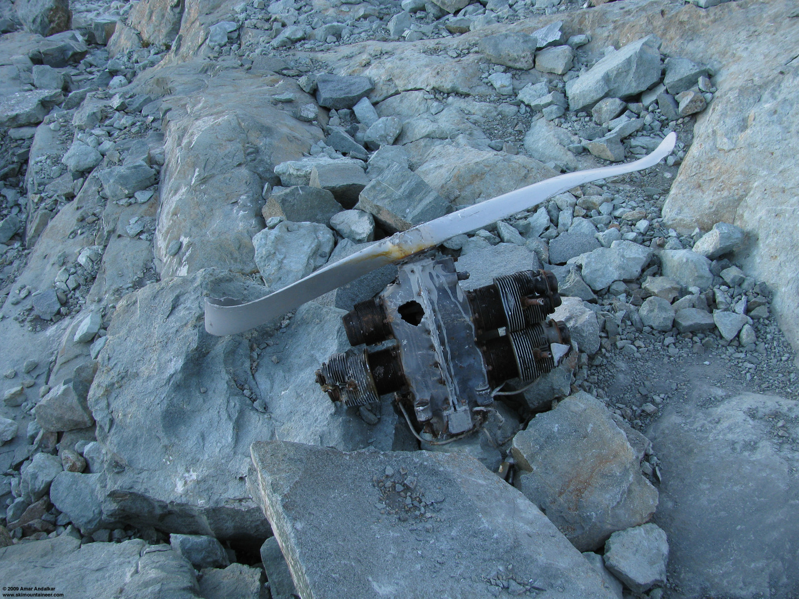
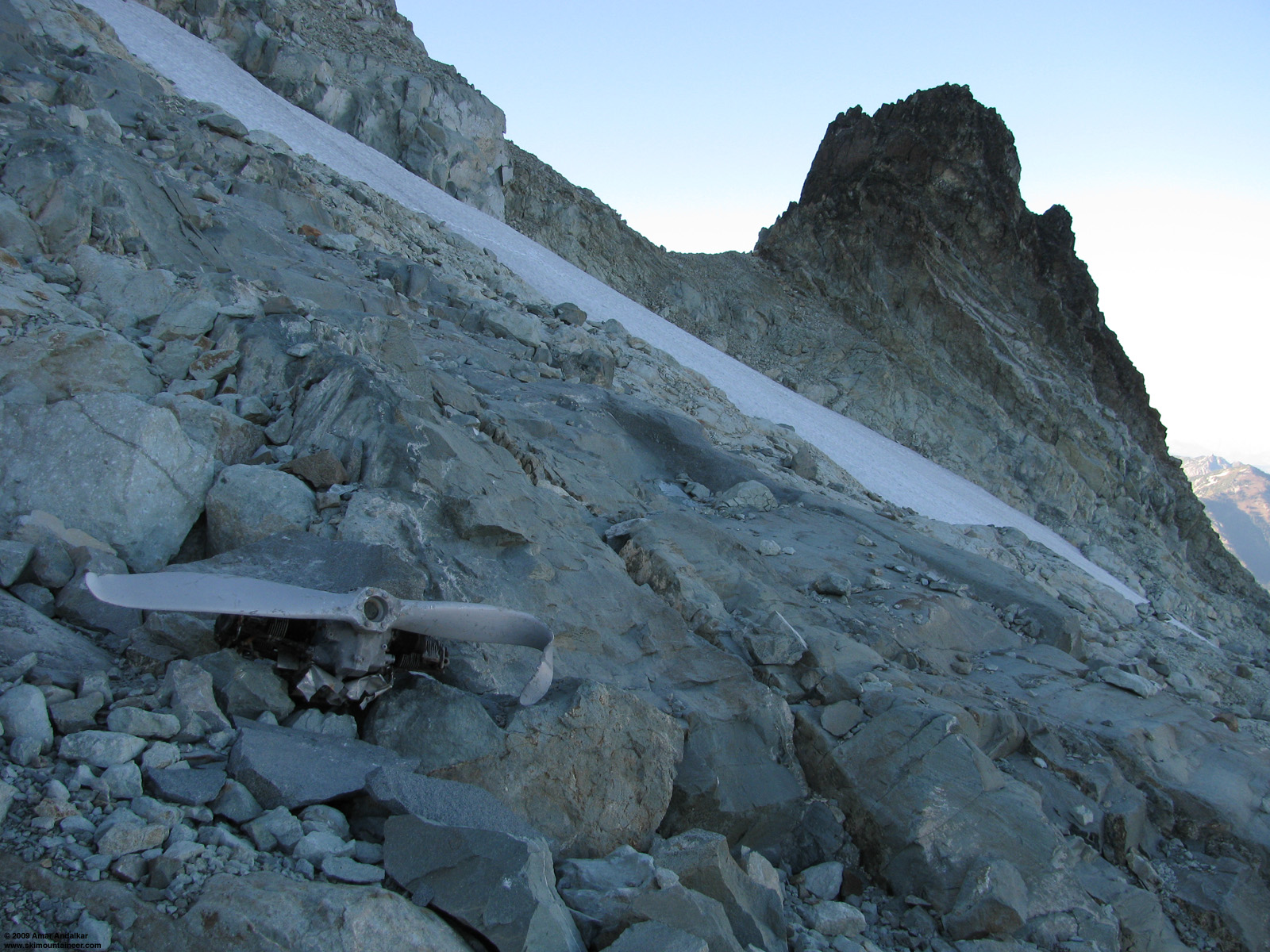
Just below the gully and above the Hyas Gl. I found this:
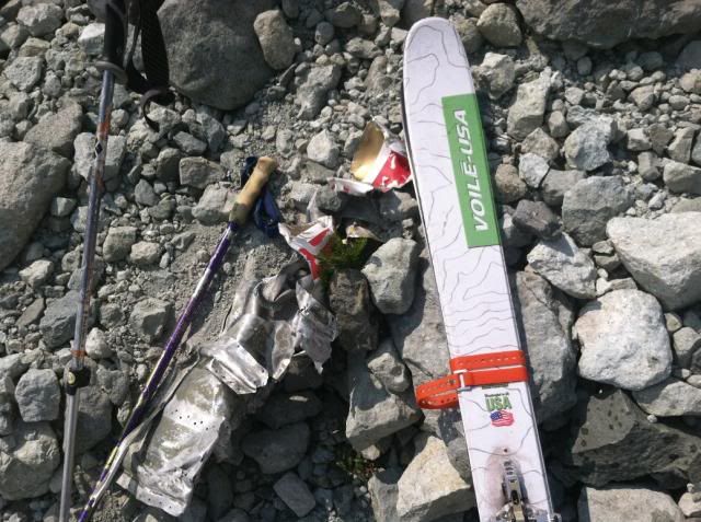
Part of an airplane maybe? It was aluminum with cloth attached.
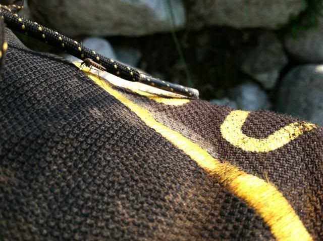
It was a great day trip! There is still enough skiing on the north side to be worth the effort to get in there, but it might be more fun as an overnight, staying near one of the summits. This last photo is for rslg:
mosquito trying to get through my shoe
In an effort to reduce trail head theft, I understand that you recommend we leave no valuables in the vehicle. Would the filling that rattled out of my mouth on road 4330 count as a valuable?
:)
I squeezed in a day trip to Mt. Daniel. Late season, but still fun. Snow is pretty sparse on the easy access side, between Peggy's pond and the East Summit. I like to walk straight up to the middle of the Hyas glacier and then decide based on coverage whether to go left around the cliffband, or right.
It was a tough decision this trip because neither route had continuous snow. I chose green, even though it was more discontinuous, because I like the steep gully, and because the no-snow area is loose rock, rather than slab.
The snow that is there skis well with very small surface irregularities. It is sparse enough, that I wouldn't recommend the trip right now if all you wanted to do was ski above Peggy's Pond (that is, unless all you wanted to do was ski the low angle Hyas Glacier). However, if you have more time or stamina, and want to ski something on the far side of the East Peak... Here is what is available up there:
Daniel Glacier from the East Peak
I went over to the Middle Summit and skied a run on the Daniel Glacier all the way to the bottom of the snow, and it was great skiing! On the way up, I had met Kurt from Seattle (BlameTheDog on nwhikers) along with his dog. Kurt went over to the West Summit to touch the top while I was skiing, and timing was good for company back to the East summit and on down from there. He was on foot, but I had no advantage with the skis since I had to take them on and off at the bottom of that gully.
I mentioned that snow is sparse east of the East Peak. Here is just how sparse:
Even so, I patched together a run from the East Peak that got me all the way to the bottom of the Hyas Gl with just two carries. The second carry was the obvious scree I knew about from first viewing. The first carry though was a doosy. On the way up that gully there was one narrow spot that I investigated before crossing:
The snow bridge was pretty thin, and I didn't think it was going to work. The snow is steep here, 45degrees-ish. From standing below the bridge on good solid snow, I could reach up with my whippet and grab onto solid snow above the bridge, which I did, and then I whacked the bridge with my arm and it broke like single pane glass. It fell (the snow, not me) maybe ten feet. I admit that I felt my stomach rise and my sphincter tighten. This almost ended the uphill for me, but there happened to be a nice bench on the slab that I was able to use to get around and above the (now) moat. Here's the broken bridge from the adjacent slab.
So anyway, the first carry on the way down was to retrace that ledge system, which I found to be easier going up than down.
Just below the gully and above the Hyas Gl. I found this:
Part of an airplane maybe? It was aluminum with cloth attached.
It was a great day trip! There is still enough skiing on the north side to be worth the effort to get in there, but it might be more fun as an overnight, staying near one of the summits. This last photo is for rslg:
mosquito trying to get through my shoe
I didn't see any skeets laying around in your pictures, Mike...but I'm sure you wouldn't have made the trip without your shotgun.
Wow - what a difference a year makes in the snow pack - last year at this time, I (and you guys) easily skied continuous snow from East peak all the way to below Peggy's.
Wow - what a difference a year makes in the snow pack - last year at this time, I (and you guys) easily skied continuous snow from East peak all the way to below Peggy's.
author=Rusty Knees link=topic=29081.msg122458#msg122458 date=1377273111]
I didn't see any skeets laying around in your pictures, Mike...
HA! that was a one time event, not completely appreciated by everyone.
author=Rusty Knees link=topic=29081.msg122458#msg122458 date=1377273111]
Wow - what a difference a year makes in the snow pack - last year at this time, I (and you guys) easily skied continuous snow from East peak all the way to below Peggy's.
That's the truth. Great contrast. I'm pretty sure I skied further down in October last year than August this.
- someone should set up a cam, to catch thieves in the mtns. - cool turns
PERFECT--I.E. THE MOSQUITO PICTURE.........THANKS FOR POSTING!!!!!!
Nice going Mike, the skiing on Daniel looks great, not so much on Hyas. Glad you got out, I am still trying to get away and get this months ski.
Just below the gully and above the Hyas Gl. I found this: [photo] Part of an airplane maybe? It was aluminum with cloth attached.
Yes, I believe those are parts of a plane. Years ago I encountered plane wreckage debris near the base of the Hyas Glacier. The parts/pieces suggested it was a small plane of some sort. I've always wondered what the story was.
Boyd you nudged my interest enough to start looking for an answer.
I found this:
http://bruce.frankweb.net/trips_2002/Daniel/plane_wreckage_research.htm
Most of the links in the page above are broken/dead, but the author believe the crash was as follows:
On the Beechcraft web page there is a link to the NTSB page which in turn has a link to the Aviation Accident Database (http://www.ntsb.gov/ntsb/query.asp). Tom checked his slides and found that he had taken them in August, 1978. A search on year=1978, state=WA and Make/Model=Beech returned seven records. One report matches the circumstances: http://www.ntsb.gov/ntsb/brief.asp?ev_id=41911&key=0. Presenting the report as a narrative: on May 16, 1978 a Beech K-35 Bonanza traveling from Seattle to Wenatchee crashed in bad weather and poor visibility killing the 69-year-old pilot who was flying alone.
Tom Gotchy pointed out something else noteworthy:
"It is interesting that the plane was flying west to east because I'm pretty sure there was impact damage on the rocks directly in front of the plane where it sat in the snow. He must have really been disoriented those last few minutes or seconds."
The locations where Tom Gotchy found the fuselage and where my party found the engine and propeller were both on the east side of Mt. Daniel and Mt. Daniel is roughly halfway between Seattle and Wenatchee. My armchair speculation is that in increasingly foul weather the pilot decided to turn around and was heading back toward Seattle when the crash occurred.
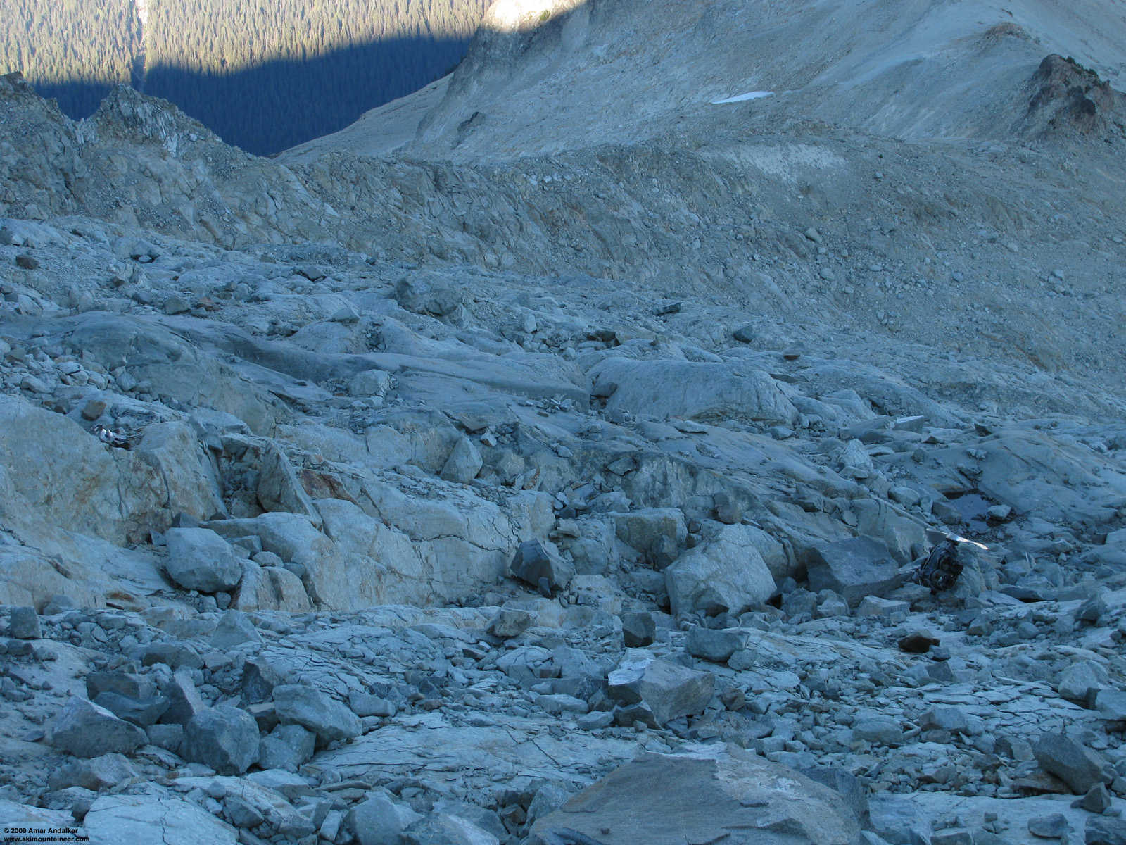
Thanks Mike for the interesting TR (as usual). For some reason, I was under the impression that the airplane wreckage below the east peak of Mount Daniel was well-known to those who frequent the area (which would not include me -- it's an awesome area, but not on my usual rounds). The one time that I day-hiked up the 3 summits of Daniel in late Sept 2009, I ascended almost the same route as you did to the right of Hyas Creek Glacier and found this engine-propellor combo sitting near 7600 ft on the east side of the East Peak:
(click for double-size version)
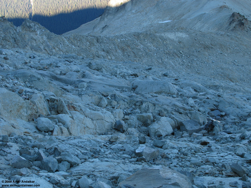
Looking down across the wreckage field. (click for double-size version)
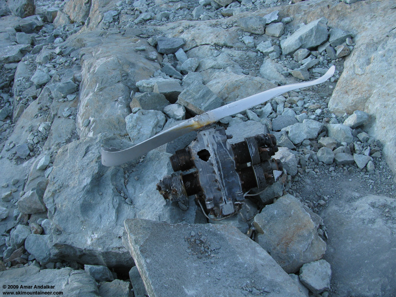
Closeup of the engine-propellor. (click for double-size version)
(click for double-size version)
I had read about the wreckage some places online prior to that hike, including the bruce.frankweb.net webpage you linked above (the photos and links there were working in 2009). However, after reading this TR last week, I tried to Google for any other info about the crash and it was not very fruitful. The one useful thing that I did manage to find was this story in Google news from 1948:
The Spokesman-Review - Aug 2, 1948: "Bodies of two men and the wreckage of a single-engined civilian plane were found today on Mount Daniel, approximately 30 miles north of Cle Elum, Wash., the air rescue service reported. In Seattle, the 13th naval district identified the craft as one missing since June 20 on a flight from The Dalles, Ore., to Whidbey Island, Wash., in Puget Sound. ... Air rescue service officers said the wreckage was discovered on the upper slopes of the 7986-foot mountain ..."
So apparently, there might be wreckage from 2 separate accidents up there. However, there is no evidence in the NTSB database that the 1978 plane actually crashed on Mt Daniel (location "NR.WENATCHEE,WA"), so all of the debris on Daniel could be from the 1948 accident alone. Here is a working link to the May 1978 accident report: http://www.ntsb.gov/aviationquery/brief.aspx?ev_id=41911&key=0
The bruce.frankweb.net webpage is unclear on whether the 1978 photos were of a fairly recent wreck, or whether it could have been an older wreck exposed after decades of burial in semi-permanent snow and ice at the edge of the then-much-larger Hyas Creek Glacier. The decade following 1948 was one of exceptional snowfall, which could have deeply buried the wreckage, while the severe drought year of 1977 could have exposed the previously buried wreckage enough to be seen by 1978. And the Beechcraft Bonanza K-35 was first produced in 1947, so it could have been the plane that crashed in 1948, barring further information to the contrary. Lots of unknowns here! More research to be done by someone.
(click for double-size version)
Looking down across the wreckage field. (click for double-size version)
Closeup of the engine-propellor. (click for double-size version)
(click for double-size version)
I had read about the wreckage some places online prior to that hike, including the bruce.frankweb.net webpage you linked above (the photos and links there were working in 2009). However, after reading this TR last week, I tried to Google for any other info about the crash and it was not very fruitful. The one useful thing that I did manage to find was this story in Google news from 1948:
The Spokesman-Review - Aug 2, 1948: "Bodies of two men and the wreckage of a single-engined civilian plane were found today on Mount Daniel, approximately 30 miles north of Cle Elum, Wash., the air rescue service reported. In Seattle, the 13th naval district identified the craft as one missing since June 20 on a flight from The Dalles, Ore., to Whidbey Island, Wash., in Puget Sound. ... Air rescue service officers said the wreckage was discovered on the upper slopes of the 7986-foot mountain ..."
So apparently, there might be wreckage from 2 separate accidents up there. However, there is no evidence in the NTSB database that the 1978 plane actually crashed on Mt Daniel (location "NR.WENATCHEE,WA"), so all of the debris on Daniel could be from the 1948 accident alone. Here is a working link to the May 1978 accident report: http://www.ntsb.gov/aviationquery/brief.aspx?ev_id=41911&key=0
The bruce.frankweb.net webpage is unclear on whether the 1978 photos were of a fairly recent wreck, or whether it could have been an older wreck exposed after decades of burial in semi-permanent snow and ice at the edge of the then-much-larger Hyas Creek Glacier. The decade following 1948 was one of exceptional snowfall, which could have deeply buried the wreckage, while the severe drought year of 1977 could have exposed the previously buried wreckage enough to be seen by 1978. And the Beechcraft Bonanza K-35 was first produced in 1947, so it could have been the plane that crashed in 1948, barring further information to the contrary. Lots of unknowns here! More research to be done by someone.
Good detective work, guys.
Amar, I'm pretty sure the engine/prop assembly in your pics is not the powerplant of a K-35 Bonanza. If memory serves, that airplane is equipped with a variable speed prop (blade angle variable) and a Continental six cylinder opposed engine. the one in pics is a four cylinder opposed engine with a fixed prop.
So it seems that your theory of Daniel claiming more than one aircraft is quite likely.
Reply to this TR
Please login first: