May 30, 2005, Shastina, Cascade Gulch and South Face
5/30/05
11392
3
Shastina is the oft-ignored and underappreciated satellite cone of Mount Shasta, completely overshadowed by its towering parent. Nevertheless, Shastina is the third highest volcanic cone in the Cascade Range at 12330 ft, exceeding even Mount Adams in height, and is certainly a worthy mountaineering and skiing objective. Cascade Gulch provides an easy ski route all the way to the summit, while excellent moderately-steep and lengthy ski descents can be found on the South Face, North Face, and Diller Canyon (west side). The NE Face above the Whitney Glacier even offers some very steep extreme skiing terrain. I'd wanted to ski Shastina for several years, but had been thwarted by overpowering winds (70+ mph, too strong to even stand upright) at the 11840 ft Shastina Saddle during my only previous attempt in May 2003.
After skiing to 12000 ft in Avalanche Gulch the previous day (see TAY report), Corey Bloom and I planned to try Shastina on Memorial Day. I was quite tired as we awoke at 6 AM at the Bunny Flat trailhead, but my spirits were lifted by the , a large flat plain at the foot of the West Face with nice protected camping spots and surrounded by excellent ski terrain on three sides. We skinned up the left side of Cascade Gulch on softening snow on the south-facing slope, eventually finding firmer snow and moderate winds as the Gulch flattens above 11000 ft. We reached the 11840 ft saddle by 1 PM, winds were strong enough to hide behind a large rock in order to eat lunch, but certainly not the hurricane force I had experienced 2 years earlier.
We continued skinning up the east face of Shastina above the saddle to the crater rim at 12100 ft (). A straight route over to Shastina's summit cone would involve losing and regaining over 100 ft, but a traverse to the right allowed us to skin to the summit with minimal elevation loss, finally following an on slushy snow to the crater rim and the top of the South Face. Here things got really nice, the
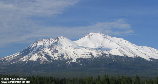
View of Shastina (left) and Shasta from the WSW at the Abrams Lake exit on I-5.
click here for an enlarged version of this photo.
This was part of a (planned to be) lengthy Cascade volcano ski road trip. Other trip reports:
After skiing to 12000 ft in Avalanche Gulch the previous day (see TAY report), Corey Bloom and I planned to try Shastina on Memorial Day. I was quite tired as we awoke at 6 AM at the Bunny Flat trailhead, but my spirits were lifted by the , a large flat plain at the foot of the West Face with nice protected camping spots and surrounded by excellent ski terrain on three sides. We skinned up the left side of Cascade Gulch on softening snow on the south-facing slope, eventually finding firmer snow and moderate winds as the Gulch flattens above 11000 ft. We reached the 11840 ft saddle by 1 PM, winds were strong enough to hide behind a large rock in order to eat lunch, but certainly not the hurricane force I had experienced 2 years earlier.
 returning to the trailhead from an extra night at Horse Camp. Continuing on to the camp, we located a good skin/boot track heading north and followed it on a lengthy rising traverse all the way to Hidden Valley at 9200 ft, with ski crampons helpful on the frozen west-facing slopes. <a href=)
We continued skinning up the east face of Shastina above the saddle to the crater rim at 12100 ft (). A straight route over to Shastina's summit cone would involve losing and regaining over 100 ft, but a traverse to the right allowed us to skin to the summit with minimal elevation loss, finally following an on slushy snow to the crater rim and the top of the South Face. Here things got really nice, the
. Shastina's summit has several volcanic craters and cones, with the main summit cone rising above the crater rim (see <a href=)
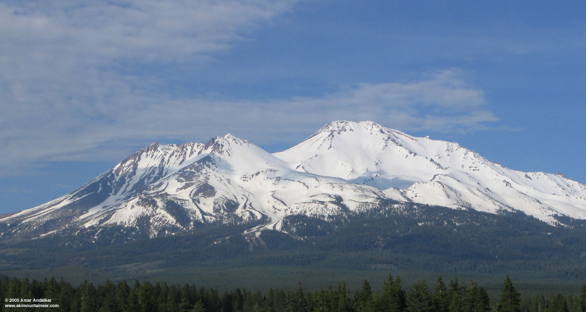
View of Shastina (left) and Shasta from the WSW at the Abrams Lake exit on I-5.
click here for an enlarged version of this photo.
This was part of a (planned to be) lengthy Cascade volcano ski road trip. Other trip reports:
Excellent report, thank you Amar!
Your photo of Hidden Valley is the best I've seen showing the West Face Gullies route, which looks mighty scrumptious, and genuinely makes me want to dial in sick and pack the freakin truck right this very instant. Do you have any estimates based on your frequent experience w South and West sides of Shasta how long the W Face Gullies might stay in that kind of shape? Seems like given their W facing these would be a good choice for a oneday from car ski ascent on a day with high FLs.
Your photo of Hidden Valley is the best I've seen showing the West Face Gullies route, which looks mighty scrumptious, and genuinely makes me want to dial in sick and pack the freakin truck right this very instant. Do you have any estimates based on your frequent experience w South and West sides of Shasta how long the W Face Gullies might stay in that kind of shape? Seems like given their W facing these would be a good choice for a oneday from car ski ascent on a day with high FLs.
Well, this is the most snow I've ever seen as of roughly June 1 on the upper parts of Shasta above 8-9000 ft, exceeding even the very deep spring snowpack of 2003 (although I missed out on the huge spring snowpacks of 1995 and 1998 in CA, which may have been deeper than this year). See this photo from June 3, 2003 for comparison, clearly less snow than this year. In 2003, the central West Face Gully remained a continuous ski until the final days of June, so unless there is a big heat wave soon I would expect the West Face to remain a fine ski descent into late June or early July this year. The three main rock ribs which divide the face should become increasingly snow-free over the next couple of weeks, unless there is additional snowfall.
I think that the fastest and most efficient way to ski the West Face is to go up Avalanche Gulch to the base of Misery Hill at 13200 ft and then traverse west, it's a much shorter route and since it softens earlier in the day it might provide an easier ski ascent than the West Face (plus the Gulch usually has a nice boot pack to climb if forced to put the skis on the back). The West Face remains firmer later into the afternoon, so 1-3 PM is often a good time to ski it with typical spring FL of around 12-13000 ft.
I think that the fastest and most efficient way to ski the West Face is to go up Avalanche Gulch to the base of Misery Hill at 13200 ft and then traverse west, it's a much shorter route and since it softens earlier in the day it might provide an easier ski ascent than the West Face (plus the Gulch usually has a nice boot pack to climb if forced to put the skis on the back). The West Face remains firmer later into the afternoon, so 1-3 PM is often a good time to ski it with typical spring FL of around 12-13000 ft.
Amar,
Great trip.
I also want to THANK YOU for all the great info and links on your website. During my 2 plus months of skiing around Tahoe and the Sierras, I would constantly use the links provided on your site.
Jill and I used the 31st as a travel day from Lassen to Shasta due to the forecast. The wildflowers were incredible and Jill was happy. We spent the evening of the 31st on the Everitt Memorial Highway and the winds were strong and the clouds periodically encased Shasta. June 1st was a beautiful day and we skied Giddy Gulch in perfect conditions.
Based upon your reports, I have wanted to ski Mt. McCloughlin and planned that for June 2. Unfortunately, the weather was not cooperating and we have to try again on our next trip. We are skiing the Three Sisters Wilderness for the next couple of days.
Zap
Reply to this TR
Please login first: