- Posts: 10
- Thank you received: 0
Mt Adams Rd??
- Stuart Ryan
- [skr]
-
 Topic Author
- Offline
- New Member
-

Less
More
14 May 2013 21:44 #209710
by Stuart Ryan
Mt Adams Rd?? was created by Stuart Ryan
Hey does anyone have any info on how far the rd is open for Adams south ridge route? It looks like the FS road conditions website hasnt been updated since mid April.
Please Log in or Create an account to join the conversation.
- nwboarder82
- [nwboarder82]
-
- Offline
- New Member
-
Less
More
- Posts: 15
- Thank you received: 1
15 May 2013 13:13 #209713
by nwboarder82
Replied by nwboarder82 on topic Re: Mt Adams Rd??
I was up there last week on the alternative route. The write up on their website is a bit off. You can actually drive all the way to the Snipes Mountain Trail. You will have to hike at least 2.5 miles until you see snow. Unless you can find a shortcut, you will have to hike through a burnt forest containing down trees and several creek crossing.
Please Log in or Create an account to join the conversation.
- Jonathan_S.
- [Jonathan_S.]
-
- Offline
- Senior Member
-

Less
More
- Posts: 290
- Thank you received: 0
16 May 2013 13:42 #209725
by Jonathan_S.
Replied by Jonathan_S. on topic Re: Mt Adams Rd??
You mean opening to Morrison Creek by mid June?I spoke to the Ranger station about 2 weeks ago and she stated that the earliest possible opening of the standard SS trailhead could be mid June. If at all. She told me they hadn't sent a crew in yet to begin work and weren't going to until it melted out.
Please Log in or Create an account to join the conversation.
- Randito
- [Randito]
-

- Offline
- Elite Member
-

Less
More
- Posts: 960
- Thank you received: 1
18 May 2013 14:27 #209741
by Randito
Replied by Randito on topic Re: Mt Adams Rd??
FWIW: THe standard south route is currently closed below timberline -- a forest fire burned through the area last fall and left a lot of dammaged trees.
www.fs.usda.gov/detail/giffordpinchot/al...?cid=stelprdb5172538
IDK how much enforcement there might be -- but I would certainly expect the clearing of downed logs from the roadway to be delayed. THe alternate route is roughtly 15 miles and 8000 vert round trip vs 11 miles 7000 vert from Cold Springs.
www.fs.usda.gov/detail/giffordpinchot/al...?cid=stelprdb5172538
There is currently no projected date for lifting of the closure area. Any person violating the closure is subject to fines.
IDK how much enforcement there might be -- but I would certainly expect the clearing of downed logs from the roadway to be delayed. THe alternate route is roughtly 15 miles and 8000 vert round trip vs 11 miles 7000 vert from Cold Springs.
Please Log in or Create an account to join the conversation.
- Patarero
- [Patarero]
-
- Offline
- New Member
-
Less
More
- Posts: 38
- Thank you received: 0
21 May 2013 11:30 #209756
by Patarero
Replied by Patarero on topic Re: Mt Adams Rd??
option a) risk the fine and go up the road.....
b) drive past the snipe trail and go to the end of the 150 rd this puts you at ~4500ft, well above the snipe trailhead and avoids the disaster that is the lower portion of snipe trail. Go up the game trail/now beaten path than parallels the creek, cross the creek ~1/2-3/4 mile up, plenty of downed trees to use, and you will be on the snipe trail at the junction with pineway trail. Car to skiable snow is ~1.6 miles as of 5/18. And yes the traverse from the SW chutes is looooooooong.
b) drive past the snipe trail and go to the end of the 150 rd this puts you at ~4500ft, well above the snipe trailhead and avoids the disaster that is the lower portion of snipe trail. Go up the game trail/now beaten path than parallels the creek, cross the creek ~1/2-3/4 mile up, plenty of downed trees to use, and you will be on the snipe trail at the junction with pineway trail. Car to skiable snow is ~1.6 miles as of 5/18. And yes the traverse from the SW chutes is looooooooong.
Please Log in or Create an account to join the conversation.
- Edgesport
- [Edgesport]
-
- Offline
- Junior Member
-

Less
More
- Posts: 177
- Thank you received: 0
24 May 2013 11:55 #209827
by Edgesport
Replied by Edgesport on topic Re: Mt Adams Rd??
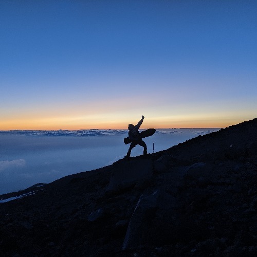
@Patarero - Great to see reports this early!! I don't know if that is good or not? Will there be enough snow to last into July? Got any pics?
Please Log in or Create an account to join the conversation.
- jesski
- [jesski]
-
- Offline
- New Member
-
Less
More
- Posts: 13
- Thank you received: 0
29 May 2013 13:40 #209881
by jesski
bumpity bumpity. Any news?
Replied by jesski on topic Re: Mt Adams Rd??
@Patarero - Great to see reports this early!! I don't know if that is good or not? Will there be enough snow to last into July? Got any pics?
bumpity bumpity. Any news?
Please Log in or Create an account to join the conversation.
- andyski
- [andyski]
-
- Offline
- Senior Member
-
Less
More
- Posts: 250
- Thank you received: 0
29 May 2013 22:06 #209884
by andyski
Replied by andyski on topic Re: Mt Adams Rd??
Someone on TGR is saying she was told by the FS that the South Climb was to "open" Saturday, which I assume just means that the fire closure ceases, and has nothing to do with the condition of the road, but I'm guessing.
Please Log in or Create an account to join the conversation.
- nickwiarda
- [nickwiarda]
-
- Offline
- New Member
-
Less
More
- Posts: 20
- Thank you received: 0
30 May 2013 09:22 #209885
by nickwiarda
I just called to check, the nice lady on the other end of the line informed me that "word must travel fast, it MAY open Saturday", she instructed me to call back tomorrow to verify. She also just "happened" to mention that fee season starts Saturday.
It's amazing how this stuff works.
Replied by nickwiarda on topic Re: Mt Adams Rd??
Someone on TGR is saying she was told by the FS that the South Climb was to "open" Saturday, which I assume just means that the fire closure ceases, and has nothing to do with the condition of the road, but I'm guessing.
I just called to check, the nice lady on the other end of the line informed me that "word must travel fast, it MAY open Saturday", she instructed me to call back tomorrow to verify. She also just "happened" to mention that fee season starts Saturday.
It's amazing how this stuff works.
Please Log in or Create an account to join the conversation.
- thatoneguydave
- [thatoneguydave]
-
- Offline
- New Member
-
Less
More
- Posts: 31
- Thank you received: 0
30 May 2013 10:14 #209886
by thatoneguydave
Replied by thatoneguydave on topic Re: Mt Adams Rd??
If the South Climb route were to be open this would imply that FS 8040 is clear and open to the Cold Springs TH? Dumb question... never climbed Adams before and just trying to get a clear picture of the route.
Thanks.
Thanks.
Please Log in or Create an account to join the conversation.
- Patarero
- [Patarero]
-
- Offline
- New Member
-
Less
More
- Posts: 38
- Thank you received: 0
31 May 2013 11:39 #209899
by Patarero
Replied by Patarero on topic Re: Mt Adams Rd??
South Climb is OPEN!
www.fs.usda.gov/wps/portal/fsinternet/!u...Alerts%20&%20Notices
www.fs.usda.gov/wps/portal/fsinternet/!u...Alerts%20&%20Notices
Please Log in or Create an account to join the conversation.
- Griff
- [Griff]
-
- Offline
- Senior Member
-
Less
More
- Posts: 413
- Thank you received: 0
31 May 2013 12:20 #209900
by Griff
Great question. A lot of times earlier in the year it is open but you cant make it all the way to Cold Springs due to snow, or just some big snow banks. Though those with 4WD and raised usually start to "plow" out the road.
That being said I think this route was closed for "other" reasons (the fire right??). I haven't been down there for awhile myself, but really want to hit the ol' SW Chutes this spring.
Replied by Griff on topic Re: Mt Adams Rd??
If the South Climb route were to be open this would imply that FS 8040 is clear and open to the Cold Springs TH? Dumb question... never climbed Adams before and just trying to get a clear picture of the route.
Thanks.
Great question. A lot of times earlier in the year it is open but you cant make it all the way to Cold Springs due to snow, or just some big snow banks. Though those with 4WD and raised usually start to "plow" out the road.
That being said I think this route was closed for "other" reasons (the fire right??). I haven't been down there for awhile myself, but really want to hit the ol' SW Chutes this spring.
Please Log in or Create an account to join the conversation.
- andyski
- [andyski]
-
- Offline
- Senior Member
-
Less
More
- Posts: 250
- Thank you received: 0
31 May 2013 20:04 #209901
by andyski
Replied by andyski on topic Re: Mt Adams Rd??
It doesn't mean the road is driveable to the TH, though I have no idea if it is or not. It means the fire closure is over.
Please Log in or Create an account to join the conversation.
- Fletcher
- [Fletcher]
-
- Offline
- New Member
-
Less
More
- Posts: 3
- Thank you received: 0
31 May 2013 22:53 #209903
by Fletcher
Replied by Fletcher on topic Re: Mt Adams Rd??
So stoked to shred the chutes next week!!!
Please Log in or Create an account to join the conversation.
- Patarero
- [Patarero]
-
- Offline
- New Member
-
Less
More
- Posts: 38
- Thank you received: 0
02 Jun 2013 15:50 #209910
by Patarero
Replied by Patarero on topic Re: Mt Adams Rd??
Rd is open to the cold springs campground. FS plowed it. Not much parking though.
Please Log in or Create an account to join the conversation.