January 19-21, 2013, Diamond Peak OR, from North

How to make use of this last week's exceptional weather? I couldn't find any partners interested in doing an overnight trip (admittedly, my first ideas probably sounded like no fun, with many miles of road skiing involved), so, being a carless dirtbag, my solo trip would be planned around a bus ride from Eugene to the Willamette Pass resort on Saturday morning. (A ride back another day wouldn't be guaranteed, but that's less important, right?) And from there, Diamond Peak, about 10 miles south, should be easily within reach, given three days to work with. This north side route to the summit is surprisingly included in Klindt Vielbig's "Cross-Country Ski Routes Oregon" book, but I have never read any reports from any approaches other than the SW side.
Upon arrival at Willamette Pass Saturday morning, I grabbed my gear from under the bus, skated past the bunny hill, and disappeared into the mossy woods toward the PCT while the rest of the riders were casually preparing for the lifts to start running. I crossed the highway and found the trail from there to be a well-beaten snowshoe track. Travel was pretty quick with XCD skis on this gently rolling and icy trail. I made it to my intended camp on the ridge between Mount Yoran and Diamond Peak without much trouble at all, thanks to tracks from a skier or two that had gone the same way in the previous days and camped a bit back, above Lils Lake.
After setting up camp, I went to climb the 400ft up to South Yoran (or whatever it's called, at 7138ft) before dark. I skinned across its smooth face as the surface snow was firming up again, then walked up the last bit of its ridge. The view of Diamond Peak gave some clues about the next day's route, but most of it was in dim shadow and indistinct. Meanwhile, the cloudless sky made a textbook-perfect illustration of the surprisingly complex atmospheric optics of twilight, all pure color gradients with an especially strong earth shadow in the east and that unusual violet high in the west. (The textbook to which I refere here is Minnaert's "The Nature of Light and Color in the Open Air", p268-275.) Skiing back down was a lot of sideslipping and some riding of the snow waves on the ridge. Then dinner, and sleep, but mostly just a long time of moonlit semi-darkness.
I waited before leaving Sunday morning, hoping to let the snow surfaces above soften some. The tracks that I had been following continued up here, through some nice patches of settled powder in the thinning trees, but then disappeared above treeline where all surfaces turned to windpack, sastrugi, and ice. I was able to skin up the north ridge to below the rocky first false summit. There were two more false summits to traverse around beyond this, and nothing looked skiable. The shaded slopes on the left were smooth hard ice, while the sunlit slopes on the right were rime chunks in a softening base, so I put crampons on and went right. I passed similarly below the second false summit, keeping my eyes on its cliffs as it let a few small pieces of ice cascade down the slope. The third false summit, from this perspective, is a broad cone, and I was hoping that its east side would be soft and skiable, but it was just as icy as everything else. So I walked up to its top and considered things. I finally had a view of the true summit and of another complex ridge traverse between. I had been there before from the other side, and today, it wouldn't earn me any more skiing or a better view (which was already perfect, everything from Hood to McLoughlin, plus the poor fogged-in valley), so I was satisfied to make this, at 8629ft, my turnaround point.
I wasn't looking forward to cramponing down the rest of the route, but I still couldn't see anything that I'd want to ski. Even the ridge that I had skinned up could be difficult to descend, since some spots were just a finger of snow pasted to a sheet of ice. But upon reaching the saddle between the second and first false summits, I noticed a shallow bowl down to the NE from there, opposite of the side I had passed before. It actually looked like a consistent slope of soft week-old powder (perhaps the only well-preserved slope on the whole long NE face), and it led fairly directly back to camp. So I put skis on and went. It ended up being somewhat stiff, so jump turns were required to keep edges free near the top, but as the angle eased, turns became more natural. The rest of the run back toward camp was great fun across the rippled low-angle slopes just above treeline (still watching carefully for ice). Then another lazy afternoon, evening, and night at camp.
In the course of Monday's glide back to Willamette Pass, I passed again below the SE face of South Yoran. Brightly lit at 10am, it looked like perfect corn. So I left my big pack there on the trail at the bottom of the open slopes, booted up, and had a joyous 500ft run. The rest of the ski back took barely 2 hours, in a fast icy track. I should have taken a couple more laps...
I thought that I might be able to make some friends at Gold Lake Sno Park and arrange a way back home. It was fairly busy, due to the holiday, but the patrol cabin wasn't open, and no deals were made by the time 3pm passed. That was my cutoff time to ski back to the resort parking lot and inquire about the bus or see if downhillers are any more sensitive to the plight of this dirtbag (though I did have a good snow bath that morning and a fresh change of clothes...). Thankfully, the bus to Eugene, which had been full in the morning, had one open spot on the way back. This also meant that I got to enjoy a screening of Happy Feet 2 to accompany the return to the foggy lowlands. Nice.
I apologize for the tedious detail here, but I thought it was unusual enough to be interesting. I don't see much about winter travel above treeline in Oregon aside from Mount Hood, and I've never seen this particular route reported on. I would certainly do it again, given good weather. It could be done in two days, with only 20mi distance and about 4000ft gain. Three days could be better used if ski conditions up high were decent. Big thanks go to the skiers who made the perfectly-routed track all the way out the PCT a few days earlier and to the one resort skier, who, for whatever reason, gave up his/her spot for the bus back on Monday.
Sunday's Route
South Yoran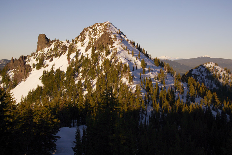
at South Yoran summit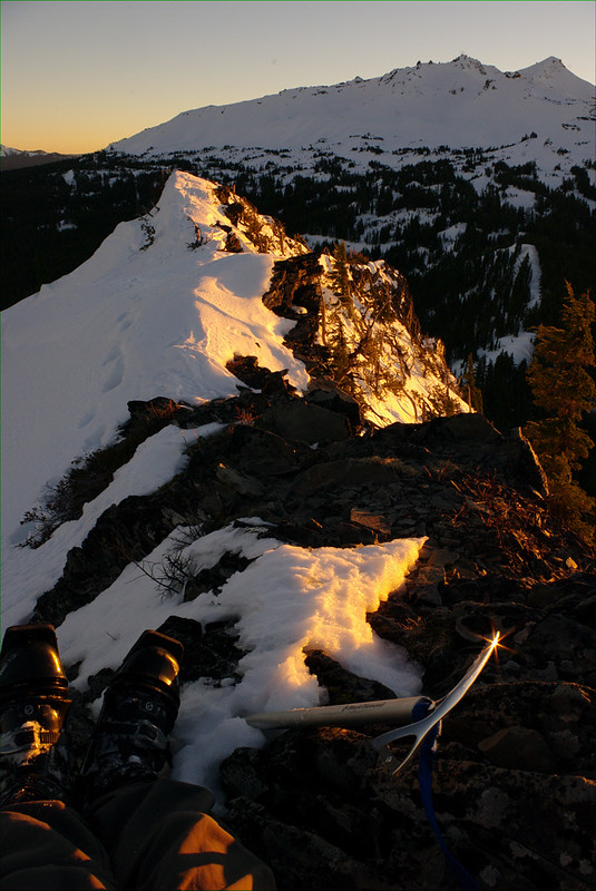
sunset on the Three Sisters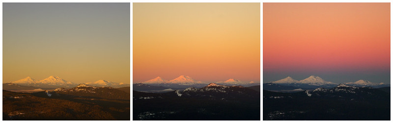
false summits: second, first, third (left to right)
below the north ridge (later descent route right along shadow line)
past first false summit
below second false summit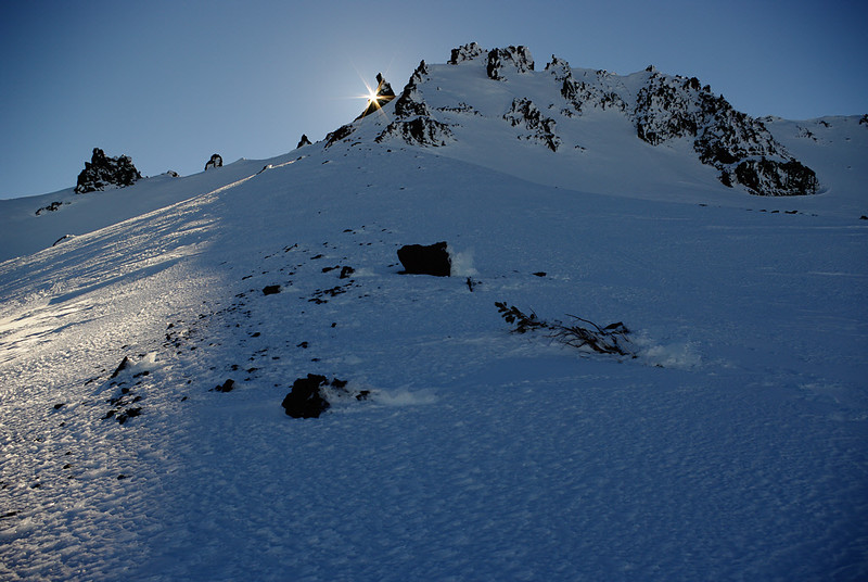
not for skiing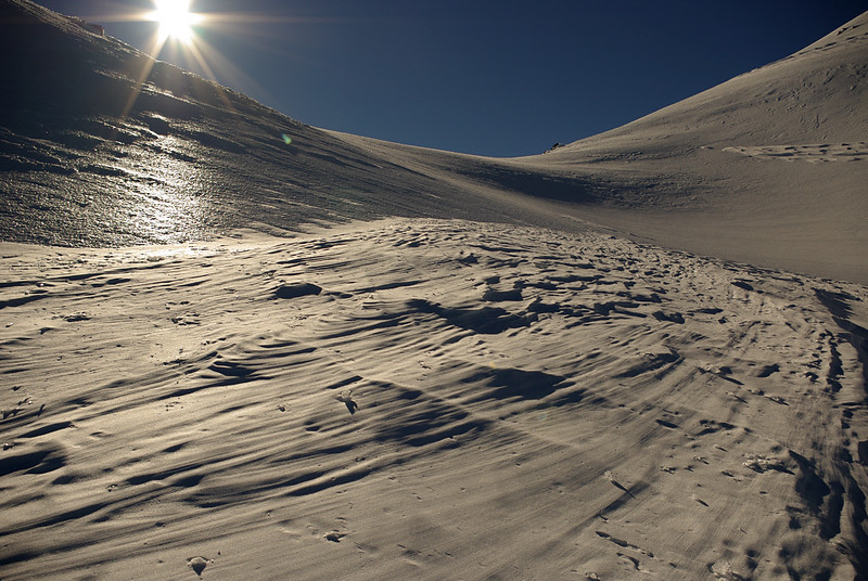
second false summit from above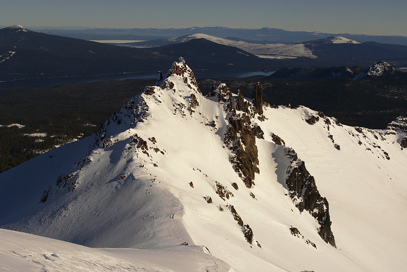
view of true summit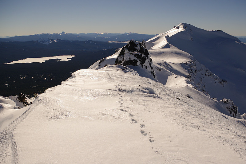
northeast bowl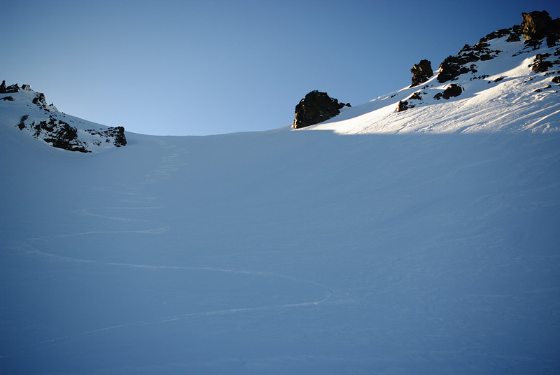
windblown surface below northeast face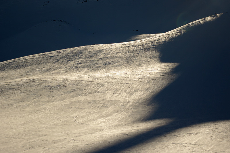
morning corn on South Yoran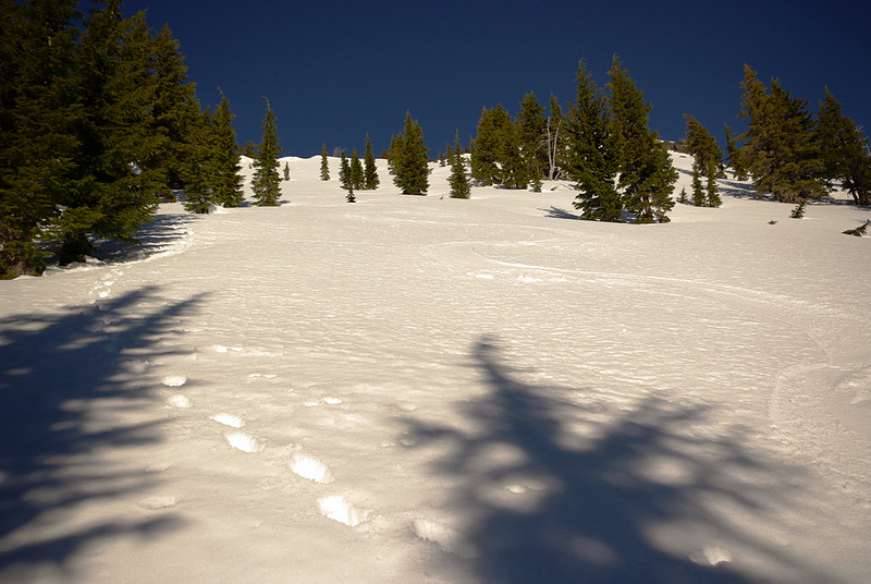
author=Micah link=topic=27165.msg114462#msg114462 date=1359056830]
Too bad I spent the whole time working!
Same here...but I do appreciate the trip reports and quality photos, they motivate me to find a job with more free time!
Great report, very interesting.
Oregon represent!
Reply to this TR
Please login first: