June 27-28, 2012, Rainier, Muir and Paradise Glacier
6/27/12
WA Cascades West Slopes South (Mt Rainier)
6870
2
Couldn't come up with a better plan for the brief day-and-half window of clear weather forecast for Wednesday into Thursday morning, so I decided to head for Rainier -- back on home snow for the first time in 3 weeks, after spending most of the previous 2 weeks skiing in Oregon and California (some of those TRs are partially written, may be posted soon). Skied 2 very different routes down Paradise Glacier from Camp Muir on Wednesday evening and Thursday mid-day, the second of which was almost entirely new to me: Paradise Glacier edge past McClure Rock down into Edith Creek Basin via an interesting snow-ridge-filled gully). Very cool to explore and discover new ground in complete solitude on a sunny summer day, smack in the middle of someplace that I've skied over 150 times before (Muir + Paradise Glacier). An excellent 24 hours with about 10600 vert of total ski ascent and descent, some fine skiing too, mostly on good to great smooth snow conditions.
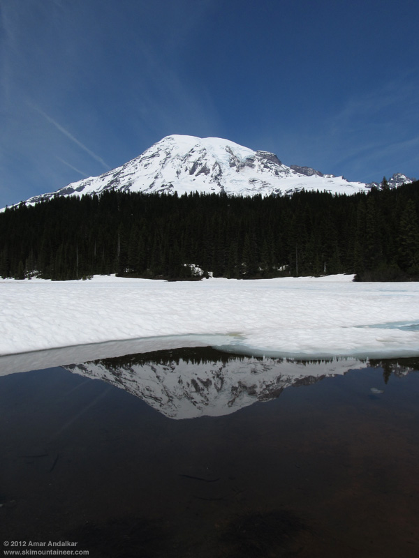
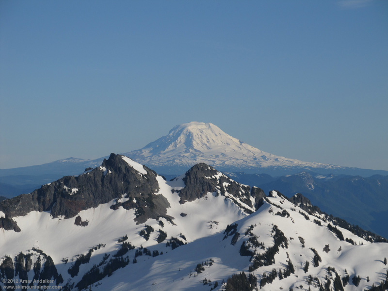
Got a late start from home Wednesday morning, and took the scenic route to Paradise via Cayuse Pass, a side trip to Chinook Pass (still 5-10 ft of roadside snow, saw several skiers), Stevens Canyon Road (annoying this summer, long construction delays of 20-30 minutes), and the mostly-frozen Reflection Lakes.
Overview of Muir Snowfield and Paradise Glacier from Stevens Canyon Road.
The main Paradise parking lot was "full" (although about 1/3 of the spots were blocked off by cones) and the Paradise Valley Road was frustratingly closed, so I was forced to park in the old visitor center lot. Skinned up after 1:30pm starting at the top of the stairs only a few yards from the car. Followed a faint skin track up Pan Face on all snow except a few yards of bare trail at the top (no vegetation stomping needed). Going around to the right, snow remained continuous to Pebble Creek except for another short discontinuity in the usual bare spot near 7000 ft, also easily crossed on skins across bare rock and dirt. The only all-snow skinning routes from Paradise to Muir are now apparently via Edith Creek Basin and Paradise Glacier.

Crossed an unusual channel eroded into the snowpack at Pebble Creek, with traces of new snow here at 7200 ft. There were increasing amounts of recent new snow above that, about 1-2" near 8000 ft growing to 6+" above 9000 ft. By mid-afternoon on this sunny day, the snow from 7000-8000 ft was corn especially where the new snow had not stuck, then a thin layer of new proto-corn above 8000 ft, but above 9000 ft it was just dense, somewhat damp, windpacked powder, not even pre-proto-corn yet. Tried to follow portions of a previous skin track, but found that I had better traction and less glopping if I just broke my own trail.
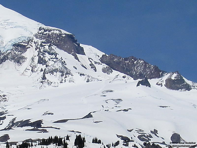
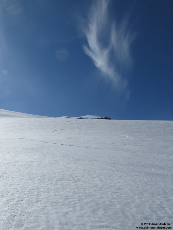
Reached Camp Muir just before 5pm in a moderate SW breeze, checked for any news at the climbing ranger hut, and then skied down, angling left towards Anvil Rock and Paradise Glacier. Dense windpacked powder up high, but transitioning to re-firming proto-corn and corn on the steep face beside Anvil and on the Paradise Glacier. Followed the standard SE-trending fall line towards Cowlitz Rocks, the bergschrund near 9000 ft is partially open and big crevasse near 8000 ft is also starting to show itself.
Excellent smooth fast snow conditions at 5:30pm, with only a single skin track and ski track from earlier in the day (plus faint traces of older ski tracks) on the entire expanse of the glacier. Lots of ice worms out on the glacier surface. Smooth snow, solitude, and lovely evening light.
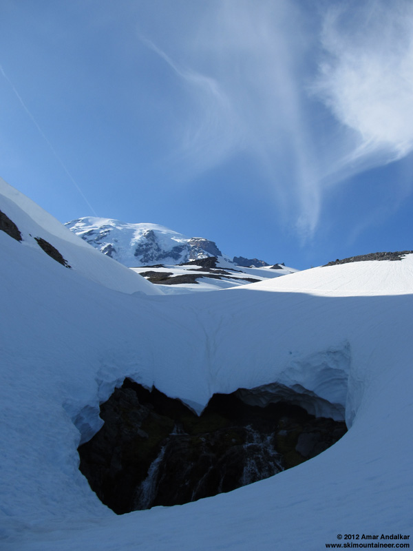
Descended and traversed through the basin of the former lower Paradise Glacier and down the rightmost gully (which as expected had a scary hole in the snowpack near a small waterfall) to the Skyline Trail bridge at 6000 ft, which is just starting to melt out of the snow.
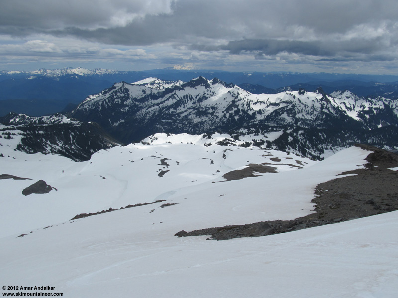
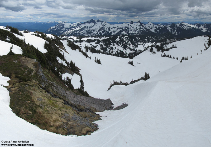
Since my car was way over at the far end of the Paradise lots, I decided to skin back up roughly along the trail's route past Golden Gate and up to the top of Panorama Point at 7000 ft, which would give me a nice fall-line descent back to the car. It was a route which I'd never skinned before, and had the unexpected bonus of spying a very interesting gully, descending through the cliffs near 6400 ft into Edith Creek Basin and filled with an unusual sharp snow ridge, curving in a vertical arc up the gully beside a small waterfall. A few recent ski tracks marked this spot, which somehow I had never skied before (or don't recall if I have). Perhaps a ski route for the next day?
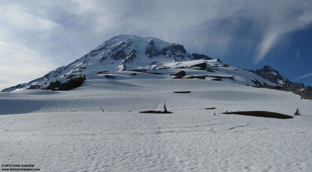
Panoramic view of the upper Edith Creek drainage above Golden Gate.
Skinned up mushy semi-consolidated snow in the upper Edith Creek drainage, and arrived leisurely above Pan Point around 7:30pm. A quick cruise down the SW ridge of Pan Point, some tight turns down the short steep south face, and then a long schuss out via Deadhorse Creek Trail back to the car. Snow conditions were nice and quick in the late evening, especially by staying on shaded slopes.
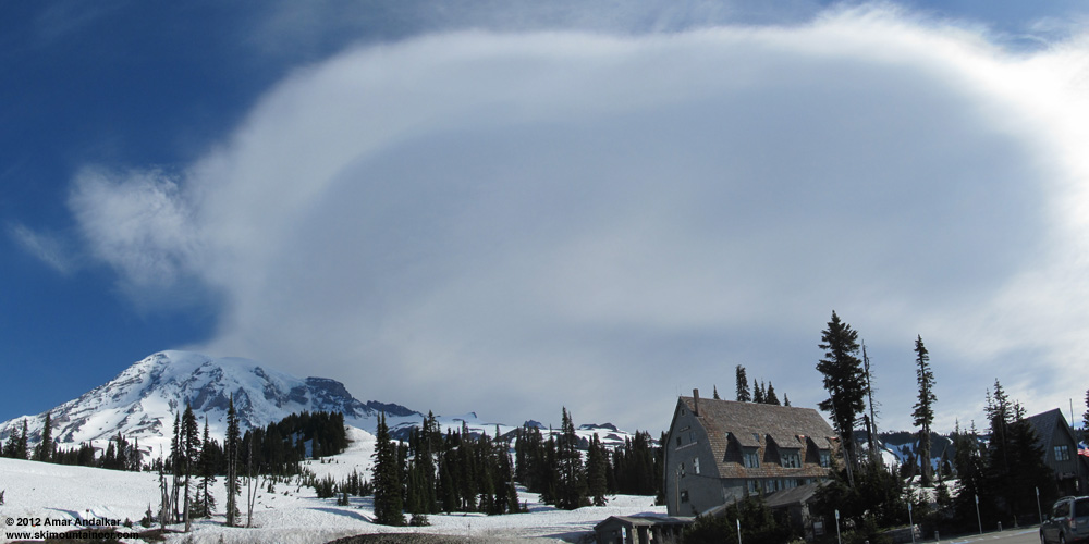
Spent the evening sightseeing in the moonlight and hanging out at Paradise Inn. By 11pm, a lenticular cloud was building on the summit, and by midnight it had grown large enough to engulf the uppermost mountain. But by dawn at 5am, the lenticular was gone, although soon an immense lee wave cloud (several times the diameter of the mountain) was building just above and east of the summit, blocking the morning sunshine from the Muir Snowfield and Paradise Glacier.
Panoramic view of the immense lee wave cloud east of the summit of Rainier.
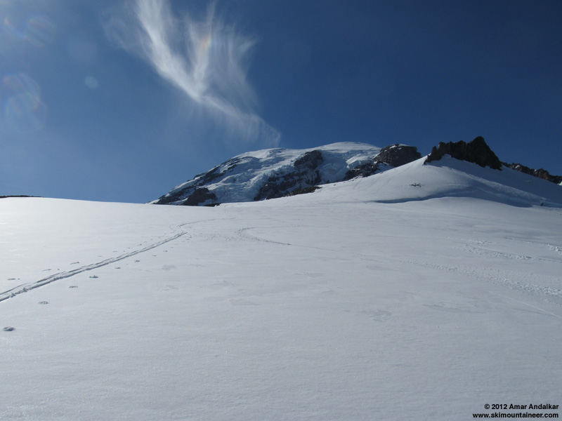
With clear skies overnight outside the lenticular, I expected a hard freeze of the snowpack, and delayed softening in the morning due to the lee wave cloud. So a very leisurely start had me skinning from Paradise (the main lot) towards Edith Creek Basin just before 9am, perhaps an hour later than I really wanted. Arrived at 6200 ft at the base of the gully that I had spied the previous evening, and decided to try to skin up that instead of the usual trail slope to Golden Gate. Luckily the sun had been on the very steep snow ridge in the gully (SE aspect) for at least an hour, and it was well-softened enough to be skinnable but not to slide, although I did sidestep about 10 vertical feet of the steepest part. Sketchy almost-extreme skinning up a scenic route, fun!
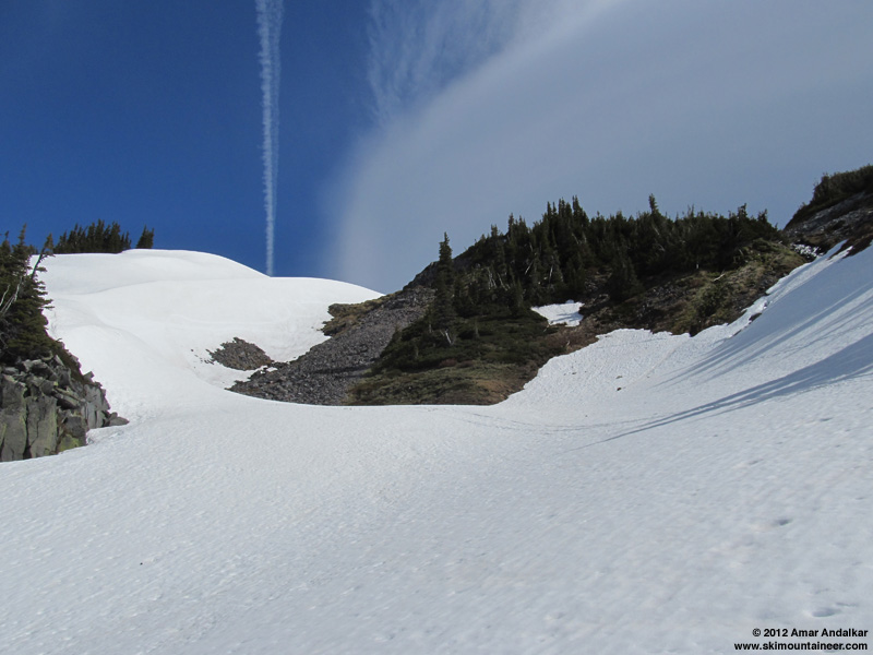
The snow-ridge gully, it's much steeper than it looks here.
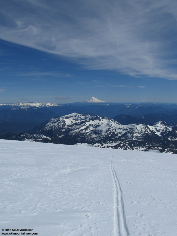
Above the gully, the upper Edith Creek drainage is a broad open bowl, and I angled NE towards the edge of Paradise Glacier just right of McClure Rock. Easily skinnable most of the way, but then the crux steep slope at 7200 ft was another story. About 35-40 degrees steep, with deep oversoftened mush on this SE aspect at 10:30am, sliding out unpredictably, slow and frustrating. This was not extreme skinning, it was a potential wet slide accident about to happen. Not worth the risk, so I carefully switched over, skied across out of the hazard and down about a hundred ft, then did a rising traverse to rejoin the standard route to Muir heading for Pebble Creek near 7100 ft.
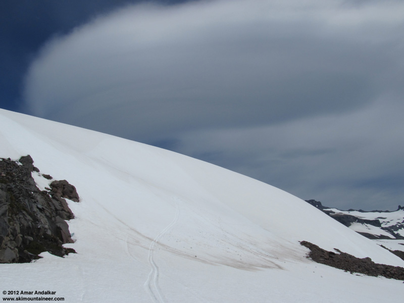
The steep slope that wasn't worth skinning, with lee wave cloud above.
It was now well after 11am, the weather was still mostly sunny and beautiful, and I was finally making swift progress towards Muir. But soon the wispy tendrils of an incipient lenticular cloud began to embrace the upper mountain, joining the lee wave cloud still persisting to the east.
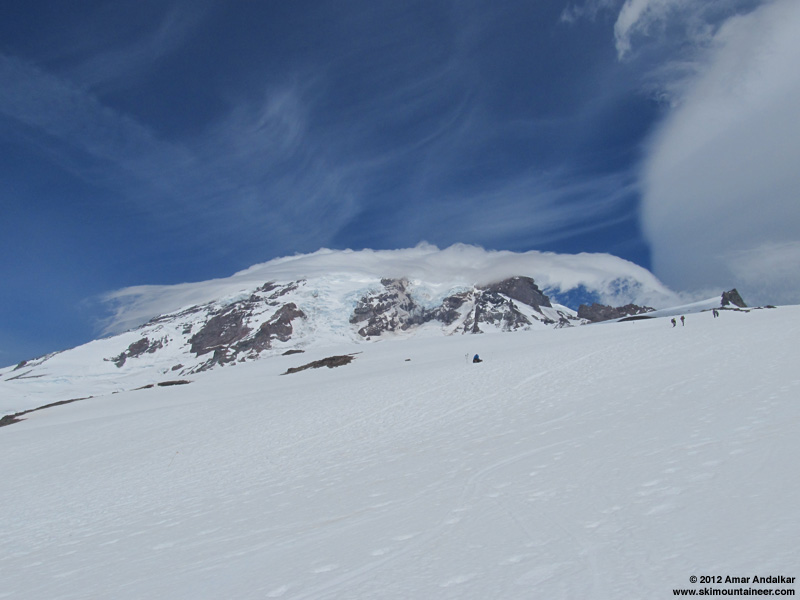
Incipient lenticular at 11:40am, with lee wave cloud still present at right.
By noon, the upper Mountain above 12000 ft had vanished into the cloud, and it grew more ominous and menacing by the minute, while other building high clouds cast the Muir Snowfield into shadow. Above 9000 ft, a gusty SW wind was often hitting 30-40 mph, although temps were well above freezing and there were still a few sun breaks as the clouds streamed past the Mountain. So it was not particularly foul weather (yet).
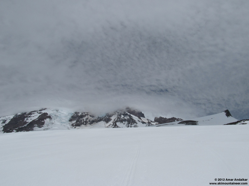
By noon, the summit was lost in the clouds, not to be seen again this day.
Arrived at Camp Muir just before 1pm, wishing for sure that I had started an hour earlier in the morning. Did a quick changeover out of the strong wind in the lee of the RMI shack, telemetry from the anemometer mounted on the far end of this same building showed winds gusting 60-70 mph (see below). Skied down towards Paradise Glacier once again, basically straightlining much of the upper part to maintain speed on the smooth wet snow in the face of a strong angled headwind.
This time, instead of following the standard fall line SE down the glacier, I aimed south and stayed close to the west edge of the glacier. A flatter and more traversing route, down past McClure Rock and the spot that I had failed to skin up in the morning mush 3 hours earlier. The steep slope slid as expected with a small wet slide as I ski cut across, but it was totally safe and harmless given the swift mobility of bare skis versus the slow vulnerability of climbing the same slope on skins.
Panoramic view (from 4 vertical photos) looking down the snow-ridge gully into Edith Creek Basin.
Back through the upper Edith Creek bowl, a mix of a few nice turns and long angling schusses, then down into the fun snow-ridge gully. Stable oversoftened corn on all that, fun skiing and no slides. Then a fairly quick exit angling down and traversing around Edith Creek Basin, back to the car at Paradise before 2pm.
Glad to have squeezed in a second day of skiing just as the weather window definitively slammed shut. A few raindrops hit the windshield on the drive home to Seattle, and webcams showed rain by evening at the Paradise parking lot.
[hr][tt]MOUNT RAINIER RECREATIONAL FORECAST
NATIONAL WEATHER SERVICE SEATTLE WA
335 AM PDT WED JUN 27 2012
SYNOPSIS...WEAK HIGH PRESSURE WILL PRODUCE DRY AND WARMER WEATHER TODAY. A WEAKENING WEATHER SYSTEM WILL ARRIVE LATE THURSDAY INTO FRIDAY MORNING. THE WEEKEND WILL REMAIN UNSETTLED WITH AN UPPER LEVEL TROUGH OFF THE COAST.
WEDNESDAY...MOSTLY SUNNY. FREEZING LEVEL 9000 FEET.
WEDNESDAY NIGHT...PARTLY CLOUDY. FREEZING LEVEL 10500 FEET.
THURSDAY...MOSTLY SUNNY IN THE MORNING...THEN MOSTLY CLOUDY WITH A CHANCE OF RAIN AND SNOW LATE IN THE AFTERNOON. SNOW LEVEL 9500 FEET.
THURSDAY NIGHT...MOSTLY CLOUDY WITH A CHANCE OF RAIN AND SNOW. SNOW LEVEL 9500 FEET.
FRIDAY...MOSTLY CLOUDY WITH SCATTERED SHOWERS. SNOW LEVEL 9500 FEET.
FRIDAY NIGHT THROUGH TUESDAY...MOSTLY CLOUDY WITH A CHANCE OF SHOWERS. SNOW LEVEL NEAR 9000 FEET.
TEMPERATURE AND WIND FORECASTS FOR SELECTED LOCATIONS.
            WED  WED  THU  THU  FRIÂ
              NIGHT     NIGHT   Â
SUMMITÂ Â (14411 FT)Â Â Â 20Â Â Â 16Â Â Â 20Â Â Â 16Â Â Â 20
           SW 30 SW 40 SW 45 SW 35 SW 30
CAMP MUIR(10188 FT)Â Â Â 36Â Â Â 32Â Â Â 36Â Â Â 32Â Â Â 34
           S 20 SW 30  S 35  W 25 SW 20
PARADISEÂ (5420 FT)Â Â Â 60Â Â Â 41Â Â Â 63Â Â Â 41Â Â Â 58
           CALM  W 10  W 10  W 10  W 5
LONGMIREÂ (2700 FT)Â Â Â 70Â Â Â 46Â Â Â 71Â Â Â 47Â Â Â 65
           CALM  CALM  CALM  CALM  CALM
++ TEMPERATURES AND WIND FOR THE SUMMIT AND CAMP MUIR ARE AVERAGE
  CONDITIONS EXPECTED IN THE FREE AIR AT THOSE ELEVATIONS.
++ TEMPERATURES FOR PARADISE AND LONGMIRE ARE THE EXPECTED HIGHS AND
  LOWS. WIND IS THE AVERAGE WIND EXPECTED DURING THAT PERIOD.
Northwest Weather and Avalanche Center
Camp Muir, Mt Rainier National Park, Washington
Wind gages unheated and may rime
ATRH sensor replaced and working--0800_6-28-12
 MM/DD  Hour  Temp   RH  Wind  Wind  Wind  Wind Solar
      PST   F   %  Min  Avg  Max  Dir  W/m2
        10110' 10110' 10110' 10110' 10110' 10110' 10110'
---------------------------------------------------------------
  6 27  500   24   45   10   14   20  249   28
  6 27  600   25   17   11   17   23  246  154
  6 27  700   26   13   10   16   23  259  336
  6 27  800   28   44   15   19   24  243  540
  6 27  900   31   12   19   26   30  240  739
  6 27  1000   34   44   25   29   32  233  908
  6 27  1100   37   12   27   30   35  244  1014
  6 27  1200   39   9   23   29   32  234  1073
  6 27  1300   34   7   0   11   21  262  1072
  6 27  1400   39   8   0   23   29  248  1055
  6 27  1500   41   8   19   22   27  252  958
  6 27  1600   40   8   20   24   28  231  752 ---- at Muir, 5pm PDT
  6 27  1700   39   42   22   27   33  244  603
  6 27  1800   37   7   20   28   34  244  315
  6 27  1900   34   37   22   28   39  250   58
  6 27  2000   34   36   28   36   43  240   25
  6 27  2100   34   38   33   40   49  248   1
  6 27  2200   34   39   30   43   52  253   0
  6 27  2300   35   12   30   50   61  252   0
  6 28   0   35   47   34   48   60  255   0
  6 28  100   34   19   31   53   63  245   0
  6 28  200   34   46   30   49   58  249   0
  6 28  300   35   12   41   53   61  248   0
  6 28  400   35   40   41   51   59  251   0
---------------------------------------------------------------
  6 28  500   36   10   33   44   51  253   16
  6 28  600   32   11   34   40   48  234   31
  6 28  700
  6 28  800   34   39   0   48   56  245  140
  6 28  900   34   40   38   47   57  251  675
  6 28  1000   35   44   40   51   62  248  960
  6 28  1100   35   74   47   55   70  241  1037
  6 28  1200   34   94   30   52   62  249  573 ---- at Muir, 1pm PDT
  6 28  1300   33  100   34   47   55  243  399
  6 28  1400   33  100   41   52   62  244  251
  6 28  1500   33   64   41   54   67  243  195
  6 28  1600   33   58   44   56   69  245  408
  6 28  1700   31   69   37   57   65  249  167
  6 28  1800   30   97   42   62   79  261  111
  6 28  1900   30  100   55   68   80  265   27
  6 28  2000   31  100   36   56   78  265   11
  6 28  2100   31  100   24   38   48  265   1
  6 28  2200   32  100   15   28   41  265   0
  6 28  2300   33  100   15   26   34  265   0
  6 29   0   34  100   21   30   44  265   0
  6 29  100   34  100   28   37   48  246   0
  6 29  200   34  100   27   40   50  251   0
  6 29  300   34  100   27   42   56  252   0
  6 29  400   35   93   19   42   59  242   0
---------------------------------------------------------------
[/tt]
Got a late start from home Wednesday morning, and took the scenic route to Paradise via Cayuse Pass, a side trip to Chinook Pass (still 5-10 ft of roadside snow, saw several skiers), Stevens Canyon Road (annoying this summer, long construction delays of 20-30 minutes), and the mostly-frozen Reflection Lakes.
Overview of Muir Snowfield and Paradise Glacier from Stevens Canyon Road.
The main Paradise parking lot was "full" (although about 1/3 of the spots were blocked off by cones) and the Paradise Valley Road was frustratingly closed, so I was forced to park in the old visitor center lot. Skinned up after 1:30pm starting at the top of the stairs only a few yards from the car. Followed a faint skin track up Pan Face on all snow except a few yards of bare trail at the top (no vegetation stomping needed). Going around to the right, snow remained continuous to Pebble Creek except for another short discontinuity in the usual bare spot near 7000 ft, also easily crossed on skins across bare rock and dirt. The only all-snow skinning routes from Paradise to Muir are now apparently via Edith Creek Basin and Paradise Glacier.
Crossed an unusual channel eroded into the snowpack at Pebble Creek, with traces of new snow here at 7200 ft. There were increasing amounts of recent new snow above that, about 1-2" near 8000 ft growing to 6+" above 9000 ft. By mid-afternoon on this sunny day, the snow from 7000-8000 ft was corn especially where the new snow had not stuck, then a thin layer of new proto-corn above 8000 ft, but above 9000 ft it was just dense, somewhat damp, windpacked powder, not even pre-proto-corn yet. Tried to follow portions of a previous skin track, but found that I had better traction and less glopping if I just broke my own trail.
Reached Camp Muir just before 5pm in a moderate SW breeze, checked for any news at the climbing ranger hut, and then skied down, angling left towards Anvil Rock and Paradise Glacier. Dense windpacked powder up high, but transitioning to re-firming proto-corn and corn on the steep face beside Anvil and on the Paradise Glacier. Followed the standard SE-trending fall line towards Cowlitz Rocks, the bergschrund near 9000 ft is partially open and big crevasse near 8000 ft is also starting to show itself.
Excellent smooth fast snow conditions at 5:30pm, with only a single skin track and ski track from earlier in the day (plus faint traces of older ski tracks) on the entire expanse of the glacier. Lots of ice worms out on the glacier surface. Smooth snow, solitude, and lovely evening light.
Descended and traversed through the basin of the former lower Paradise Glacier and down the rightmost gully (which as expected had a scary hole in the snowpack near a small waterfall) to the Skyline Trail bridge at 6000 ft, which is just starting to melt out of the snow.
Since my car was way over at the far end of the Paradise lots, I decided to skin back up roughly along the trail's route past Golden Gate and up to the top of Panorama Point at 7000 ft, which would give me a nice fall-line descent back to the car. It was a route which I'd never skinned before, and had the unexpected bonus of spying a very interesting gully, descending through the cliffs near 6400 ft into Edith Creek Basin and filled with an unusual sharp snow ridge, curving in a vertical arc up the gully beside a small waterfall. A few recent ski tracks marked this spot, which somehow I had never skied before (or don't recall if I have). Perhaps a ski route for the next day?
Panoramic view of the upper Edith Creek drainage above Golden Gate.
Skinned up mushy semi-consolidated snow in the upper Edith Creek drainage, and arrived leisurely above Pan Point around 7:30pm. A quick cruise down the SW ridge of Pan Point, some tight turns down the short steep south face, and then a long schuss out via Deadhorse Creek Trail back to the car. Snow conditions were nice and quick in the late evening, especially by staying on shaded slopes.
Spent the evening sightseeing in the moonlight and hanging out at Paradise Inn. By 11pm, a lenticular cloud was building on the summit, and by midnight it had grown large enough to engulf the uppermost mountain. But by dawn at 5am, the lenticular was gone, although soon an immense lee wave cloud (several times the diameter of the mountain) was building just above and east of the summit, blocking the morning sunshine from the Muir Snowfield and Paradise Glacier.
Panoramic view of the immense lee wave cloud east of the summit of Rainier.
With clear skies overnight outside the lenticular, I expected a hard freeze of the snowpack, and delayed softening in the morning due to the lee wave cloud. So a very leisurely start had me skinning from Paradise (the main lot) towards Edith Creek Basin just before 9am, perhaps an hour later than I really wanted. Arrived at 6200 ft at the base of the gully that I had spied the previous evening, and decided to try to skin up that instead of the usual trail slope to Golden Gate. Luckily the sun had been on the very steep snow ridge in the gully (SE aspect) for at least an hour, and it was well-softened enough to be skinnable but not to slide, although I did sidestep about 10 vertical feet of the steepest part. Sketchy almost-extreme skinning up a scenic route, fun!
The snow-ridge gully, it's much steeper than it looks here.
Above the gully, the upper Edith Creek drainage is a broad open bowl, and I angled NE towards the edge of Paradise Glacier just right of McClure Rock. Easily skinnable most of the way, but then the crux steep slope at 7200 ft was another story. About 35-40 degrees steep, with deep oversoftened mush on this SE aspect at 10:30am, sliding out unpredictably, slow and frustrating. This was not extreme skinning, it was a potential wet slide accident about to happen. Not worth the risk, so I carefully switched over, skied across out of the hazard and down about a hundred ft, then did a rising traverse to rejoin the standard route to Muir heading for Pebble Creek near 7100 ft.
The steep slope that wasn't worth skinning, with lee wave cloud above.
It was now well after 11am, the weather was still mostly sunny and beautiful, and I was finally making swift progress towards Muir. But soon the wispy tendrils of an incipient lenticular cloud began to embrace the upper mountain, joining the lee wave cloud still persisting to the east.
Incipient lenticular at 11:40am, with lee wave cloud still present at right.
By noon, the upper Mountain above 12000 ft had vanished into the cloud, and it grew more ominous and menacing by the minute, while other building high clouds cast the Muir Snowfield into shadow. Above 9000 ft, a gusty SW wind was often hitting 30-40 mph, although temps were well above freezing and there were still a few sun breaks as the clouds streamed past the Mountain. So it was not particularly foul weather (yet).
By noon, the summit was lost in the clouds, not to be seen again this day.
Arrived at Camp Muir just before 1pm, wishing for sure that I had started an hour earlier in the morning. Did a quick changeover out of the strong wind in the lee of the RMI shack, telemetry from the anemometer mounted on the far end of this same building showed winds gusting 60-70 mph (see below). Skied down towards Paradise Glacier once again, basically straightlining much of the upper part to maintain speed on the smooth wet snow in the face of a strong angled headwind.
This time, instead of following the standard fall line SE down the glacier, I aimed south and stayed close to the west edge of the glacier. A flatter and more traversing route, down past McClure Rock and the spot that I had failed to skin up in the morning mush 3 hours earlier. The steep slope slid as expected with a small wet slide as I ski cut across, but it was totally safe and harmless given the swift mobility of bare skis versus the slow vulnerability of climbing the same slope on skins.
Panoramic view (from 4 vertical photos) looking down the snow-ridge gully into Edith Creek Basin.
Back through the upper Edith Creek bowl, a mix of a few nice turns and long angling schusses, then down into the fun snow-ridge gully. Stable oversoftened corn on all that, fun skiing and no slides. Then a fairly quick exit angling down and traversing around Edith Creek Basin, back to the car at Paradise before 2pm.
Glad to have squeezed in a second day of skiing just as the weather window definitively slammed shut. A few raindrops hit the windshield on the drive home to Seattle, and webcams showed rain by evening at the Paradise parking lot.
[hr][tt]MOUNT RAINIER RECREATIONAL FORECAST
NATIONAL WEATHER SERVICE SEATTLE WA
335 AM PDT WED JUN 27 2012
SYNOPSIS...WEAK HIGH PRESSURE WILL PRODUCE DRY AND WARMER WEATHER TODAY. A WEAKENING WEATHER SYSTEM WILL ARRIVE LATE THURSDAY INTO FRIDAY MORNING. THE WEEKEND WILL REMAIN UNSETTLED WITH AN UPPER LEVEL TROUGH OFF THE COAST.
WEDNESDAY...MOSTLY SUNNY. FREEZING LEVEL 9000 FEET.
WEDNESDAY NIGHT...PARTLY CLOUDY. FREEZING LEVEL 10500 FEET.
THURSDAY...MOSTLY SUNNY IN THE MORNING...THEN MOSTLY CLOUDY WITH A CHANCE OF RAIN AND SNOW LATE IN THE AFTERNOON. SNOW LEVEL 9500 FEET.
THURSDAY NIGHT...MOSTLY CLOUDY WITH A CHANCE OF RAIN AND SNOW. SNOW LEVEL 9500 FEET.
FRIDAY...MOSTLY CLOUDY WITH SCATTERED SHOWERS. SNOW LEVEL 9500 FEET.
FRIDAY NIGHT THROUGH TUESDAY...MOSTLY CLOUDY WITH A CHANCE OF SHOWERS. SNOW LEVEL NEAR 9000 FEET.
TEMPERATURE AND WIND FORECASTS FOR SELECTED LOCATIONS.
            WED  WED  THU  THU  FRIÂ
              NIGHT     NIGHT   Â
SUMMITÂ Â (14411 FT)Â Â Â 20Â Â Â 16Â Â Â 20Â Â Â 16Â Â Â 20
           SW 30 SW 40 SW 45 SW 35 SW 30
CAMP MUIR(10188 FT)Â Â Â 36Â Â Â 32Â Â Â 36Â Â Â 32Â Â Â 34
           S 20 SW 30  S 35  W 25 SW 20
PARADISEÂ (5420 FT)Â Â Â 60Â Â Â 41Â Â Â 63Â Â Â 41Â Â Â 58
           CALM  W 10  W 10  W 10  W 5
LONGMIREÂ (2700 FT)Â Â Â 70Â Â Â 46Â Â Â 71Â Â Â 47Â Â Â 65
           CALM  CALM  CALM  CALM  CALM
++ TEMPERATURES AND WIND FOR THE SUMMIT AND CAMP MUIR ARE AVERAGE
  CONDITIONS EXPECTED IN THE FREE AIR AT THOSE ELEVATIONS.
++ TEMPERATURES FOR PARADISE AND LONGMIRE ARE THE EXPECTED HIGHS AND
  LOWS. WIND IS THE AVERAGE WIND EXPECTED DURING THAT PERIOD.
Northwest Weather and Avalanche Center
Camp Muir, Mt Rainier National Park, Washington
Wind gages unheated and may rime
ATRH sensor replaced and working--0800_6-28-12
 MM/DD  Hour  Temp   RH  Wind  Wind  Wind  Wind Solar
      PST   F   %  Min  Avg  Max  Dir  W/m2
        10110' 10110' 10110' 10110' 10110' 10110' 10110'
---------------------------------------------------------------
  6 27  500   24   45   10   14   20  249   28
  6 27  600   25   17   11   17   23  246  154
  6 27  700   26   13   10   16   23  259  336
  6 27  800   28   44   15   19   24  243  540
  6 27  900   31   12   19   26   30  240  739
  6 27  1000   34   44   25   29   32  233  908
  6 27  1100   37   12   27   30   35  244  1014
  6 27  1200   39   9   23   29   32  234  1073
  6 27  1300   34   7   0   11   21  262  1072
  6 27  1400   39   8   0   23   29  248  1055
  6 27  1500   41   8   19   22   27  252  958
  6 27  1600   40   8   20   24   28  231  752 ---- at Muir, 5pm PDT
  6 27  1700   39   42   22   27   33  244  603
  6 27  1800   37   7   20   28   34  244  315
  6 27  1900   34   37   22   28   39  250   58
  6 27  2000   34   36   28   36   43  240   25
  6 27  2100   34   38   33   40   49  248   1
  6 27  2200   34   39   30   43   52  253   0
  6 27  2300   35   12   30   50   61  252   0
  6 28   0   35   47   34   48   60  255   0
  6 28  100   34   19   31   53   63  245   0
  6 28  200   34   46   30   49   58  249   0
  6 28  300   35   12   41   53   61  248   0
  6 28  400   35   40   41   51   59  251   0
---------------------------------------------------------------
  6 28  500   36   10   33   44   51  253   16
  6 28  600   32   11   34   40   48  234   31
  6 28  700
  6 28  800   34   39   0   48   56  245  140
  6 28  900   34   40   38   47   57  251  675
  6 28  1000   35   44   40   51   62  248  960
  6 28  1100   35   74   47   55   70  241  1037
  6 28  1200   34   94   30   52   62  249  573 ---- at Muir, 1pm PDT
  6 28  1300   33  100   34   47   55  243  399
  6 28  1400   33  100   41   52   62  244  251
  6 28  1500   33   64   41   54   67  243  195
  6 28  1600   33   58   44   56   69  245  408
  6 28  1700   31   69   37   57   65  249  167
  6 28  1800   30   97   42   62   79  261  111
  6 28  1900   30  100   55   68   80  265   27
  6 28  2000   31  100   36   56   78  265   11
  6 28  2100   31  100   24   38   48  265   1
  6 28  2200   32  100   15   28   41  265   0
  6 28  2300   33  100   15   26   34  265   0
  6 29   0   34  100   21   30   44  265   0
  6 29  100   34  100   28   37   48  246   0
  6 29  200   34  100   27   40   50  251   0
  6 29  300   34  100   27   42   56  252   0
  6 29  400   35   93   19   42   59  242   0
---------------------------------------------------------------
[/tt]
Thanks for sharing. I was on Interglacier on the 28th and was wondering what the weather was doing at Muir. We watched the clouds rip over Rainier from the south. In under a minute the the top 4000 feet of Rainier went from blue skies to complete whiteout.
Amar
Thanks for taking a picture of my tracks......and where I skied that day it was memorable one besides the extra walk on the road from the Jackson Center to Mazama Ridge area. I was concerned about crevasses so I traveled up the way I descended.
Thanks for taking a picture of my tracks......and where I skied that day it was memorable one besides the extra walk on the road from the Jackson Center to Mazama Ridge area. I was concerned about crevasses so I traveled up the way I descended.
Reply to this TR
Please login first: