May 13, 2012, Mt Arriva west face
Mt Arriva's west face, photos courtesy of John Scurlock: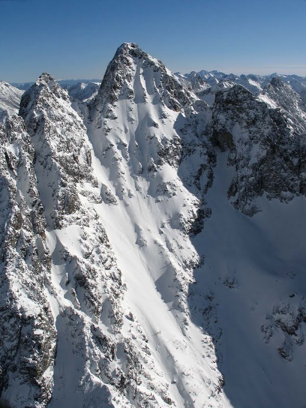
On May 13th, Chad and Eric Miller and I skied this appealing 3,000' line in typically mixed spring conditions. Approached the morning before via Easy Pass and Fisher Creek, leaving plenty of time for relaxing and a short tour. We left our bivy maybe a ¼ mile short of the west face's outlet* at 4:30a, and were on the summit at around 7:30a. Perhaps unnecessarily early, but for a couple good reasons we didn't want to be climbing in the potentially active late morning hours. Fireworks were disappointingly (?) muted, however, with maybe one significant echo of slide/rockfall activity during our 4+ hours of summit lounging (waiting for the west face to soften). An excellent place to wait!
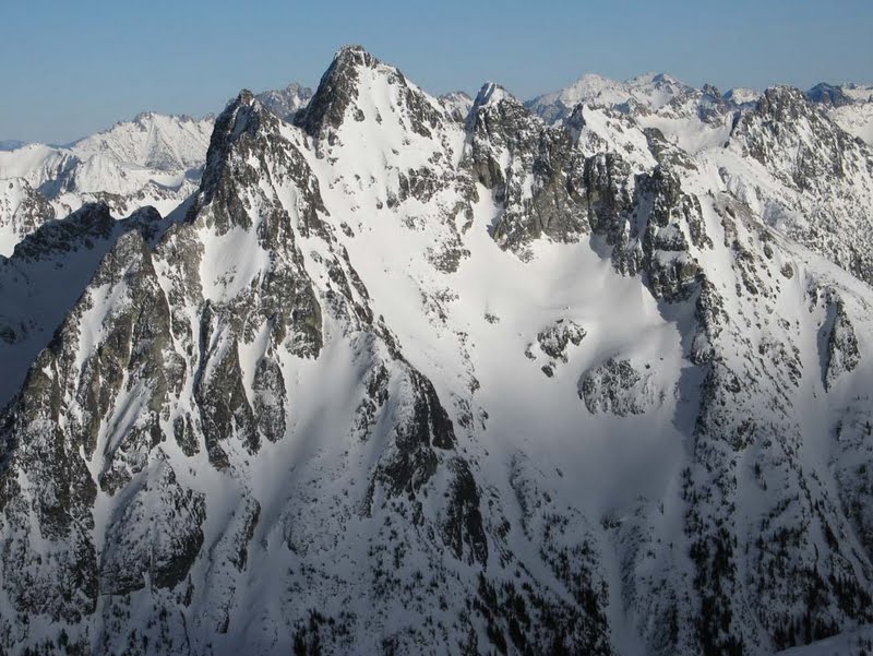
Mt Logan, Buckner left background
Mt Goode, Storm King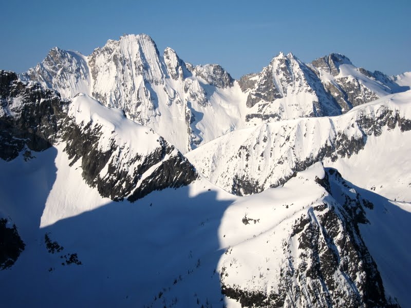
We had to down-climb the top strip of snow shown in Scurlock's 2nd photo; maybe only a couple weeks ago this could've been skied. Around 100' below the summit we put on the skis. The descent began steeply on firm snow, then on corny snow in the mid-section, and required quick feet at the lower choke and through the softening avy debris--overall a pleasant mix of exhilarating, on-your-toes challenging and uneventful skiing. 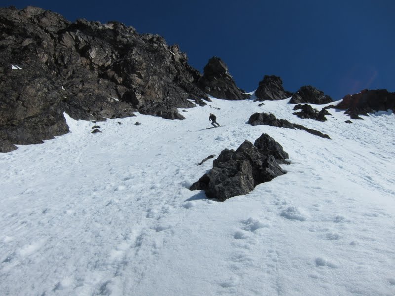
Didn't take as many pics as usual, once we began skiing we didn't pause much (perhaps it was that NWAC warning in the back of our heads?).
Posted a few more pics here. (One photo includes a coyote/wolf feral dog that sniffed around Easy Pass on our way in; it had a tag hanging off its collar, but did not behave like a domestic dog--anybody up at Easy Pass have a dog precede you by 30 minutes or so? weird.)
An incredible place to spend a weekend; however, with the approach reckoned and less foreboding conditions (the Great Warm-Up of 2012!), I'd recommend blasting this in a push, or mixing in a number of excellent tours in the area (this site has some; Lowell's site lists a few options; and I spotted other attractive tours). Love skiing off the North Cascades Highway, even in May conditions; wish the state would let folks access these lower areas earlier in a practical manner while they finish clearing the thornier high passes.
*I'd say we were maybe 1 mile up the south fork of Fisher Creek, as this tributary drains into the Fisher Cr that eventually flows into Thunder Cr, but there's another Fisher Cr to the south that flows the opposite direction to Grizzly Cr. Confusing?
Yeah Kyle, it's an enticingly close objective and I was surprised that there were no reported descents (or ascents, for that matter) of that face. Maybe Lowell or someone else here has heard tale?
author=hedonaut link=topic=24789.msg104776#msg104776 date=1337130836]
Yeah Kyle, it's an enticingly close objective and I was surprised that there were no reported descents (or ascents, for that matter) of that face. Maybe Lowell or someone else here has heard tale?
I'm not aware of previous ascents or descents. I don't think people have been aware of it as a potential ski line for very long--only since Scurlock's pictures have become available.
Reply to this TR
Please login first: