3-1 Mt. Catherine Sufferfest
3/15/12
WA Snoqualmie Pass
6418
10
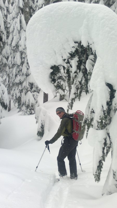
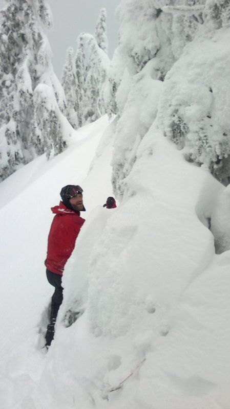
Dave Coombs, Chad and I left the Hyak Parking lot about 9:30. At 7:30, we glided to a stop to gratefully climb out of our smoking ski boots.
Lowlights:
- Breaking trail continuously after the Hyak escalator.
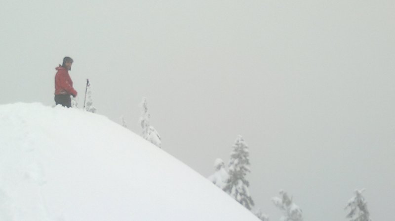
- Experiencing Catherine's multiple summits.
- Multiples of "I'll go down a ways and look" and "Does it go?" and "I can't tell, but it looks cliffy" and "Let's climb back up."
- Transitioning about 20 times.
- Skiing back down the West Ridge - the consolation prize.
- Getting nearly creeked out. Climbing out of the creek.
- The Nordic trails all look different in the dark.
- Being put in the basement of the Doghouse by my wife. Even the dog didn't want me around.
Highlights:
- Great snow on the way down, but too short.
- Skiing wonderful silky snow on the Hyak face, in the dark!
- Drinking a beer and a quart of Gatorade in North Bend.
- Good companions, Dave and Chad were strong trail breakers.
- Great attitudes, and Living to ski another day.
PM me if anyone is willing to show me a safe way to ski down. But only if you also promise to show me the short way up. I'm beat!
Lowlights:
- Breaking trail continuously after the Hyak escalator.
- Experiencing Catherine's multiple summits.
- Multiples of "I'll go down a ways and look" and "Does it go?" and "I can't tell, but it looks cliffy" and "Let's climb back up."
- Transitioning about 20 times.
- Skiing back down the West Ridge - the consolation prize.
- Getting nearly creeked out. Climbing out of the creek.
- The Nordic trails all look different in the dark.
- Being put in the basement of the Doghouse by my wife. Even the dog didn't want me around.
Highlights:
- Great snow on the way down, but too short.
- Skiing wonderful silky snow on the Hyak face, in the dark!
- Drinking a beer and a quart of Gatorade in North Bend.
- Good companions, Dave and Chad were strong trail breakers.
- Great attitudes, and Living to ski another day.
PM me if anyone is willing to show me a safe way to ski down. But only if you also promise to show me the short way up. I'm beat!
Catherine produces. Nate, Kirsten, Anastasia and I had a tour up there many years ago that was dubbed the Catherine Circum-summi-navigation and included the long, long slog, half in skins, half trying to skate, out the nordic trail at the end of the day. I love how much such a close, short peak can pack in.
Now this is a report that is really appreciated.
I've been looking at Mt. Catherine ever since Volken's book came out listing it as a tour. But every time I look at it, whether live, or in Google Earth, the skiable lines just don't seem to be there.
Is there a line worth skiing on this mountain(s).
Also recently noted Google Earth has the same ridge named both Mt. Catherine and Mt. Hyak, with latter on the right of this up is north oriented photo. Are they the same mountain or is this an error in GE (I am open to: "so what, in any case it's just a bump in the woods" as an answer. But really looking for the passionate Mt. Catherine devotee who wants to share her charms:
Oh man, that sounds rough. Its such a great ski when you get it. Don't let this keep you from trying again. When you hit it right it may be one of your go-to's in conditions like we're currently experiencing.
author=JibberD link=topic=23971.msg101442#msg101442 date=1330719011]
But really looking for the passionate Mt. Catherine devotee who wants to share her charms:
Check out the report from from last weekend. It seemed like it was good.
author=Rusty Knees link=topic=23971.msg101435#msg101435 date=1330714289]I can do half of that:
PM me if anyone is willing to show me a safe way to ski down. But only if you also promise to show me the short way up.
1. There are some really nice lines in big well-spaced old growth (Silver Fir, I think) on the N side of the mountain. I've run into numerous TAYers up there, e.g., GregL, md2020 and Brenda.
2. There is no short way up ;D but it's really not that bad
Here's a shot of my typical route. You can take Central or Hyak up, but I prefer Hyak. The key is to cross the river on the nordic trail (hard skier's right when descending the backside of Hyak). Ascend a clearcut area of shrubs and trees, then enter the old growth. There is a major cliff band about halfway up, but that's partly what makes Catherine so good (steep, protected tree skiing). Circumnavigate the cliff band or choose one of the many chutes that cut through it. Pretty fun 1 hour laps once the track is set and you figure it out.
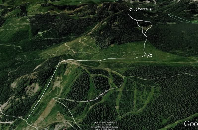
There are a number of nice ski lines that look improbable from above, (hint: most of them are breaks in the cliff band and require decent snow coverage). Some of them are visible from below as you detour out to the ridge on the normal ascent route. Most of these are too steep to skin comfortably, so almost everyone ascends by way of the west ridge.
Nice to meet you in the parking lot. It sounds like you guys got pretty turned around out there. The only time I went out there we took a non-ideal route but I can't say that it took 10 hours. (!)
Volken's book describes a reasonable enough route with a nice 1K north treed line. Lots of travel to/from that line but that's kind of what you'd expect with a mountain set back a ways from plowed roads...
Thanks for the TR, Don. Always great to have an epic trip with most of it within sight and sound of I-90. I hope you are working on your home chores now, trying to rebuild that stack of chips.
Reply to this TR
Please login first: