2-19-12 Lookout Mountain near Mt Hood
2/19/12
OR Mt Hood
5056
8
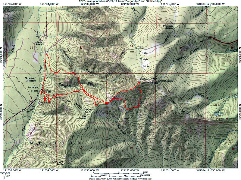
The trip started out at 8:45am from a spur road 5/8 mile north of the Gumjuwac trail head heading SE with Wayne (aka Koda) and myself. The attached map shows the approximate line of ascent and descent traveling in a clockwise direction. At 4000' we left the top of a small clear cut and began and eastward bushwack on thin snow pack with about 4-6" of soft fresh on top. Much dead fall littered the route, and the debate began regarding route selection, but both agreed that we were out for adventure, and this fit the bill. Rounding north of a pinnacle capped butte we dropped down through a tight saddle into Hellroaring creek, and executed a treacherous crossing. From this point the route eased, and in a few minutes we were into a large clear cut that would take us up to the ridge to the SW of Lookout. By this time it was noon, as the bushwack had consumed much time, and we were beginning to temper our goals of skiing a pitch to the west of high praire, and focus on Lookout itself, and our return route. After a quick lunch the final climb began, and by ~2pm we were on the summit ridge, skipping the true summit as it didn't have the down line we were interested in. The ski down the south aspect was better than expected with excellent glades, trees, gullies, about as varied of terrain as i have skied in the hood area. Snow quality remained good all day with no significant warming, and very good stability. Nicely bonded to the rain crust, with very little wind effect. Propagation was nil. We both would have liked another lap, but time was running short, so we started our westerly traverse back to the ridge. At this point we were back at the top of the large clear cut with about 750' of vert, so the decision was made to down ski this slope, and take a contour traverse w/sw to the Gumjuwac trail for the remainder of our escape. Simple, right.... This bushwhack made the mornings route seem like child's play, as it traversed a very steep cross slope, and involved the worst stream crossing i have encountered. We finally reached the trail at ~5pm, and descended as night was falling, hitting the trail head without the need for headlamps, and booted the remaining 5/8 mile east on hwy 35 to the jeep. A very satisfying trip leaving us both weary and in need of food and beer.
Excellent summary Ron, I'll have to add that while I've scoured the map for a direct route to Lookout from the hwy I'll pass on anything other than the Gumjuwac trail until we get a winter with a much deeper snowpack in lower elevations. The intense bushwhacking otherwise not worth it, and I think I added a few new profanities to my vocabulary at times, especially that traverse out.
I loved the adventure and routefinding though, and the ski terrain up there excites me despite its aspect.... I'm excited I got a taste of it in the right conditions, one of the longer ski descents I've encountered below timberline on Mt Hood.
A few pics to add to the thread
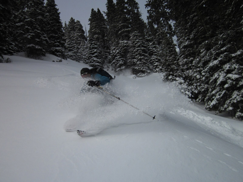
near the top with eastern Oregon in the distance

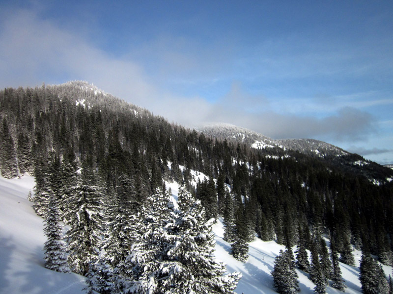
view from clearcut

Ron leading the way home...

I loved the adventure and routefinding though, and the ski terrain up there excites me despite its aspect.... I'm excited I got a taste of it in the right conditions, one of the longer ski descents I've encountered below timberline on Mt Hood.
A few pics to add to the thread
near the top with eastern Oregon in the distance
view from clearcut
Ron leading the way home...
Nice work, that's an ambitious trip to do on foot power alone!
Nice work guys! Looking forward to getting back out with you again Ron on another outing soon.......
Ambitious! Way to go.
I was thinking about doing this, but heading up Gumjuwac Trail (my map calls it Lookout Mnt trail) and then doing laps on the clearcut off the saddle down into Hellroaring creek. I guess we would still hit the terrible bushwhack on the way home, but wondering what you think of this approach?
tx
I was thinking about doing this, but heading up Gumjuwac Trail (my map calls it Lookout Mnt trail) and then doing laps on the clearcut off the saddle down into Hellroaring creek. I guess we would still hit the terrible bushwhack on the way home, but wondering what you think of this approach?
tx
author=pabloson link=topic=23801.msg100788#msg100788 date=1329852585]
Ambitious! Way to go.
I was thinking about doing this, but heading up Gumjuwac Trail (my map calls it Lookout Mnt trail) and then doing laps on the clearcut off the saddle down into Hellroaring creek. I guess we would still hit the terrible bushwhack on the way home, but wondering what you think of this approach?
tx
The Lookout Mountain Trail is what I recommend, that last photo I posted is the clearcut you are referring to. Its worth a few laps but I would make the effort to skin back up the clearcut for any exit home via the Lookout Mtn Trail (you are correct about the trail name). I can't recommend any bushwhack route in the Hellroaring canyon unless the snowpack was deep enough to allow tree skiing all the way down to the hwy. Right now its like playing pick up sticks with the intense blowdown but iced over...
I've skied this area twice over the last couple years, both times on a deep snowpack. The first time we simply parked along Hwy 35 where the Hwy crosses Hell Roaring Creek and went straight up the creek drainage. If the snowpack is deep this is a very direct route with very little route finding. Last season we parked at the Pocket Creek Sno-Park and approached via Gunsight Ridge, this route is very easy, but much longer.
Great photos of a great area.
Great photos of a great area.
Thanks for the info.
Looking at Google Earth and Topo it seems like there would be some good turns off the back side too (east side of the ridge).
Looking at Google Earth and Topo it seems like there would be some good turns off the back side too (east side of the ridge).
NICE!!!
Reply to this TR
Please login first: