Sept 23-24, 2011, Black Tusk
9/23/11
2546
2
My legs are still sore as I write this. The story went something like this:
Getting there:
Myself, James, and Kristin left Vancouver Friday night and started the hike to Taylor meadows around 8 pm. Tents were set up and everyone was in bed by 11:30. The trail is very well marked, well maintained, and the stars were shining bright.
The interesting part is when Phil (TAY 'dirtnerd' I think) confirmed Friday night around 5 pm he would be joining us, just the next day. He woke up at 4 am to leave Bellingham and was at our campsite by 8:45 am. Frankly, I was still in bed not expecting him to be early for 9 am on a 7.5 km hike after hours of driving. But there he was, waiting for me to get ready...I got myself together and our quad was off by 10 am. Tusking had begun! Not sure if anyone here knows the folks at MW or OED, but 'tusking' is now a verb.
Stepping back for a second, the route went something like this:
From Rubble Creek parking to Taylor meadows:Length-7.5 km; time-2.5 to 3 hrs; elevation change- 915 metres up.
From Taylor meadows to the Tusk viewpoint: Lengh-7km; time-2 hrs; elevation change-850 metres up.
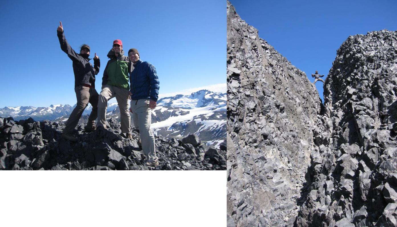
The tusk summit is then another 100 m of scrambling a narrow chimney. I don't climb but this is apparently a class 2 to class 3 scramble (II, III?). Now you're really tusking.
The whole thing ends up being about 30 km roundtrip and 2000 m up, depending on how much you want to ski. Suffice it to say, I won't be doing any TAY joymeter calcs on this one. We had a blast and that's all that matters, right?
The skiing:
The ski run starts off the NE side of the Tusk and is very obvious. It's funny to face Whistler without snow while doing this. The run delivers 200 m of vertical and the snow was pretty good! Radder and radder might be one characterization. Oddly it seemed like there were these lines of snow actually coming up all the way down the run...like the anti-runnel or something. Anyone know what that is called? From the top of the tusk it actually made the run look groomed.
Odd highlight/lowlight: When we got back to the top of the run a group we saw on the tusk before our ski descent said "Yeah it was crazy, there I am standing naked on the tusk and I'm watching people SKI". Highlight: Naked girl watching us ski. Lowlight: summiting the tusk an hour to early. Tuskin'...
Anyway, here are some pictures. I'm not sure about the caption thing so here is the order:
1) Summit pic/scramble pic
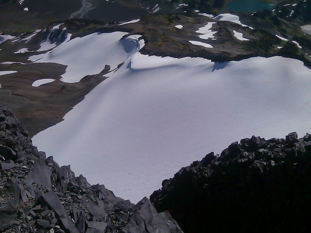
2) The run before we skied it as viewed from the top
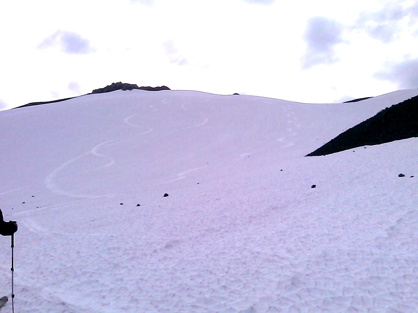
3) The run after we skied it...47 months. Check.
See you all in Oct.
Getting there:
Myself, James, and Kristin left Vancouver Friday night and started the hike to Taylor meadows around 8 pm. Tents were set up and everyone was in bed by 11:30. The trail is very well marked, well maintained, and the stars were shining bright.
The interesting part is when Phil (TAY 'dirtnerd' I think) confirmed Friday night around 5 pm he would be joining us, just the next day. He woke up at 4 am to leave Bellingham and was at our campsite by 8:45 am. Frankly, I was still in bed not expecting him to be early for 9 am on a 7.5 km hike after hours of driving. But there he was, waiting for me to get ready...I got myself together and our quad was off by 10 am. Tusking had begun! Not sure if anyone here knows the folks at MW or OED, but 'tusking' is now a verb.
Stepping back for a second, the route went something like this:
From Rubble Creek parking to Taylor meadows:Length-7.5 km; time-2.5 to 3 hrs; elevation change- 915 metres up.
From Taylor meadows to the Tusk viewpoint: Lengh-7km; time-2 hrs; elevation change-850 metres up.
The tusk summit is then another 100 m of scrambling a narrow chimney. I don't climb but this is apparently a class 2 to class 3 scramble (II, III?). Now you're really tusking.
The whole thing ends up being about 30 km roundtrip and 2000 m up, depending on how much you want to ski. Suffice it to say, I won't be doing any TAY joymeter calcs on this one. We had a blast and that's all that matters, right?
The skiing:
The ski run starts off the NE side of the Tusk and is very obvious. It's funny to face Whistler without snow while doing this. The run delivers 200 m of vertical and the snow was pretty good! Radder and radder might be one characterization. Oddly it seemed like there were these lines of snow actually coming up all the way down the run...like the anti-runnel or something. Anyone know what that is called? From the top of the tusk it actually made the run look groomed.
Odd highlight/lowlight: When we got back to the top of the run a group we saw on the tusk before our ski descent said "Yeah it was crazy, there I am standing naked on the tusk and I'm watching people SKI". Highlight: Naked girl watching us ski. Lowlight: summiting the tusk an hour to early. Tuskin'...
Anyway, here are some pictures. I'm not sure about the caption thing so here is the order:
1) Summit pic/scramble pic
2) The run before we skied it as viewed from the top
3) The run after we skied it...47 months. Check.
See you all in Oct.
Nice work! Lots of work. It used to be that you could drive all the way to the microwave towers. I think that changed in '05. I miss the drive-to skiing in September!!! boo-hoo...
Great trip. thanks again for the invite. still feeling it in my feet
apparently I'm not as good at the km to miles conversion as I thought because i was only expecting about 12 miles instead of 20. Oh well. makes for a better story this way.
tuskin' or perhaps Tuscan. this crossed my mind hauling gear up the hill under the tusk-and-sun (Tuscan[d] sun)
is there a place where i can download Canadian topo maps for free?
something similar to wagda for washington?
I can map out our route with the gps data.....
again, great trip. snow was much better than i expected. way better that artist point last weekend
cant wait for sober october turns. Ryan, good luck with the rest of sober september. stay away from the dale's
-gettin radder and radder brah!!!!!
Reply to this TR
Please login first: