July 2, 2011, Skyscraper Mtn
7/2/11
5101
11
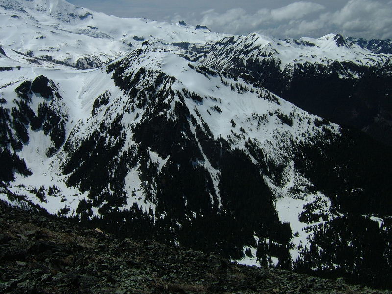
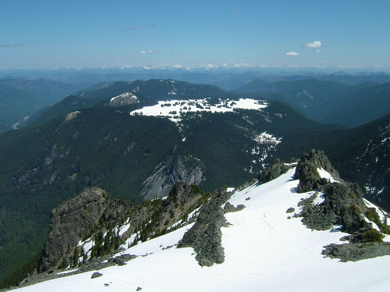
I've wanted to snowboard Skyscraper since hiking it nearly 6 years ago on a cool late September day. Since that time I have seen images of the north face and hatched the plan to go up from the south, over the top, and ride the north face down to the meadows at 5500'. The typical late opening of Sunrise by MRNP has made this plan impossible as too much snow has melted by the time we have been allowed up there. Last spring I decided to take matters into my own hands and approach via FSR 73, Lk Eleanor, and Grand Park. That turned into a fantastic trip up the closer, irresistable slopes of Mt Freemont and a perfect photo-op of the north side of Skycraper covered in snow: http://www.turns-all-year.com/skiing_snowboarding/trip_reports/index.php?topic=16849.0
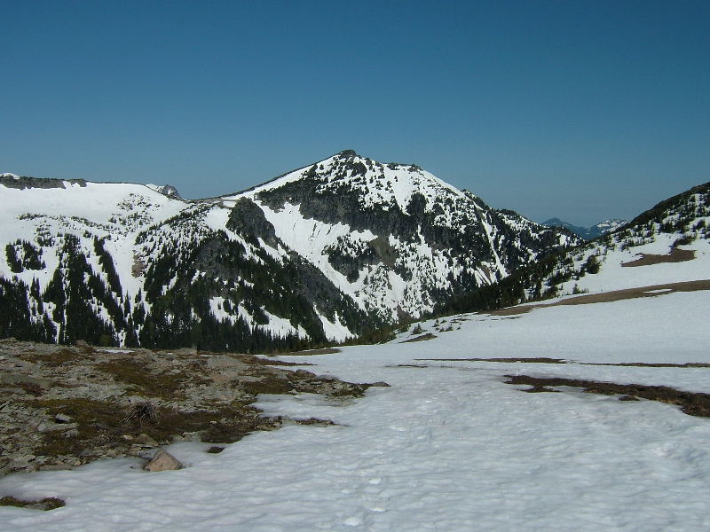
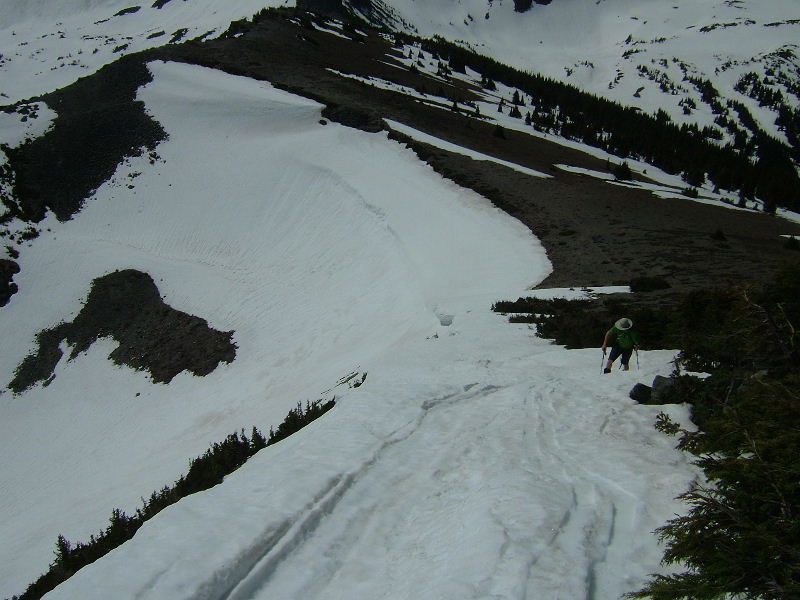
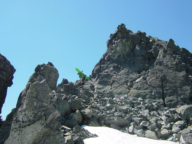
Kudos to the Park for kicking it in gear this season and getting Sunrise open last Friday. Even though it was nearly a month later in the year it seemed a good bet with the deeper snow-pack that the trip could go from Sunrise. Brian and I arrived at 7am for the front parking spot and were off by 7:30. Having never toured from Sunrise before our only mishap of the day was not dropping down from the lodge before heading up, but once corrected we skinned quickly up to Frozen Lk for a short break and look at the objective. My excitement for this tour took a bit of a gut punch as it looked like the snow on the south face of Sky was completely melted off except for what appeared from the distance to be a narrow finger of old cornice snow along the east ridge extending just short of the summit. I started considering Plan B's, but seeing how much snow was on north facing slopes I still felt confident the north side would be good to the bottom, our time was looking good, and though I didn't want to boot up dirt and rock to the summit, it was no more than 500'. We were both in for a big tour/exploration kind of day and just maybe we could skin that finger of snow, so off we went. We were pleasantly surprised how quickly we put another mile behind us as we rode down and across most of Berkely Park, switched back to skins and soon found ourselves a closer look at that sketchy snow finger. We booted a short distance to the bottom of the finger got back on our boards and were able to skin nearly to its end before booting the final pitch to the summit. The summit views are fabulous. Unfortunately, though expected, we still had to down climb a spicey rock section, traverse a small plateau along the north ridge, and hope that from the top of the face it would look good. I began to get a bit nervous thinking how disheartening it was going to be for both of us if the look was bad (rock face, crappy snow, or no snow down to the bottom). I took the look from a perfect, flat launching spot and yelled back to Brian that we hit our promise land for the day 8). After all that work and knowing we had a lot of work to go on the climb out we were anxious to ride our big slope for the day, so we got our boards ready and hit it. Sweet butter turns all the way to the bottom with very little of the suncups or runnels we encountered earlier in the morning. After a nice break in the shade we headed for Lodi Creek, which turned out to be one of the prettiest creeks in the Park, and up Berkely Park. We managed one more nice set of turns off the shoulder of First Burroughs and a short skin back to the Sunrise Zoo ;). Another little nothing of a 7000' WA peak, but one that delivered a great adventure for someone who loves both the planning and execution of an off-beat trip.
First Pic: North slopes from Freemont last year.
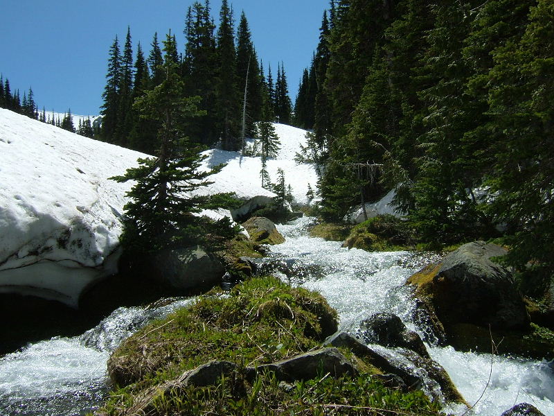
Second Pic: Skyscraper from Frozen Lake.
Third Pic: Brian skinning up the skinny finger.
Kudos to the Park for kicking it in gear this season and getting Sunrise open last Friday. Even though it was nearly a month later in the year it seemed a good bet with the deeper snow-pack that the trip could go from Sunrise. Brian and I arrived at 7am for the front parking spot and were off by 7:30. Having never toured from Sunrise before our only mishap of the day was not dropping down from the lodge before heading up, but once corrected we skinned quickly up to Frozen Lk for a short break and look at the objective. My excitement for this tour took a bit of a gut punch as it looked like the snow on the south face of Sky was completely melted off except for what appeared from the distance to be a narrow finger of old cornice snow along the east ridge extending just short of the summit. I started considering Plan B's, but seeing how much snow was on north facing slopes I still felt confident the north side would be good to the bottom, our time was looking good, and though I didn't want to boot up dirt and rock to the summit, it was no more than 500'. We were both in for a big tour/exploration kind of day and just maybe we could skin that finger of snow, so off we went. We were pleasantly surprised how quickly we put another mile behind us as we rode down and across most of Berkely Park, switched back to skins and soon found ourselves a closer look at that sketchy snow finger. We booted a short distance to the bottom of the finger got back on our boards and were able to skin nearly to its end before booting the final pitch to the summit. The summit views are fabulous. Unfortunately, though expected, we still had to down climb a spicey rock section, traverse a small plateau along the north ridge, and hope that from the top of the face it would look good. I began to get a bit nervous thinking how disheartening it was going to be for both of us if the look was bad (rock face, crappy snow, or no snow down to the bottom). I took the look from a perfect, flat launching spot and yelled back to Brian that we hit our promise land for the day 8). After all that work and knowing we had a lot of work to go on the climb out we were anxious to ride our big slope for the day, so we got our boards ready and hit it. Sweet butter turns all the way to the bottom with very little of the suncups or runnels we encountered earlier in the morning. After a nice break in the shade we headed for Lodi Creek, which turned out to be one of the prettiest creeks in the Park, and up Berkely Park. We managed one more nice set of turns off the shoulder of First Burroughs and a short skin back to the Sunrise Zoo ;). Another little nothing of a 7000' WA peak, but one that delivered a great adventure for someone who loves both the planning and execution of an off-beat trip.
First Pic: North slopes from Freemont last year.
Second Pic: Skyscraper from Frozen Lake.
Third Pic: Brian skinning up the skinny finger.
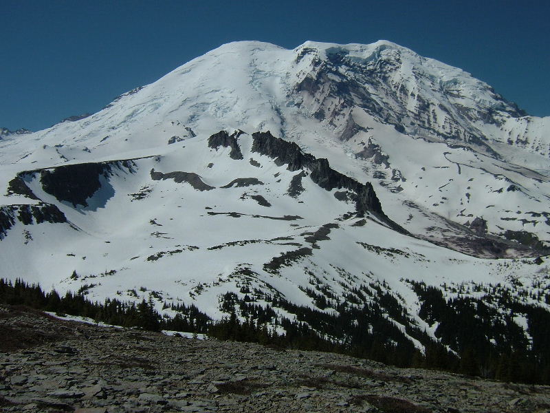
Pic 4: Third Burroughs and Big R.
Pic 5: North ridge to Grand Park.
Pic 6: Little down climb always fun with a board on the back!
Pic 5: North ridge to Grand Park.
Pic 6: Little down climb always fun with a board on the back!
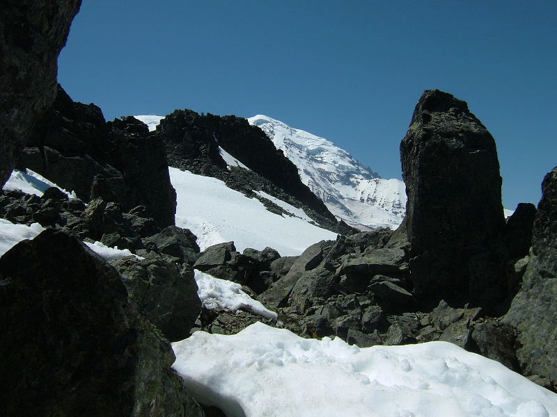
Pic 7: Looking back from our launching zone.
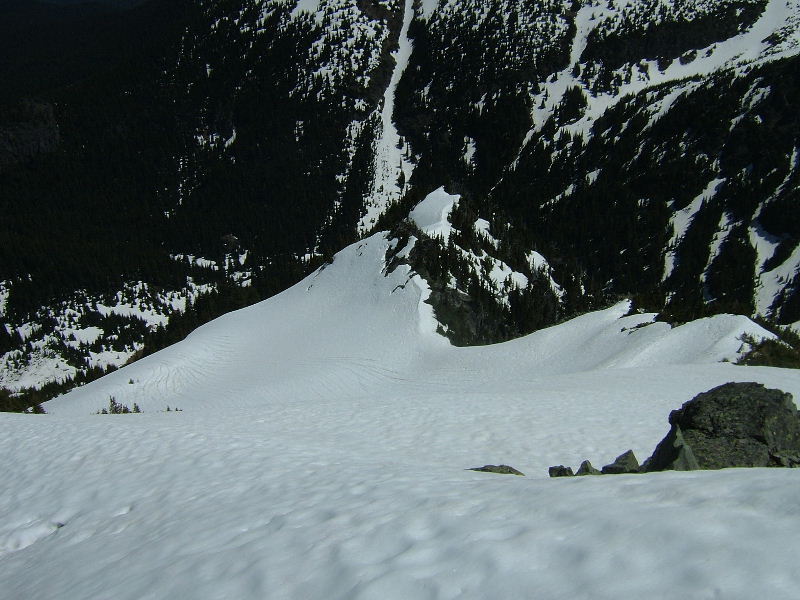
Pic 8: The upper north face/bowl down to the meadow goes.
Pic 9: Beautiful Lodi Creek and the way home.
Twas a beautiful day!
Pic 8: The upper north face/bowl down to the meadow goes.
Pic 9: Beautiful Lodi Creek and the way home.
Twas a beautiful day!
Nice one Boot and Brian.
I've been eying that one for some time. Looking at the many options, but man that is a long way out of the hole once you get down there. It would be cool to see those pictures from the bottom looking back up. Great day of hard work! Always wanted to do that thanks for the beta. Yeah the trip from Eleanor side seems like good idea, maybe if you left a car there and went from Sunrise, Skyscraper to Eleanor?
I've been eying that one for some time. Looking at the many options, but man that is a long way out of the hole once you get down there. It would be cool to see those pictures from the bottom looking back up. Great day of hard work! Always wanted to do that thanks for the beta. Yeah the trip from Eleanor side seems like good idea, maybe if you left a car there and went from Sunrise, Skyscraper to Eleanor?
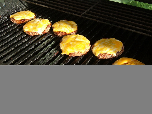
A great day to be in exploring the hills with blue skies and a sustained cool breeze. Glad to have joined you, Boot. By the way, those burgers looked tasty!
Thanks Joe. My only regret was not getting "that picture from the bottom looking back up". By the time we stopped we were under some cliffs and trees and part way around to the east such that you couldn't see anything but our lower tracks. Wish I had hiked out a ways to get that shot. I mapped it out tonight on Natnl Geo Topo and was just over 8 miles RT, so not that way out there and we were back to the car in 8hrs.
I can imagine the canopy being a little thick at the bottom there and just going in one directions in the bearing of Frozen Lake/ Burroughs 2 or such to get out of there.
The route through the forest along Lodi creek was very easy and straight forward affording a little cool shade for a while. We looked for a shelter (one or two seen on different maps), but saw none. Wonder if they have been hit by avalanches in the past and never rebuilt?
We are pondering a trip to Fremont from Sunrise this weekend. Did you happen to notice what the coverage was like on the route to Fremont from Sunrise?
In particular I was wondering what the west side of the south ridge (where the summer trail goes up) looks like?
Any advice you can offer based on your previous experience with Fremont is most welcome ;)
In particular I was wondering what the west side of the south ridge (where the summer trail goes up) looks like?
Any advice you can offer based on your previous experience with Fremont is most welcome ;)
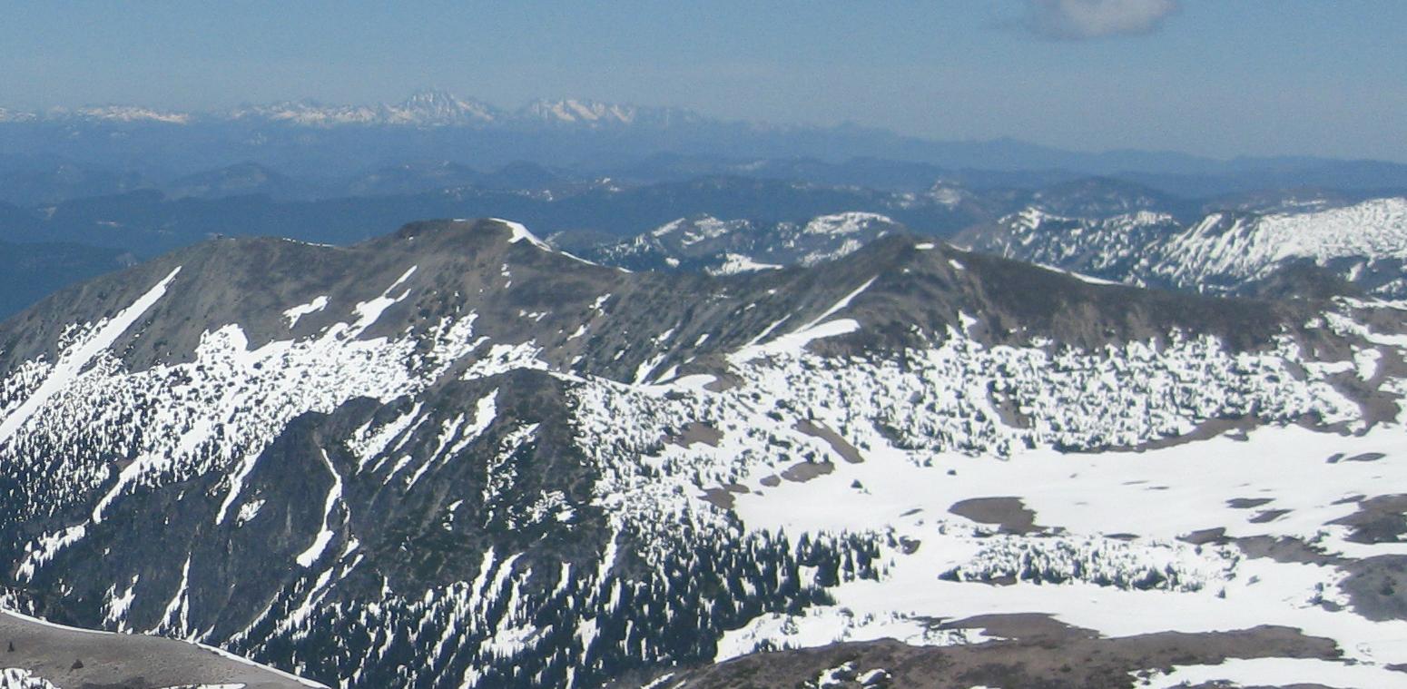
can't say what the West side of Fremont looks like but here's a pic of the East side from last weekend

The west side of the ridge trail from the Lookout all the way back south to Frozen Lake had maybe four short patches of snow on it a week ago. Only one of them looked big enough to still be there this weekend. I presume you are planning a hike and not a ski? As you can see from Altasnob's picture, the best way in there to ski from Sunrise would be into one of the north facing basins and over the east ridge seen in his photo on the left and up to the lookout or the 7291' summit seen on the left.
W side Fremont looked well melted out 4 July already, just one possible finger just below L/O and that one didn't look to touch bottom. Pic is from 4 July.
Reply to this TR
Please login first: