Jan 25-27 Wasatch! Redpine, Dry Creek, Hogum Fork
1/15/11
1720
1
I've been in the Wasatch this week, and spent the past few days exploring west from the White Pine Trailhead in Little Cottonwood. Tuesday I was practicing whiteout navigation in upper Maybird Gulch, and I repeated that tour on Wednesday to see it in full color. The Pfeifferhorn has had my attention for a while now. I had considered spending the night up there, but a city full of food and a warm bed within 15 minutes from the trailhead is hard to pass up.
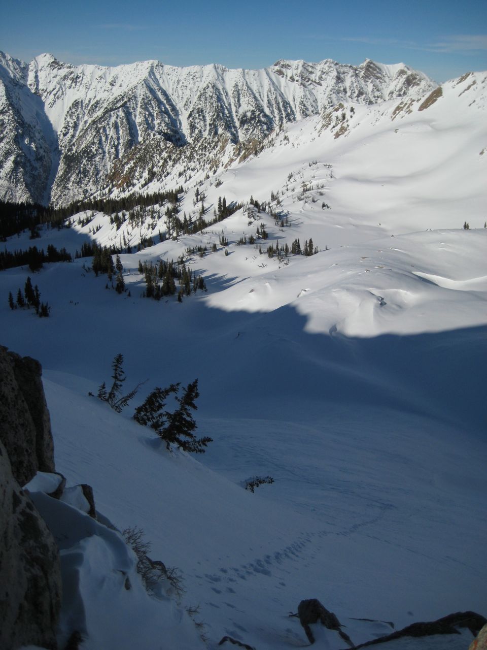
Today I went to spend more time up in the alpine, with the objective of circling the Pfeiff. The climb to Red Pine Lake is moderate (3.7 miles/2500' gain), and the snow is decent and stable in the shady trees between 8-10k'. Above treeline, windscoured crust dominates. I dug a pit at 10,033' on a shady N slope (28 degree) and found easy shears below the "MLK rain crust" (CT0, Q2 & ECTP4, Q2). However, it took some serious sawing to get through the crust... I could break the crust in places, but it was not collapsing the way the buried surface hoar (below) had been in the Brighton area several days ago (scary). In fact, Saturdays collapsing sounded distinctly like rolling thunder moving into the distance and produced shooting cracks. None of that here today.
My intended ascent out of Red Pine cirque had a cornice blocking the top, so I went further S to the low spot on the ridge and climbed 50 degree hard crust to the col (10,650'). It was late in the day (I got a late start) but despite the suns warmth, the alpine terrain was not softening much, and I decided to drop south into upper Dry Creek for the traverse to the top of Hogum Fork. This, of course, was much longer than it looked.
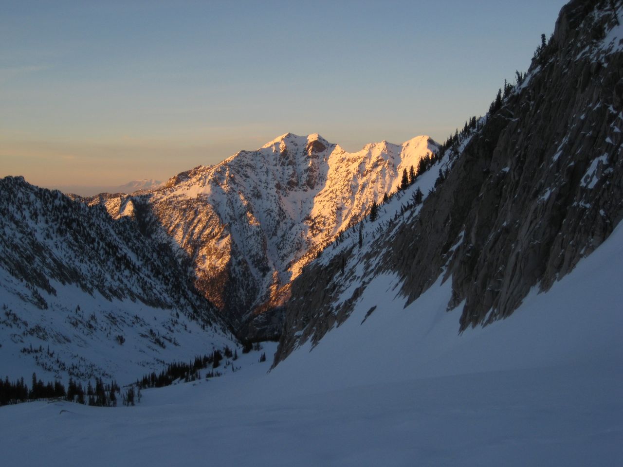
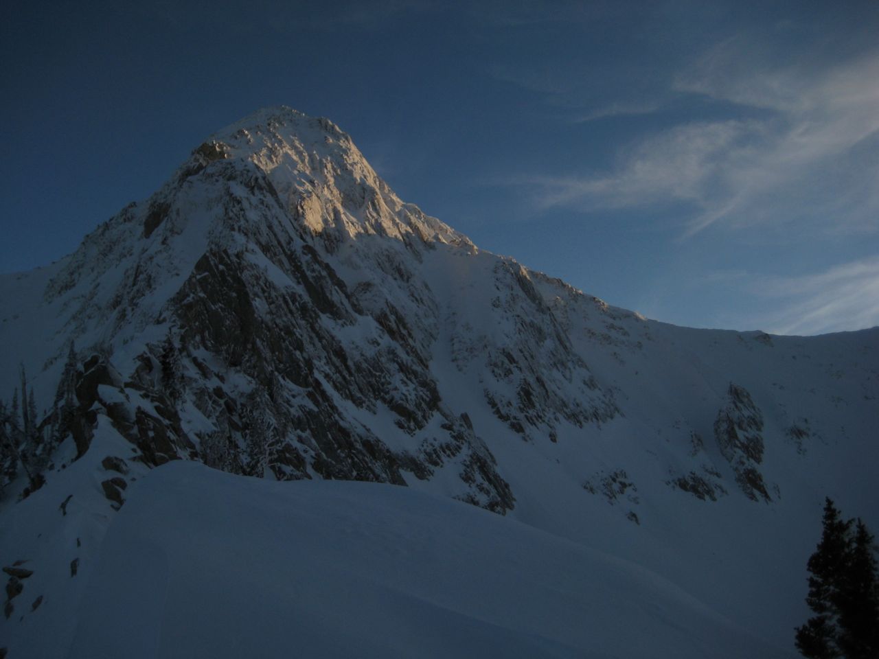
By 5pm, I had climbed the South side of the Dry Creek/Hogum divide, which was beautiful, rugged, and icy. Now I was trying to decide whether to rappel or downclimb the rocky headwall, and realizing I had a long way to go as the sun set. I climbed down an icy chute (super thankful for both ski and boot crampons today!) and into the shadows of rugged Lightning Ridge. After rounding the W and N of the Pfeifferhorn, I realized it would be pitch black before I got to the final col, with a 3000' descent through 3 drainages beyond. It didn't take long to decide to go for the full Hogum fork descent instead (generally not recommended).
I skied and traversed the lower runouts of some of the big W facing slidepaths, which was beautiful in the last light, but more fun (and safer) with my headlamp. Snow here was good! It seemed important to stay away from the Creek/Gulch, so I traversed skiers right as much as possible. After a sporty adventure through the last 1000' of vertical in the dark, I found myself doing circles on the flat until I pulled out the compass and bushwacked to Little Cottonwood Creek, found a log crossing, and eventually found a trail to the road where I got a ride immediately.
Distance: 10 miles, Elevation Gain: 3500', Descent: 4650'
Today I went to spend more time up in the alpine, with the objective of circling the Pfeiff. The climb to Red Pine Lake is moderate (3.7 miles/2500' gain), and the snow is decent and stable in the shady trees between 8-10k'. Above treeline, windscoured crust dominates. I dug a pit at 10,033' on a shady N slope (28 degree) and found easy shears below the "MLK rain crust" (CT0, Q2 & ECTP4, Q2). However, it took some serious sawing to get through the crust... I could break the crust in places, but it was not collapsing the way the buried surface hoar (below) had been in the Brighton area several days ago (scary). In fact, Saturdays collapsing sounded distinctly like rolling thunder moving into the distance and produced shooting cracks. None of that here today.
My intended ascent out of Red Pine cirque had a cornice blocking the top, so I went further S to the low spot on the ridge and climbed 50 degree hard crust to the col (10,650'). It was late in the day (I got a late start) but despite the suns warmth, the alpine terrain was not softening much, and I decided to drop south into upper Dry Creek for the traverse to the top of Hogum Fork. This, of course, was much longer than it looked.
By 5pm, I had climbed the South side of the Dry Creek/Hogum divide, which was beautiful, rugged, and icy. Now I was trying to decide whether to rappel or downclimb the rocky headwall, and realizing I had a long way to go as the sun set. I climbed down an icy chute (super thankful for both ski and boot crampons today!) and into the shadows of rugged Lightning Ridge. After rounding the W and N of the Pfeifferhorn, I realized it would be pitch black before I got to the final col, with a 3000' descent through 3 drainages beyond. It didn't take long to decide to go for the full Hogum fork descent instead (generally not recommended).
I skied and traversed the lower runouts of some of the big W facing slidepaths, which was beautiful in the last light, but more fun (and safer) with my headlamp. Snow here was good! It seemed important to stay away from the Creek/Gulch, so I traversed skiers right as much as possible. After a sporty adventure through the last 1000' of vertical in the dark, I found myself doing circles on the flat until I pulled out the compass and bushwacked to Little Cottonwood Creek, found a log crossing, and eventually found a trail to the road where I got a ride immediately.
Distance: 10 miles, Elevation Gain: 3500', Descent: 4650'
Thanks for the tour update in the Wasatch.
Glad the return was only a semi epic.
Glad the return was only a semi epic.
Reply to this TR
Please login first: