December 6 Simcoe Mountains
12/15/10
3146
6
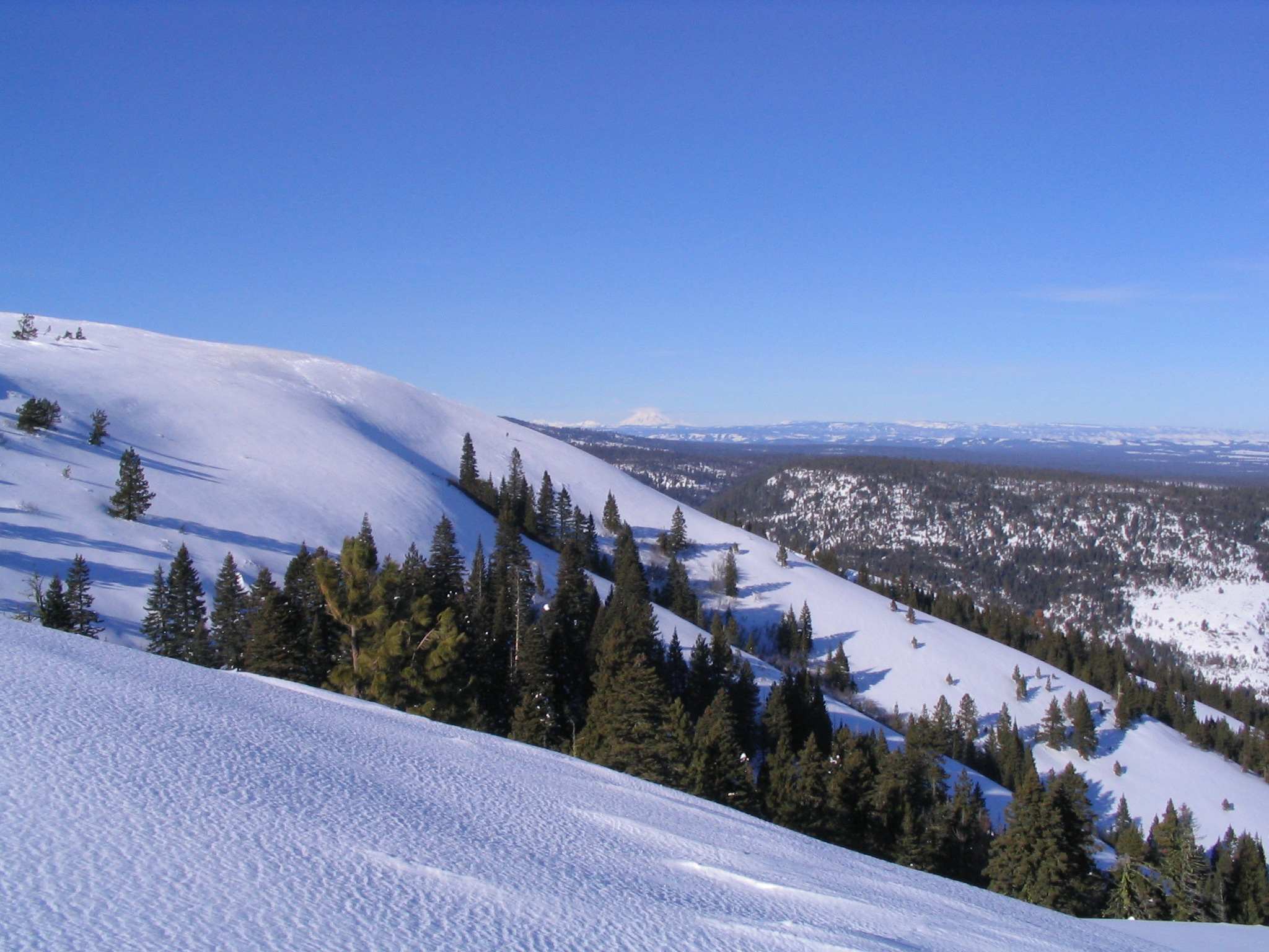
My 1st trip up this season. There is plenty of coverage already and there was 2-3 inches of nice powder on top of super hard pack.
Sorry, no pix or great stories, just a conditions report for anybody passing through
Sorry, no pix or great stories, just a conditions report for anybody passing through
Nice, I haven't been there in years. Do you mind my asking how you went in? Satus Pass or up from Goldendale? I've only been in the Satus Pass way but I wonder about the other way in, the approach described in Vielbig's book.
Very cool. I've wondered if there was much skiing up there.
I went up the Satus Pass way. It's a bit of a long haul into the area I like to ski, but worth it. The ski out is all downhill so that's a bonus - 2.5 miles to top of ski hill with elevation gain of 1700 feet. My favorite ski hill is steepish with about 1000 feet of vert but there is more to be had elsewhere. In a good year, you could probably ski from 5000 foot level down to 2500 foot level.
The other route described by Veilbig is a tough one. Very confusing maze of residential and logging roads on mostly private land. You can get in that way, but it is more of a BC XC type of hill than downhill. Maybe 10-20% slopes. Also, in the winter, most of the roads are snowed in.
The Satus Pass entry may be closed in the future. The land was traded by the state to a timber company I believe who agreed to leave it open for public access for 10 years (this happened 2 or 3 years ago). There was some talk about real estate development on the old ski hill. My memory is hazy about all of this, but check with DNR out of Ellensburg for more info.
I have some pix of Simcoe Butte ski run. E-mail and I will send them to you. Too big for this site. I also have a .tpo route map. It can be real nice weather up there when it's storming in the Cascades.
I'm hoping this year to try for Lone Pine Butte which is on the EAST side of the pass. I've been drooling over that one for years, but it's tricky to get to....
Cool, I've read the Vielbig description and often wondered about that when I've gone over Satus Pass. I'll have to look for Lone Pine Butte on the topos and think about heading up there sometime. That's one of those areas that's been on my list but I never get to. I'm only an hour or so away, but Vielbig's route never sounded very realistic and I'm thinking it would be hard to navigate a big rounded dome like the Simcoes appear to be from the views I've had.
author=TeleMurray link=topic=18360.msg78140#msg78140 date=1292367754]
Cool, I've read the Vielbig description and often wondered about that when I've gone over Satus Pass. I'll have to look for Lone Pine Butte on the topos and think about heading up there sometime. That's one of those areas that's been on my list but I never get to. I'm only an hour or so away, but Vielbig's route never sounded very realistic and I'm thinking it would be hard to navigate a big rounded dome like the Simcoes appear to be from the views I've had.
I've found Google Earth pretty helpful over the years.
One of the things to keep in mind in this area is that you are skirting Yakima tribal lands. At the Satus pass entry, there is a sign that makes it look like you are trespassing, but the forest road runs right directly on the boundary so you are ok. A few steps to the right of road = tribal. I've never seen any tribal authorities up there in the winter, but they are pretty serious about enforcing access rules in the summer. Also, there is a new resident (on the left) with tons of your typical intimidating sounding no trespassing signs, but just stay on the road and you are ok. I've driven my 4x up to a mile up the road to shorten the hike, but if you aren't confident in your car and digging ability just park in the large parking area off the pass. Weekends = a few snowmo's....
Reply to this TR
Please login first: