July 3, 2010, Chiwawa Basin, Chiwawa n' Fortress
7/3/10
1307
1
I posted this TR to CascadeClimbers, but I figured I'd also post in here for any TAYers interested in conditions in this area!
=========================================
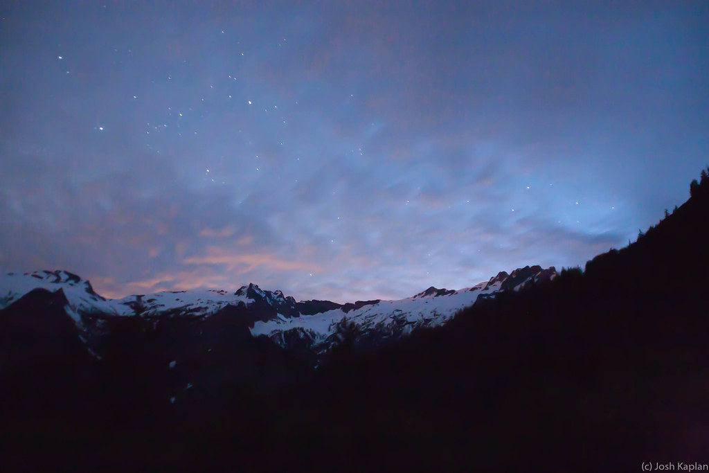
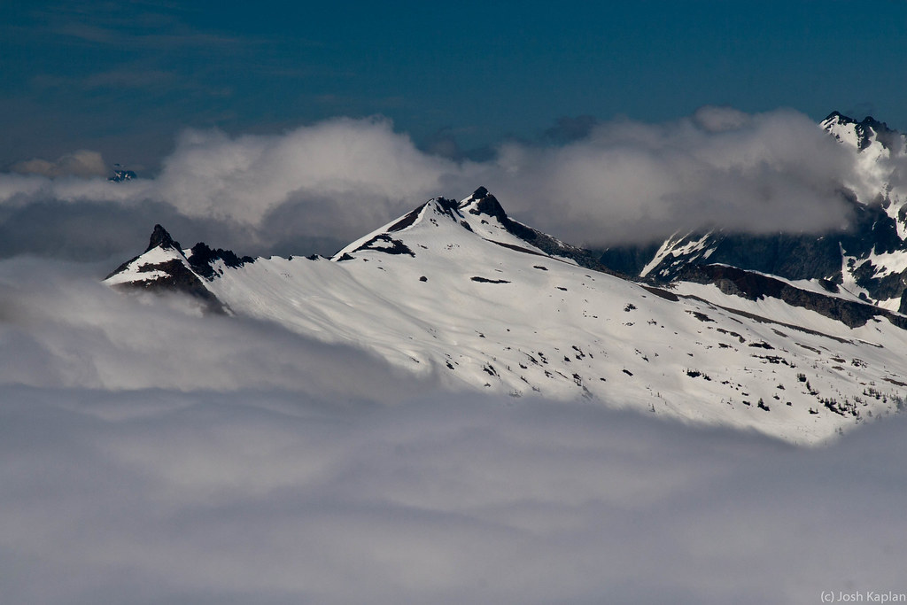
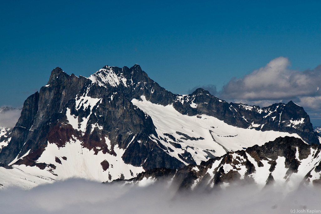
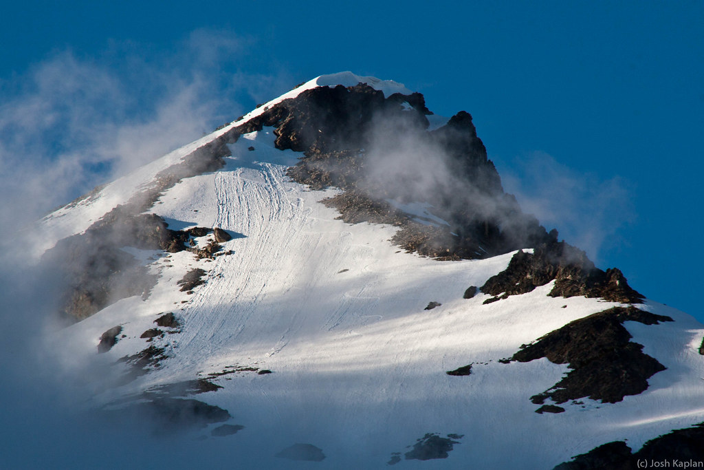
I've wanted to explore Chiwawa Basin for years. On my White River to Holden tour in May we had planned on crossing over but bad avy conditions made us change our route. With a few days of marginal weather I decided to give it a go, figuring it's at least a "little bit east". In fact, both Fortress and Chiwawa fall right along the crest, which became evident over the course of a few days where it was generally sunny to my east and generally cloudy right on top of me and to the west.
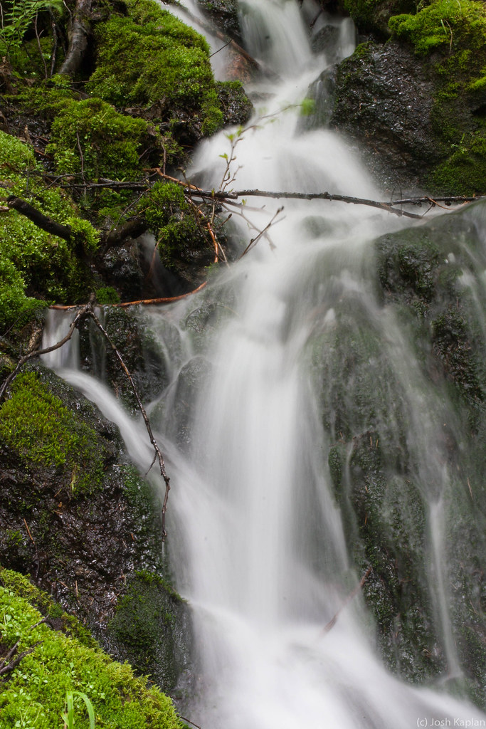
The trail past the turn off to Buck Creek isn't in the best shape right now. Lots of new growth and recent wind and avy debris cover the trail, and there is a lot of mud and water. Large snow patches started below 4300 feet and I was shocked to find complete coverage at the Red Mt/Chiwawa Basin trail junction. A center part of the main meadow has melted out, leaving it a swampy, nasty mess at the moment. Fortunately you can cross the main river down low and skirt the west edge of the meadow on snow. Unfortuantely I didn't discover this until the way down. As it was I resorted to taking off shoes and fording a river six times during this trip.
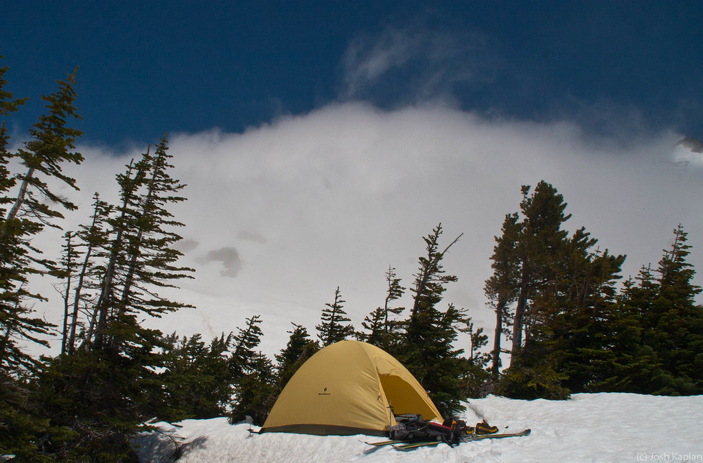
After leaving the lower meadow the rain/snow mix began to fall. I bivied in the upper meadow around 6,100 feet and enjoyed pretty much constant precip and wind for the rest of the night. The wind and clouds continued well in to the next day, but by late morning it looked like their might be some clearing. I had been considering just going home, but I figured I'd head up a bit higher.
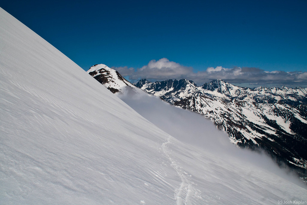
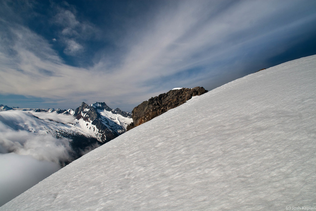
Around 7,600 feet the clouds finally broke. Sure enough, everything to the west was completely covered in clouds, and it was clear to the east. The upper part of Chiwawa Basin and my bivy were in the cloud "waterfall" that was pouring over the crest. I skinned up Fortress to just below the summit block. It was getting pretty late and I still had to get up Chiwawa so I quickly turned around, and skied a descending traverse back towards the Fortress-Chiwawa saddle and back in to the muck. Thanks to the soft snow I was able to skin nearly to the top of Chiwawa.
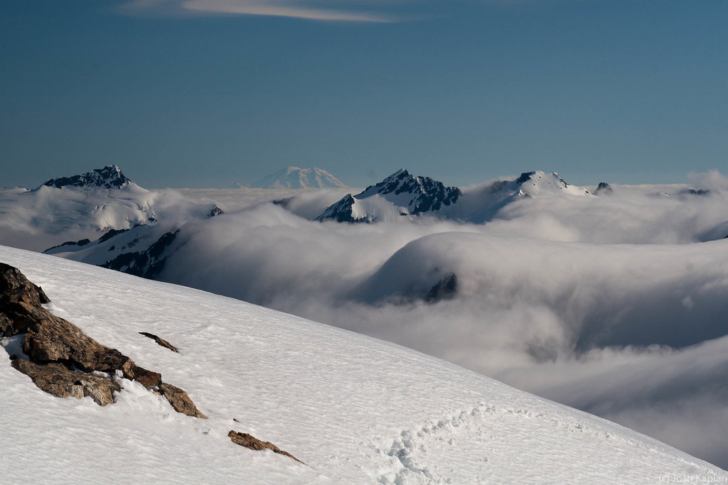
My original plan had been to ski down the north side of Chiwawa on to the Lyman Glacier, then go back up over Spider Gap and out Phelps Creek. From the top, clouds were obscuring the col to the north of the summit that drops to the Lyman Glacier. It was well past 5pm now due to my late start so I decided to retrace my route and simply return back down the southwest slope of Chiwawa and enjoy another round of swamp fun. I took some photos, clicked in to my skis and dropped back over to the main slope. The snow on the upper mountain was pretty heavy from roasting all day so I made a big cut across the face which set off a nice slide that lasted a good 5 minutes. With control work completed I enjoyed my few hundred feet of sunny turns before dropping in to vertigo-land again. I skied to 4800 feet before taking off my skis to cross the river. Sure the weather sucked, but 3,650 feet of vertical, summit to basin, in July...yeah, I'll take that.
More pictures at http://www.flickr.com/photos/46825587@N02/sets/72157624298586533/
=========================================
I've wanted to explore Chiwawa Basin for years. On my White River to Holden tour in May we had planned on crossing over but bad avy conditions made us change our route. With a few days of marginal weather I decided to give it a go, figuring it's at least a "little bit east". In fact, both Fortress and Chiwawa fall right along the crest, which became evident over the course of a few days where it was generally sunny to my east and generally cloudy right on top of me and to the west.
The trail past the turn off to Buck Creek isn't in the best shape right now. Lots of new growth and recent wind and avy debris cover the trail, and there is a lot of mud and water. Large snow patches started below 4300 feet and I was shocked to find complete coverage at the Red Mt/Chiwawa Basin trail junction. A center part of the main meadow has melted out, leaving it a swampy, nasty mess at the moment. Fortunately you can cross the main river down low and skirt the west edge of the meadow on snow. Unfortuantely I didn't discover this until the way down. As it was I resorted to taking off shoes and fording a river six times during this trip.
After leaving the lower meadow the rain/snow mix began to fall. I bivied in the upper meadow around 6,100 feet and enjoyed pretty much constant precip and wind for the rest of the night. The wind and clouds continued well in to the next day, but by late morning it looked like their might be some clearing. I had been considering just going home, but I figured I'd head up a bit higher.
Around 7,600 feet the clouds finally broke. Sure enough, everything to the west was completely covered in clouds, and it was clear to the east. The upper part of Chiwawa Basin and my bivy were in the cloud "waterfall" that was pouring over the crest. I skinned up Fortress to just below the summit block. It was getting pretty late and I still had to get up Chiwawa so I quickly turned around, and skied a descending traverse back towards the Fortress-Chiwawa saddle and back in to the muck. Thanks to the soft snow I was able to skin nearly to the top of Chiwawa.
My original plan had been to ski down the north side of Chiwawa on to the Lyman Glacier, then go back up over Spider Gap and out Phelps Creek. From the top, clouds were obscuring the col to the north of the summit that drops to the Lyman Glacier. It was well past 5pm now due to my late start so I decided to retrace my route and simply return back down the southwest slope of Chiwawa and enjoy another round of swamp fun. I took some photos, clicked in to my skis and dropped back over to the main slope. The snow on the upper mountain was pretty heavy from roasting all day so I made a big cut across the face which set off a nice slide that lasted a good 5 minutes. With control work completed I enjoyed my few hundred feet of sunny turns before dropping in to vertigo-land again. I skied to 4800 feet before taking off my skis to cross the river. Sure the weather sucked, but 3,650 feet of vertical, summit to basin, in July...yeah, I'll take that.
More pictures at http://www.flickr.com/photos/46825587@N02/sets/72157624298586533/
Sweet, that's a great area! I've been wondering what kind of shape the Red Mt/Chiwawa River trail was in. Too bad you had some clouds, but it looks like you had great weather at times and the mountains all to yourself! The snowpack this year seems ideal for that area...
Reply to this TR
Please login first: