May 31, 2010, Navaho Peak NE Slope Ski
5/31/10
WA Cascades East Slopes Central
4253
8
Mike and Brenda inspired this one. I met up with donb, Randy, and Andy for a fine daytrip in the hills with much less rainy weather than expected.
The important stuff:
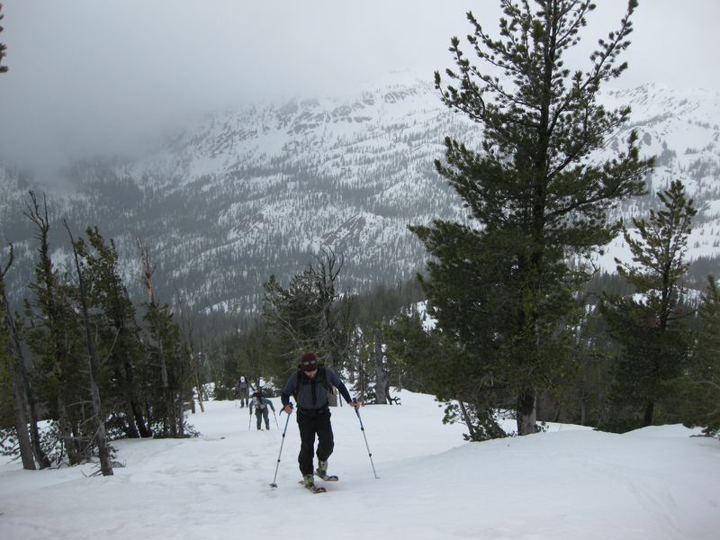
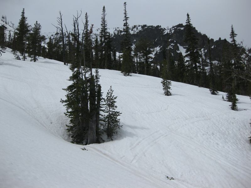
The Stafford Creek Road is open to the Stafford Creek Trailhead at 3100 feet. We hiked with the skis on our backs for about 3.5 miles to the creek that drains the saddle between Navaho Peak and Little Navaho at 4800 ft. After crossing the creek we headed directly north uphill toward the top of Navaho Peak, putting the skis on at 5500 feet. Snow on the south side was pleasantly firm on the ascent.
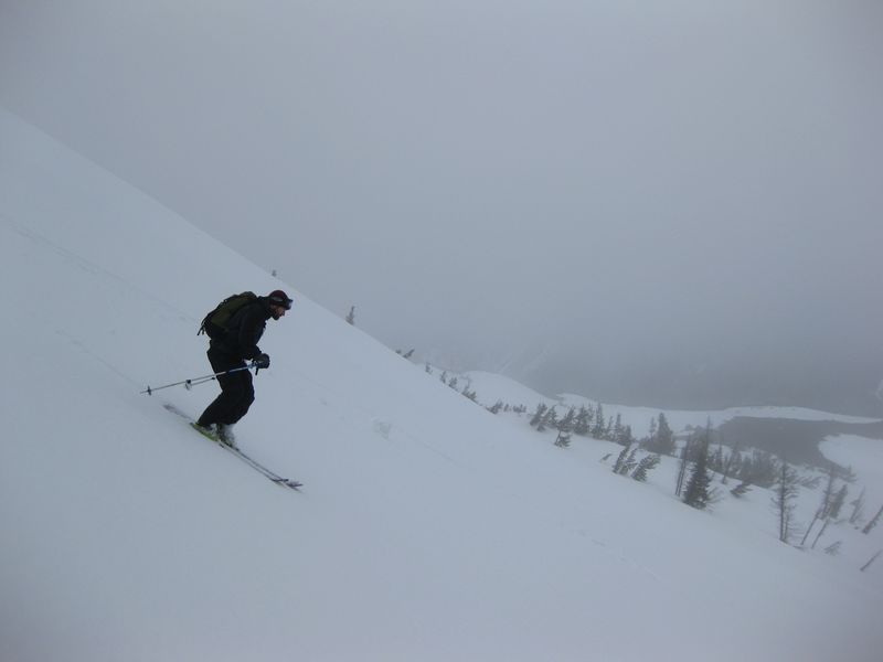
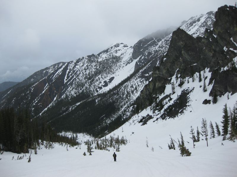
Rain started pretty good at the summit where we were met with BigSteve and company. They headed back SW on the descent, we wanted to ski the NE Slope. From 7200 feet down to about 6000 feet on the north side the new snow from the past few weeks had settled into 6 inches or more of coarse grained wet snow. Though a bit heavy it was consistent and turnable. Below 6000 feet ski penetration was reduced to 3 or 4 inches or less, improving as we went. At the bottom of the NE slope we turned SE and climbed to the Falls Creek/Negro Creek divide. From there it was a slight descent before we could turn a corner, traverse some rocks, and climb up to the Little Navaho Saddle at 6000 feet. One last final west facing run opened up below us skiing to 5100 feet before running out of snow. Snow was softening but our ski penetration was only a few inches. A quick boot descent brought us back to the trail at the creek crossing of the morning. Stafford Creek Trail is a pleasant low gradient frolic out to the TH.
The important stuff:
The Stafford Creek Road is open to the Stafford Creek Trailhead at 3100 feet. We hiked with the skis on our backs for about 3.5 miles to the creek that drains the saddle between Navaho Peak and Little Navaho at 4800 ft. After crossing the creek we headed directly north uphill toward the top of Navaho Peak, putting the skis on at 5500 feet. Snow on the south side was pleasantly firm on the ascent.
Rain started pretty good at the summit where we were met with BigSteve and company. They headed back SW on the descent, we wanted to ski the NE Slope. From 7200 feet down to about 6000 feet on the north side the new snow from the past few weeks had settled into 6 inches or more of coarse grained wet snow. Though a bit heavy it was consistent and turnable. Below 6000 feet ski penetration was reduced to 3 or 4 inches or less, improving as we went. At the bottom of the NE slope we turned SE and climbed to the Falls Creek/Negro Creek divide. From there it was a slight descent before we could turn a corner, traverse some rocks, and climb up to the Little Navaho Saddle at 6000 feet. One last final west facing run opened up below us skiing to 5100 feet before running out of snow. Snow was softening but our ski penetration was only a few inches. A quick boot descent brought us back to the trail at the creek crossing of the morning. Stafford Creek Trail is a pleasant low gradient frolic out to the TH.

Nice John! Something to ruminate on for my birthday ski next weekend...
Excellent. Snow quality was obviously much better than we found around Ingalls. I love that tour. For us it's just the right amount of committment to feel like we actually did something.
See any snowmobilers?
author=TobyT link=topic=16810.msg70579#msg70579 date=1275448717]
See any snowmobilers?
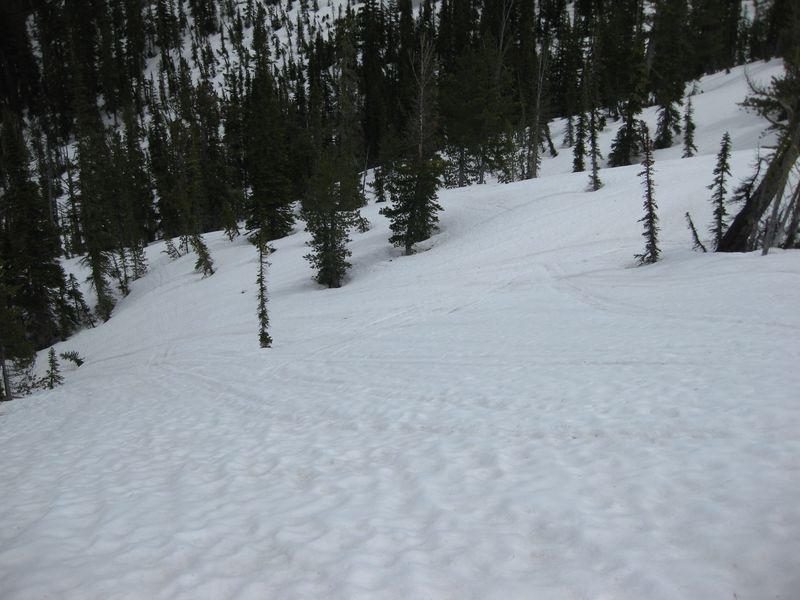
None actively, probably because their approach via King Creek/Shaser Creek (gated roads) has long since melted out. But we could still could see many older snowmobile tracks throughout all the open slopes this deep in the wilderness. See photos below. There is a bright red wilderness boundary sign at the Falls Creek/Negro Creek divide with tracks going past it . I will also note that there were many tracks that also turned around at the divide and stayed in legal terrain. My synopsis is most stayed legal but those who entered the wilderness new they were doing so, new exactly which terrain in the wilderness they sought, and purposedly disregarded the law with intent.
Photo 1: old tracks lower right of skier on NE gully Navaho.
Photos 2 and 3: tracks in basin, east slope Navaho, below Falls divide and climbing toward saddle
Wow, too bad. That is some ammo for the WMC.
John, fun hanging out with you guys for a few stormy minutes on the Navaho summit. Fun skiing on the SW ridge. We'll do MD/Brenda's loop tour another year.
Hey, looks like the Flyers are trying to make a series of it. ;)
Hey, looks like the Flyers are trying to make a series of it. ;)
Nice skiing with you, John. Eager to ski more gems of the Teannaway.
author=lowrider link=topic=16810.msg70701#msg70701 date=1275633933]
Nice skiing with you, John. Eager to ski more gems of the Teannaway.
Likewise Andy. You going to make it out this weekend?
J
Reply to this TR
Please login first: