March 6, 2010, Cashmere Mtn, Indecision Tour
3/6/10
WA Cascades East Slopes Central
2274
2
Last year we had named this route starting from the Icicle River and circling around Cashmere Mountain, the Indecision Tour. Unpredictable weather had us planning to go, cancelling our plans, and then restoring our plans.
This year a tweaked knee creates the indecision. Tom Janisch and I leave the Icicle River at 7:15 a.m. Saturday morning with the maps of two outings tucked in our pockets. The Wounded-Knee option will take us up northwest-facing slopes to the top of the Cannon Mountain Couloir. If the knee misbehaves, a quick fall-line descent will deliver us from evil.
The other map depicts a longer route up the West Peak of Cashmere via the Goat Highway with an appropriately named descent of Doctor Creek leading us back to the Icicle River.
The first three miles of travel up the Eightmile Road are important. With 800 milligrams of Ibuprofen controlling inflammation and motion pumping synovial fluid throughout the joint, the niggling knee is tested. At the 3000-foot level its time to get decisive.
Whats it going to be? Tom asks.
Caution pulls left toward Cannon. The desire to ski the most interesting route, however, leads us right.
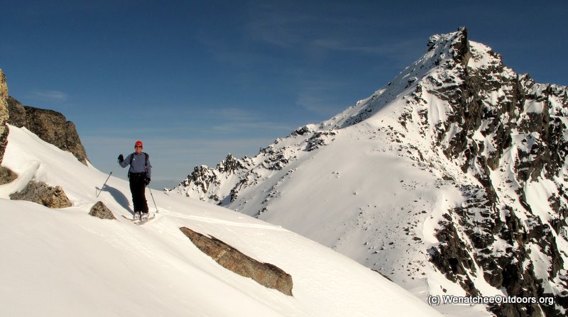
Over the next six hours we follow a small segment of the Eightmile Trail, boot up the Goat Highway, and skin the long ascending traverse leading to the West Peak of Cashmere. We plod upward through warm air and soft corn with Cannon Mountain, Enchantment Peak, Little Annapurna, Dragontail, Colchuck, Stuart and Eightmile Peak, like framed pictures, decorating the blue wall of the sky.
At the ridgeline connecting the true summit of Cashmere to our 8200-foot sub-summit, we intersect the prints of a goat that has been enjoying the fine weather and summiting all the rime-plastered pyramids along this divide. We encounter the goat near our summit and, powder pig that he is, he bolts down the ridge well be descending, claiming first tracks.
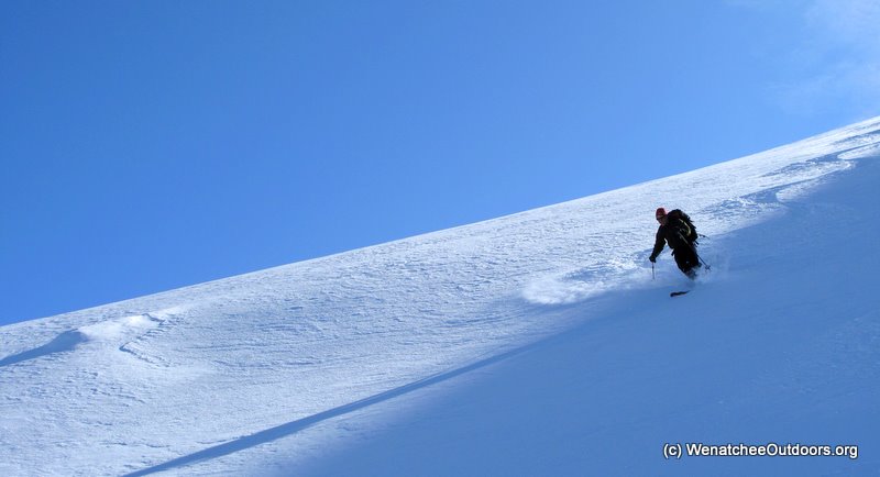
Soon we follow suit. Allthough corn snow coated the slopes of the ascent, its a bipolar day. The north-facing slopes are frozen-finger cold and packed with powder. We photograph and gloat our way down 3000 vertical feet of shaded turns.
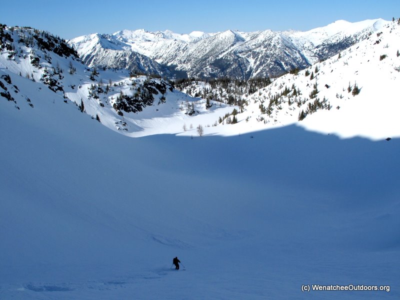
Around the 5300-foot level, the combination of warmer, crusted snow and heavy forest cover degrades the skiing. In powder conditions we could keep working the fall line, but today we traverse toward higher roads before tricky snows twist tweaky knees.
We find the roads then fly down icy snowmobile tracks that sometimes trap us in a luge course whose 7degree pitch generates more fear than teaching a teenager to drive. Eventually we slip out onto the Icicle River Road about 3.5 miles upriver of the car.
Milking the privileges of the crippled I tuck in behind Tom and draft him as he skates and double poles. Gliding in the wake of a human engine Im decidedly jazzed about the days fruits. But was it clever or reckless to harvest those fruits? Ahhh, so many questions in this world¦and so much indecision.
+++++
More pictures and a map of this tour at WenatcheeOutdoors.org
This year a tweaked knee creates the indecision. Tom Janisch and I leave the Icicle River at 7:15 a.m. Saturday morning with the maps of two outings tucked in our pockets. The Wounded-Knee option will take us up northwest-facing slopes to the top of the Cannon Mountain Couloir. If the knee misbehaves, a quick fall-line descent will deliver us from evil.
The other map depicts a longer route up the West Peak of Cashmere via the Goat Highway with an appropriately named descent of Doctor Creek leading us back to the Icicle River.
The first three miles of travel up the Eightmile Road are important. With 800 milligrams of Ibuprofen controlling inflammation and motion pumping synovial fluid throughout the joint, the niggling knee is tested. At the 3000-foot level its time to get decisive.
Whats it going to be? Tom asks.
Caution pulls left toward Cannon. The desire to ski the most interesting route, however, leads us right.
Over the next six hours we follow a small segment of the Eightmile Trail, boot up the Goat Highway, and skin the long ascending traverse leading to the West Peak of Cashmere. We plod upward through warm air and soft corn with Cannon Mountain, Enchantment Peak, Little Annapurna, Dragontail, Colchuck, Stuart and Eightmile Peak, like framed pictures, decorating the blue wall of the sky.
At the ridgeline connecting the true summit of Cashmere to our 8200-foot sub-summit, we intersect the prints of a goat that has been enjoying the fine weather and summiting all the rime-plastered pyramids along this divide. We encounter the goat near our summit and, powder pig that he is, he bolts down the ridge well be descending, claiming first tracks.
Soon we follow suit. Allthough corn snow coated the slopes of the ascent, its a bipolar day. The north-facing slopes are frozen-finger cold and packed with powder. We photograph and gloat our way down 3000 vertical feet of shaded turns.
Around the 5300-foot level, the combination of warmer, crusted snow and heavy forest cover degrades the skiing. In powder conditions we could keep working the fall line, but today we traverse toward higher roads before tricky snows twist tweaky knees.
We find the roads then fly down icy snowmobile tracks that sometimes trap us in a luge course whose 7degree pitch generates more fear than teaching a teenager to drive. Eventually we slip out onto the Icicle River Road about 3.5 miles upriver of the car.
Milking the privileges of the crippled I tuck in behind Tom and draft him as he skates and double poles. Gliding in the wake of a human engine Im decidedly jazzed about the days fruits. But was it clever or reckless to harvest those fruits? Ahhh, so many questions in this world¦and so much indecision.
+++++
More pictures and a map of this tour at WenatcheeOutdoors.org
I tthink you guys made the right decision!
Agreed, good decision and good writing!
Reply to this TR
Please login first: