June 4, Overcoat Peak, North Couloir
6/15/09
1669
2
As soon as I caught a glimpse of Overcoat's north face and the snow ramp that splits it, I wanted to ski it. After skiing Baker from the Glacier Creek road a couple weeks ago, another bike-hike-ski triathlon seemed unsavory. Plus the approach up the Middle Fork looked like it had good potential to be a real ski-joust with the brush if the snow was gone in the subalpine. However, a thorough review of the maps showed that the Cooper Creek Road outside Cle Elum got you within striking distance to the east side of Overcoat. So my friend Chris and I gave that a try.
We set off at 6AM in sneakers from the Cooper Lake TH. We hit patches of snow almost immediately, but nothing long enough to bother putting on the skis and boots. In any case, the trail to Pete Lake is cursed with gaining only 300 feet in 5 miles, so even with continuous snow, snow is a dubious advantage, unless you've got pattern bases or kick wax.
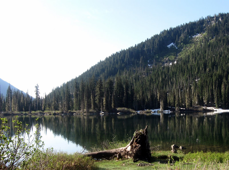
We hit Pete Lake at 8:15. This was taking longer than I thought. At least now we were on the map, though. Another 3 hours of hiking following the trail as it joined the PCT, then leaving the trail as it began switchbacking its way east and following the bank of the tributary creek of the Cooper for a half mile through big timber, then open slopes finally got us to where it was clear we had snow for the rest of the way up.


[One of numerous creek crossings, Pete Lake, One of numerous avalanche debris fans]
We skinned through piles of avalanche debris full of rocks and trees, all the while looking back to the south at the clouds building. The key to getting to the Chimney-Overcoat Col from the Cooper drainage were two broad couloirs that provide a gentle way through otherwise cliffy terrain. I was worried even these could be melted out to slab by all the heat we were getting. Luckily my worries proved to be unfounded. We made it to the head of the valley, and turned nearly 180 degrees south-southwest and ascended the first couloir/ramp. 500 feet of skinning took us to the unnamed glacier below the east face of Chimney. We turned 90 degrees north and found the next ramp. It had some waterfalls and cliff bands showing on its east side, and looked steeper. This being Chris's first time on skins, it seemed wise to switch to booting for more security, and to take a more direct line away from Chimney's face, which had dropped some rocks onto the snowfield.
We booted our way between a few glide cracks and 1000 feet later had arrived on the Overcoat Glacier. It was already 2 PM, but fortunately the clouds to the south had retreated. After taking another break and admiring the scenery, we skinned our way across the broad glacier, almost an icecap, and went around the corner to Overcoat's north side. The couloir was fat. Switching to boots, we kicked steps up to the wide col at the top of the couloir, between crags of the summit ridge. My altimeter was claiming we needed another 300 feet for the summit of Overcoat, but I didn't want to to believe it and scrambled a little ways up the tower to the southeast, until I finally caught a view of the true summit of Overcoat, towering several hundred feet above me and looking decidedly fifth class from that side. So I deemed the skier's summit "good enough." It had a cool window you could scramble through and catch a view to the south, anyway. Anyone know where the "third class" route is supposed to go once you gain the col?
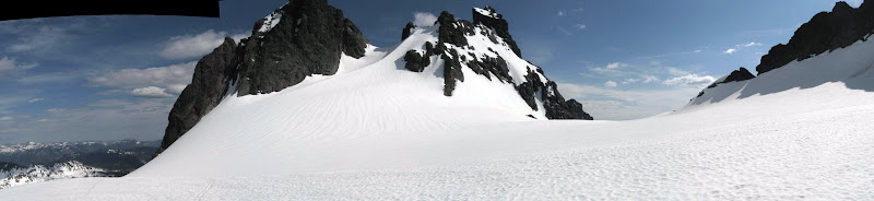
Panorama of Chimney from the Overcoat icecap
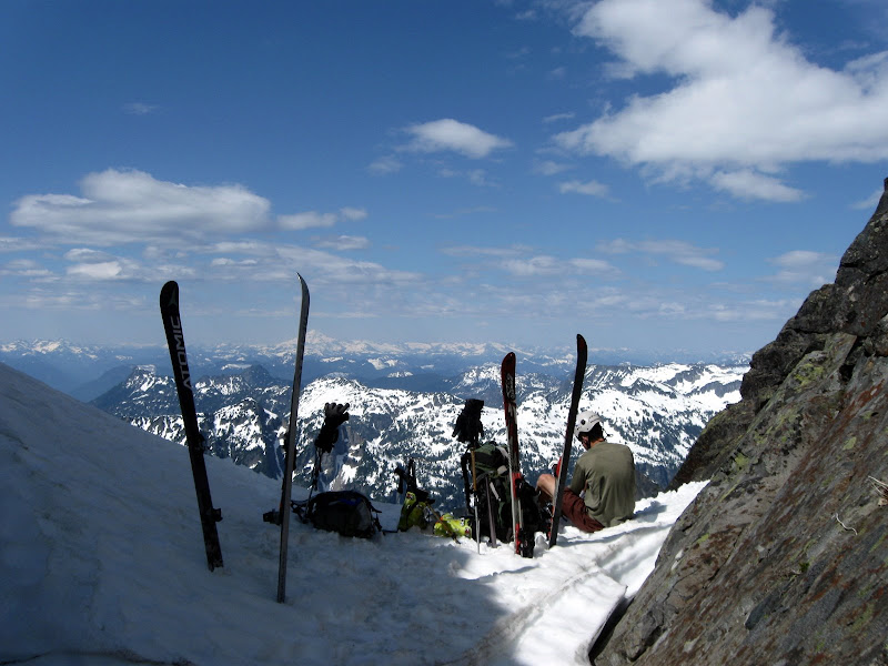
View from Overcoat's col

Chris skiing the apron below the couloir
The top of the run was the steepest, but the snow was good, albeit a little overcooked. They seemed like some of the steeper turns I've linked in a while. Chris did an excellent job for not having skied for the past two years.
The rest of the run was all downhill from there, however. Even at 6600 feet, over 1000 feet above treeline, the snow was fouled with pollen. We skated our way downhill across the glacier, only to endure a 2000 foot run of sticky, grabby snow. I was able to straightline 20-25 degree slopes at barely above a running pace. This transitioned into rock-strewn avalanche debris lower down, which actually skied better than the rest of the tar, since the chunks meant less snow contacted the ski.


[Putting on the game face for the depproach, Pollen sticks, Puddle of pollen]
We changed back to boots at 6PM and prepared for the long hike out. We made it back to Pete Lake around 8, and I was still feeling pretty good. However, by the time sunset rolled around, I was starting to bonk. We arrived at the car at 11, hallucinating a little by headlamp: snakes in the bushes, snakes in the trees.
We set off at 6AM in sneakers from the Cooper Lake TH. We hit patches of snow almost immediately, but nothing long enough to bother putting on the skis and boots. In any case, the trail to Pete Lake is cursed with gaining only 300 feet in 5 miles, so even with continuous snow, snow is a dubious advantage, unless you've got pattern bases or kick wax.
We hit Pete Lake at 8:15. This was taking longer than I thought. At least now we were on the map, though. Another 3 hours of hiking following the trail as it joined the PCT, then leaving the trail as it began switchbacking its way east and following the bank of the tributary creek of the Cooper for a half mile through big timber, then open slopes finally got us to where it was clear we had snow for the rest of the way up.
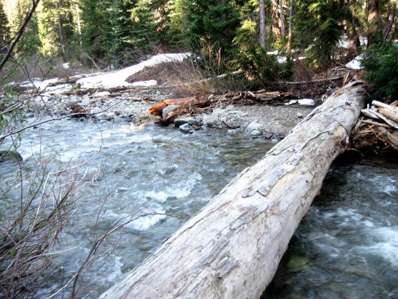
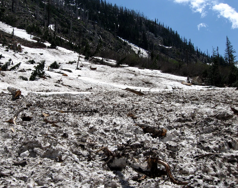
[One of numerous creek crossings, Pete Lake, One of numerous avalanche debris fans]
We skinned through piles of avalanche debris full of rocks and trees, all the while looking back to the south at the clouds building. The key to getting to the Chimney-Overcoat Col from the Cooper drainage were two broad couloirs that provide a gentle way through otherwise cliffy terrain. I was worried even these could be melted out to slab by all the heat we were getting. Luckily my worries proved to be unfounded. We made it to the head of the valley, and turned nearly 180 degrees south-southwest and ascended the first couloir/ramp. 500 feet of skinning took us to the unnamed glacier below the east face of Chimney. We turned 90 degrees north and found the next ramp. It had some waterfalls and cliff bands showing on its east side, and looked steeper. This being Chris's first time on skins, it seemed wise to switch to booting for more security, and to take a more direct line away from Chimney's face, which had dropped some rocks onto the snowfield.
We booted our way between a few glide cracks and 1000 feet later had arrived on the Overcoat Glacier. It was already 2 PM, but fortunately the clouds to the south had retreated. After taking another break and admiring the scenery, we skinned our way across the broad glacier, almost an icecap, and went around the corner to Overcoat's north side. The couloir was fat. Switching to boots, we kicked steps up to the wide col at the top of the couloir, between crags of the summit ridge. My altimeter was claiming we needed another 300 feet for the summit of Overcoat, but I didn't want to to believe it and scrambled a little ways up the tower to the southeast, until I finally caught a view of the true summit of Overcoat, towering several hundred feet above me and looking decidedly fifth class from that side. So I deemed the skier's summit "good enough." It had a cool window you could scramble through and catch a view to the south, anyway. Anyone know where the "third class" route is supposed to go once you gain the col?
Panorama of Chimney from the Overcoat icecap
View from Overcoat's col
Chris skiing the apron below the couloir
The top of the run was the steepest, but the snow was good, albeit a little overcooked. They seemed like some of the steeper turns I've linked in a while. Chris did an excellent job for not having skied for the past two years.
The rest of the run was all downhill from there, however. Even at 6600 feet, over 1000 feet above treeline, the snow was fouled with pollen. We skated our way downhill across the glacier, only to endure a 2000 foot run of sticky, grabby snow. I was able to straightline 20-25 degree slopes at barely above a running pace. This transitioned into rock-strewn avalanche debris lower down, which actually skied better than the rest of the tar, since the chunks meant less snow contacted the ski.
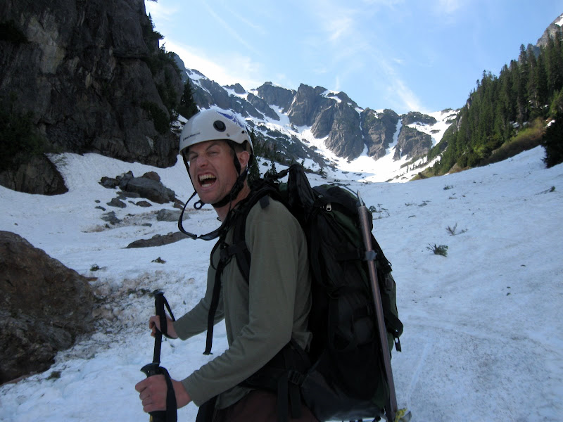
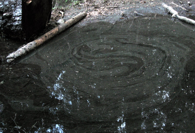
[Putting on the game face for the depproach, Pollen sticks, Puddle of pollen]
We changed back to boots at 6PM and prepared for the long hike out. We made it back to Pete Lake around 8, and I was still feeling pretty good. However, by the time sunset rolled around, I was starting to bonk. We arrived at the car at 11, hallucinating a little by headlamp: snakes in the bushes, snakes in the trees.
Awesome... I was looking at coming in via the Middle Fork for that last year -- nice variation. Thanks for posting.
I thought that would be a long day, but it looks like a great trip. Nice work, and a well written report.
Reply to this TR
Please login first: