April 30, 2009, Main Avy Path, The Sherwins
4/30/09
1776
0
If youve traveled hwy 395 near Mammoth Lakes and looked west, youve probably seem The Sherwins and Mammoth Rock. We have toured along the Mammoth Crest near Crystal Crag and Red Cone and have skied Mammoth Rock Bowl in The Sherwins. Ive wanted to ski the Main Avy Path for years but the conditions were never quite right when we were in the area. This year we were able to drive the Sherwin Creek Road past the Sierra Meadows Ranch and take a side road behind the Snowcreek development.
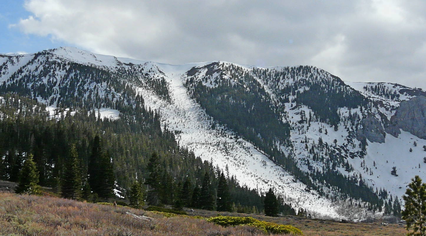
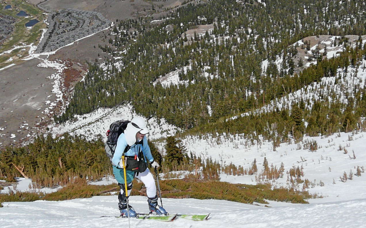
The normal approach is to tour from the Tamarack Cross Country Center off the Lake Mary road, then saddle the skis and hike the ridge to the top of the Sherwins. You then ski down to a second car or take public transportation out. We decided to approach from the base and skin up the slope we planned to ski. It was a sunny day in the 40s with brisk ridge top winds forecasted and a system approaching by evening. We saddled the skis at the base and actually walked on dirt and snow patches for half a mile this is a violation of one of my touring rules but I was determined to ski that slope. Jill put on her knee/leg brace and we old timers were off hiking and kicking up some dust. Rather than hiking to the base of the slope, we angled through the trees until we hit continuous snow mistake. It would have been easier to follow the path around the development to the base of the slope. The skinning was pleasant with about an inch of ski penetration in corn snow. We decided to put on ski crampons early for some of the shady sections and the upper pitch. The slope is wide and there are scattered new growth trees poking through the snow pack. The main slope slid in 1986 and created the nicely spaced treed terrain. The slope averages about 30 degrees until the upper bowl which is about 38 degrees. A large cornice is centered above the slope. Its about 2200vf and was a rather pleasant ascent. From the summit ridge you can look further west to the Mammoth Crest, north to the Mammoth Mtn ski area, east to town and the dry hot springs area, and south to Punta Bardini, Pyramid Peak and Bloody Mtn. Its always interesting to ski along the Sierra where the westerly views are typically snow-covered terrain and easterly views are desert and brown-colored terrain.
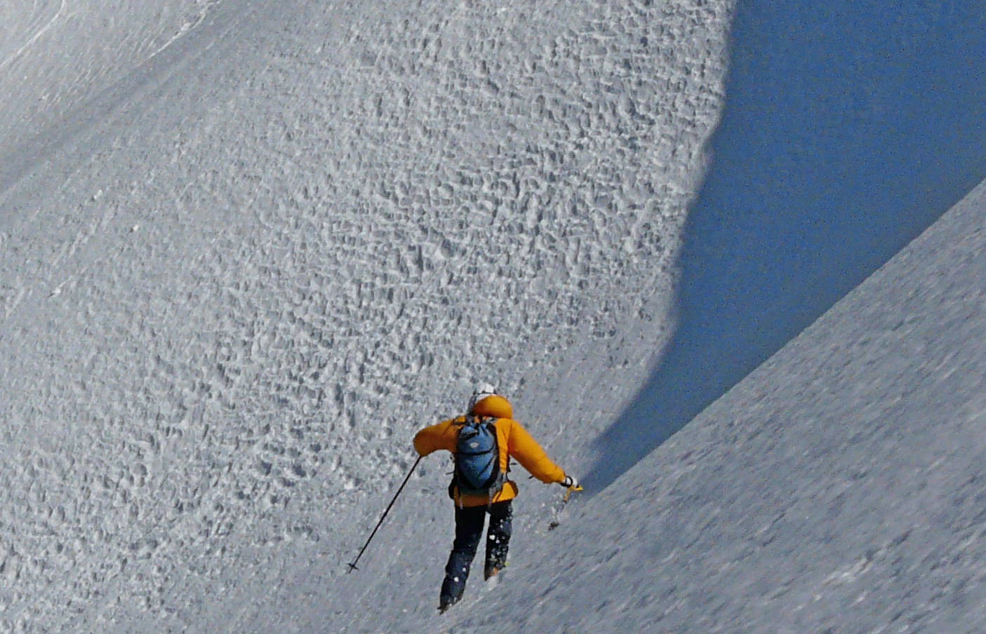
We started our descent about 3pm and our skis had about 2-3 penetration in the soft spring snow. The upper bowl is treeless, but you quickly descend into the new growth trees and play a game of slalom skiing the wide open treed terrain. We read about the potential hazard of old tree trunks protruding from the melting snow and the trunks were readily visible. I would imagine a few inches of fresh snow would hide many of the stumps and create a potential hazard. We had the whole place to ourselves, so we did short slalom and big giant slalom turns and used up as much terrain as needed to create grins. The final 200vf was a maze of scrub that was getting bigger as we descended to the creek at the bottom. We adopted the attitude of making it a game to find a path out without removing our skis rather than whining about it. Finally down to the dirt, we saddled the skis and walked about three-quarters of a mile back to the campervan. A quick solar shower and we watched the approaching storm system shadow our descent lines. We drove a couple miles to a small stream, listened to the birds, looked up towards Bloody and Laurel Mountains and enjoyed a cold one. Grandma Jill was awesome.
The normal approach is to tour from the Tamarack Cross Country Center off the Lake Mary road, then saddle the skis and hike the ridge to the top of the Sherwins. You then ski down to a second car or take public transportation out. We decided to approach from the base and skin up the slope we planned to ski. It was a sunny day in the 40s with brisk ridge top winds forecasted and a system approaching by evening. We saddled the skis at the base and actually walked on dirt and snow patches for half a mile this is a violation of one of my touring rules but I was determined to ski that slope. Jill put on her knee/leg brace and we old timers were off hiking and kicking up some dust. Rather than hiking to the base of the slope, we angled through the trees until we hit continuous snow mistake. It would have been easier to follow the path around the development to the base of the slope. The skinning was pleasant with about an inch of ski penetration in corn snow. We decided to put on ski crampons early for some of the shady sections and the upper pitch. The slope is wide and there are scattered new growth trees poking through the snow pack. The main slope slid in 1986 and created the nicely spaced treed terrain. The slope averages about 30 degrees until the upper bowl which is about 38 degrees. A large cornice is centered above the slope. Its about 2200vf and was a rather pleasant ascent. From the summit ridge you can look further west to the Mammoth Crest, north to the Mammoth Mtn ski area, east to town and the dry hot springs area, and south to Punta Bardini, Pyramid Peak and Bloody Mtn. Its always interesting to ski along the Sierra where the westerly views are typically snow-covered terrain and easterly views are desert and brown-colored terrain.
We started our descent about 3pm and our skis had about 2-3 penetration in the soft spring snow. The upper bowl is treeless, but you quickly descend into the new growth trees and play a game of slalom skiing the wide open treed terrain. We read about the potential hazard of old tree trunks protruding from the melting snow and the trunks were readily visible. I would imagine a few inches of fresh snow would hide many of the stumps and create a potential hazard. We had the whole place to ourselves, so we did short slalom and big giant slalom turns and used up as much terrain as needed to create grins. The final 200vf was a maze of scrub that was getting bigger as we descended to the creek at the bottom. We adopted the attitude of making it a game to find a path out without removing our skis rather than whining about it. Finally down to the dirt, we saddled the skis and walked about three-quarters of a mile back to the campervan. A quick solar shower and we watched the approaching storm system shadow our descent lines. We drove a couple miles to a small stream, listened to the birds, looked up towards Bloody and Laurel Mountains and enjoyed a cold one. Grandma Jill was awesome.
Reply to this TR
Please login first: