Feb 20, 2009, Pyramid Pk, NE Ridge
2/20/09
WA Cascades East Slopes North
6324
13
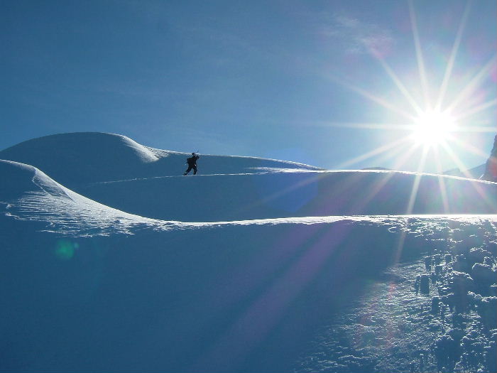
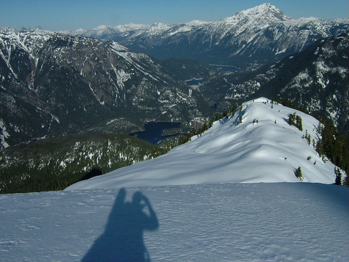
Struggled all week with the dilemma of searching for powder or hoping for corn. Decided to head for the North Cascades in search of powder on north facing slopes, but with pretty low expectations. The cirque north of Pyramid Pk looks like it stays in the shade all day, so we headed up from Hwy 20 and easily followed Pyramid Creek into the basin. Snow coverage was surprisingly good, though the largest headwall at about 3000' presented a little challenge getting up (and down). We were greatly encouraged though by how soft the snow was, even down at this low level, when not in the trees (where it was quite hard). The upper creek veers left in a wide chute for more than 2000' under the impressive North face of Pyramid Pk. The "left-over" powder in here was unbelievable and certainly blew away our expectations. The views were spectacular at the 6000' saddle and though the valley was cold, the ridge was sunny, windless, and warm 8). Great ride down nearly 4000', easy walk out, and headed to Marblemount to recoup before day 2. FYI- Buffalo Run Restaurant and Inn is a great place for food and a room.
Great idea! I've wondered about that bowl and the possibility of a headwall. That view is from Ruby, eh? How are the run possibilities on it, or is it too much approach for too little? Long drive for me but I gotta get up there.
Thanks for sharing.
J
Thanks for sharing.
J
Came back from Rainy pass on Friday......saw a guy with skis on backpack riding a motorcycle......near Newhalem.....was that you? Rainy pass was also very nice! Thanks for the report..it looked enticing!
John, Yes, Ruby TR in the works.
Samoon, We were in the 4-Runner. Was that you and Monica on the snowmo Friday?
Boot
Samoon, We were in the 4-Runner. Was that you and Monica on the snowmo Friday?
Boot
Yea.....we had a long day with a few minor sled issues with getting the sled over one of the slide paths....but otherwise a productive outing.
Any pics of the slide? Isn't that about 25 miles all the way to Rainy Pass from the West end?
Excellent, I had been curious about that basin too... and it looks like there are good bivi spots on the NW ridge of Pinnacle. Look forward to any more photos there or of Ruby too.
I was on ruby by snowshoeing the west ridge a month ago with an overnight (bad skiing conditions), Did you make it near Ruby's Northeast basin? That is also a spot to find 'preserved powder' in stable conditions, with a shorter approach from the Ross Dam TH.
I was on ruby by snowshoeing the west ridge a month ago with an overnight (bad skiing conditions), Did you make it near Ruby's Northeast basin? That is also a spot to find 'preserved powder' in stable conditions, with a shorter approach from the Ross Dam TH.
author=Boot link=topic=12427.msg51909#msg51909 date=1235413926]
Any pics of the slide? Isn't that about 25 miles all the way to Rainy Pass from the West end?
The slide is about 3 miles east of Ross Lake resort overlook. We went about 20 miles to Porcupine Creek. The slide path is a bit on the icy side.....required a little mining with the ice tools. I imagine the road could be open by middle of March depending on the balance of the winter.
SM

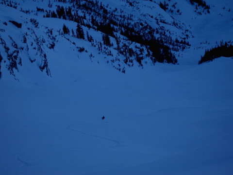
What a narly peak. This was one valley I didn't even like being down in on a safe day. The evidence of massive slides was fully encompassing.

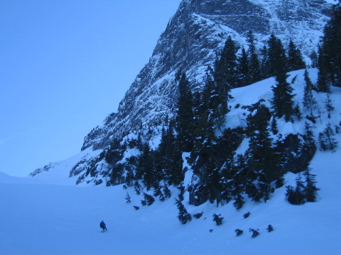
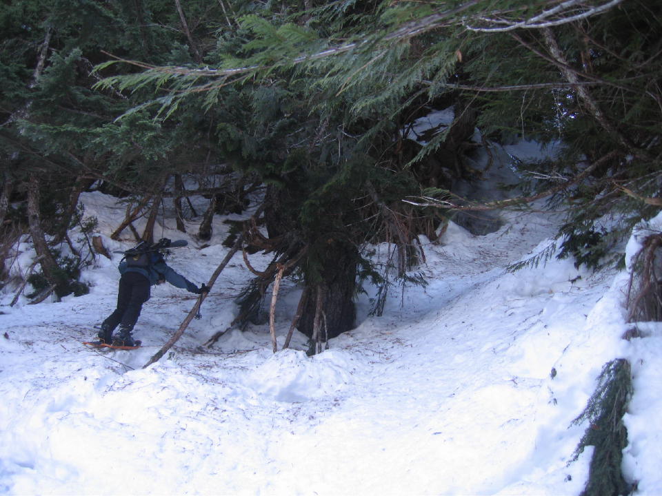
The route finding was alittle difficult. Note, the water ice in the trees.
MSR snowshoes are the best.
MSR snowshoes are the best.
author=schu link=topic=12427.msg51961#msg51961 date=1235451299]
What a narly peak. This was one valley I didn't even like being down in on a safe day. The evidence of massive slides was fully encompassing.
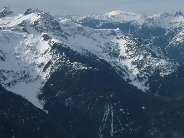
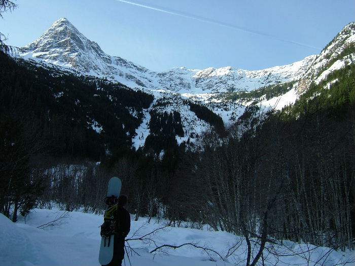
That giant trough/gully looks as spectacular in the photos as the map suggests! Did you all get a look at the north facing basin west of the pyramid summit? Map shows it could have cliffs 1/2 way up but I was wondering if it held steep snow.
Thanks,
John
Nice trip! Some gnarly terrain, sweet pics!
That giant trough/gully looks as spectacular in the photos as the map suggests! Did you all get a look at the north facing basin west of the pyramid summit? Map shows it could have cliffs 1/2 way up but I was wondering if it held steep snow.
Thanks,
John
That basin was our other option. It did look "cliffy", but I don't think we ever really saw into it with the view of it's upper reaches being blocked by Pyramid. This is the only pic I have of it.
author=Boot link=topic=12427.msg52020#msg52020 date=1235542232]
That basin was our other option. It did look "cliffy", but I don't think we ever really saw into it with the view of it's upper reaches being blocked by Pyramid. This is the only pic I have of it.
Thanks for the pic, I know what you mean: it is tough to tell if it wraps around the west side of Pyramid or not. Just got to get up there to find out I guess!
Thanks,
John
Reply to this TR
Please login first: