October 29, 2008, Heliotrope air strip
10/29/08
WA Cascades West Slopes North (Mt Baker)
35722
6
Started walking at about 1, got to snow 6000' at 3:30, then up the glazed surface with crampons (thanks to the prior trip report so recommending). Went to the top of Heliotrope (the rocky pinnacle on the far right looking up, appeared to be the high spot). Nice views of the Sisters from the ridge there, as the day was clearer than expected. The dirt on top of the ridge was "fluffy", was this due to frost heave?
Then it was aircraft engines on for the descent. Perhaps not quite as icy as the previous reports but still has an icy crust. If it snows on this it will be a prime avalanche surface from 7000' to 6000'. As it turns out there is 1040' of skiable snow from the very top to where the last finger of snow runs out.
Needed to get back to the trail by 6 to avoid bumbling on the ridge by headlamp. easily did so, then just hoofing back.
2400' of hiking for 1000' of incredibly loud skiing - that's pretty silly. That's October turns, I guess.
On the bright side, Jeff did not see his shadow so that means snow is coming!
author=Travertine link=topic=11131.msg45770#msg45770 date=1225377602]
Started walking at about 1, got to snow 6000' at 3:30, then up the glazed surface with crampons (thanks to the prior trip report so recommending). Went to the top of Heliotrope (the rocky pinnacle on the far right looking up, appeared to be the high spot).
According to this map acquired through my SPOT device, the high point is a bit to the east. http://maps.google.com/maps?f=q&hl=en&geocode=&q=48.783,-121.8748&ie=UTF8&om=1&ll=48.783,-121.8748&spn=0.0371,0.110722&t=p&z=14
I'm sorry that we couldn't get together this month,Travertine. I'm especially sorry that you couldn't join us a week ago. Well, maybe in November.
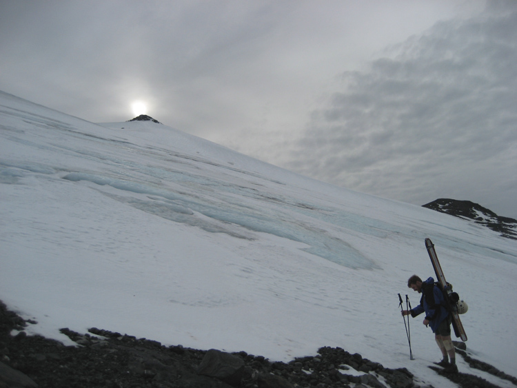
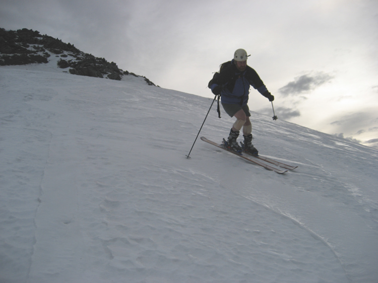
Here's a couple of photos from yesterday:
#1: JW in transition. The rocky point in the background was our destination. I don't think he saw his shadow either
#2: JW doing his jet engine impression. Loud skiing at its best (no soundtrack, just use your imagination)
Given recent trip reports, the skiing was actually better than I thought it would be. At least we had some grip in making turns. This trip completes 12 consecutive months for each of us!
author=Telemon link=topic=11131.msg45786#msg45786 date=1225415763]
According to this map acquired through my SPOT device, the high point is a bit to the east. http://maps.google.com/maps?f=q&hl=en&geocode=&q=48.783,-121.8748&ie=UTF8&om=1&ll=48.783,-121.8748&spn=0.0371,0.110722&t=p&z=14
I'm sorry that we couldn't get together this month,Travertine. I'm especially sorry that you couldn't join us a week ago. Well, maybe in November.
Well, it's our loss not catching one of the earlier trips with the better conditions. I have to learn this more thoroughly - when there's snow, it's time to go!
I guess I'm a little confused about the boundary of the actual glacier in that area. When we first got to "snow", there were obvious glacier features up and to the left (east), so we started heading up and right through alternating crust and blue ice, and I thought we were on shallow cover over the rock, but then came to a couple of narrow crevasses so we headed hard right to get away from that and walked up near the prominent snow ridge on the way right side up to an obvious rock pinnacle at 7000'. This route had no glacier-like features and appeared safer, but I am guessing that it is permanent snow since presumably our trip was at the lowest snow point of the year.
November: come up to Whistler over US Thanksgiving if you want, I will tour on either Friday or Saturday if there is any snow at all (I guess that is in doubt so far).
author=Travertine link=topic=11131.msg45792#msg45792 date=1225430723]
I guess I'm a little confused about the boundary of the actual glacier in that area.
Join the club. Every topo I've seen shows the obvious glacier area to the east as glacier, and the rest is just permenant snowfield. However, by mid-August, that snowfield generates deep crevasses... Really deep. I'm no snowologist, but right around the roll-over it sure looks like a wide short glacier.
but then came to a couple of narrow crevasses so we headed hard right to get away from that and walked up near the prominent snow ridge on the way right side up to an obvious rock pinnacle at 7000'
Yes, Guynoir and his friend went up the snow ridge, including another skier and boarder the same day as us. I however, ignored the "glacial like" features since they were well covered the day we were there and I went right in between many of them. I just did hard forward pole thrusts every time I came near a "feature". Nothing punched through. I felt relatively safe the whole time, and it obviously worked out ok since I'm still here. However, a lot of fresh snow had fallen just a few hours before we were up there, so that either made it safer or more dangerous to travel through that area.
Early last October2007 there was such a big dumping that I never saw the glacial like features that were present this year in 2008.
The glacier vs permanent snowfield designation has been discussed on TAY before, in regards to Muir and Palmer snowfields. I believe that the area that we (Telemon, Travertine, Mostick, and others) climbed last week is a permanent snowfield that occasionally displays cracks. We didn't see any last week, but I have seen some while hiking there in previous summers.
Reply to this TR
Please login first: