Tenpeak, North Couloir, July 19-20
7/15/08
9444
16
Last week I intended to scare myself into climbing season by following Sky down the north side of the Triad. But on the way up, as I soaked up the views in every direction, my eyes fell upon this:

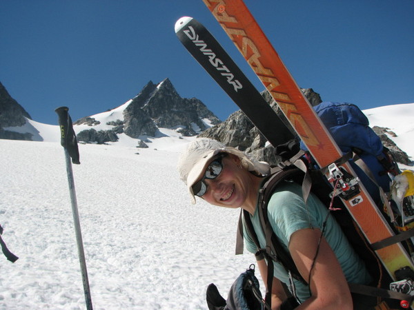
I've been wanting to ski Tenpeak's North couloir ever since I saw John Scurlock's beautiful photo of it a few years ago (http://www.pbase.com/nolock/image/57354751). I tried once last year but only managed to climb it's bottom third before retreating with my tail between my legs. Another loose attempt foiled by weather this spring, along with one a few weeks ago, had me chalking up Tenpeak for next season. Until I saw it from the Triad, that is.
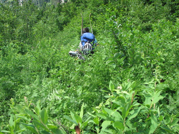
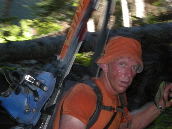
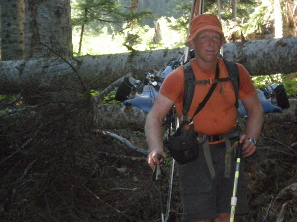
Monika needed little convincing, even though it would mean the third weekend in a row she'd be packing a sleeping bag along with her skis. We left the White River Trailhead north of Lake Wenatchee around 1 on Saturday afternoon. Enough time had passed since our trip up Glacier for us to forget the occasional, shall we say "unpleasantness", of the trail.

With the occasional surgical schwack, we made good time and arrived at snow level (approx. 6200') well before dark. We had neither a tent nor bivy sacks, so we wanted to make camp on grass as opposed to snow. The night was spectacular. The near full moon rose blood red over Bandit, leaving a trail of endless stars in it's wake as it made it's way across the nighttime sky. Truly one of the most awe inspiring skies I've ever had the pleasure to witness.
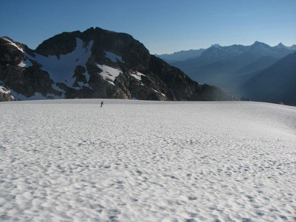
We were moving before six the next morning. The snow had frozen nicely and the skies were crystal clear. I had that pleasant calmness that comes from knowing conditions are perfect. We crossed onto the Honeycomb Glacier at the col to the west of Tenpeak and had fun skiing on hard snow for over a thousand feet:
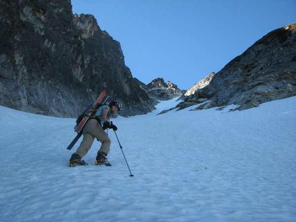
We climbed to a small knoll and had an easy traverse to the couloir. I was a little disappointed that the apron had melted and shorted us some perfectly pitched fall line skiing. It is the middle of July though, so I wasn't too upset. Conditions were excellent- soft but firm down low changing into hardened corn up top. I was happy to have crampons and an ice axe. And hardly any sun cups.

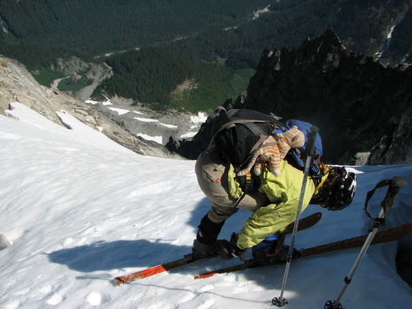
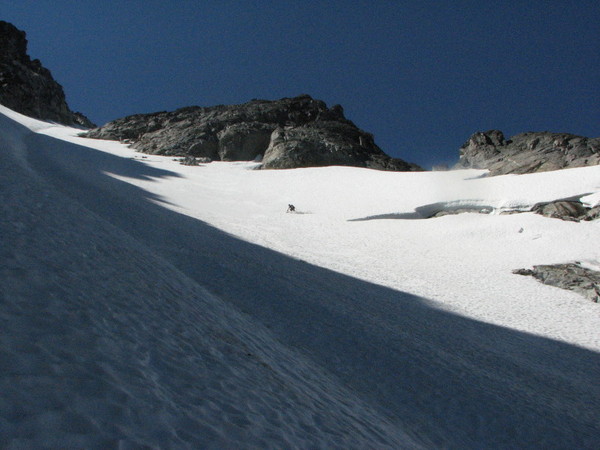
We got to the top just as the first rays of sunlight began to kiss the upper face. It was 9:30. We were psyched. I thought about summiting, but decided against it due to the time it would have required. We wanted to ski as soon as the couloir softened since we had such a long day ahead of us. So we took pictures, ate, napped, took more pictures, and just flat out enjoyed what summer skiing is about. By 10:45 we were getting antsy. Neither Monika nor I wanted to slog back up the Honeycomb in slush.Or depraoch in the dark. So we got ready and dropped in:
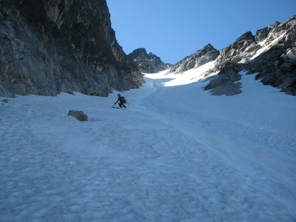
The skiing was sensational. The top and steepest bit had softened to the firm side of perfect corn. Not hero snow, but so solid under edge that the exposure added rather than detracted from the experience. And it was GREAT exposure- almost 1500' to the talus below. The parts of the couloir that remained in the shade were less affected by sun so as to be soft enough for fun, short radius turns.


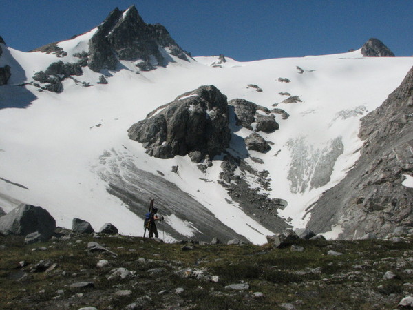
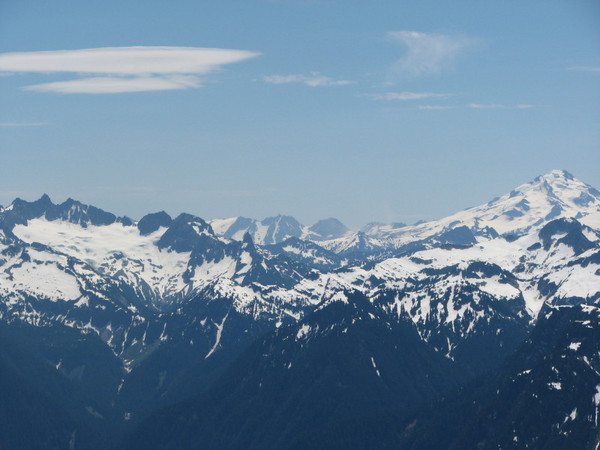
At the bottom we traversed back to col overlooking the Honeycomb and began to think about what neither of us had wanted to think about: the LONG way back to Monika's car. But at least we got to start it off with one (actually two) of my favorite views in the cascades:

I've been wanting to ski Tenpeak's North couloir ever since I saw John Scurlock's beautiful photo of it a few years ago (http://www.pbase.com/nolock/image/57354751). I tried once last year but only managed to climb it's bottom third before retreating with my tail between my legs. Another loose attempt foiled by weather this spring, along with one a few weeks ago, had me chalking up Tenpeak for next season. Until I saw it from the Triad, that is.
Monika needed little convincing, even though it would mean the third weekend in a row she'd be packing a sleeping bag along with her skis. We left the White River Trailhead north of Lake Wenatchee around 1 on Saturday afternoon. Enough time had passed since our trip up Glacier for us to forget the occasional, shall we say "unpleasantness", of the trail.
With the occasional surgical schwack, we made good time and arrived at snow level (approx. 6200') well before dark. We had neither a tent nor bivy sacks, so we wanted to make camp on grass as opposed to snow. The night was spectacular. The near full moon rose blood red over Bandit, leaving a trail of endless stars in it's wake as it made it's way across the nighttime sky. Truly one of the most awe inspiring skies I've ever had the pleasure to witness.
We were moving before six the next morning. The snow had frozen nicely and the skies were crystal clear. I had that pleasant calmness that comes from knowing conditions are perfect. We crossed onto the Honeycomb Glacier at the col to the west of Tenpeak and had fun skiing on hard snow for over a thousand feet:
We climbed to a small knoll and had an easy traverse to the couloir. I was a little disappointed that the apron had melted and shorted us some perfectly pitched fall line skiing. It is the middle of July though, so I wasn't too upset. Conditions were excellent- soft but firm down low changing into hardened corn up top. I was happy to have crampons and an ice axe. And hardly any sun cups.
We got to the top just as the first rays of sunlight began to kiss the upper face. It was 9:30. We were psyched. I thought about summiting, but decided against it due to the time it would have required. We wanted to ski as soon as the couloir softened since we had such a long day ahead of us. So we took pictures, ate, napped, took more pictures, and just flat out enjoyed what summer skiing is about. By 10:45 we were getting antsy. Neither Monika nor I wanted to slog back up the Honeycomb in slush.Or depraoch in the dark. So we got ready and dropped in:
The skiing was sensational. The top and steepest bit had softened to the firm side of perfect corn. Not hero snow, but so solid under edge that the exposure added rather than detracted from the experience. And it was GREAT exposure- almost 1500' to the talus below. The parts of the couloir that remained in the shade were less affected by sun so as to be soft enough for fun, short radius turns.
At the bottom we traversed back to col overlooking the Honeycomb and began to think about what neither of us had wanted to think about: the LONG way back to Monika's car. But at least we got to start it off with one (actually two) of my favorite views in the cascades:
Nice, Ryan. Glad you got it. Let's go climb some rocks.
Congratulations Ryan to finally getting that long sought after line! 8)
Nice work. I looked up at that line a few years ago on a cross country hike and remember thinking it would be a sweet run. I'll have to go back and look at my photos, but it seems the Honeycomb Glacier is noticably smaller in your picture then it was five years ago. Scary..
Kudos on a great trip and nice tr! Your pics were really captivating!
author=ski_photomatt link=topic=10696.msg43585#msg43585 date=1216748759]
. . . it seems the Honeycomb Glacier is noticably smaller in your picture then it was five years ago. Scary..
Great TR and pics of an ambitious trip, Ryan!
ski_photomatt, Ryan's very cool pic does not depict the full extent of the Honeycomb. We traveled the entire length of the Honeycomb 2 years ago, from the Honeycomb HR to Kololo Peaks late season, so we got a good look at it. Compared to the map (mid-90's??), the snout of the glacier had retreated significantly, resulting in a large silty lake (area obscured by the moraine in Ryan's pic) and the N flank of the upper Honeycomb had melted out near Kopeetah Divide (beyond and to the right of the rock peak on upper right of Ryan's pic) leaving a big ice wall (and a great flat rocky campsite) on its upper N flank. By my estimation, in 2006 the Honeycomb was a few per cent smaller than that depicted on the mid-90's map, and thus looked to be faring much better than many other glaciers in the area (e.g., the White River Glacier).
Glad you got that bad-boy. Those are some cool looking peaks. Strange you got a freeze but I didn't encounter any frozen snow on Baker. Rocks.
Schweet Ryan, glad you got that!!!
Very nice, way to get the objective.

Photos of Honeycomb Glacier in 1977 (top, Bill Arundell) and 2006 (bottom, Lowell Skoog) from 2007 NWMJ.
Wow. wow.
Just so we're clear on this, that really is a stuffed tiger-ish cat in one of the photos above, right? Huzzah! :).
That's amazing. Only 30 years ago. I feel like I've been kicked in the groin. Thanks for the post, though.
author=whitethunder link=topic=10696.msg43643#msg43643 date=1216825472]
That's amazing. Only 30 years ago. I feel like I've been kicked in the groin. Thanks for the post, though.
One of my early North Cascade trips was a traverse of the Dakobed Range from Glacier Peak to High Pass with Gary Brill and Jens Kieler in 1976. That was a year before Bill Arundell's photo (upper, above) was taken. When Garth Ferber, Mark Kroese and I retraced the route in the opposite direction in 2006 (lower photo, above) I kept saying to myself, "I don't remember a lake here." Unfortunately I didn't own a camera in 1976 and my partners didn't take pictures there either. But when I saw the Bill Arundell photo while preparing last year's NWMJ, I was reassured that I wasn't losing my mind.
WoW, it's depressing how much glaciers are recceding.
great trip, I'm sorry I didn't get to see/ski the area with you, though my dog sure was happy about not being in a kennel, but in hindsight, I should have just strapped her to my pack like Monika did with her cat ;)
great trip, I'm sorry I didn't get to see/ski the area with you, though my dog sure was happy about not being in a kennel, but in hindsight, I should have just strapped her to my pack like Monika did with her cat ;)
Lowell's pic depicts what we saw in 2006 when we popped over the moraine on the Honeycomb HR. It's a pretty darn big lake. Just checked the 7.5 Glacier Peak East map (showing no lake) which is dated 1988. On our traverse in 2006, we counted something like 4 or 5 lakes at the snouts of glaciers that were not shown on the maps. Lowell's pics show that the thickness of the Honeycomb has been greatly reduced, so my estimation of a "few percent" loss was way the heck off if one is talking 3D -- I was looking at the maps in 2D. Bad guess on my part, way more loss than we surmised.
Traveling on the Lynch Glacier and E flank of Hinman last year was equally sad. Pea Soup Lake is no longer the color of pea soup, the Lynch is about half the size (2D) depicted on the map and I question whether the ice on the E flank of Hinman are real glaciers or mere remnants.
So sad. See 'em while ya can.
These photos say to me: I kick ass
Reply to this TR
Please login first: