July 14, 2008, Anvil Rock + Paradise Glacier
7/14/08
WA Cascades West Slopes South (Mt Rainier)
3854
4
Andru and I had a different original destination in mind, Van Trump. NPS signs at TH told of bridge out. Based on the usual pattern of NPS trail condition information being overblown and outdated, we continued on. Lingering snow on the lower trail. Upon reaching Falls Creek, site of said bridge-out .... indeed. Log literally snapped in half and seemingly nothing really holding it onto either side. Snow bridges had very recently melted out. So recently that there was a solo skier guy that had just managed to cross back to our side, after being unable to cross the previous day. He had first crossed Saturday while snowbridge still viable, and made some improv stick bridge + extensive snowbank cutting to get back over. I am sure we could have crossed his stick bridge w.o. trouble at that moment. But the wild card was how much would creek rise during heat of day; I was sure it would wipe out his little bridge and perhaps rise 2+ feet. Arggghhh what to do. I decided was not worth the chance of getting stuck over there, particularly with multiple Plan B's near at hand. So back down trail we marched in defeat. JOM for this "unapproach" - 0%.
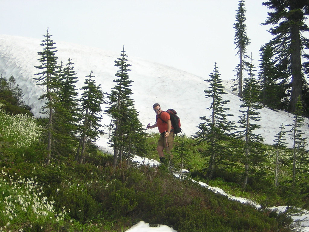
Plan B. Crack o noon start from Paradise. Basically can skin from car save from about summer PanPoint trail to Pebble Creek where we booted. Heat of day slowed pace. Decent skinning from Pebble on. Round about 9K, snow got worse, not better. Lookers left side of snowfield, which is usually better for avoiding tracks and cups, not so good. Original Plan B had been ski that side into the (scratchy but still appearing continuous) Nisqually Chutes.
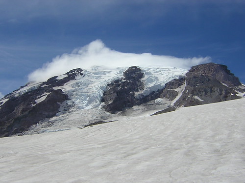
The not so great lookers left Muir
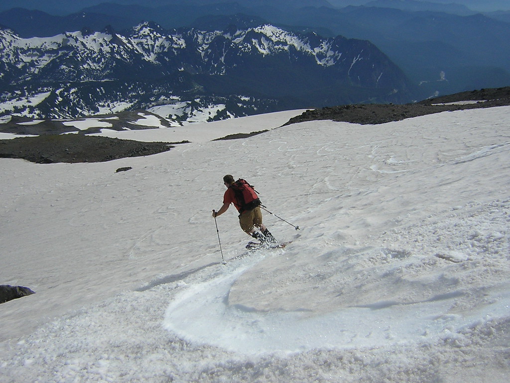
Plan B-2. Traversed right to Anvil, where recent tracks were hoped to have smoothed snow. Nice view from Anvil at least. As far as smooth - not so much. Lots of surface texture, bumpy ride for first 300vf or so. About half way down Anvil slope things got better. And then better yet. Although Paradise Gl had apparent texture too, and some raised tracks, all was nicely soft and pleasant despite that minimal texture. Had to scoot left and right a little trying to find a good compromise margin between staying off old tracks and not getting too close to sags and crevasses. Snow maybe a little suctiony if moving slow but it didn't take much to break suction and get nice turns.
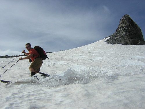
Andru + Anvil
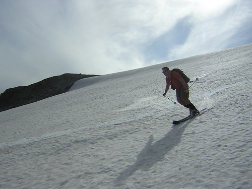
Nice evening light is a side benefit of crack o noon starts

All too soon the real skiing part was over and it was time to slog the basin and figure out how to get back to Paradise. There was some disagreement over whether to go down the river valley or climb to Golden Gate (and for that matter, of just where Golden Gate was). Andru claimed that it was possible to ski Mazama Ridge all the way to Fourth Crossing. I was skeptical. But Andru was right (mostly) - we skied right to the Crossing TH on surprisingly good snow.


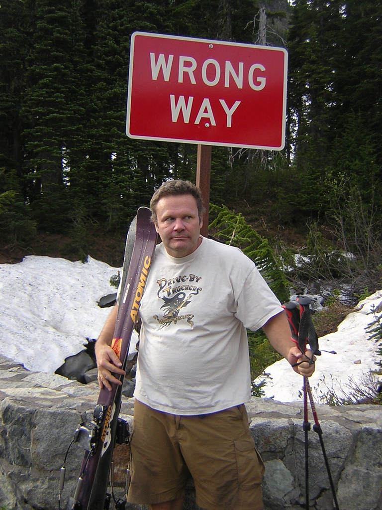
Only one problem. Skiing to the road did not equate to skiing to the car (which was at Paradise) so Andru then had to march Wrong Way up the road and retrieve vehicle.

Actually, it turned out to be MUCH funner to ski the fall line to 4th crossing than would have been to grovel in the sticky and postholed snow of Paradise environs post Pan Point, all for the mere cost of buying Andru a burrito. Woot!
JOM for Plan B - 100% and then some!
Plan B. Crack o noon start from Paradise. Basically can skin from car save from about summer PanPoint trail to Pebble Creek where we booted. Heat of day slowed pace. Decent skinning from Pebble on. Round about 9K, snow got worse, not better. Lookers left side of snowfield, which is usually better for avoiding tracks and cups, not so good. Original Plan B had been ski that side into the (scratchy but still appearing continuous) Nisqually Chutes.
The not so great lookers left Muir
Plan B-2. Traversed right to Anvil, where recent tracks were hoped to have smoothed snow. Nice view from Anvil at least. As far as smooth - not so much. Lots of surface texture, bumpy ride for first 300vf or so. About half way down Anvil slope things got better. And then better yet. Although Paradise Gl had apparent texture too, and some raised tracks, all was nicely soft and pleasant despite that minimal texture. Had to scoot left and right a little trying to find a good compromise margin between staying off old tracks and not getting too close to sags and crevasses. Snow maybe a little suctiony if moving slow but it didn't take much to break suction and get nice turns.
Andru + Anvil
Nice evening light is a side benefit of crack o noon starts
All too soon the real skiing part was over and it was time to slog the basin and figure out how to get back to Paradise. There was some disagreement over whether to go down the river valley or climb to Golden Gate (and for that matter, of just where Golden Gate was). Andru claimed that it was possible to ski Mazama Ridge all the way to Fourth Crossing. I was skeptical. But Andru was right (mostly) - we skied right to the Crossing TH on surprisingly good snow.

Only one problem. Skiing to the road did not equate to skiing to the car (which was at Paradise) so Andru then had to march Wrong Way up the road and retrieve vehicle.
Actually, it turned out to be MUCH funner to ski the fall line to 4th crossing than would have been to grovel in the sticky and postholed snow of Paradise environs post Pan Point, all for the mere cost of buying Andru a burrito. Woot!
JOM for Plan B - 100% and then some!
Nice pix and tour, wolfs---esp. the old guy with half a binding. ;)
( I met you at Alpental on the evening of June 20.)
( I met you at Alpental on the evening of June 20.)
nice tour and pics!
Thanks for the great narrative, pics and data. I was thinking of doing the Van Trump this weekend. How bad is the spot with bridge gone? Is there so much water that a crossing really isn't possible? That must be the bridge a couple hundred yards before comet falls? Thanks Wolfs!
Yes the Falls Creek (non)bridge is just short of where you can actually see Comet falls. As to how bad it is you might get varying opinions. Probably many cascade hardman types would think nothing of it.
I personally would not cross what is left of bridge. If it did fail to hold your weight and moved/fell in that is at worst possible spot, above a plunge pool and small falls series.
Otherwise there is (was) a snow bank leading in that complicates just rock hopping somehow because the lip is thin right above the water. That snow bank WAS a snow bridge just a few days prior. Would say water is about 12 feet across and 2-3 feet deep but moving fast. The main problem was that between snowbank and little cliffs constraining there is only like a 50ft stretch available to try and find rocks or less rough water.
Nevertheless, if you just had two people and like a 50 ft handline for safety you could probably cross it under any circumstances.
Reply to this TR
Please login first: