May 10, 2008; Silver Star Mtn
5/15/08
WA Cascades East Slopes North
4661
4
Mustering the motivation for a 5 am wake-up, our tribe of 5 set out early for Silver Star Mtn. The group (Kathleen, Dave, Sara, Matt, and myself) had congregated for a weekend of skiing in the Washington Pass vicinity to celebrate Kathleens birthday.
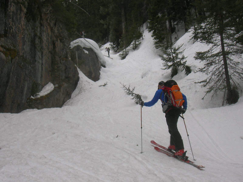
An unusual but welcome sight for this time of year was a couple feet of snow cover still remaining at the Silver Star Creek start along Hwy 20, allowing continuous skinning all the way up.
Keeping with the trend of all four Silver Star ventures Ive been on over the years, the clouds thickened and dropped as we neared the high col. We eventually hit a white-out at about 8,000-ft, with only Dave venturing all the way up to the ~8,600-ft col atop the Silver Star Glacier. Dave reported breakable crust on the slope just below the col. From about 8,300-ft to 7,000-ft was not-so-awesome slightly edgeable crust with occasional ice chunks.
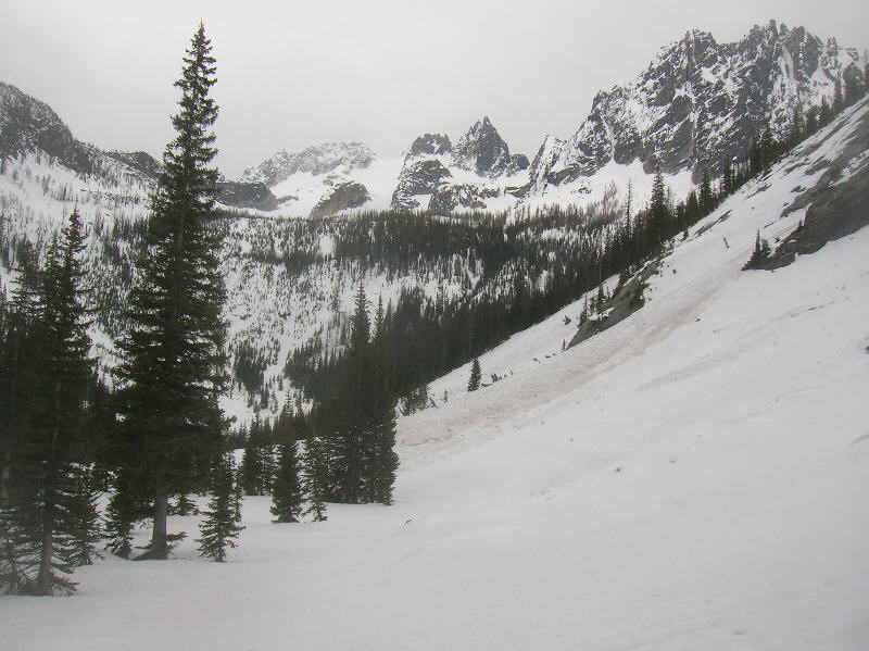
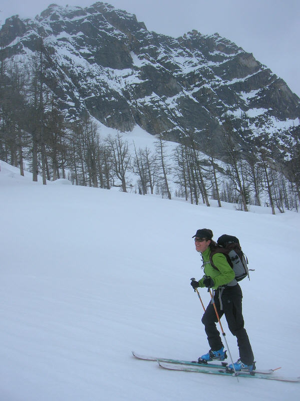
Conditions and visibility vastly improved at the moraines, finding excellent fast and smooth softened surface snow down glades to the main valley floor at about 5,000-ft (Not corn, but a nicely softened melt/freeze surface crust; ski penetration less than a couple inches). Soft (but not too mushy) surface snow continued in the trees back to Hwy 20, finding an occasional open glade for nice turns in the lower forested section. Back at the car by 2 pm, then off to camp for beer, snacks, and naps.
I departed in the morning for Mothers Day obligations as the rest of the clan set out to ski the birthday tour on Kathleens actual birthday. A dusting of fresh snow had fallen at Washington Pass overnight; crazy to see the trees frosted in fresh snow in mid-May and light snow falling down to about 3,000-ft on the west side of the crest. I forgot the SLR at home, and most of the pics taken with my point-and-shoot turned out lousy, but a some of the photos are posted below and here.
An unusual but welcome sight for this time of year was a couple feet of snow cover still remaining at the Silver Star Creek start along Hwy 20, allowing continuous skinning all the way up.
Keeping with the trend of all four Silver Star ventures Ive been on over the years, the clouds thickened and dropped as we neared the high col. We eventually hit a white-out at about 8,000-ft, with only Dave venturing all the way up to the ~8,600-ft col atop the Silver Star Glacier. Dave reported breakable crust on the slope just below the col. From about 8,300-ft to 7,000-ft was not-so-awesome slightly edgeable crust with occasional ice chunks.
Conditions and visibility vastly improved at the moraines, finding excellent fast and smooth softened surface snow down glades to the main valley floor at about 5,000-ft (Not corn, but a nicely softened melt/freeze surface crust; ski penetration less than a couple inches). Soft (but not too mushy) surface snow continued in the trees back to Hwy 20, finding an occasional open glade for nice turns in the lower forested section. Back at the car by 2 pm, then off to camp for beer, snacks, and naps.
I departed in the morning for Mothers Day obligations as the rest of the clan set out to ski the birthday tour on Kathleens actual birthday. A dusting of fresh snow had fallen at Washington Pass overnight; crazy to see the trees frosted in fresh snow in mid-May and light snow falling down to about 3,000-ft on the west side of the crest. I forgot the SLR at home, and most of the pics taken with my point-and-shoot turned out lousy, but a some of the photos are posted below and here.
We tried Silver Star yesterday. There is no longer snow down to Highway 20. We ran into continuous snow at around 4400 feet and the trail below that is a mess of blow-down and obstacles.
So did you make it up Silver Star?? Is it worth the bush below?? I would like to get out there this weekend if the trip is worth the $$$ for gasoline!!
Thanks!!
Thanks!!
author=powdrx link=topic=10035.msg40917#msg40917 date=1211995261]
So did you make it up Silver Star?? Is it worth the bush below?? I would like to get out there this weekend if the trip is worth the $$$ for gasoline!!
Thanks!!
We didn't make it up the peak. It took us a while with the thrashing through the blow-down and by the time we were getting up above it, we had lost a lot of time and also found clouds sitting in the valley which were going to obscure our views and impair visibility.
We also made a mistake with navigation which didn't help matters. The map in Burgdorfer's book shows a solid line going up the west (skier's right) side of the creek and we opted to follow that route rather than going up the left (east) side of the creek which is what he describes doing in the text. There is a trail that can be followed on that side but there is still a lot of blow down there as well from what our friends who went in the night before told us. It makes for faster travel, however. He has a dotted line in the map which shows that route. Why he has the preferred route as a dotted line and the alternate as a solid line is not clear to me.
Pretty continuous snow starts around 4,200 feet, if I remember correctly, so if the weather is good and you don't mind the walking it is probably still a worthwhile trip.
Thanks a bunch!! I was confused about the map as well. I think it is less critical when there is snow all the way to the road!!
Reply to this TR
Please login first: