May 7-8, 2008, Sasse Mtn. - West Peak
5/7/08
2920
1
Here's a voluntary non-motorized area that does not get as much use by skiers as it might. John M. and I call the high point, 5590' by GPS, "Sasse Mtn. West Peak" for lack of a better name. It's just west of Sasse Mtn.
I used to snow camp here on my XC skis, but have not been back overnight because of the long flat approach. A few years ago, John M. and I shortcut the road during a day ski, and found the route much shorter and more attractive. I never went very far up on my XC skis, so I've been intending to go back overnight for some time. The run off the top is [a mental state induced by the sudden release of stress hormones]. This is good by the way. :)
This week seemed like the week to try; a nice place to camp, west facing so that the slope does not slush out too soon, and the chance the snowpack would be more consolidated than last week at the crest.
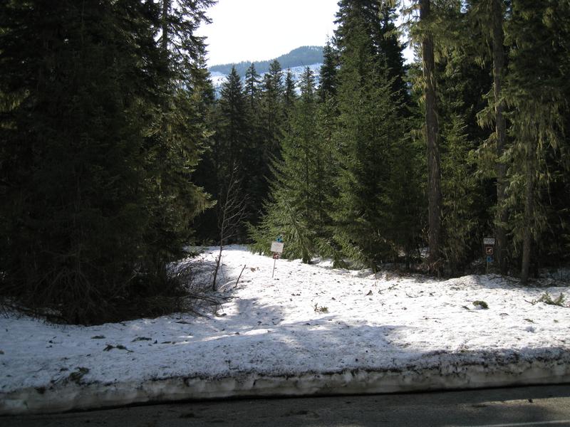
To get there, drive the Salmon La Sac Road, and find the Red Mtn. Campground on the east side of the road. Go 0.3 miles further to find FS Road 128. The FS road marker, if it's still there, will typically be buried in the snow. Hopefully there will be a voluntary NM sign marking the road, which can be hard to spot when the snow banks are high. See pic 1. In the winter you can park along the side of the main road per the winter parking signs; they are gone now, but there is room to pull off the pavement now and park on the west side.
You can simply ski up the FS 128 for as long as you like if you prefer very gentle terrain. (This would be a good area to introduce people to XC skiing.) Alternatively, you can take the second spur road that branches off to the north, and continue until you are quite near Little Salmon La Sac Creek. At this point turn up the hill and make your way through the forest. There is an initial short steeper portion, and then it levels off some, climbing continually. The trick is to stay fairly well north. If you do it right, you will find yourself in more open terrain, which you follow up. At about 3300 feet you will enter a regenerating clearcut. Ski up until you encounter the upper of two spur roads, follow it to the end, and again head up in an easterly direction before turning slightly south east; this will put you in an area that is open enough for turns coming down.
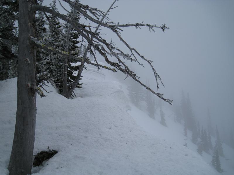
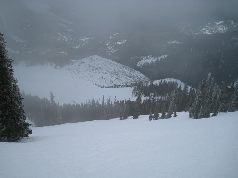
At 3800 feet, find the road near where it switches back, follow it for a bit and then head up. From here on the route is fairly obvious. This time of year, I would consider ski crampons mandatory, as the top few hundred feet of the slope is up to 40 to 45 (max) degrees. Crampons at least when it's 27 degrees and the slope is frozen nice and hard. :) See pic 2. Pic 3 is the view down showing the upper part of the ski slopes. No snomo tracks up there this year which is very nice. Old snow full of snomo tracks does not make for good skiing. There were some tracks lower down, but not as many as I've seen before.
Skiing out, the question is whether to take the road or go down the way you came up. The route up is not very amenable to skiing down, so my choice would be the road. This week I was fairly lucky. I had only 3 or 4 very short ski carries, with the snow otherwise holding all the way to the car. However, below about 3000 feet, there is only 6 inches to a foot of snow on areas of the road that get sun. That will be gone quickly. You can always walk I suppose.
Larry
I used to snow camp here on my XC skis, but have not been back overnight because of the long flat approach. A few years ago, John M. and I shortcut the road during a day ski, and found the route much shorter and more attractive. I never went very far up on my XC skis, so I've been intending to go back overnight for some time. The run off the top is [a mental state induced by the sudden release of stress hormones]. This is good by the way. :)
This week seemed like the week to try; a nice place to camp, west facing so that the slope does not slush out too soon, and the chance the snowpack would be more consolidated than last week at the crest.
To get there, drive the Salmon La Sac Road, and find the Red Mtn. Campground on the east side of the road. Go 0.3 miles further to find FS Road 128. The FS road marker, if it's still there, will typically be buried in the snow. Hopefully there will be a voluntary NM sign marking the road, which can be hard to spot when the snow banks are high. See pic 1. In the winter you can park along the side of the main road per the winter parking signs; they are gone now, but there is room to pull off the pavement now and park on the west side.
You can simply ski up the FS 128 for as long as you like if you prefer very gentle terrain. (This would be a good area to introduce people to XC skiing.) Alternatively, you can take the second spur road that branches off to the north, and continue until you are quite near Little Salmon La Sac Creek. At this point turn up the hill and make your way through the forest. There is an initial short steeper portion, and then it levels off some, climbing continually. The trick is to stay fairly well north. If you do it right, you will find yourself in more open terrain, which you follow up. At about 3300 feet you will enter a regenerating clearcut. Ski up until you encounter the upper of two spur roads, follow it to the end, and again head up in an easterly direction before turning slightly south east; this will put you in an area that is open enough for turns coming down.
At 3800 feet, find the road near where it switches back, follow it for a bit and then head up. From here on the route is fairly obvious. This time of year, I would consider ski crampons mandatory, as the top few hundred feet of the slope is up to 40 to 45 (max) degrees. Crampons at least when it's 27 degrees and the slope is frozen nice and hard. :) See pic 2. Pic 3 is the view down showing the upper part of the ski slopes. No snomo tracks up there this year which is very nice. Old snow full of snomo tracks does not make for good skiing. There were some tracks lower down, but not as many as I've seen before.
Skiing out, the question is whether to take the road or go down the way you came up. The route up is not very amenable to skiing down, so my choice would be the road. This week I was fairly lucky. I had only 3 or 4 very short ski carries, with the snow otherwise holding all the way to the car. However, below about 3000 feet, there is only 6 inches to a foot of snow on areas of the road that get sun. That will be gone quickly. You can always walk I suppose.
Larry
Thanks for the directions... that really looks cool.
Reply to this TR
Please login first: